- Maryland Route 756
-
Maryland Route 756
Old Snow Hill Road Route information Maintained by MDSHA Length: 1.17 mi[1] (1.88 km) Major junctions South end:  US 13 in Pocomoke City
 MD 359 in Pocomoke City
North end:  US 113 in Pocomoke City
Location Counties: Worcester Highway system Maryland highway system
Interstate • US • State • Minor • Former • Turnpikes←  MD 755
MD 759  →
→Maryland Route 756 (MD 756) is a state highway in the U.S. state of Maryland. Known as Old Snow Hill Road, the state highway runs 1.17 miles (1.88 km) from U.S. Route 13 (US 13) east to US 113 within Pocomoke City. MD 756 is the original alignment of US 113 in Pocomoke City. That original alignment was bypassed by what is now MD 359 in the mid 1930s.
Contents
Route description
MD 756 begins at an intersection with US 13 (Ocean Highway) in the middle of a commercial area on the eastern edge of incorporated Pocomoke City.[1][2] Linden Avenue, which was formerly part of MD 756, heads west toward the central business district. MD 756 heads east past the commercial area and crosses Town Branch. From there, the state highway turns northeast through a mix of farms and residences.[2] After meeting the northern end of MD 359 at an oblique angle, MD 756 reaches its northern terminus at US 113 (Worcester Highway).[1][2]
History
MD 756 follows the original alignment of US 113 through Pocomoke City.[3] US 113's first bypass of Pocomoke City, which is now MD 359 and MD 250A, was completed in 1936.[4][5] The state highway was signed as MD 756 by 1946.[6] The state highway once continued west to US 13 Business along Linden Avenue and Sixth Street. MD 756 was rolled back to US 13 by 1999.[7]
Junction list
The entire route is in Pocomoke City in Worcester County.
Mile
[1]Destinations Notes 0.00 Linden Avenue west Western terminus; Linden Avenue is old alignment of MD 756 US 13 (Ocean Highway) – Salisbury, Norfolk1.07 MD 359 south (Bypass Road)Old alignment of US 113 1.17 US 113 (Worcester Highway) – Snow Hill, Ocean CityEastern terminus 1.000 mi = 1.609 km; 1.000 km = 0.621 mi References
- ^ a b c d "Highway Location Reference: Worcester County" (PDF). Maryland State Highway Administration. 2009. http://www.marylandroads.com/Location/2009_WORCESTER.pdf. Retrieved 2010-10-24.
- ^ a b c Google, Inc. Google Maps – Maryland Route 756 (Map). Cartography by Google, Inc. http://maps.google.com/maps?f=d&source=s_d&saddr=MD-756+E%2FOld+Snow+Hill+Rd&daddr=MD-756+E&hl=en&geocode=Fcj6RAIdtBJ_-w%3BFQgVRQId3lZ_-w&mra=ls&sll=38.074894,-75.557292&sspn=0.003877,0.009645&ie=UTF8&t=h&z=16. Retrieved 2010-05-12.
- ^ Maryland Geological Survey. Map of Maryland: Showing State Road System and State Aid Roads (Map) (1927 ed.).
- ^ Report of the State Roads Commission of Maryland. 1935-1936. Baltimore: Maryland State Roads Commission. 1936-12-04. p. 63. http://www.archive.org/details/reportofstateroa1935mary. Retrieved 2010-05-12.
- ^ Maryland State Roads Commission. Map of Maryland Showing State Road System (Map) (1936 ed.).
- ^ Maryland State Roads Commission. Maryland: Official Highway Map (Map) (1946-47 ed.).
- ^ "Highway Location Reference: Worcester County" (PDF). Maryland State Highway Administration. 1999. http://www.marylandroads.com/Location/1999_WORCESTER.pdf. Retrieved 2010-10-24.[dead link]
External links
Roads in Worcester County, Maryland State highways 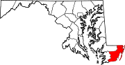
U.S. Highways Categories:- State highways in Maryland
- Roads in Worcester County, Maryland


Wikimedia Foundation. 2010.