- Maryland Route 482
-
Maryland Route 482
Hampstead Mexico Road 
Route information Maintained by MDSHA Length: 5.45 mi[1] (8.77 km) Major junctions West end:  MD 27 in Mexico
 MD 30 in Hampstead
East end: 
 MD 30 Bus. in Hampstead
Highway system Maryland highway system
Interstate • US • State • Minor • Former • Turnpikes←  MD 481
MD 483  →
→Maryland Route 482 (MD 482) is a state highway in the U.S. state of Maryland. Known as Hampstead Mexico Road, the state highway runs 5.45 miles (8.77 km) from MD 27 in Mexico east to MD 30 Business in Hampstead. In conjunction with MD 27, MD 482 connects Westminster with Hampstead. The state highway was constructed at both ends in the early 1930s; the middle section was completed in the late 1940s. MD 482 was relocated in Mexico around 1960 and in Hampstead in 2009, the latter to connect with the new alignment of MD 30.
Contents
Route description
MD 482 begins at an intersection with MD 27 (Manchester Road) in Mexico. The roadway continues west as Guadelupe Drive into the residential community of New Mexico. In Mexico, MD 482 intersects Old Manchester Road, which is unsigned MD 852G, and Leisters Church Road, which heads west as unsigned MD 849. The state highway heads east as a two-lane road through farmland that traverses Aspen Run and the East Branch of the North Branch of the Patapsco River. Just after entering the town of Hampstead, MD 482 meets MD 30 (Hampstead Bypass) at a roundabout. The state highway passes North Carroll High School and crosses over CSX's Hanover Subdivision before reaching its eastern terminus at MD 30 Business (Main Street). The roadway continues east as municipally-maintained Fairmount Road.[1][2]
History
The first improved highway east from Mexico was MD 87, which was constructed in 1925 along Leisters Church Road from Old Manchester Road—which was then MD 31 and now MD 852G—in Mexico southeast approximately 2 miles (3.2 km).[3][4] MD 482 proper was constructed from MD 87 east to near Brodbeck Road and from MD 30 in Hampstead west to east of the East Branch of the North Branch of the Patapsco River by 1933.[5][6] The eastern section of the state highway was extended west over the East Branch in 1936.[7] The two sections of MD 482 were united when the middle section was improved in 1947.[8][9] After MD 87 was removed from the state highway system in 1956, MD 482 was extended west to MD 31 along Leisters Church Road.[10] The state highway was relocated to its present alignment west of Leisters Church Road in 1960 concurrent with the relocation of MD 31 between Westminster and Manchester; the old alignment became MD 849.[11] MD 482 was relocated when its roundabout at the MD 30 Hampstead Bypass was constructed in 2009 concurrent with the completion of the bypass.[1]
Junction list
The entire route is in Carroll County.
Location Mile
[1]Destinations Notes Mexico 0.00 MD 27 (Manchester Road) / Guadelupe Drive west – Westminster, Manchester, New MexicoWestern terminus 0.11 Old Manchester Road Unsigned MD 852G 0.55 Leisters Church Road Westbound Leisters Church Road is unsigned MD 849 Hampstead 4.77 MD 30 (Hampstead Bypass) – Reisterstown, ManchesterRoundabout 5.45
MD 30 Bus. (Main Street) / Fairmount Road east – Greenmount, UppercoEastern terminus 1.000 mi = 1.609 km; 1.000 km = 0.621 mi Auxiliary route
MD 482A is the designation for Lare Street, a 0.04-mile (0.064 km) section of old alignment of MD 482 between the main route and First Street in Hampstead.[1][12]
References
- ^ a b c d e "Highway Location Reference: Carroll County" (PDF). Maryland State Highway Administration. 2009. http://www.marylandroads.com/Location/2009_CARROLL.pdf. Retrieved 2011-04-30.
- ^ Google, Inc. Google Maps – Maryland Route 482 (Map). Cartography by Google, Inc. http://maps.google.com/maps?f=d&source=s_d&saddr=MD-482+E%2FHampstead+Mexico+Rd&daddr=Westminster+St&hl=en&geocode=FSJDXAIdyOFp-w%3BFRpzXAIdYlBr-w&mra=ls&sll=39.60615,-76.900075&sspn=0.059647,0.154324&ie=UTF8&t=h&z=13. Retrieved 2011-04-30.
- ^ Report of the State Roads Commission of Maryland. 1924-1926. Baltimore: Maryland State Roads Commission. January 1927. p. 73. http://www.archive.org/details/annualreportsofs1924mary. Retrieved 2011-04-30.
- ^ Maryland Geological Survey. Map of Maryland: Showing State Road System and State Aid Roads (Map) (1927 ed.).
- ^ Maryland Geological Survey. Map of Maryland Showing State Road System: State Aid Roads and Improved County Road Connections (Map) (1933 ed.).
- ^ Report of the State Roads Commission of Maryland. 1931-1934. Baltimore: Maryland State Roads Commission. 1934-12-28. p. 326. http://www.archive.org/details/reportofstateroa1931mary. Retrieved 2011-04-30.
- ^ Report of the State Roads Commission of Maryland. 1937-1938. Baltimore: Maryland State Roads Commission. 1939-03-04. p. 126. http://www.archive.org/details/reportofstateroa1937mary. Retrieved 2011-04-30.
- ^ Report of the State Roads Commission of Maryland. 1947-1948. Baltimore: Maryland State Roads Commission. 1949-02-15. p. 114. http://www.archive.org/details/reportofstateroa1947mary. Retrieved 2011-04-30.
- ^ Maryland State Roads Commission. Maryland: Official Highway Map (Map) (1948 ed.).
- ^ Maryland State Roads Commission. Maryland: Official Highway Map (Map) (1956 ed.).
- ^ Maryland State Roads Commission. Maryland: Official Highway Map (Map) (1960 ed.).
- ^ Google, Inc. Google Maps – Maryland Route 482A (Map). Cartography by Google, Inc. http://maps.google.com/maps?f=d&source=s_d&saddr=1st+St&daddr=1st+St&hl=en&geocode=FcByXAIdhExr-w%3BFeRxXAId1kpr-w&mra=ls&sll=39.612722,-76.854172&sspn=0.001864,0.004823&ie=UTF8&ll=39.612788,-76.853887&spn=0.001864,0.004823&t=h&z=18. Retrieved 2011-04-30.
External links
Roads in Carroll County, Maryland State highways 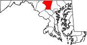
U.S. Highways Interstate Highways Categories:- State highways in Maryland
- Roads in Carroll County, Maryland


Wikimedia Foundation. 2010.