- Maryland Route 383
-
Maryland Route 383
Broad Run Road 
Route information Maintained by MDSHA Length: 5.48 mi[1] (8.82 km) Major junctions South end:  MD 180 in Jefferson
North end:  MD 17 near Burkittsville
Location Counties: Frederick Highway system Maryland highway system
Interstate • US • State • Minor • Former • Turnpikes←  MD 382
MD 384  →
→Maryland Route 383 (MD 383) is a state highway in the U.S. state of Maryland. Known as Broad Run Road, the state highway runs 5.48 miles (8.82 km) from MD 180 in Jefferson north to MD 17 near Burkittsville. MD 383 was built in four sections from MD 17 toward Jefferson between 1929 and 1953.
Contents
Route description
MD 383 begins at an intersection with MD 180 (Jefferson Pike) a short distance west of the center of Jefferson. The state highway heads northwest as a two-lane road through farmland. MD 383 intersects Corun Road, which leads to the historic Lewis Mill Complex, before descending into the valley of and crossing Catoctin Creek. West of the creek, the state highway reaches a four-way intersection with south-facing St. Marks Road and Gapland Road, which heads west toward Burkittsville. MD 383 turns north to remain on Broad Run Road. The state highway passes Poffenberger Road and Sumantown Road as it veers west again. Poffenberger Road leads to the historic Poffenberger Road Bridge and Sumantown Road leads to the contemporary Catoctin Creek Park. MD 383 crosses a tributary of Broad Run and reaches another four-way intersection at the hamlet of Broad Run. Picnic Woods Road and Catholic Church Road head west and south, respectively, from the intersection. MD 383 turns north to its northern terminus at MD 17 (Burkittsville Road) about midway between Burkittsville and Middletown.[1][2]
History
The first portion of MD 383 was constructed as a concrete road from MD 33 (now MD 17) south to Broad Run in 1929 and 1930.[3][4] The state highway was extended east as a macadam road to near the Poffenberger Road intersection in 1934 and 1935.[5][6] By 1946, MD 383 was extended south and east to Catoctin Creek.[7][8] The state highway was completed after the state route designation was extended to U.S. Route 340 (now MD 180) following the completion of a new bridge over Catoctin Creek in 1953.[9][10]
Junction list
The entire route is in Frederick County.
Location Mile[1] Destinations Notes Jefferson 0.00 MD 180 (Jefferson Pike) – Jefferson, BrunswickSouthern terminus Broad Run 2.36 Gapland Road west / St. Marks Road south MD 383 turns north to remain on Broad Run Road 4.15 Catholic Church Road south / Picnic Woods Road west MD 383 turns north to remain on Broad Run Road Burkittsville 5.48 MD 17 (Burkittsville Road) – Brunswick, MiddletownNorthern terminus 1.000 mi = 1.609 km; 1.000 km = 0.621 mi References
- ^ a b c "Highway Location Reference: Frederick County" (PDF). Maryland State Highway Administration. 2009. http://www.marylandroads.com/Location/2009_FREDERICK.pdf. Retrieved 2011-03-30.
- ^ Google, Inc. Google Maps – Maryland Route 383 (Map). Cartography by Google, Inc. http://maps.google.com/maps?f=d&source=s_d&saddr=MD-383+N%2FBroad+Run+Rd&daddr=MD-383+N%2FBroad+Run+Rd&hl=en&geocode=FXKXWAIdertg-w%3BFYdcWQIdsR1g-w&mra=ls&sll=39.359512,-77.546482&sspn=0.003741,0.009645&ie=UTF8&t=h&z=13. Retrieved 2011-03-30.
- ^ Report of the State Roads Commission of Maryland. 1927-1930. Baltimore: Maryland State Roads Commission. 1930-10-01. p. 210. http://www.archive.org/details/reportofstateroa1927mary. Retrieved 2011-03-30.
- ^ Maryland Geological Survey. Map of Maryland Showing State Road System: State Aid Roads and Improved County Road Connections (Map) (1930 ed.).
- ^ Report of the State Roads Commission of Maryland. 1931-1934. Baltimore: Maryland State Roads Commission. 1934-12-28. p. 335. http://www.archive.org/details/reportofstateroa1931mary. Retrieved 2011-03-30.
- ^ Maryland Geological Survey. Map of Maryland Showing State Road System: State Aid Roads and Improved County Road Connections (Map) (1935 ed.).
- ^ Report of the State Roads Commission of Maryland. 1945-1946. Baltimore: Maryland State Roads Commission. 1947-02-01. p. 109. http://www.archive.org/details/reportofstateroa1945mary. Retrieved 2011-03-30.
- ^ Maryland State Roads Commission. Maryland: Official Highway Map (Map) (1946-47 ed.).
- ^ "NBI Structure Number: 100000100087010". National Bridge Inventory. http://nationalbridges.com/nbi_record.php?StateCode=24&struct=100000100087010. Retrieved 2011-03-30.
- ^ Maryland State Roads Commission. Maryland: Official Highway Map (Map) (1954 ed.).
External links
Roads in Frederick County, Maryland State highways 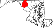
U.S. Highways Interstate Highways Categories:- State highways in Maryland
- Roads in Frederick County, Maryland


Wikimedia Foundation. 2010.