- Martin Place railway station
-
 Martin Place
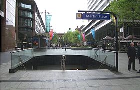
Eastern Suburbs & Illawarra Line Station code MPC Suburb Sydney Street(s) Macquarie Street Distance from Central Station 2.10 km Altitude (above sea level) ? m Types of stopping trains Suburban all stops
Suburban limited stops
Intercity (peak hour only)Number of platforms 2 Number of tracks 3 (1 track is a turnback siding) Platform arrangement 1 island Type of station Underground Ticket barriers Yes Transfers available Bus Disabled access 
Yes Station facilities Link Martin Place railway station is a station on the CityRail Eastern Suburbs railway line, located under Martin Place in the CBD of the city of Sydney, Australia. The station opened in 1979 with the opening of the Eastern Suburbs railway line. It consists of an underground island platform and a turnback siding with an underground concourse between the platform and street level. Escalators connect the concourse with the platforms. In 2010, work commenced on an Easy Access upgrade to the station, consisting of two lifts and an accessible toilet. [1] The upgrade was completed in time for the influx of commuters expected for ANZAC day commemorations on the 25th April.[2] Annual ridership to/from Martin Place railway station is 5.5 million journeys.[2]
Contents
Service tunnel
A service tunnel extends from Martin Place railway station under Sydney Hospital into The Domain. The tunnel carries air conditioning services from an underground room, which is located beneath two ventilation towers in The Domain, by the side of the road behind Sydney Hospital.
Platforms and services
The station is served by six to eight trains per hour each way, with additional trains during weekday peak hours.
Platform Line Stopping Pattern Notes 
Eastern Suburbs & Illawarra Line all stations and limited stops services to Hurstville, Mortdale, Sutherland, Cronulla, and Waterfall via Central intercity services to Thirroul and Port Kembla operate during peak hours 
Eastern Suburbs & Illawarra Line all stations services to Bondi Junction intercity services to Bondi Junction from Thirroul and Port Kembla operate during peak hours Bus services
 Concourse of Station featuring ticket office
 Concourse of Station featuring travel Indicators
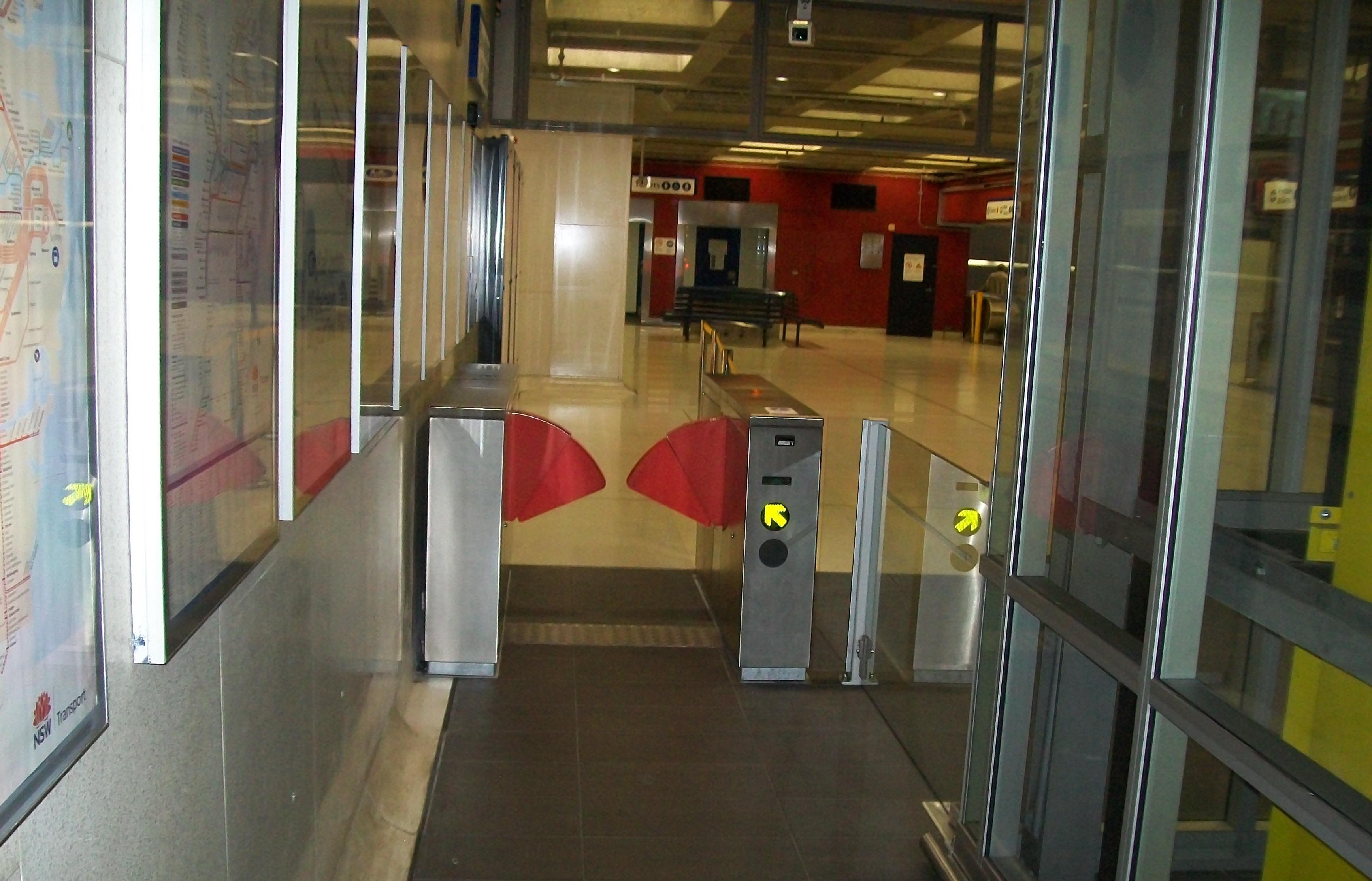
 Main Ticket Barriers
 Lift Upgrade under construction
 Ticket Barriers and lift after upgrade
Macquarie Street
- 200 - to Bondi Junction Railway Station Bus Interchange set down only
- 200 - to Chatswood - (Victoria Avenue Set Down (west side))
- 222 - Bondi Explorer tourist bus (inbound)
Elizabeth Street
- 311 - to Railway Square (Central Railway Station) - (Lee Street Set Down Only)
- 323 - to Vaucluse - (Military Road near Old South Head Road)
- 324 - to Watsons Bay - (Military Road Terminus)
- 325 - to Watsons Bay - (Military Road Terminus)
- 326 - to Bondi Junction Railway Station Bus Interchange
- 327 - to Bondi Junction Railway Station Bus Interchange
- 333 - to North Bondi - (Campbell Parade Terminus)
- 371 - to Randwick - (Perouse Road and St Paul Street)
- 373 - to Coogee - (Arden and Dolphin Streets)
- X73 - to Coogee - (Arden and Dolphin Streets)
- 374 - to Coogee - (Arden and Dolphin Streets)
- X74 - to Coogee - (Arden and Dolphin Streets)
- 376 - to Maroubra - (Maroubra Beach)
- 377 - to Maroubra - (Maroubra Beach)
- X77 - to Maroubra - (Maroubra Beach)
- 380 - to Watsons Bay - (Military Road Terminus)
- 389 - to North Bondi terminus
- 391 - to Port Botany - (Port Botany Terminus); to La Perouse (Anzac Parade Terminus)
- 392 - to Little Bay - (Anzac Parade at Prince Henry Hospital)
- X92 - to Little Bay - (Anzac Parade at Prince Henry Hospital)
- 394 - to La Perouse - (Anzac Parade Terminus)
- L94 - to La Perouse - (Anzac Parade Terminus)
- X94 - to La Perouse - (Anzac Parade Terminus)
- 396 - to Maroubra - (Maroubra Beach)
- X96 - to Maroubra - (Maroubra Beach)
- 397 - to South Maroubra - (Minneapolis Street and Midway Street)
- 399 - to Little Bay - (Anzac Parade at Prince Henry Hospital)
Castlereagh Street
- 301 - to Pagewood - (Eastgardens Shopping Centre - Bunnerong Road and Wenworth Avenue)
- 302 - to Pagewood - (Eastgardens Shopping Centre lower level)
- 303 - to Sans Souci - (Botany Road and Hollingshed Street)
- 303 - to Sans Souci - (Wellington Street and Rocky Point Road)
- 309 - to Matraville - (Matraville Hotel - Bunnerong Road and Franklin Road)
- 309 - to Chifley - (Bunnerong Road and Moorina Road)
- 309 - to Matraville - (Port Botany Terminus)
- X09 - to Banksmeadow - (Botany Road near Excell Street)
- 310 - to Pagewood - (Eastgardens Shopping Centre - Bunnerong Road and Wenworth Avenue)
- X10 - to Pagewood - (Eastgardens Shopping Centre - Bunnerong Road and Wenworth Avenue)
- 339 - to Clovelly - (Clovelly Road Terminus)
- X39 - to Clovelly - (Clovelly Road Terminus)
- 343 - to Daceyville - (Bunnerong Road near Gardeners Road)
- X43 - to Daceyville - (Bunnerong Road near Gardeners Road)
- 422 - to Tempe Bus Depot; to Newtown, New South Wales Bridge (King Street)
- 423 - to Kingsgrove Bus Depot (Richland Street)
- L23 - to Kingsgrove Bus Depot (Richland Street)
- 426 - to Dulwich Hill (Marrickville Road near New Canterbury Road)
- 428 - to Canterbury (Broughton Street, near Canterbury Railway Station
- L28 - to Canterbury (Broughton Street, near Canterbury Railway Station
Trackplan
 Track arrangement at Martin Place
Neighbouring stations
Preceding station CityRail Following station Town HallEastern Suburbs & Illawarra Line towards Bondi JunctionGallery
-

Platform.
-

Ticket barriers prior to easy access upgrade
-

Lift on Street Level at Martin Place
-

Lift on Concourse, leading to Platforms
-

Lift on Platform
-

Wide Access Ticket Barrier next to lift
-

Escalators leading to unpaid station area
-

Looking at main barriers from inside paid area
-

Looking at lift and barriers from inside paid area
-

Stairs leading to concourse
-

Looking out onto Martin Place from near the top of the stairs at exit of station
-

The plaque unveiled by State Premier Neville Wran upon the opening of the Eastern Suburbs line in 1979.
-

Engineers Australia plaque recognising the engineering achievements of the Eastern Suburbs Railway Line.
References
- ^ Transit Newsfile: Sydney Trains. Transit Australia, Vol 65, no 11, November 2010. Transit Australia Publishing.
- ^ a b "Media Release: Station upgrades completed in time for ANZAC day". NSW Department of Transport, 20 April 2011.
Coordinates: 33°52′04″S 151°12′37″E / 33.86785°S 151.21014°E
Eastern Suburbs
& Illawarra Line- Bondi Junction
- Edgecliff
- Kings Cross
- Martin Place
- Town Hall
- Central
- Redfern
- Sydenham
- Tempe
- Wolli Creek
- Arncliffe
- Banksia
- Rockdale
- Kogarah
- Carlton
- Allawah
- Hurstville
- Penshurst
- Mortdale
- Oatley
- Como
- Jannali
- Sutherland
- Loftus
- Engadine
- Heathcote
- Waterfall
- Kirrawee
- Gymea
- Miranda
- Caringbah
- Woolooware
- Cronulla
(stations in italics are under planning or under construction)CityRail Lines Suburban - Eastern Suburbs & Illawarra
- Bankstown
- Inner West
- Airport & East Hills
- South
- Cumberland
- Western
- North Shore
- Carlingford
- Olympic Park
- Northern
Interurban and regional - South Coast
- Southern Highlands
- Blue Mountains
- Newcastle & Central Coast
- Hunter
Under construction or planning: South West Rail Link, North West Rail Link Categories:- Railway stations in Sydney
- Railway stations opened in 1979


Wikimedia Foundation. 2010.