- Maphumulo Local Municipality
-
Maphumulo Local Municipality — Local municipality — Location in KwaZulu-Natal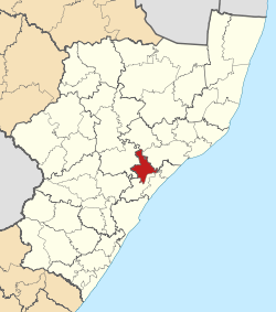
Country South Africa Province KwaZulu-Natal District iLembe District Seat Maphumulo Area - Total 896 km2 (345.9 sq mi) Population (2007)[1] - Total 109,157 - Density 121.8/km2 (315.5/sq mi) - Households 19,934 Racial makeup[2] (2007) - Black African 100.0% - White 0.00% - Coloured 0.00% - Indian or Asian 0.00% Time zone SAST (UTC+2) Municipal code KZN294 Maphumulo Local Municipality is an administrative area in the iLembe District of KwaZulu-Natal in South Africa. Maphumulo is an isiZulu name meaning "place of rest".[3]
The municipality is predominantly rural, comprising mostly tribal land, which is administered by the Ingonyama Trust on behalf of local communities.[4] Sugar-cane cultivation is the predominant economic activity and land use in the municipality. Subsistence agricultural activities in the form of small cropping areas attached to traditional family units dominate land usage.[4]
The only major town in the municipality is Maphumulo.[5]
References
- ^ "Community Survey, 2007: Basic Results Municipalities" (PDF). Statistics South Africa. http://www.statssa.gov.za/Publications/P03011/P030112007.pdf. Retrieved 2009-10-20.
- ^ "Community Survey 2007 interactive data". Statistics South Africa. http://www.statssa.gov.za/community_new/content.asp?link=interactivedata.asp. Retrieved 19 October 2009.
- ^ South African Languages - Place names
- ^ a b KwaZulu-Natal Top Business - Maphumulo Municipality
- ^ Provincial Profile 2004, KwaZulu-Natal, Statistics South Africa
Province of KwaZulu-Natal, South Africa Provincial Capital: Pietermaritzburg Metropolitan
MunicipalitiesDistrict
and Local
MunicipalitiesVulamehlo · uMdoni · Umzumbe · uMuziwabantu · Ezingoleni · Hibiscus CoastEmnambithi-Ladysmith · Indaka · Umtshezi · Okhahlamba · ImbabazaneNewcastle · eMadlangeni · DannhauseruMhlabuyalingana · Jozini · The Big Five False Bay · Hlabisa · MtubatubaIngwe · Kwa Sani · Greater Kokstad · Ubuhlebezwe · UmzimkhuluCategories:- Local municipalities of iLembe

Wikimedia Foundation. 2010.