- List of streets in Manhattan
-
This article covers numbered east-west streets in Manhattan, New York City. Major streets have their own linked articles; minor streets are discussed here. The streets do not run exactly east-west, because their grid is aligned with the Hudson River rather than with the cardinal directions. Rather their "west" is approximately 29 degrees north of west.
The numbered streets carry crosstown traffic. In general, even-numbered streets are one-way eastbound and odd-numbered streets are one-way west. Several exceptions reverse this. Most wider streets carry two-way traffic, as do a few of the narrow ones.
Streets change from west to east (for instance, East 10th Street to West 10th Street) at Broadway below 8th Street, and at Fifth Avenue from 8th Street and above.
Although the numbered streets begin just north of East Houston Street in the East Village, they generally do not extend west into Greenwich Village, which already had streets when the grid plan was laid out by the Commissioners' Plan of 1811. Streets that do continue farther west change directions before reaching the Hudson River. The grid covers the length of the island from 14th Street up. (13th Street is almost the southernmost numbered street to cover the entire width of Manhattan without changing directions, but diverts briefly northward as it meets 8th Avenue.)
The highest street number in Manhattan is 220th Street, but the numbering continues in The Bronx up to 263rd Street.[1]
Details
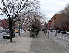 Peretz Square, Houston Street on left; First Street on right
1st Street - 7th Street
East 1st Street begins just north of East Houston Street at Avenue A and continues to Bowery. Peretz Square, a small triangular sliver park where Houston Street, First Street and First Avenue meet marks the spot where the grid takes hold.[2]
The east end of these streets is Avenue D, except for the aforementioned East 1st Street and East 6th Street, which connects to FDR Drive.
The west end of these streets is Bowery/Third Avenue, except for 3rd Street, formerly Amity Place, (to Sixth Avenue) and 4th Street (to West Street), which extend west and north, respectively, into Greenwich Village. Great Jones Street connects East 3rd to West 3rd.
East 5th Street is cut into three parts. 1st part is from Avenue D and ends on a dead end after Avenue C. Then it goes from Avenue B to Avenue A, and the 3rd part is from 1st Avenue to Cooper Square.
Lengths of streets
Street Start End Length 1st Street Avenue A/E Houston Street Bowery 0.6 km/0.4m 2nd Street Avenue D/E Houston Street Bowery 1.3 km/0.8m 3rd Street Avenue D Bowery 1.3 km/0.8m 4th Street Avenue D W 13th Street 3.1 km/2.0m 5th Street Avenue D Cooper Square/3rd Avenue 1 km/0.6m 6th Street FDR Drive Cooper Square/3rd Avenue 1.5 km/0.9m 7th Street Avenue D 3rd Avenue 1.3 km/0.8m - Also see West 4th Street (Manhattan)
8th Street and 9th Street
8th and 9th Streets run parallel to each other, beginning at Avenue D, interrupted by Tompkins Square Park at Avenue B, resuming at Avenue A and continuing to Sixth Avenue. West 8th Street is an important local shopping street. 8th Street between Avenue A and 3rd Avenue is called St Mark's Place, but it is counted in the length below.
M8 bus route operates eastbound on 8th Street and westbound on 9th Street between Avenue A and Sixth Avenue.
Lengths of streets
Street Start End Length 8th Street Avenue D 6th Avenue 2 km/1.3m 9th Street Avenue D 6th Avenue 2 km/1.3m - Also see 8th Street and St. Mark's Place (Manhattan)
10th Street to 13th Street
10th Street begins at FDR Drive and 11th and 12th Streets at Avenue C. West of Sixth Avenue they turn southward about 40 degrees to join the Greenwich Village street grid and continue to West Street on the Hudson River. Because West 4th Street turns northward at Sixth Avenue, it intersects 10th, 11th and 12th and 13th Streets in the West Village.
M8 bus operates on 10th Street in both directions between Avenue D and Avenue A, and eastbound between West Street and Sixth Avenue.
10th Street has an eastbound bike lane from 6th Avenue to the East River. In 2009, the two-way section of 10th Street between Avenue A and the East River had bicycle markings and sharrows installed, but it still has no bike lane.
13th Street is in 3 parts. The first is a dead end from Avenue C. Then it starts at a dead end, just before Avenue B, and runs to Greenwich Avenue, and the 3rd part is from 8th Avenue to 10th Avenue.
Lengths of streets
Street Start End Length 10th Street FDR Drive West Street 3.4 km/2.1m 11th Street Avenue C West Street 2.8 km/1.9m 12th Street Avenue C West Street 3.1 km/2.0m 13th Street Avenue C Dead End 0.3 km/0.2m 13th Street Dead End (Av B) 10th Avenue 3 km/1.9m 14th Street
14th Street is a main numbered street in Manhattan. It begins at Avenue C and ends at West Street. Its length is 3.4 km (2.1 mi). It has six underground stations:
- First Avenue (L train)
- Third Avenue (L train)
- 14th Street – Union Square (4 5 6 <6> L N Q R trains)
- 14th Street (Sixth Avenue) (L F M trains)
- 14th Street (Seventh Avenue) (1 2 3 trains)
- 14th Street – Eighth Avenue (A C E L trains)
From Avenue A or Avenue C to West Street there is service M14AD bus.
- Also see 14th Street
15th and 16th Streets
15th Street starts at FDR Drive, and 16th Street starts at a dead end half way between FDR Drive and Avenue C. They are both stopped at Avenue C and continue from 1st Avenue to West Street, stopped again at Union Square, and 16th Street also pauses at Stuywesant Square.
Lengths of streets
Street Start End Length 15th Street FDR Drive Avenue C 0.3 km/0.2m 15th Street 1st Avenue West Street 2.4 km/1.5m 16th Street Dead end (Av C) Avenue C 0.2 km/0.1m 16th Street 1st Avenue West Street 2.9 km/1.8m 17th to 19th Streets
All three, 17th, 18th and 19th Street start at 1st Avenue and finish at 11th Avenue.
18th Street has a local subway station at the crossing with 7th Avenue, served by the 1 2 trains on the IRT Broadway – Seventh Avenue Line. There used to be an 18th Street station on the IRT Lexington Avenue Line at the crossing with Park Avenue South.
On the part of 19th Street between 10th and 11th Avenues, the travel direction is different.
Lengths of streets
Street Start End Length 17th Street 1st Avenue 11th Avenue 2.6 km/1.6m 18th Street 1st Avenue 11th Avenue 2.6 km/1.6m 19th Street 1st Avenue 11th Avenue 2.6 km/1.6m Also see 17th Street
20th to 22nd Streets
20th Street starts at FDR Drive, and 21st and 22nd Streets start at 1st Avenue. They all end at 11th Avenue. Travel on the last block of the 20th, 21st and 22nd Streets (10th - 11th Avenues) is in the other direction than normal.
Lengths of streets
Street Start End Length 20th Street FDR Drive 11th Avenue 3.1 km/1.9m 21st Street 1st Avenue 11th Avenue 2.7 km/1.6m 22nd Street 1st Avenue 11th Avenue 2.7 km/1.6m 23rd Street
23rd Street is another main-er numbered street in Manhattan. It begins at FDR Drive and ends at 11th Avenue. Its length is 3.1 km/1.9m. It has two-way travel. On 23rd Street there are five local underground stations:
- 23rd Street at the crossing with Park Avenue South (4 6 <6> trains) on the IRT Lexington Avenue Line
- 23rd Street at the crossing with Fifth Avenue (N R trains) on the BMT Broadway Line
- 23rd Street at the crossing with Sixth Avenue (F M trains) on the IND Sixth Avenue Line
- 23rd Street at the crossing with Seventh Avenue (1 2 trains) on the IRT Broadway – Seventh Avenue Line
- 23rd Street at the crossing with Eighth Avenue (A C E trains) on the IND Eighth Avenue Line
Additionally, there is the M23 bus, running through the length of 23rd Street.
Also see 23rd Street
24th to 27th Streets
24th and 25th Street are in two parts. 24th Street starts at 1st Avenue, 25th Street at FDR Drive and they both end at Madison Avenue, because of Madison Square Park, then they continue from 5th Avenue to 11th Avenue (25th) or 12th Avenue (24th)
26th Street is all in one part
27th Street is also in 2 parts, one from 2nd to 8th Avenues and the other from 9th to 12th Avenues
26th Street after reaching FDR Drive bends and runs parallel to FDR Drive up to 30th Street.
There are no subway stations on these streets.
On 24th Street between 3rd and Lexington Avenues there is a bus stop for routes M101 (Night only), M102 and M103 towards East Village or City Hall, and between 11th and 12th Avenue there is an M23 bus stop towards FDR Drive
Lengths of streets
Street Start End Length 24th Street 1st Avenue Madison Avenue 0.9 km/0.6m 24th Street 5th Avenue 12th Avenue 1.9 km/1.2m 25th Street FDR Drive Madison Avenue 1.2 km/0.7m 25th Street 5th Avenue 11th Avenue 1.7 km/1m 26th Street 30th Street/FDR Drive 12th Avenue 3.5 km/2.2m 27th Street 2nd Avenue 8th Avenue 1.7 km/1m 27th Street 9th Avenue 12th Avenue 0.8 km/0.5m 28th Street
Three local subway stations:
- 28th Street (4 6 <6> trains) on the IRT Lexington Avenue Line at Park Avenue South.
- 28th Street (N R trains) on the BMT Broadway Line at Broadway.
- 28th Street (1 2 trains) on the IRT Broadway – Seventh Avenue Line at Seventh Avenue.
Also:
- The former 28th Street station on PATH at Sixth Avenue.
31st and 32nd Streets
31st Street begins on the West Side at the West Side Yard while 32nd Street, which includes a segment known as "Korea Way" between Fifth Avenue and Broadway in Manhattan's Koreatown, begins at the entrance to Penn Station and Madison Square Garden. On the East Side, both streets end at Second Avenue at Kips Bay Towers and NYU Medical Center which occupy the area between 30th and 33rd Streets.
33rd Street
- For subway and PATH stations, see 34th Street
34th Street
- See 34th Street
42nd Street
- See 42nd Street
47th Street
- See 47th Street
50th Street
- See 50th Street
51st Street
- See 51st Street
52nd Street
- See 52nd Street
53rd Street
- See 53rd Street
55th Street
- See 55th Street
57th Street
- See 57th Street
58th Street
A section of East 58th Street is also known as Designers Way
59th Street
- See 59th Street
66th Street
- See 66th Street
72nd Street
- See 72nd Street
79th Street
- See 79th Street
85th Street
- See 85th Street
86th Street
- See 86th Street
96th Street
- See 96th Street
110th Street
- See 110th Street
112th Street
- See 112th Street
116th Street
- See 116th Street
122nd Street
- See 122nd Street
125th Street
- See 125th Street
130th Street
- See 130th Street
132nd Street
- See 132nd Street
135th Street
Two local subway stations:
- 135th Street on the IND Eighth Avenue Line (A B C trains) at Saint Nicholas Avenue.
- 135th Street on the IRT Lenox Avenue Line (2 3 trains) at Lenox Avenue.
137th Street
One local subway station:
- 137th Street on the IRT Broadway – Seventh Avenue Line (1 train) at Broadway.
139th Street
- See 139th Street
145th Street
- See 145th Street
148th Street
One subway terminal:
- 148th Street on the IRT Lenox Avenue Line (3 train) at Adam Clayton Powell Jr. Boulevard.
155th Street
- See 155th Street
157th Street
One local subway station:
- 157th Street on the IRT Broadway – Seventh Avenue Line (1 train) at Broadway.
163rd Street
One local subway station:
- 163rd Street on the IND Eighth Avenue Line (A C trains) at Saint Nicholas Avenue and Amsterdam Avenue.
168th Street
A station complex with platforms for two subway lines:
- 168th Street on the IRT Broadway – Seventh Avenue Line (1 train) at Broadway.
- 168th Street on the IND Eighth Avenue Line (A C trains) at Saint Nicholas Avenue.
175th Street
One local subway station:
- 175th Street on the IND Eighth Avenue Line (A train) at Fort Washington Avenue.
181st Street
- See 181st Street
187th Street
- See 187th Street
190th Street
One local subway station:
- 190th Street on the IND Eighth Avenue Line (A train) at Fort Washington Avenue.
191st Street
One local subway station:
- 191st Street on the IRT Broadway – Seventh Avenue Line (1 train) at Saint Nicholas Avenue.
207th Street
Two local subway stations:
- 207th Street terminal on the IND Eighth Avenue Line (A train) at Broadway.
- 207th Street on the IRT Broadway – Seventh Avenue Line (1 train) at Tenth Avenue.
215th Street
One local subway station:
- 215th Street on the IRT Broadway – Seventh Avenue Line (1 train) at Tenth Avenue.
See also
References
- ^ New York City Map
- ^ Peretz Square, New York City Department of Parks and Recreation. Accessed July 12, 2007. "A sliver of Manhattan bounded by Houston Street, First Street and First Avenue, Peretz Square marks the spot where the tangled jumble of lower Manhattan meets the regularity of the Commissioners' Plan street grid."
Categories:- Streets in Manhattan

Wikimedia Foundation. 2010.