- Table of the major 4000 meter summits of the United States
-
Main article: Mountain peaks of the United StatesSee also: Table of the highest major summits of the United States, Table of the most prominent summits of the United States, and Table of the most isolated major summits of the United States
Contents
The following sortable table lists the 104 mountain peaks of the United States with at least 4000 meters (13,123.4 feet) of elevation and at least 500 meters (1640.4 feet) of topographic prominence.
Topographic elevation is the vertical distance above the reference geoid, a precise mathematical model of the Earth's sea level as an equipotential gravitational surface. Topographic prominence is the elevation difference between the summit and the highest or key col to a higher summit. Topographic isolation is the minimum great circle distance to a point of higher elevation.
This article defines a significant summit as a summit with at least 100 meters (328.1 feet) of topographic prominence, and a major summit as a summit with at least 500 meters (1640.4 feet) of topographic prominence. An ultra-prominent summit is a summit with at least 1500 meters (4921.3 feet) of topographic prominence. There are 129 ultra-prominent summits in the United States.
All elevations in the 48 states of the contiguous United States include an elevation adjustment from the National Geodetic Vertical Datum of 1929 (NGVD 29) to the North American Vertical Datum of 1988 (NAVD 88). For further information, please see this United States National Geodetic Survey note.
Of these 104 major 4000 meter peaks, 55 are located in Colorado, 23 in Alaska, 16 in California, 5 in Wyoming, 2 in Hawaiʻi, and one each in Washington, Utah, and New Mexico.
In the United States, only Mount McKinley exceeds 6000 meters (19,685 feet) elevation. Four major summits exceed 5000 meters (16,404.2 feet), and the following 104 major summits exceed 4000 meters (13,123.4 feet) elevation.
Table
Gallery
-

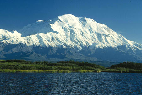
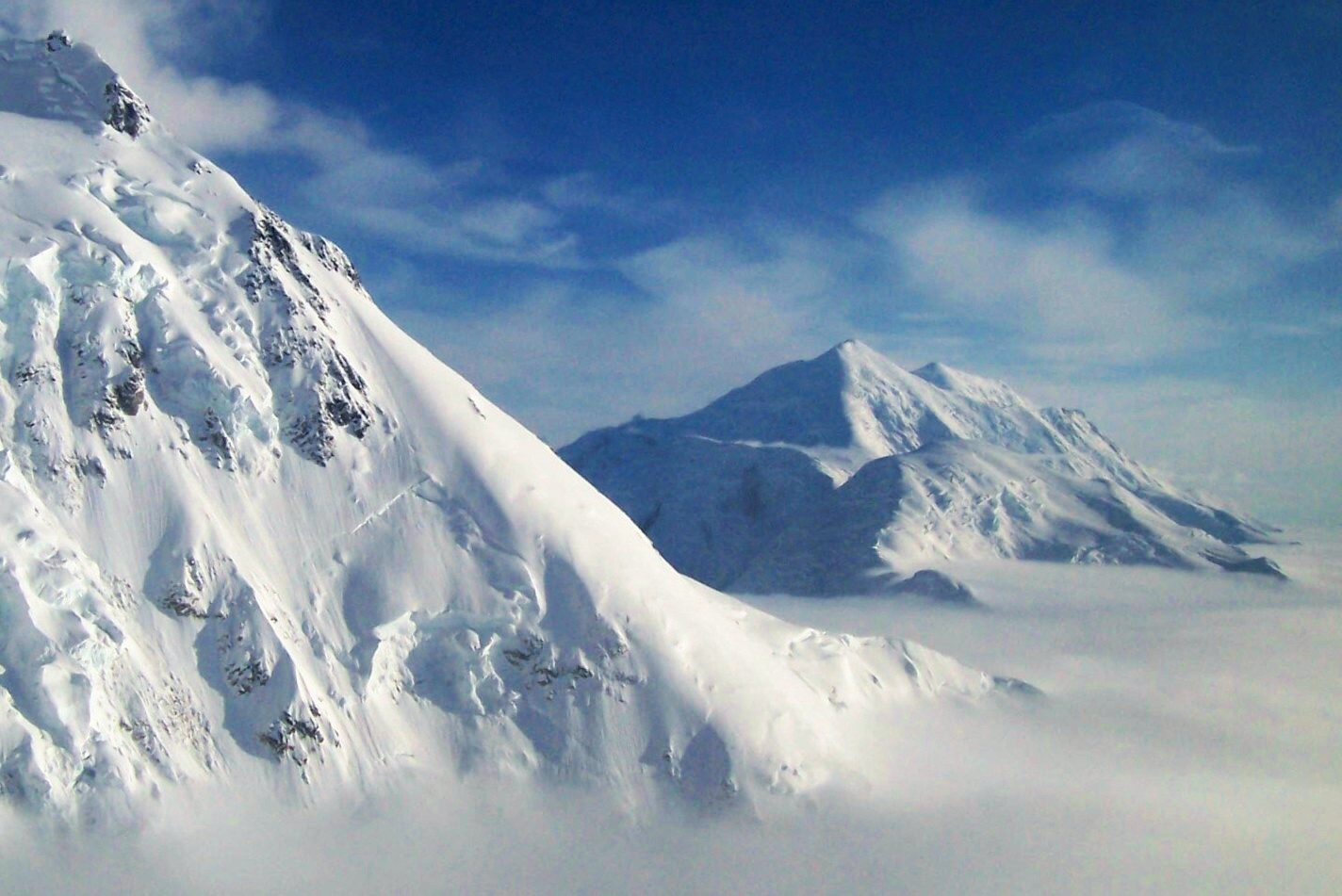
1. Mount McKinley, or Denali, in Alaska is the highest mountain peak of the United States and North America.
-
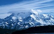
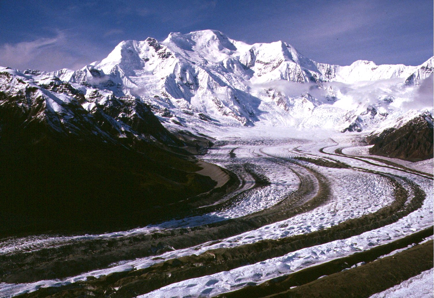
2. Mount Saint Elias on the border of Alaska and the Yukon is the second highest mountain peak of both the United States and Canada.
-

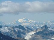
3. Mount Foraker is the second highest mountain peak of the Alaska Range.
-

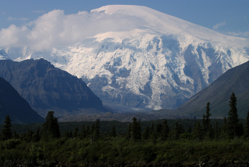
5. Mount Blackburn in Alaska is the highest peak of the Wrangell Mountains.
-

6. Mount Sanford in Alaska is the second highest peak of the Wrangell Mountains.
-
7. Mount Fairweather on the border of Alaska and British Columbia is the fourth most topographically prominent mountain peak of the U.S.
-

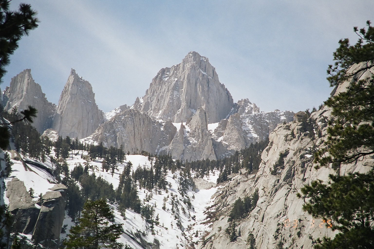
11. Mount Whitney in California is the highest mountain peak of the contiguous United States.
-

14. Mount Elbert in Colorado is the highest peak of the Rocky Mountains.
-

17. Mount Rainier in Washington is the third most topographically prominent mountain peak of the U.S.
-
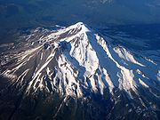
34. Mount Shasta in California is the second highest summit of the Cascade Range.
See also
- Outline of the United States
- Index of United States-related articles
- Lists of mountains
- Mountain peaks of North America
- Mountain peaks of Greenland
- Mountain peaks of Canada
- Mountain peaks of the Rocky Mountains
- Mountain peaks of the United States
- The 180 highest major summits of the United States
- The 104 major 4000 meter summits of the United States
- The 180 most prominent summits of the United States
- The 129 ultra-prominent summits of the United States
- The 180 most isolated major summits of the United States
- Mountain peaks of Alaska
- Mountain peaks of California
- Mountain peaks of Colorado
- The 180 highest major summits of the United States
- Mountain peaks of México
- Mountain peaks of Central America
- Mountain peaks of the Caribbean
- Physical geography
- Topography
- Topographic elevation
- Topographic isolation
- Topographic prominence
- Topographic summit
- Topography
- United States of America
- Geography of the United States
- Category:Mountains of the United States
- Geography of the United States
References
- ^ The summit of Mount McKinley (Denali) is the highest point of the Alaska Range, the State of Alaska, the United States of America, and all of North America.
- ^ "Mount McKinley". Summits of the World. peakbagger.com. http://www.peakbagger.com/peak.aspx?pid=271. Retrieved January 27, 2010.
- ^ The summit of Mount Saint Elias on the international border between Alaska and the Yukon is the second highest mountain peak of both Canada and the United States.
- ^ "Mount Saint Elias". Summits of the World. peakbagger.com. http://www.peakbagger.com/peak.aspx?pid=552. Retrieved January 11, 2010.
- ^ The summit of Mount Foraker is the westernmost 5000 m (16,404-foot) summit of North America.
- ^ "Mount Foraker". NGS Station Datasheet. United States National Geodetic Survey. http://www.ngs.noaa.gov/cgi-bin/ds_mark.prl?PidBox=UW6284. Retrieved January 27, 2010.
- ^ "Mount Foraker". Summits of the World. peakbagger.com. http://www.peakbagger.com/peak.aspx?pid=284. Retrieved January 27, 2010.
- ^ "Mount Bona". NGS Station Datasheet. United States National Geodetic Survey. http://www.ngs.noaa.gov/cgi-bin/ds_mark.prl?PidBox=UV4083. Retrieved January 27, 2010.
- ^ "Mount Bona". Summits of the World. peakbagger.com. http://www.peakbagger.com/peak.aspx?pid=496. Retrieved January 27, 2010.
- ^ "Mount Blackburn". NGS Station Datasheet. United States National Geodetic Survey. http://www.ngs.noaa.gov/cgi-bin/ds_mark.prl?PidBox=UV4136. Retrieved January 11, 2010.
- ^ "Mount Blackburn". Summits of the World. peakbagger.com. http://www.peakbagger.com/peak.aspx?pid=437. Retrieved January 11, 2010.
- ^ "Mount Sanford". Summits of the World. peakbagger.com. http://www.peakbagger.com/peak.aspx?pid=428. Retrieved January 27, 2010.
- ^ The summit of Mount Fairweather (Fairweather Mountain) on the border of Alaska is the highest point of the Province of British Columbia.
- ^ "Mount Fairweather". Summits of the World. peakbagger.com. http://www.peakbagger.com/peak.aspx?pid=566. Retrieved January 11, 2010.
- ^ "Mount Hubbard". Summits of the World. peakbagger.com. http://www.peakbagger.com/peak.aspx?pid=548. Retrieved January 25, 2010.
- ^ "Mount Bear". Summits of the World. peakbagger.com. http://www.peakbagger.com/peak.aspx?pid=501. Retrieved January 27, 2010.
- ^ "Mount Hunter". NGS Station Datasheet. United States National Geodetic Survey. http://www.ngs.noaa.gov/cgi-bin/ds_mark.prl?PidBox=UW6282. Retrieved January 27, 2010.
- ^ "Mount Hunter". Summits of the World. peakbagger.com. http://www.peakbagger.com/peak.aspx?pid=285. Retrieved January 27, 2010.
- ^ The summit of Mount Whitney is the highest point of the Sierra Nevada, the State of California, and the contiguous United States.
- ^ "Mount Whitney". NGS Station Datasheet. United States National Geodetic Survey. http://www.ngs.noaa.gov/cgi-bin/ds_mark.prl?PidBox=GT1812. Retrieved January 17, 2010.
- ^ "Mount Whitney". Summits of the World. peakbagger.com. http://www.peakbagger.com/peak.aspx?pid=2829. Retrieved January 17, 2010.
- ^ The summit elevation of Mount Whitney includes a vertical adjustment of +1.869 m (+6.1 ft).
- ^ "Mount Alverstone". Summits of the World. peakbagger.com. http://www.peakbagger.com/peak.aspx?pid=543. Retrieved January 25, 2010.
- ^ "University Peak". Summits of the World. peakbagger.com. http://www.peakbagger.com/peak.aspx?pid=499. Retrieved January 27, 2010.
- ^ The summit of Mount Elbert is the highest point of the Rocky Mountains and the State of Colorado.
- ^ "Mount Elbert". NGS Station Datasheet. United States National Geodetic Survey. http://www.ngs.noaa.gov/cgi-bin/ds_mark.prl?PidBox=KL0637. Retrieved January 17, 2010.
- ^ "Mount Elbert". Summits of the World. peakbagger.com. http://www.peakbagger.com/peak.aspx?pid=5736. Retrieved January 17, 2010.
- ^ The summit elevation of Mount Elbert includes a vertical adjustment of +1.995 m (+6.5 ft).
- ^ "Mount Massive". NGS Station Datasheet. United States National Geodetic Survey. http://www.ngs.noaa.gov/cgi-bin/ds_mark.prl?PidBox=KL0640. Retrieved January 17, 2010.
- ^ "Mount Massive". Summits of the World. peakbagger.com. http://www.peakbagger.com/peak.aspx?pid=5729. Retrieved January 17, 2010.
- ^ The summit elevation of Mount Massive includes a vertical adjustment of +2.087 m (+6.8 ft).
- ^ "Mount Harvard". NGS Station Datasheet. United States National Geodetic Survey. http://www.ngs.noaa.gov/cgi-bin/ds_mark.prl?PidBox=JL0879. Retrieved January 17, 2010.
- ^ "Mount Harvard". Summits of the World. peakbagger.com. http://www.peakbagger.com/peak.aspx?pid=5754. Retrieved January 17, 2010.
- ^ The summit elevation of Mount Harvard includes a vertical adjustment of +2.084 m (+6.8 ft).
- ^ The summit elevation of Mount Harvard includes a vertical offset of +1.8 m (+5.9 ft) from the benchmark.
- ^ The summit of Mount Rainier is the highest point of the Cascade Range and the State of Washington.
- ^ "Mount Rainier". NGS Station Datasheet. United States National Geodetic Survey. http://www.ngs.noaa.gov/cgi-bin/ds_mark.prl?PidBox=SB1041. Retrieved January 27, 2010.
- ^ "Mount Rainier". Summits of the World. peakbagger.com. http://www.peakbagger.com/peak.aspx?pid=2296. Retrieved January 27, 2010.
- ^ The summit elevation of Mount Rainier includes a vertical adjustment of +1.935 m (+6.3 ft).
- ^ "Mount Williamson". Summits of the World. peakbagger.com. http://www.peakbagger.com/peak.aspx?pid=2814. Retrieved January 28, 2010.
- ^ The summit elevation of Mount Williamson includes a vertical adjustment of +1.807 m (+5.9 ft).
- ^ "La Plata Peak". Summits of the World. peakbagger.com. http://www.peakbagger.com/peak.aspx?pid=5744. Retrieved January 28, 2010.
- ^ The summit elevation of La Plata Peak includes a vertical adjustment of +1.983 m (+6.5 ft).
- ^ "Blanca Peak". NGS Station Datasheet. United States National Geodetic Survey. http://www.ngs.noaa.gov/cgi-bin/ds_mark.prl?PidBox=HK0514. Retrieved January 2, 2010.
- ^ "Blanca Peak". Summits of the World. peakbagger.com. http://www.peakbagger.com/peak.aspx?pid=5921. Retrieved January 2, 2010.
- ^ The summit elevation of Blanca Peak includes a vertical adjustment of +1.755 m (+5.8 ft).
- ^ "Uncompahgre Peak". NGS Station Datasheet. United States National Geodetic Survey. http://www.ngs.noaa.gov/cgi-bin/ds_mark.prl?PidBox=JL0798. Retrieved January 17, 2010.
- ^ "Uncompahgre Peak". Summits of the World. peakbagger.com. http://www.peakbagger.com/peak.aspx?pid=5836. Retrieved January 17, 2010.
- ^ The summit elevation of Uncompahgre Peak includes a vertical adjustment of +1.967 m (+6.5 ft).
- ^ "Crestone Peak". Summits of the World. peakbagger.com. http://www.peakbagger.com/peak.aspx?pid=5908. Retrieved January 2, 2010.
- ^ The summit elevation of Crestone Peak includes a vertical adjustment of +1.76 m (+5.8 ft).
- ^ "Mount Lincoln". NGS Station Datasheet. United States National Geodetic Survey. http://www.ngs.noaa.gov/cgi-bin/ds_mark.prl?PidBox=KL0627. Retrieved January 17, 2010.
- ^ "Mount Lincoln". Summits of the World. peakbagger.com. http://www.peakbagger.com/peak.aspx?pid=5793. Retrieved January 17, 2010.
- ^ The summit elevation of Mount Lincoln includes a vertical adjustment of +2.098 m (+6.9 ft).
- ^ "Castle Peak". NGS Station Datasheet. United States National Geodetic Survey. http://www.ngs.noaa.gov/cgi-bin/ds_mark.prl?PidBox=KL0659. Retrieved January 17, 2010.
- ^ "Castle Peak". Summits of the World. peakbagger.com. http://www.peakbagger.com/peak.aspx?pid=5709. Retrieved January 17, 2010.
- ^ The summit elevation of Castle Peak includes a vertical adjustment of +2.165 m (+7.1 ft).
- ^ The summit of Grays Peak is the highest point on the Continental Divide of North America.
- ^ "Grays Peak". NGS Station Datasheet. United States National Geodetic Survey. http://www.ngs.noaa.gov/cgi-bin/ds_mark.prl?PidBox=KK2036. Retrieved January 17, 2010.
- ^ "Grays Peak". Summits of the World. peakbagger.com. http://www.peakbagger.com/peak.aspx?pid=5664. Retrieved January 17, 2010.
- ^ The summit elevation of Grays Peak includes a vertical adjustment of +1.881 m (+6.2 ft).
- ^ "Mount Antero". NGS Station Datasheet. United States National Geodetic Survey. http://www.ngs.noaa.gov/cgi-bin/ds_mark.prl?PidBox=JL0883. Retrieved January 17, 2010.
- ^ "Mount Antero". Summits of the World. peakbagger.com. http://www.peakbagger.com/peak.aspx?pid=5759. Retrieved January 17, 2010.
- ^ The summit elevation of Mount Antero includes a vertical adjustment of +2.071 m (+6.8 ft).
- ^ "Mount Evans". NGS Station Datasheet. United States National Geodetic Survey. http://www.ngs.noaa.gov/cgi-bin/ds_mark.prl?PidBox=KK2030. Retrieved January 17, 2010.
- ^ "Mount Evans". Summits of the World. peakbagger.com. http://www.peakbagger.com/peak.aspx?pid=5676. Retrieved January 17, 2010.
- ^ The summit elevation of Mount Evans includes a vertical adjustment of +1.827 m (+6.0 ft).
- ^ "Longs Peak". NGS Station Datasheet. United States National Geodetic Survey. http://www.ngs.noaa.gov/cgi-bin/ds_mark.prl?PidBox=LL1346. Retrieved January 17, 2010.
- ^ "Longs Peak". Summits of the World. peakbagger.com. http://www.peakbagger.com/peak.aspx?pid=5642. Retrieved January 17, 2010.
- ^ The summit elevation of Longs Peak includes a vertical adjustment of +1.652 m (+5.4 ft).
- ^ "Mount Wilson". Summits of the World. peakbagger.com. http://www.peakbagger.com/peak.aspx?pid=5820. Retrieved January 2, 2010.
- ^ The summit elevation of Mount Wilson includes a vertical adjustment of +1.899 m (+6.2 ft).
- ^ "White Mountain Peak". NGS Station Datasheet. United States National Geodetic Survey. http://www.ngs.noaa.gov/cgi-bin/ds_mark.prl?PidBox=HR2559. Retrieved January 17, 2010.
- ^ "White Mountain Peak". Summits of the World. peakbagger.com. http://www.peakbagger.com/peak.aspx?pid=3628. Retrieved January 17, 2010.
- ^ The summit elevation of White Mountain Peak includes a vertical adjustment of +1.91 m (+6.3 ft).
- ^ "North Palisade". NGS Station Datasheet. United States National Geodetic Survey. http://www.ngs.noaa.gov/cgi-bin/ds_mark.prl?PidBox=HR2629. Retrieved January 17, 2010.
- ^ "North Palisade". Summits of the World. peakbagger.com. http://www.peakbagger.com/peak.aspx?pid=2727. Retrieved January 17, 2010.
- ^ The summit elevation of North Palisade includes a vertical adjustment of +1.867 m (+6.1 ft).
- ^ "Mount Princeton". NGS Station Datasheet. United States National Geodetic Survey. http://www.ngs.noaa.gov/cgi-bin/ds_mark.prl?PidBox=JL0886. Retrieved January 17, 2010.
- ^ "Mount Princeton". Summits of the World. peakbagger.com. http://www.peakbagger.com/peak.aspx?pid=5757. Retrieved January 17, 2010.
- ^ The summit elevation of Mount Princeton includes a vertical adjustment of +2.075 m (+6.8 ft).
- ^ "Mount Yale". NGS Station Datasheet. United States National Geodetic Survey. http://www.ngs.noaa.gov/cgi-bin/ds_mark.prl?PidBox=JL0889. Retrieved January 17, 2010.
- ^ "Mount Yale". Summits of the World. peakbagger.com. http://www.peakbagger.com/peak.aspx?pid=5756. Retrieved January 17, 2010.
- ^ The summit elevation of Mount Yale includes a vertical adjustment of +2.036 m (+6.7 ft).
- ^ The summit elevation of Mount Yale includes a vertical offset of +0.6 m (+2.0 ft) from the benchmark.
- ^ "Mount Shasta". NGS Station Datasheet. United States National Geodetic Survey. http://www.ngs.noaa.gov/cgi-bin/ds_mark.prl?PidBox=MX1016. Retrieved January 17, 2010.
- ^ "Mount Shasta". Summits of the World. peakbagger.com. http://www.peakbagger.com/peak.aspx?pid=2477. Retrieved January 17, 2010.
- ^ The summit elevation of Mount Shasta includes a vertical adjustment of +1.791 m (+5.9 ft).
- ^ "Maroon Peak". NGS Station Datasheet. United States National Geodetic Survey. http://www.ngs.noaa.gov/cgi-bin/ds_mark.prl?PidBox=KL0805. Retrieved January 17, 2010.
- ^ "Maroon Peak". Summits of the World. peakbagger.com. http://www.peakbagger.com/peak.aspx?pid=5701. Retrieved January 17, 2010.
- ^ The summit elevation of Maroon Peak includes a vertical adjustment of +2.048 m (+6.7 ft).
- ^ "Mount Wrangell". Summits of the World. peakbagger.com. http://www.peakbagger.com/peak.aspx?pid=434. Retrieved January 27, 2010.
- ^ "Mount Sneffels". NGS Station Datasheet. United States National Geodetic Survey. http://www.ngs.noaa.gov/cgi-bin/ds_mark.prl?PidBox=JL0826. Retrieved January 17, 2010.
- ^ "Mount Sneffels". Summits of the World. peakbagger.com. http://www.peakbagger.com/peak.aspx?pid=5830. Retrieved January 17, 2010.
- ^ The summit elevation of Mount Sneffels includes a vertical adjustment of +1.879 m (+6.2 ft).
- ^ "Capitol Peak". NGS Station Datasheet. United States National Geodetic Survey. http://www.ngs.noaa.gov/cgi-bin/ds_mark.prl?PidBox=KL0688. Retrieved January 17, 2010.
- ^ "Capitol Peak". Summits of the World. peakbagger.com. http://www.peakbagger.com/peak.aspx?pid=5695. Retrieved January 17, 2010.
- ^ The summit elevation of Capitol Peak includes a vertical adjustment of +1.991 m (+6.5 ft).
- ^ "Pikes Peak". NGS Station Datasheet. United States National Geodetic Survey. http://www.ngs.noaa.gov/cgi-bin/ds_mark.prl?PidBox=JK1242. Retrieved January 17, 2010.
- ^ "Pikes Peak". Summits of the World. peakbagger.com. http://www.peakbagger.com/peak.aspx?pid=5689. Retrieved January 17, 2010.
- ^ The summit elevation of Pikes Peak includes a vertical adjustment of +1.678 m (+5.5 ft).
- ^ "Mount Eolus". Summits of the World. peakbagger.com. http://www.peakbagger.com/peak.aspx?pid=5860. Retrieved January 28, 2010.
- ^ The summit elevation of Mount Eolus includes a vertical adjustment of +1.756 m (+5.8 ft).
- ^ "Mount Augusta". Summits of the World. peakbagger.com. http://www.peakbagger.com/peak.aspx?pid=551. Retrieved January 26, 2010.
- ^ "Handies Peak". NGS Station Datasheet. United States National Geodetic Survey. http://www.ngs.noaa.gov/cgi-bin/ds_mark.prl?PidBox=HL0635. Retrieved January 17, 2010.
- ^ "Handies Peak". Summits of the World. peakbagger.com. http://www.peakbagger.com/peak.aspx?pid=5840. Retrieved January 17, 2010.
- ^ The summit elevation of Handies Peak includes a vertical adjustment of +1.994 m (+6.5 ft).
- ^ "Culebra Peak". Summits of the World. peakbagger.com. http://www.peakbagger.com/peak.aspx?pid=5924. Retrieved January 2, 2010.
- ^ The summit elevation of Culebra Peak includes a vertical adjustment of +1.74 m (+5.7 ft).
- ^ "San Luis Peak". NGS Station Datasheet. United States National Geodetic Survey. http://www.ngs.noaa.gov/cgi-bin/ds_mark.prl?PidBox=HL0570. Retrieved January 17, 2010.
- ^ "San Luis Peak". Summits of the World. peakbagger.com. http://www.peakbagger.com/peak.aspx?pid=5874. Retrieved January 17, 2010.
- ^ The summit elevation of San Luis Peak includes a vertical adjustment of +2.098 m (+6.9 ft).
- ^ "Mount of the Holy Cross". NGS Station Datasheet. United States National Geodetic Survey. http://www.ngs.noaa.gov/cgi-bin/ds_mark.prl?PidBox=KL0649. Retrieved January 17, 2010.
- ^ "Mount of the Holy Cross". Summits of the World. peakbagger.com. http://www.peakbagger.com/peak.aspx?pid=5725. Retrieved January 17, 2010.
- ^ The summit elevation of Mount of the Holy Cross includes a vertical adjustment of +1.926 m (+6.3 ft).
- ^ "Grizzly Peak". NGS Station Datasheet. United States National Geodetic Survey. http://www.ngs.noaa.gov/cgi-bin/ds_mark.prl?PidBox=KL0800. Retrieved January 17, 2010.
- ^ "Grizzly Peak". Summits of the World. peakbagger.com. http://www.peakbagger.com/peak.aspx?pid=5741. Retrieved January 17, 2010.
- ^ The summit elevation of Grizzly Peak includes a vertical adjustment of +2.035 m (+6.7 ft).
- ^ "Mount Humphreys". NGS Station Datasheet. United States National Geodetic Survey. http://www.ngs.noaa.gov/cgi-bin/ds_mark.prl?PidBox=HR2626. Retrieved January 17, 2010.
- ^ "Mount Humphreys". Summits of the World. peakbagger.com. http://www.peakbagger.com/peak.aspx?pid=2681. Retrieved January 17, 2010.
- ^ The summit elevation of Mount Humphreys includes a vertical adjustment of +1.842 m (+6.0 ft).
- ^ "Mount Keith". NGS Station Datasheet. United States National Geodetic Survey. http://www.ngs.noaa.gov/cgi-bin/ds_mark.prl?PidBox=GT1807. Retrieved January 17, 2010.
- ^ "Mount Keith". Summits of the World. peakbagger.com. http://www.peakbagger.com/peak.aspx?pid=2811. Retrieved January 17, 2010.
- ^ The summit elevation of Mount Keith includes a vertical adjustment of +1.795 m (+5.9 ft).
- ^ "Mount Ouray". NGS Station Datasheet. United States National Geodetic Survey. http://www.ngs.noaa.gov/cgi-bin/ds_mark.prl?PidBox=JL0672. Retrieved January 17, 2010.
- ^ "Mount Ouray". Summits of the World. peakbagger.com. http://www.peakbagger.com/peak.aspx?pid=5764. Retrieved January 17, 2010.
- ^ The summit elevation of Mount Ouray includes a vertical adjustment of +1.871 m (+6.1 ft).
- ^ "Vermilion Peak". Summits of the World. peakbagger.com. http://www.peakbagger.com/peak.aspx?pid=5828. Retrieved January 28, 2010.
- ^ The summit elevation of Vermilion Peak includes a vertical adjustment of +1.827 m (+6.0 ft).
- ^ "Atna Peaks". Summits of the World. peakbagger.com. http://www.peakbagger.com/peak.aspx?pid=17397. Retrieved January 27, 2010.
- ^ "Regal Mountain". NGS Station Datasheet. United States National Geodetic Survey. http://www.ngs.noaa.gov/cgi-bin/ds_mark.prl?PidBox=UV4133. Retrieved January 27, 2010.
- ^ "Regal Mountain". Summits of the World. peakbagger.com. http://www.peakbagger.com/peak.aspx?pid=436. Retrieved January 27, 2010.
- ^ "Mount Darwin". NGS Station Datasheet. United States National Geodetic Survey. http://www.ngs.noaa.gov/cgi-bin/ds_mark.prl?PidBox=HR2631. Retrieved January 17, 2010.
- ^ "Mount Darwin". Summits of the World. peakbagger.com. http://www.peakbagger.com/peak.aspx?pid=2691. Retrieved January 17, 2010.
- ^ The summit elevation of Mount Darwin includes a vertical adjustment of +1.886 m (+6.2 ft).
- ^ The summit of Mount Hayes is the northernmost 4000 m (13,123-foot) summit of North America.
- ^ "Mount Hayes". NGS Station Datasheet. United States National Geodetic Survey. http://www.ngs.noaa.gov/cgi-bin/ds_mark.prl?PidBox=TT6365. Retrieved January 27, 2010.
- ^ "Mount Hayes". Summits of the World. peakbagger.com. http://www.peakbagger.com/peak.aspx?pid=305. Retrieved January 27, 2010.
- ^ "Mount Silverheels". NGS Station Datasheet. United States National Geodetic Survey. http://www.ngs.noaa.gov/cgi-bin/ds_mark.prl?PidBox=KL0629. Retrieved January 17, 2010.
- ^ "Mount Silverheels". Summits of the World. peakbagger.com. http://www.peakbagger.com/peak.aspx?pid=5681. Retrieved January 17, 2010.
- ^ The summit elevation of Mount Silverheels includes a vertical adjustment of +1.982 m (+6.5 ft).
- ^ "Rio Grande Pyramid". NGS Station Datasheet. United States National Geodetic Survey. http://www.ngs.noaa.gov/cgi-bin/ds_mark.prl?PidBox=HL0589. Retrieved January 17, 2010.
- ^ "Rio Grande Pyramid". Summits of the World. peakbagger.com. http://www.peakbagger.com/peak.aspx?pid=5869. Retrieved January 17, 2010.
- ^ The summit elevation of Rio Grande Pyramid includes a vertical adjustment of +1.801 m (+5.9 ft).
- ^ The summit of Gannett Peak is the highest point of the Central Rocky Mountains and the State of Wyoming.
- ^ "Gannett Peak". NGS Station Datasheet. United States National Geodetic Survey. http://www.ngs.noaa.gov/cgi-bin/ds_mark.prl?PidBox=OW0356. Retrieved January 17, 2010.
- ^ "Gannett Peak". Summits of the World. peakbagger.com. http://www.peakbagger.com/peak.aspx?pid=5352. Retrieved January 17, 2010.
- ^ The summit elevation of Gannett Peak includes a vertical adjustment of +1.737 m (+5.7 ft).
- ^ "Mount Kaweah". Summits of the World. peakbagger.com. http://www.peakbagger.com/peak.aspx?pid=2807. Retrieved January 28, 2010.
- ^ The summit elevation of Mount Kaweah includes a vertical adjustment of +1.652 m (+5.4 ft).
- ^ The summit of Mauna Kea is the highest point of the Island of Hawaiʻi, the State of Hawaiʻi, and the entire North Pacific Ocean. Mauna Kea is also the tallest mountain on Earth as measured from base to summit. The shield volcano sits on the ocean floor at a depth of 5,998 meters (19,678 ft) for a total height of 10,205.3 meters (33,482 ft).
- ^ "Mauna Kea". NGS Station Datasheet. United States National Geodetic Survey. http://www.ngs.noaa.gov/cgi-bin/ds_mark.prl?PidBox=TU2314. Retrieved January 2, 2010.
- ^ "Mauna Kea". Summits of the World. peakbagger.com. http://www.peakbagger.com/peak.aspx?pid=11909. Retrieved January 2, 2010.
- ^ "Grand Teton". NGS Station Datasheet. United States National Geodetic Survey. http://www.ngs.noaa.gov/cgi-bin/ds_mark.prl?PidBox=OX0838. Retrieved January 17, 2010.
- ^ "Grand Teton". Summits of the World. peakbagger.com. http://www.peakbagger.com/peak.aspx?pid=5218. Retrieved January 17, 2010.
- ^ The summit elevation of Grand Teton includes a vertical adjustment of +1.571 m (+5.2 ft).
- ^ "Mount Cook". Summits of the World. peakbagger.com. http://www.peakbagger.com/peak.aspx?pid=554. Retrieved January 26, 2010.
- ^ "Mount Morgan". NGS Station Datasheet. United States National Geodetic Survey. http://www.ngs.noaa.gov/cgi-bin/ds_mark.prl?PidBox=HR2627. Retrieved January 17, 2010.
- ^ "Mount Morgan". Summits of the World. peakbagger.com. http://www.peakbagger.com/peak.aspx?pid=2662. Retrieved January 17, 2010.
- ^ The summit elevation of Mount Morgan includes a vertical adjustment of +1.853 m (+6.1 ft).
- ^ "Mount Gabb". Summits of the World. peakbagger.com. http://www.peakbagger.com/peak.aspx?pid=2668. Retrieved January 28, 2010.
- ^ The summit elevation of Mount Gabb includes a vertical adjustment of +1.958 m (+6.4 ft).
- ^ "Bald Mountain". Summits of the World. peakbagger.com. http://www.peakbagger.com/peak.aspx?pid=16675. Retrieved January 28, 2010.
- ^ The summit elevation of Bald Mountain includes a vertical adjustment of +1.922 m (+6.3 ft).
- ^ "Mount Oso". Summits of the World. peakbagger.com. http://www.peakbagger.com/peak.aspx?pid=7854. Retrieved September 20, 2010.
- ^ The summit elevation of Mount Oso includes a vertical adjustment of +1.776 m (+5.8 ft).
- ^ "Mauna Loa". NGS Station Datasheet. United States National Geodetic Survey. http://www.ngs.noaa.gov/cgi-bin/ds_mark.prl?PidBox=TU0145. Retrieved January 2, 2010.
- ^ "Mauna Loa". Summits of the World. peakbagger.com. http://www.peakbagger.com/peak.aspx?pid=11915. Retrieved January 2, 2010.
- ^ The shield volcano Mauna Loa is the most voluminous mountain on Earth with an estimated volume of 74,000 km³ (17,800 cubic miles), or enough material to fill the Grand Canyon more than 18 times.
- ^ "Mount Jackson". NGS Station Datasheet. United States National Geodetic Survey. http://www.ngs.noaa.gov/cgi-bin/ds_mark.prl?PidBox=KL0650. Retrieved January 17, 2010.
- ^ "Mount Jackson". Summits of the World. peakbagger.com. http://www.peakbagger.com/peak.aspx?pid=16632. Retrieved January 17, 2010.
- ^ The summit elevation of Mount Jackson includes a vertical adjustment of +1.922 m (+6.3 ft).
- ^ "Mount Tom". Summits of the World. peakbagger.com. http://www.peakbagger.com/peak.aspx?pid=2673. Retrieved January 28, 2010.
- ^ The summit elevation of Mount Tom includes a vertical adjustment of +1.796 m (+5.9 ft).
- ^ "Bard Peak". Summits of the World. peakbagger.com. http://www.peakbagger.com/peak.aspx?pid=16639. Retrieved January 28, 2010.
- ^ The summit elevation of Bard Peak includes a vertical adjustment of +1.707 m (+5.6 ft).
- ^ The summit of West Spanish Peak is the easternmost 4000 m (13,123-foot) summit of the United States.
- ^ "West Spanish Peak". Summits of the World. peakbagger.com. http://www.peakbagger.com/peak.aspx?pid=5928. Retrieved January 28, 2010.
- ^ The summit elevation of West Spanish Peak includes a vertical adjustment of +1.468 m (+4.8 ft).
- ^ "Mount Powell". Summits of the World. peakbagger.com. http://www.peakbagger.com/peak.aspx?pid=5774. Retrieved January 28, 2010.
- ^ The summit elevation of Mount Powell includes a vertical adjustment of +1.771 m (+5.8 ft).
- ^ "Hagues Peak". NGS Station Datasheet. United States National Geodetic Survey. http://www.ngs.noaa.gov/cgi-bin/ds_mark.prl?PidBox=LL1350. Retrieved January 17, 2010.
- ^ "Hagues Peak". Summits of the World. peakbagger.com. http://www.peakbagger.com/peak.aspx?pid=5590. Retrieved January 17, 2010.
- ^ The summit elevation of Hagues Peak includes a vertical adjustment of +1.719 m (+5.6 ft).
- ^ "Mount Dubois". Summits of the World. peakbagger.com. http://www.peakbagger.com/peak.aspx?pid=3627. Retrieved January 28, 2010.
- ^ The summit elevation of Mount Dubois includes a vertical adjustment of +1.879 m (+6.2 ft).
- ^ "Tower Mountain". Summits of the World. peakbagger.com. http://www.peakbagger.com/peak.aspx?pid=16643. Retrieved January 28, 2010.
- ^ The summit elevation of Tower Mountain includes a vertical adjustment of +1.796 m (+5.9 ft).
- ^ "Treasure Mountain". Summits of the World. peakbagger.com. http://www.peakbagger.com/peak.aspx?pid=5707. Retrieved January 28, 2010.
- ^ The summit elevation of Treasure Mountain includes a vertical adjustment of +2.008 m (+6.6 ft).
- ^ The summit of Kings Peak is the highest point of the Western Rocky Mountains and the State of Utah.
- ^ "Kings Peak". NGS Station Datasheet. United States National Geodetic Survey. http://www.ngs.noaa.gov/cgi-bin/ds_mark.prl?PidBox=LO1058. Retrieved January 3, 2010.
- ^ "Kings Peak". Summits of the World. peakbagger.com. http://www.peakbagger.com/peak.aspx?pid=5507. Retrieved January 3, 2010.
- ^ The summit elevation of Kings Peak includes a vertical adjustment of +1.794 m (+5.9 ft).
- ^ "North Arapaho Peak". NGS Station Datasheet. United States National Geodetic Survey. http://www.ngs.noaa.gov/cgi-bin/ds_mark.prl?PidBox=LL1357. Retrieved January 17, 2010.
- ^ "North Arapaho Peak". Summits of the World. peakbagger.com. http://www.peakbagger.com/peak.aspx?pid=5646. Retrieved January 17, 2010.
- ^ The summit elevation of North Arapaho Peak includes a vertical adjustment of +1.763 m (+5.8 ft).
- ^ "Mount Pinchot". Summits of the World. peakbagger.com. http://www.peakbagger.com/peak.aspx?pid=2750. Retrieved January 3, 2010.
- ^ The summit elevation of Mount Pinchot includes a vertical adjustment of +1.81 m (+5.9 ft).
- ^ "Mount Natazhat". Summits of the World. peakbagger.com. http://www.peakbagger.com/peak.aspx?pid=494. Retrieved January 27, 2010.
- ^ "Mount Jarvis". Summits of the World. peakbagger.com. http://www.peakbagger.com/peak.aspx?pid=432. Retrieved January 27, 2010.
- ^ "Parry Peak". Summits of the World. peakbagger.com. http://www.peakbagger.com/peak.aspx?pid=16682. Retrieved January 28, 2010.
- ^ The summit elevation of Parry Peak includes a vertical adjustment of +1.763 m (+5.8 ft).
- ^ "Williams Mountains High Point". Summits of the World. peakbagger.com. http://www.peakbagger.com/peak.aspx?pid=16642. Retrieved January 3, 2010.
- ^ The summit elevation of Williams Mountains High Point includes a vertical adjustment of +2.044 m (+6.7 ft).
- ^ "Sultan Mountain". Summits of the World. peakbagger.com. http://www.peakbagger.com/peak.aspx?pid=16630. Retrieved January 28, 2010.
- ^ The summit elevation of Sultan Mountain includes a vertical adjustment of +1.649 m (+5.4 ft).
- ^ "Mount Herard". Summits of the World. peakbagger.com. http://www.peakbagger.com/peak.aspx?pid=5911. Retrieved January 28, 2010.
- ^ The summit elevation of Mount Herard includes a vertical adjustment of +1.64 m (+5.4 ft).
- ^ "West Buffalo Peak". NGS Station Datasheet. United States National Geodetic Survey. http://www.ngs.noaa.gov/cgi-bin/ds_mark.prl?PidBox=JL0653. Retrieved January 28, 2010.
- ^ "West Buffalo Peak". Summits of the World. peakbagger.com. http://www.peakbagger.com/peak.aspx?pid=5808. Retrieved January 28, 2010.
- ^ The summit elevation of West Buffalo Peak includes a vertical adjustment of +1.834 m (+6.0 ft).
- ^ "Tressider Peak". Summits of the World. peakbagger.com. http://www.peakbagger.com/peak.aspx?pid=21309. Retrieved January 27, 2010.
- ^ "Summit Peak". NGS Station Datasheet. United States National Geodetic Survey. http://www.ngs.noaa.gov/cgi-bin/ds_mark.prl?PidBox=HL0503. Retrieved January 17, 2010.
- ^ "Summit Peak". Summits of the World. peakbagger.com. http://www.peakbagger.com/peak.aspx?pid=5882. Retrieved January 17, 2010.
- ^ The summit elevation of Summit Peak includes a vertical adjustment of +1.877 m (+6.2 ft).
- ^ "Dolores Peak". Summits of the World. peakbagger.com. http://www.peakbagger.com/peak.aspx?pid=5818. Retrieved January 2, 2010.
- ^ The summit elevation of Dolores Peak includes a vertical adjustment of +1.8 m (+5.9 ft).
- ^ "Antora Peak". NGS Station Datasheet. United States National Geodetic Survey. http://www.ngs.noaa.gov/cgi-bin/ds_mark.prl?PidBox=JL0670. Retrieved January 28, 2010.
- ^ "Antora Peak". Summits of the World. peakbagger.com. http://www.peakbagger.com/peak.aspx?pid=5766. Retrieved January 28, 2010.
- ^ The summit elevation of Antora Peak includes a vertical adjustment of +1.884 m (+6.2 ft).
- ^ "Henry Mountain". Summits of the World. peakbagger.com. http://www.peakbagger.com/peak.aspx?pid=5758. Retrieved January 28, 2010.
- ^ The summit elevation of Henry Mountain includes a vertical adjustment of +2.037 m (+6.7 ft).
- ^ "Hesperus Mountain". Summits of the World. peakbagger.com. http://www.peakbagger.com/peak.aspx?pid=5849. Retrieved January 3, 2010.
- ^ The summit elevation of Hesperus Mountain includes a vertical adjustment of +1.65 m (+5.4 ft).
- ^ "Mount Silverthrone". Summits of the World. peakbagger.com. http://www.peakbagger.com/peak.aspx?pid=268. Retrieved January 27, 2010.
- ^ "Jacque Peak". Summits of the World. peakbagger.com. http://www.peakbagger.com/peak.aspx?pid=5781. Retrieved January 28, 2010.
- ^ The summit elevation of Jacque Peak includes a vertical adjustment of +1.866 m (+6.1 ft).
- ^ "Bennett Peak". Summits of the World. peakbagger.com. http://www.peakbagger.com/peak.aspx?pid=5880. Retrieved January 28, 2010.
- ^ The summit elevation of Bennett Peak includes a vertical adjustment of +1.782 m (+5.8 ft).
- ^ "Wind River Peak". NGS Station Datasheet. United States National Geodetic Survey. http://www.ngs.noaa.gov/cgi-bin/ds_mark.prl?PidBox=NS0274. Retrieved January 17, 2010.
- ^ "Wind River Peak". Summits of the World. peakbagger.com. http://www.peakbagger.com/peak.aspx?pid=5399. Retrieved January 17, 2010.
- ^ The summit elevation of Wind River Peak includes a vertical adjustment of +1.587 m (+5.2 ft).
- ^ "Conejos Peak". NGS Station Datasheet. United States National Geodetic Survey. http://www.ngs.noaa.gov/cgi-bin/ds_mark.prl?PidBox=HL0502. Retrieved January 17, 2010.
- ^ "Conejos Peak". Summits of the World. peakbagger.com. http://www.peakbagger.com/peak.aspx?pid=5883. Retrieved January 17, 2010.
- ^ The summit elevation of Conejos Peak includes a vertical adjustment of +1.792 m (+5.9 ft).
- ^ "Mount Marcus Baker". Summits of the World. peakbagger.com. http://www.peakbagger.com/peak.aspx?pid=443. Retrieved January 27, 2010.
- ^ "Cloud Peak". NGS Station Datasheet. United States National Geodetic Survey. http://www.ngs.noaa.gov/cgi-bin/ds_mark.prl?PidBox=PW0524. Retrieved January 17, 2010.
- ^ "Cloud Peak". Summits of the World. peakbagger.com. http://www.peakbagger.com/peak.aspx?pid=5323. Retrieved January 17, 2010.
- ^ The summit elevation of Cloud Peak includes a vertical adjustment of +1.293 m (+4.2 ft).
- ^ The summit of Wheeler Peak is the highest point of the State of New Mexico.
- ^ "Wheeler Peak". NGS Station Datasheet. United States National Geodetic Survey. http://www.ngs.noaa.gov/cgi-bin/ds_mark.prl?PidBox=GM0779. Retrieved January 2, 2010.
- ^ "Wheeler Peak". Summits of the World. peakbagger.com. http://www.peakbagger.com/peak.aspx?pid=5937. Retrieved January 2, 2010.
- ^ The summit elevation of Wheeler Peak includes a vertical adjustment of +1.631 m (+5.4 ft).
- ^ "Francs Peak". NGS Station Datasheet. United States National Geodetic Survey. http://www.ngs.noaa.gov/cgi-bin/ds_mark.prl?PidBox=OW0325. Retrieved January 17, 2010.
- ^ "Francs Peak". Summits of the World. peakbagger.com. http://www.peakbagger.com/peak.aspx?pid=5311. Retrieved January 17, 2010.
- ^ The summit elevation of Francs Peak includes a vertical adjustment of +1.674 m (+5.5 ft).
- ^ "Twilight Peak". Summits of the World. peakbagger.com. http://www.peakbagger.com/peak.aspx?pid=16612. Retrieved January 28, 2010.
- ^ The summit elevation of Twilight Peak includes a vertical adjustment of +1.537 m (+5.0 ft).
- ^ "Red Slate Mountain". NGS Station Datasheet. United States National Geodetic Survey. http://www.ngs.noaa.gov/cgi-bin/ds_mark.prl?PidBox=HR2690. Retrieved January 17, 2010.
- ^ "Red Slate Mountain". Summits of the World. peakbagger.com. http://www.peakbagger.com/peak.aspx?pid=2651. Retrieved January 17, 2010.
- ^ The summit elevation of Red Slate Mountain includes a vertical adjustment of +1.893 m (+6.2 ft).
- ^ "South River Peak". NGS Station Datasheet. United States National Geodetic Survey. http://www.ngs.noaa.gov/cgi-bin/ds_mark.prl?PidBox=HL0558. Retrieved January 28, 2010.
- ^ "South River Peak". Summits of the World. peakbagger.com. http://www.peakbagger.com/peak.aspx?pid=16516. Retrieved January 28, 2010.
- ^ The summit elevation of South River Peak includes a vertical adjustment of +1.879 m (+6.2 ft).
- ^ "Mount Ritter". Summits of the World. peakbagger.com. http://www.peakbagger.com/peak.aspx?pid=2626. Retrieved January 28, 2010.
- ^ The summit elevation of Mount Ritter includes a vertical adjustment of +1.786 m (+5.9 ft).
External links
- National Geodetic Survey (NGS)
- United States Geological Survey (USGS)
- North America @ peakbagger.com
- peaklist.org
- summitpost.org
- World Mountain Encyclopedia @ peakware.com
Mountain peaks of North America Sovereign states - Antigua and Barbuda
- Bahamas
- Barbados
- Belize
- Canada
- Costa Rica
- Cuba
- Dominica
- Dominican Republic
- El Salvador
- Grenada
- Guatemala
- Haiti
- Honduras
- Jamaica
- Mexico
- Nicaragua
- Panama
- Saint Kitts and Nevis
- Saint Lucia
- Saint Vincent and the Grenadines
- Trinidad and Tobago
- United States
Dependencies and
other territories- Anguilla
- Aruba
- Bermuda
- Bonaire
- British Virgin Islands
- Cayman Islands
- Curaçao
- Greenland
- Guadeloupe
- Martinique
- Montserrat
- Puerto Rico
- Saint Barthélemy
- Saint Martin
- Saint Pierre and Miquelon
- Saba
- Sint Eustatius
- Sint Maarten
- Turks and Caicos Islands
- United States Virgin Islands
Categories:- Geography of the United States
- Lists of mountains by country
- Lists of mountains by elevation
- Lists of mountains of the United States
- Mountains of the United States
- Top lists
-


Wikimedia Foundation. 2010.