- Magwi County
-
For other uses, see Magwe (disambiguation).
 Map of Eastern Equatoria - Magwi County in Bottom Left Corner
Magwi County, also Magwe County, is a county in South Sudan.
Contents
Location
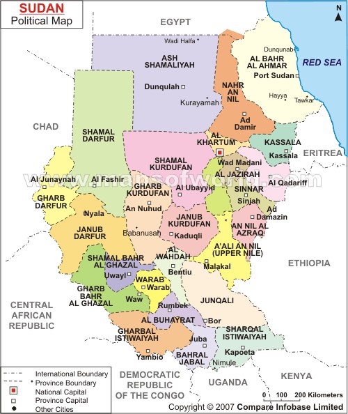
The county is located in Eastern Equatoria State, in southern South Sudan. It is bordered to the west and north by Juba County, by Torit County to the north east, by Ikotos County to the southeast and by the Republic of Uganda to the south. The county headqarters at Magwi, are located approximately 140 kilometres (87 mi), by road, southeast of Juba, the capital and largest city in the country.[1] Towns include Nimule, Pageri, Magwi, Palotaka and Pajok.[2]
Overview
The county is one of the eight counties that constitute Eastern Equatoria State. The county borders one of South Sudan's most important trading partners; the Republic of Uganda. The White Nile enters the county near the town of Nimule, before flowing north along the county's eastern border. Magwi County is divided into two payams (sub-counties): Magwi Payam and Pageri Payam. The town of Magwi is the county headquarters.
History
Historically, the inhabitants of Magwi County are athnic Acholi; they constitute the largest significant ethnic Acholi community outside of the Acholi sub-region in Northern Uganda.[3]
During the Second Sudanese Civil War, the Sudanese government-aligned SPLA-United established a Magwi corridor, establishing lines of communication with the Lord's Resistance Army (LRA) of Uganda in early 1993. A counter-offensive by the Sudan People's Liberation Army in October 1995 recaptured the corridor. The county was severely adversely affected by the LRA insurgency, causing many to flee to neighboring counties, or to other countries, including Uganda, Kenya and the Democratic Republic of the Congo. Others took refugee near large urban centers in Sudan, such as Khartoum or South Sudan such as Juba and Nimule.[4]
In January 2007, an Indian peacekeeper of the United Nations Mission in Sudan was killed by unknown assailants near the town of Magwi.[5]
Population
The 2008 Sudanese census estimated the population of Magwi county at approximately 169,830[6] Although these results were disputed by the South Sudanese authorities, they are the only recent figures available and form a basis on which newer studies can be based.
External links
- Administrative Divisions of Sudan And South Sudan - Narrative
- The States of South Sudan - Map
- Political Map of Sudan And South Sudan
- The Counties of South Sudan - Map
See also
References
- ^ Estimated Road Distance Between Juba And Magwe With Map
- ^ "Eastern Equatoria State Map". UN Sudan IG. http://www.unsudanig.org/library/mapcatalogue/south/data/state/SS_0022_EE_State_A4_20100308_300_1.pdf. Retrieved 2011-07-28.
- ^ Acholi Elders Head To Juba To Save Talks
- ^ Lord;'s Resistance Army Destabilised The Population of Magwi County
- ^ "Ban Ki-moon calls for probe into murder of peacekeeper in southern Sudan", UN News Centre, 26 January 2007
- ^ 2008 South Sudanese Population By County
Coordinates: 04°00′N 32°18′E / 4°N 32.3°E
Counties Torit · Lafon · Magwi · Ikotos · Budi · Kapoeta North · Kapoeta South · Kapoeta East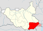
Principal towns Airports Torit · Kapoeta · NimuleRivers Mountains Communities Categories:- Counties of Eastern Equatoria


Wikimedia Foundation. 2010.