Dundraw

Dundraw
Farmland - geograph.org.uk - 130922.jpg

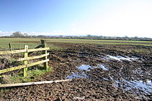
Dundraw is a village and a civil parish near Abbeytown, in the Allerdale district, in the county of Cumbria, England.

References

External links

Media related to Dundraw at Wikimedia Commons

Coordinates: 54°50′13″N 3°13′23″W / 54.837°N 3.223°W / 54.837; -3.223


Wikimedia Foundation. 2010.

Игры ⚽ Нужно сделать НИР?

Look at other dictionaries:

  • Waverton, Cumbria — Waverton is a linear village and civil parish in Cumbria, northwest England.Waverton lies on the main A596 road east of a bridge over the River Waver some 13½ miles southwest of the city of Carlisle. Administratively it forms part of Allerdale… …   Wikipedia

  • Cumberland — This article is about the former county of Cumberland in England. For other uses, see Cumberland (disambiguation). Cumberland Ancient extent of Cumberland Geography Status …   Wikipedia

  • List of civil parishes in Cumbria — This is a list of civil parishes in Cumbria, England. Most parishes have their own parish council, but some smaller parishes may have a parish meeting, or may join together as a combined parish council. Some larger parishes have town status, and… …   Wikipedia

  • List of places in Cumbria — This is a list of cities, towns and villages in the county of Cumbria, England. See the list of places in England for places in other counties.compactTOC NOTOC A*Abbey Town, Above Derwent, Ackenthwaite, Adgarley, Aglionby *Aiketgate, Aikhead,… …   Wikipedia

  • Civil parishes in Cumbria — A map of Cumbria, showing the districts: (1) Barrow in Furness; (2) South Lakeland; (3) Copeland; (4) Allerdale; (5) Eden; and (6) Carlisle. A civil parish is a subnational entity, forming the lowest unit of local government in England. There are …   Wikipedia

Share the article and excerpts

Direct link
Do a right-click on the link above
and select “Copy Link”