- Duddon
-
For the river in Cumbria, see River Duddon.
Coordinates: 53°10′N 2°44′W / 53.17°N 2.73°W
Duddon 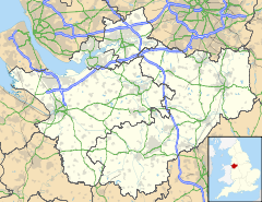
 Duddon
Duddon shown within CheshirePopulation 473 (2001) OS grid reference SJ5164 Parish Duddon Unitary authority Cheshire West and Chester Ceremonial county Cheshire Region North West Country England Sovereign state United Kingdom Post town Tarporley Postcode district CW Dialling code 01829 Police Cheshire Fire Cheshire Ambulance North West EU Parliament North West England List of places: UK • England • Cheshire Duddon is a small settlement in the unitary authority of Cheshire West and Chester and the ceremonial county of Cheshire, England. It is on the A51 road and is 8 kilometres (5 mi) east of the town of Chester. Local features include Duddon St. Peter's Church and St. Peter's Primary School. The church was erected in 1835 as a chapel of ease to the parish church at Tarvin. It was built in the early English style at a cost of £603 to the designs of William Railton.[1][2]
Contents
Legend of the "Headless Woman"
 Headless Woman placard at the closed down pub
The name of the Headless Woman public house name recalls the local legend of Grace Trigg who died in about 1664. She was a servant at nearby Hockenhull Hall, found hiding in a cellar there by Oliver Cromwell's parliamentarian soldiers after the royalist owners had fled. They tortured her to force her to reveal where the family valuables were hidden and, when she would not tell them, beheaded her in the attic, dragged her body downstairs and dumped it off one of the "Roman Bridges" (a pair of medieval packhorse bridges on the River Gowy, still standing today at the end of Platts Lane in Hockenhull).
Legend has it that, 250 years following her beheading, the inn's owners, after researching the story, ascended to the attic to discover the bloodstains were still present where she had been killed. For nearly 300 years, her ghost has been reported to wander the roads about Duddon, visiting the local park and bridges, and has been seen returning to her place of execution at the Headless Woman pub. Local farmers have reported seeing her ghost walking through rows of maize. She reportedly carries her severed head beneath her arm. The most common sightings of her ghost have been at the Roman Bridges in Hockenhull. In 2009, a professional paranormal investigation took place at the pub and bridges by local investigators to gather evidence of her ghost. With their instruments, they were able to detect unexplained sounds and many more mysterious pieces of evidence that could reveal her actual presence.[3][4]
See also
References
- ^ The British magazine and monthly register of religious and ecclesiastical information, 1835, p.31
- ^ http://www.nationalarchives.gov.uk/a2a/records.aspx?cat=017-p9&cid=-1#-1 Retrieved 29 May 2011
- ^ Naomi Dunning (2009-02-27). "Paranormal Research UK investigators look for ghosts at the Headless Woman pub in Duddon". Chester Chronicle. http://www.chesterchronicle.co.uk/chester-news/local-chester-news/2009/02/27/paranormal-research-uk-investigators-look-for-ghosts-at-the-headless-woman-pub-in-duddon-59067-23020349. Retrieved 27 March 2011.
- ^ Phil Hayes (Lead), Denis France, Paul Barrow and Nicola Railton (2009-02-01). "ROMAN BRIDGES, Hockenhull & HEADLESS WOMAN, Duddon". Paranormal Research UK. http://www.paranormalresearchuk.org/Pages/cases/HeadlessWomanReport.html. Retrieved 27 March 2011.
External links
Ceremonial county of Cheshire Cheshire Portal Unitary authorities Major settlements Alsager • Birchwood • Bollington • Chester • Congleton • Crewe • Ellesmere Port • Frodsham • Knutsford • Macclesfield • Middlewich • Nantwich • Neston • Northwich • Poynton • Runcorn • Sandbach • Warrington • Widnes • Wilmslow • Winsford
See also: List of civil parishes in CheshireRivers Topics History • MuseumsCategories:- Villages in Cheshire
- Civil parishes in Cheshire
- Cheshire geography stubs


Wikimedia Foundation. 2010.