- Doumba
-
Doumba — Commune and town — Location in Mali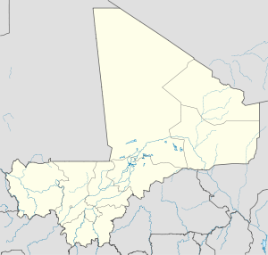
 Doumba
Coordinates: 12°1′34″N 8°7′12″W / 12.02611°N 8.12°WCoordinates: 12°1′34″N 8°7′12″W / 12.02611°N 8.12°W Country  Mali
MaliRegion Koulikoro Region Cercle Koulikoro Cercle Population (1998) – Total 2,647 Time zone GMT (UTC+0) Doumba is a small town and commune in the Cercle of Koulikoro in the Koulikoro Region of south-western Mali. It covers a surface of 250 km2 and comprises 7 villages: Doumba, Fani, Babougou, Dombana, Kossaba, Dibaro, and Sinzani. As of 2008 the commune had a population of 7557 inhabitants [1]
References
- ^ "Plan de securite alimentaire commune rurale de Doumba 2008-2012". Commissariat a la Sécurité Alimentaire. http://www.csa-mali.org/plans/koulikoro/plansa_kkro/P_S_A_Doumba.pdf. Retrieved August 10, 2011.
 Communes and towns of the Koulikoro RegionCapital:Koulikoro
Banamba Cercle Banamba (Banamba) · Ben Kadi (Samakele) · Boron (Boron) · Duguwolowula (Touba) · Kiban (Kiban) · Madina Sacko (Madina Sacko) · Sebete (Sebete) · Toubakoro (Toubakoro)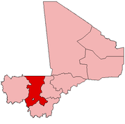
Dioila Cercle Banko (Banko) · Benkadi (Kotoula) · Binko (Tingole) · Degnekoro (Degnekoro) · Diebé (Diebé) · Diédougou (Belekosoba) · Diouman (Dioumanzana) · Dolendougou (Dandougou) · Guegneka (Fana) · Jekafo (Jekafo) · Kaladougou (Diolila) · Kemekafo (Senou) · Kerela (Kerela) · Kilidougou (N'Tobougou) · Massigui (Massigui) · Nangola (Nangola) · Niantjila (Niantjila) · N'Dolondougou (Mena) · N'Garadougou (N'Gara) · N'Golobougou (N'Golobougou) · Tenindougou (Falako) · Wacoro (Wacoro) · Zan Coulibaly (Marka Coungo)Kangaba Cercle Kangaba (Minidian Kangaba) · Balan Bakama (Namakama) · Benkadi Habaladougou (Kéniéba) · Kaniogo (Kaniogo) · Karan (Karan) · Maramandougou (Figuira-Toma) · Narena (Narena) · Nouga (Keliegoue) · Selefougou (Selefougou)Koulikoro Cercle Kolokani Cercle Kolokani (Kolokani) · Didieni (Didieni) · Guihoyo (Guihoyo) · Massantola (Massantola) · Nossombougou (Nossombougou) · Nonkon (Nonkon) · Ouolodo (Ouolodo) · Sagabala (Sagabala) · Sebecoro (Sebecoro) · Tioribougou (Tioribougou) ·Kati Cercle Kati (Kati) · Baguineda-Camp (Baguineda-Camp) · Bankoumana (Bankoumana) · Bossofala (Neguela) · Bougoula (Bougoula) · Daban (Daban) · Diago (Diago) · Dialakoroba (Dialakoroba) · Dialakorodji (Dialakorodji) · Diédougou (Torado) · Dio-Gare (Dio-Gare) · Dogodouman (Dogodouman) · Dombila (Dombila) · Doubabougou (Doubabougou) · Faraba (Faraba) · Kalabancoro (Kalabancoro) · Kalifabougou (Kalifabougou) · Kambila (Kambila) · Kourouba (Kourouba) · Mandé (Ouezzindougou) · Moribabougou (Moribabougou) · Mountougoula(Mountougoula) · N'Gabacoro (N'Gabacoro-Droit) · N'Gouraba (N'Gouraba) · Niagadina (Niagadina) · Nioumamakana (Nioumamakana) · N'Tjiba (Faladie) · Ouelessebougou (Ouelessebougou) · Safo (Safo) · Sanankoro Djitoumou (Sanankoro Djitoumou) · Sanankoroba (Sanankoroba) · Sangarebougou (Sarambougou) · Siby (Siby) · Tiakadougou-Dialakoro (Tiakadougou-Dialakoro) · Tiele (Tiele) · Yelekebougou (Yelekebougou)Nara Cercle Categories:- Koulikoro Region geography stubs
- Populated places in the Koulikoro Region
- Communes of Mali


Wikimedia Foundation. 2010.