- Dougherty, Alameda County, California
-
Coordinates: 37°42′40″N 121°54′35″W / 37.71111°N 121.90972°W
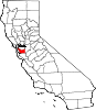
Dougherty — Unincorporated community — Location in California
 Dougherty
Coordinates: 37°42′40″N 121°54′35″W / 37.71111°N 121.90972°W Country United States State California County Alameda County Elevation[1] 348 ft (106 m) Dougherty (also, Amador's, Amador Valley, and Dougherty Station)[2] is an unincorporated community in Alameda County, California. It is located just north of Dublin,[2] at an elevation of 348 feet (106 m).
James Witt Dougherty purchased the land here in 1852, including a two-story adobe building.[2] A community grew up around the adobe, and was first called Amador's and Amador Valley.[2] The post office arrived in 1860 and renamed the place Dougherty Station.[2] The southern part of the settlement broke off and became Dublin.[2] The post office was renamed Dougherty in 1896 and closed in 1908.[2]
References
Municipalities and communities of Alameda County, California County seat: Oakland Cities Alameda | Albany | Berkeley | Dublin | Emeryville | Fremont | Hayward | Livermore | Newark | Oakland | Piedmont | Pleasanton | San Leandro | Union City
CDPs Ashland | Castro Valley | Cherryland | Fairview | San Lorenzo | Sunol
Unincorporated
communitiesAlbrae | Altamont | Asco | Baumberg | Brightside | Brookshire | Carpenter | Dougherty | Dresser | East Pleasanton | Farwell | Hall Station | Halvern | Kilkare Woods | Komandorski Village | Lorenzo Station | Mattos | Mendenhall Springs | Midway | Mountain House | Mowry Landing | Radum | San Ramon Village | Scotts Corner | Sorenson | Verona
Former settlements Alden | Alvarado | Ann | Decoto | Drawbridge | Eden Landing | Elliot | Goecken | Greenville | Hacienda | Hayward Heath | Laddville | Larkin's Landing | Mallard | Melita | Merienda | Monte Vista | Remillard | Robert | Russell City | Stokes Landing | Tesla
Categories:- Populated places in Alameda County, California
- Unincorporated communities in California
- Alameda County, California geography stubs
- Populated places established in 1852


Wikimedia Foundation. 2010.