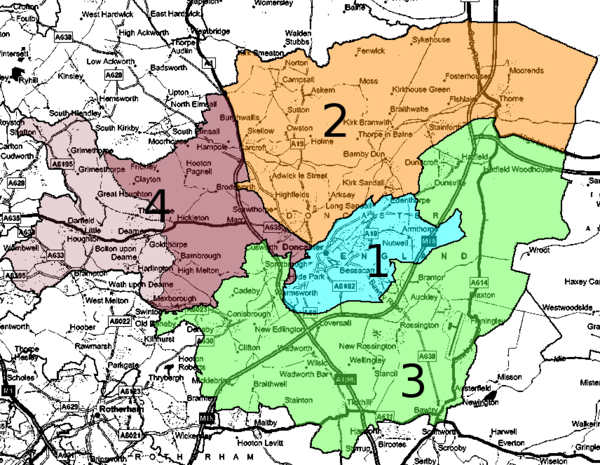
- Doncaster Parliamentary constituencies
-
Doncaster is divided into and across four Parliamentary constituencies.
Three Constituencies are wholly contained within Doncaster, most of the fourth constituency consists of wards of Barnsley.
These divisions were drawn up for the 1997 General election when the Mexborough area was added to the Barnsley East constituency to create the new constituency of Barnsley East and Mexborough. These changes will be reversed for the 2010 General election when Doncaster will be again divided into three constituencies entirely located in the borough of Doncaster.[1]
Name Current boundaries 1 Doncaster Central - Colour code - Pale Blue
2 Doncaster North - Colour code - Orange
3 Don Valley - Colour code - green
4 Barnsley East and Mexborough - Colour code - Dark Brown (within Doncaster MBC boundary) - Colour code - Pale Brown (within Barnsley MBC boundary)Barnsley East and Mexborough is shared between Doncaster and Barnsley.
References
Categories:

Wikimedia Foundation. 2010.