- List of north–south roads in Toronto
-
The following is a list of the north–south arterial thoroughfares in the Canadian city of Toronto. The city is organized in a grid pattern dating back to the plan laid out by Augustus Jones between 1793 and 1797. Most streets are aligned in the north-south or east-west direction, based on the shoreline of Lake Ontario. In other words, major north–south roads are generally perpendicular to the Lake Ontario shoreline and major east–west roads are generally parallel to the lake's shoreline. The Toronto road system is also influenced by its topography as some roads are aligned with the old Lake Iroquois shoreline, or the deep valleys. Minor streets with documented history or etymology are listed in a separate section.
North–south roads
Listed west to east
Renforth Drive
Renforth Drive Location: Bloor Street West – Carlingview Drive
()Carlingview Drive
Carlingview Drive Location:  Highway 401 – Disco Road
()Browns Line
Brown's Line
Location: Lake Shore Boulevard – Coules Court
(continues north as Highway 427)Highway 427
Main article: Ontario Highway 427King's Highway 427 Location: Coules Court –
(continues south as Brown's Line
north into Vaughan)Highway 27
Highway 27 Location: Highway 401 – Steeles Avenue West
(continues north into Vaughan)Martin Grove Road
Martin Grove Road
Location: Swan Avenue – Steeles Avenue West
(continues north into Vaughan)Kipling Avenue
Kipling Avenue Location: Lake Shore Boulevard West – Steeles Avenue West
(resumes south of Highway 7 in Vaughan) Highway 409 above Kipling Avenue
Kipling Avenue is rumoured to be named after Rudyard Kipling, author of The Jungle Book. Kipling was scheduled to read at the Woodbridge fair in 1907, but was forced to cancel at the last moment for reasons of health; it is said that the road to Woodbridge, thereto referred to as Mimico Street, was named in honour of the anticipated author.[1] The road was named by 1908, but may have been named earlier in honour of a local farmer with that last name.[citation needed]
Islington Avenue
Islington Avenue
Location: Lake Shore Boulevard West – Steeles Avenue West
(continues north into Vaughan) Just north of Bloor Street West, Islington Avenue is bridged by the CPR midtown line
Islington Avenue is named for the village it passed at Dundas Street. The village of Islington was previously known as Mimico, and grew up around the Montgomery . This resulted in confusion with the nearby Mimico post office, and so the name was changed in 1858 by the wife of innkeeper Thomas Montgomery, Elizabeth Smith. Elizabeth chose the name after her birthplace, now a borough of London, England.[2]
Islington Avenue begins at Lake Shore Boulevard West in New Toronto, and progresses north to Steeles Avenue West, where it crosses into Vaughan in York Region. The road is mostly suburban in nature, passing through largely residential sections of Etobicoke.[3]
Royal York Road
Royal York Road Location: Lake Shore Boulevard West – Dixon Road
(continues north as St. Phillips Road)Weston Road
Weston Road
Location: St. Clair Avenue West – Steeles Avenue West
(continues south as Keele Street
north into Vaughan) The Weston radial line, pictured here in October 1925, about a month before opening, was the impetus for development along what was until then a muddy stagecoach trail.
Scarlett Road
Scarlett Road
Location: Dundas Street West – north of Lawrence Avenue West
(continues west as Dixon Road)Scarlett Road is named for John Scarlett, who moved to Upper Canada in 1808 and owned several square kilometres of property northwest of Bloor and Keele. "Scarlett's Road" was opened along the route of the Toronto–Carrying Place Trail north of his property. The road begins at Dundas Street West immediately south of the CPR crosstown rail line. It connects with the western terminus of St. Clair Avenue, then progresses north alongside the Humber River to north of Lawrence Avenue West, where it curves to the east and becomes Dixon Road.[3]
Jane Street
Jane Street
Location: Bloor Street West – Steeles Avenue West
(continues north into Vaughan)Runnymede Road
Runnymede Road Location:
()Runnymede Road is named for the house of John Scarlett, built at the corner of Dundas and Keele in 1838. Runnymede is a field in England, southwest of London, where the Magna Carta was signed in 1215.[4]
Parkside Drive
Parkside Drive Location: Lake Shore Boulevard West – Bloor Street West
(continues north as Keele Street)Parkside Drive was formerly a portion of Keele Street until 1921, when it was renamed by the City of Toronto. John Howard sold his estate to the city in 1873 to use as a public park. The road was renamed on June 13, 1921 by order of Bylaw 8663.[5]
Parkside Drive begins at Lake Shore Boulevard West. Passing beneath the Gardiner Expressway and The Queensway, the road travels north alongside High Park, which lay to the west. At Bloor Street West, Parkside Drive becomes Keele Street. The entirety of the road is residential, with houses to the east side of the road.[3]
Keele Street
Keele Street
Location: Bloor Street – St. Clair Avenue
Lavender Road – Steeles Avenue
(continues north into Vaughan)Main article: Keele StreetKeele Street is named for lawyer William Keele. William owned land across the road from John Scarlett at Dundas and Keele, gradually expanding his acreage in the mid-19th century. William opened the Carleton Race Course in 1857, which held the first Queen's Plate in 1860.[6]
Roncesvalles Avenue
Roncesvalles Avenue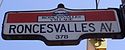
Location: The Queensway / Queen Street – Dundas Street West
(continues north as Dundas Street
south as King Street)Length: 1.8 km[7] (1.1 mi) Main article: Roncesvalles AvenueRoncesvalles Avenue was named by or in honour of Colonel Walter O'Hara, who fought in the Peninsular War and owned large land grants that were eventually subdivided to form Parkdale. The name originates from a village in northern Spain near the border with France, where O'Hara fought a battle against Napoleon I.[8] Roncesvalles begins at an intersection with The Queensway, Queen Street and King Street and travels north to Dundas Street West.[3]
Jameson Avenue
Jameson Avenue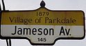
Location: Lake Shore Boulevard West – Queen Street
(continues north as Lansdowne Avenue via Queen Street)Main article: Jameson AvenueJameson Avenue is named for Robert Sympson Jameson, Attourney General for Upper Canada in the late 1830s. Jameson bought land south of Queen Street between the second and third concessions (Dufferin and Parkside today) in the late 1840s. Jameson Avenue was built through his property when it was subdivided by the growing city.[9] The road begins at Lake Shore Boulevard West, where access is provided to the Gardiner Expressway. The road crosses the expressway and travels north through Parkdale between rows of apartment buildings. Jameson Avenue ends at Queen Street West; the traffic signal is coordinated with the southern terminus of Lansdowne Avenue, nearby to the east.[3]
Lansdowne Avenue
Lansdowne Avenue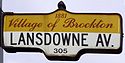
Location: Queen Street – St. Clair Avenue West
(continues south as Jameson Avenue via Queen Street) Marquis of Lansdowne
Lansdowne Avenue was originally known as North Jameson Avenue. It was renamed by the Parkdale village council in 1883 to honour the new Governor General, Henry Petty-Fitzmaurice, 5th Marquess of Lansdowne, who served between 1883 and 1888. [10] Lansdowne Avenue begins at Queen Street West, a short distance east of the northern terminus of Jameson Avenue. It passes beneath the Georgetown GO line, meets Dundas Street West and College Street, then passes Lansdowne Subway Station at Bloor Street West. The road continues north past Dupont Street, then passes beneath the CPR Midtown line before ending at St. Clair Avenue West.[3]
Caledonia Road
Caledonia Road Location:
()Dufferin Street
Dufferin Street Location: British Columbia Drive – Steeles Avenue West
(interrupted by Downsview Airport)Main article: Dufferin StreetDufferin Street, known as the Side Line until 1876, was renamed in honour of Governor General Frederick Temple Blackwood, Lord Dufferin. Dufferin served as Governor General between 1872 and 1878, and presided over the opening of the first Canadian National Exhibition in 1878.[11] Dufferin Street begins at Exhibition Place and travels north into Vaughan. The road is interrupted between Wilson Avenue and Sheppard Avenue West by Downsview Park.[3] Dufferin was disjointed at Queen Street West by a railway, a detour famously known as the Dufferin Jog. Following decades of negotiation, construction began in 2007 on remedying the jog by excavating a tunnel beneath the active tracks. This tunnel was completed and opened to traffic on November 10, 2010.[citation needed]
Oakwood Avenue
Oakwood Avenue Location:
()Oakwood Avenue is named for the settlement that grew near its intersection with St. Clair Avenue West.
Marlee Avenue
Marlee Avenue Location: Eglinton Avenue West – Lawrence Avenue West Length: 2 km (1.2 mi) Marlee Avenue was originally known as Lyon Avenue. The name was changed in 1953 at the request of Bernice Stein, who lived at 184 Woodmount Avenue. It is named for Mrs. Stein's niece.[12] Marlee Avenue connects Eglinton Avenue West with Lawrence Avenue West to the west of Allen Road.[3]
Ossington Avenue
Ossington Avenue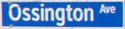
Location: Queen Street West – Davenport Road Length: 3.5 km[13] (2.2 mi) Main article: Ossington AvenueOssington Avenue is named for the estate of the Denison family in Nottinghamshire.[14] John Denison moved to York and built Brookfield House at a corner on Dundas Street, which is now the intersection of Queen Street West and Ossington Avenue. Dundas Street then followed what is now Queen Street West and then Ossington Avenue, obstructed by the valley of Garrison Creek. Ossington Avenue was later built north from the present corner of Ossington and Dundas to Bloor Street West.[15] The section between Bloor Street and Davenport Road was formerly known as Lancaster Road.[14]
Allen Road
William R. Allen Road
Location: Eglinton Avenue – Kennard Avenue
()Main article: Allen RoadWilliam R. Allen Road, known more commonly as Allen Road, The Allen Expressway or simply The Allen and formerly as the Spadina Expressway, is a short expressway which travels from Eglinton Avenue West in the south to Kennard Avenue in the north. The portion south of Sheppard Avenue was originally the completed section of the Spadina Expressway. Allen Road is named after late Metro Toronto Chairman William R. Allen and maintained by the City of Toronto. Landmarks along the road include the Yorkdale Shopping Centre and Downsview Park (formerly CFB Downsview).
Bathurst Street
Bathurst Street
Location: Lake Ontario – Steeles Avenue West
(continues north into Vaughan)Main article: Bathurst Street (Toronto)Bathurst Street is named after Henry, 3rd Earl of Bathurst, who was Secretary of War during the reign of George IV. Henry's contributions to Toronto include organizing the successive waves of British settlers following the War of 1812, and granting the charter to the first university in the city, King's College. Bathurst originally only referred to the section south of Queen Street. In 1870, the section north of Queen Street became part of Bathurst Street. It was known until then as Crookshank's Lane, after Honourable George Crookshank. The road acted as a driveway to his 300 acres (1.2 km2) farm.[16]
Spadina
Spadina Avenue
Spadina RoadLocation:
()Main article: Spadina AvenueSpadina Avenue, and its extension north of Bloor Street, Spadina Road, originally pronounced "spa-dee-nuh", are named after the estate of Dr. William Baldwin. After a fire and two complete reconstructions, this estate has since become the Spadina House. The Baldwin's held numerous important positions in the early government of York, having several streets named after them (including Baldwin Street). William originally planned Spadina Avenue as the driveway to his new estate in 1818, and laid the street in 1836 with the unusual width of two chains (132 feet), double the width of any street laid to that date.[17] It was eventually extended north and over the Nordheimer Ravine to the village of Forest Hill, and thereafter to Eglinton Avenue. Its southern terminus is at the edge of Lake Ontario.[3]
Spadina has been transformed numerous times, once almost to a depressed expressway known as the Spadina Expressway, which was cancelled by premier Bill Davis in 1971 after extensive protesting. Casa Loma was built next to the Spadina House in the early 20th century.
University Avenue
University Avenue Location: Front Street – College Street
(continues north as Queen's Park Crescent)Main article: University Avenue (Toronto)University Avenue shares its origins with College Street as one of the two private entrances to King's College (now the University of Toronto) opened in 1829. King's College was the first college in Canada when it was chartered by Henry, 3rd Earl of Bathurst two years earlier. Both roads were known as College Avenue. In an attempt to create a stately elegant driveway to the college, the road was cut 120 feet wide and lined with chestnut trees and ornamental fences. A gatehouse designed by John Howard sat at the entranceway at present-day Queen and University. The road quickly became an obstacle to the growing city, and the gates surrounding it were torn down in 1859.[18]
As part of a depression relief program, University was extended south of Queen Street to meet York Street at Front beginning in 1929.
Avenue Road
Avenue Road Location: Bloor St – Bombay Ave (just north of Hwy 401)
(continues south as Queen's Park Crescent)There are several stories relating to the origin of Avenue Road. The most popular legend retells that of an early surveying team travelling west along what is now Bloor Street. Upon reaching the location of the intersection with Avenue Road today, the lead surveyor, a Scottish man, pointed north and proclaimed "Let's 'ave a new road here"
Bay Street
Bay Street
Location: Queen's Quay – Davenport Road
(continues north as Davenport Road) The intersection of Bay Street and King Street is considered the heart of Canada's economyMain article: Bay Street
Bay Street was originally known as Bear Street, supposedly a reference to a "noted chase given to a bear" by settlers in that area.[19] It is the centre of Toronto's Financial District and is often used as a metonymy to refer to Canada's financial industry, similar to Wall Street in the United States. Within the legal profession, the term Bay Street is also used colloquially to refer to the large, full-service business law firms of Toronto, particularly the top-tier law firms known as the Seven Sisters. The street was officially named when the land it occupies was annexed by the first expansion of York. Originally, Bay travelled from Lake Ontario to Lot Street, now Queen Street West. North of Queen Street and travelling to College Street was Teraulay Street. Several disconnected side streets existed north of there to Davenport Road. In 1922, By-Law 9316 joined these streets together as far north as Scollard Street.[20] By-Law 9884, enacted on January 28, 1924, changed the name of Ketchum Avenue to Bay Street, officially extending it to Davenport Road.[21] The bend in Bay Street south of Old City Hall reflects this history.
Yonge Street
Yonge Street
Location: Queen's Quay – Steeles Avenue
(continues north into Thornhill)Main article: Yonge StreetChurch Street
Church Street
Location:
()Church Street is so named because where St. James Cathedral sits upon today, at King Street and Church, was the site of the first church in York, a wooden building built in 1807 and referred to simply as "the church". Three incarnations sat on the site of the current cathedral; the dedication to St. James came in 1828, four years prior to the construction of a new stone church. This building burnt shortly after becoming a cathedral. A new cathedral was constructed, only to burn down in the Great Fire of 1849. John Strachan, first Bishop of Toronto after 1839, rebuilt the present cathedral in 1853 (the spire was not completed until 1874) in a gothic revival style.[22] The St. James Cathedral was the tallest structure in Toronto until the Royal York Hotel was completed in 1927.
Jarvis Street
Jarvis Street
Location: Queen's Quay – Charles Street
()Main article: Jarvis StreetJarvis Street recognizes the Jarvis family, who lived on land north of Queen Street and centred on Jarvis Street between 1824 and 1846. William Jarvis was Provincial Secretary and Registrar of Records between 1792 and his death in 1817. His son, Samuel Jarvis, won the last duel held in Toronto when he mortally wounded his neighbour and rival John Ridout. He was arrested as a result, but later acquitted, after which he took over his father's position. The increasing debt of the family led Samuel to sell off the property beginning in 1846. His house, Hazel Burn, was demolished to make way for Jarvis Street. Mutual Street was established at the same time on the property line between the former rivals.[23]
Jarvis Street begins at Queen's Quay north of the Lake Ontario shoreline. It travels north to one block south of Bloor Street, where most traffic is siphoned on to Mount Pleasant Road.[3] Jarvis previously extended to Bloor Street, but was truncated On August 26, 2009. The section between Charles Street and Bloor Street was renamed Ted Rogers Way.
Mount Pleasant Road
Mount Pleasant Road
Location: Charles Street – Glen Echo Drive
(continues south as Jarvis Street)Main article: Mount Pleasant RoadMount Pleasant Road was named after the cemetery which it passes through when it was constructed in the late 1910s. The road follows the course of several earlier streets, many of which it assumed, including Kinsman Avenue (1918), Sidmouth Avenue (1920) and Hilda Avenue (1935). In the late 1940s, Mount Pleasant Road was extended south to its current terminus. This was initially referred to as the Clifton Road Extension, and is considered Toronto's first expressway.
Mount Pleasant Road begins at the northern terminus of Jarvis Street, one block south of Bloor Street East. It passes through the communities of Rosedale, Moore Park and Lawrence Park and crosses the Rosedale Ravine, Yellow Creek and Blythwood Ravine. The road ends near the Doncrest bus loop at Glen Echo Drive.[3]
Sherbourne Street
Sherbourne Street Location: Queen's Quay – South Drive Sherbourne Street was named by Samuel Ridout in 1845 after the town in Dorset, England; the Ridout family emigrated from Sherborne.[24]
Parliament Street
Parliament Street
Location: Lake Shore Boulevard East – Bloor Street East
(continues south as Queen's Quay)Main article: Parliament Street (Toronto)Parliament Street was the site of the original Parliament Buildings of Upper Canada, constructed on Front Street between Berkeley and Parliament by 1797 under the orders of John Graves Simcoe. The buildings, originally planned as one with two wings, were not completed and in 1813 were destroyed by the invading American army.[25] Parliament Street begins at Lake Shore Boulevard East, where it continues southwest as Queen's Quay, and travels north along the eastern outskirts of downtown Toronto. The road ends at Bloor Street East between the Rosedale and Sherbourne phases of the Prince Edward Viaduct.[3] Prior to the construction of the viaduct, Parliament Street ended at Hayter Street.[citation needed]
Willowdale Avenue
Willowdale Avenue Location: – Steeles Avenue East Bayview Avenue
Bayview Avenue Location: – Steeles Avenue East
(continues north into Markham)Main article: Bayview Avenue Looking north along Bayview from Eglinton in 1910
Bayview Avenue, previously known as East York Avenue, was named in 1930 after the estate of Dr. James Stanley McLean, Bay View. The McLean House forms a part of the Sunnybrook Health Sciences Centre today.[26] Several notable estates were built along Bayview in the early 20th century, many of which still exist, since converted to a variety of public uses.
Don Valley Parkway
Don Valley Parkway
Location:  Highway 401 –
  Gardiner Expressway
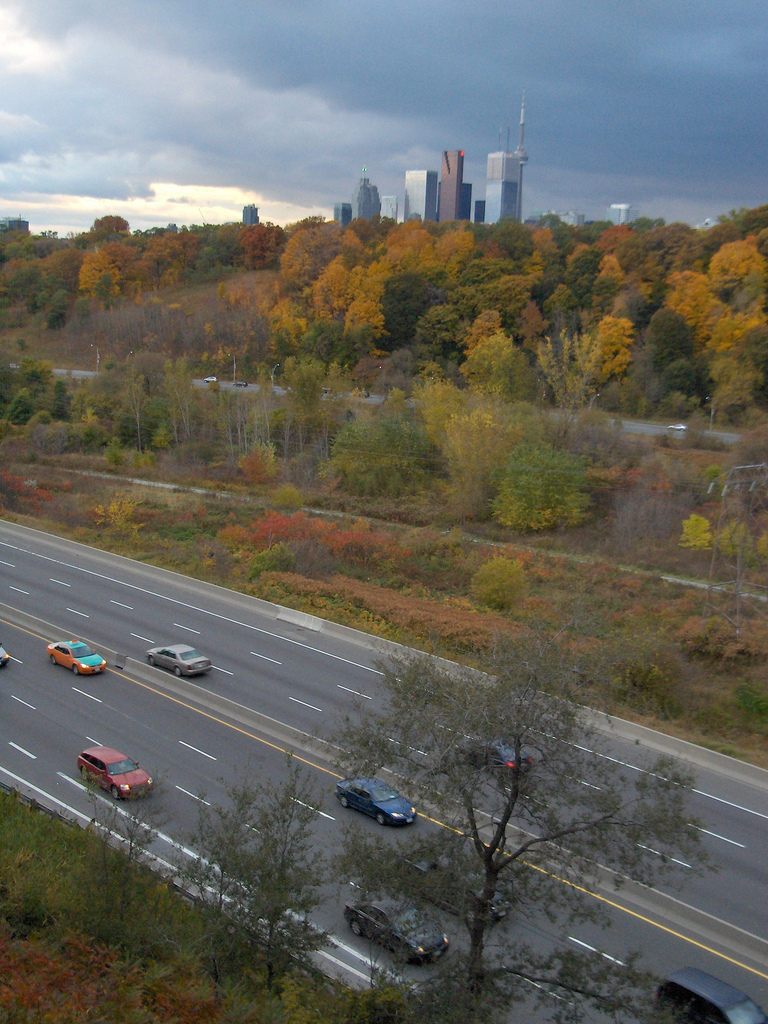
Length: 15.0 km (9.3 mi) Main article: Don Valley Parkway The Don Valley Parkway in the autumn facing southwest from the Prince Edward Viaduct
The Don Valley Parkway (DVP) is a controlled-access six-lane expressway in Toronto connecting the Gardiner Expressway in downtown Toronto with Highway 401. North of Highway 401, the expressway continues as Highway 404 to Newmarket. The parkway runs through the parklands of the Don River valley, after which it is named. It is patrolled by the Toronto Police Service, has a maximum speed limit of 90 km/h (56 mph) and is 15.0 km (9.3 mi) in length.[27]
The parkway was the second expressway to be built by Metropolitan Toronto (Metro). Planning for it began in 1954, the year of Metro's formation, the first section opened in 1961 and the entire route was completed by the end of 1966. South of Bloor Street, the expressway was constructed over existing roadways. North of Bloor Street, the expressway was built on a new alignment through the valley, requiring the removal of several hills, the rerouting of the Don River and the clearing of green space. North of Eglinton Avenue, the expressway follows the former Woodbine Avenue right-of-way north to Highway 401.
The parkway operates well beyond its intended capacity of 60,000 vehicles per day and is known for its daily traffic jams; some sections carry an average of 100,000 vehicles a day. Planned as part of a larger expressway network within Toronto, it was one of the few expressways built before the public opposition which cancelled many of the others.
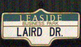
Laird Drive
Laird Drive
Location: Millwood Road – Glenvale Boulevard
(continues southeast as Millwood Road)Laird Drive takes its name from Robert Laird Borden, Prime Minister of Canada between 1911 and 1920. Borden, whose middle name is his mother's maiden name, led the country through the First World War. After leaving office, Borden went on to play an instrumental role in the crafting of the Paris Treaty and the subsequent independence of Canada from the British Crown.[28]
Broadview Avenue
Broadview Avenue
Location: Sunlight Park Road – Fernwood Gardens
(continues east as O'Connor Drive)Broadview Avenue, known the Mill Road until 1884, was constructed in 1798 by Timothy Skinner, owner of several mills in Todmorden. The name is a reference to the broad view from the crest overlooking Riverdale Park. The road was extended in 1913 and 1922 by absorbing parts of Don Mills Road as far north as O'Connor Drive.[29]
Pape Avenue
Pape Avenue
Location:
()Leslie Street
Leslie Street Location: Unwin Avenue – Steeles Avenue East
(resumes north of 14th Avenue in Markham via Don Mills Road) Looking south along the third segment of Leslie Street, in North York
Leslie Street was named for nursery owner George Leslie, who owned a store on Queen Street in Leslieville.[30][31]
Leslie Street, which has four separate sections, begins at Lake Ontario at the foot of the Leslie Street Spit. Just north at Lake Shore Boulevard East was the former eastern terminus of the Gardiner Expressway. It continues north to the railway tracks north of Gerrard Street East, where the first segment ends. Donlands Avenue, which runs from the north side of the railway tracks to north of O'Connor Drive, was originally another segment of Leslie Street. The second segment is represented by a one-block stretch of road between Wicksteed Avenue and Vanderhoof Avenue in the Leaside Industrial land area. It is separated from the third segment by the Ernest Thompson Seton parklands.
The third segment begins at Eglinton Avenue near E.T. Seton and Wilket Creek Park. It travels north through commercial and residential neighbourhoods in Don Mills and the Don Valley. A proposed extension from Eglinton Avenue south to Bayview Avenue (north of Pottery Road) never came to fruition.[32] It exits Toronto and enters York Region at Steeles Avenue. North of there, Leslie Street is a local road and ends shortly thereafter in Wycliffe Park. The fourth segment continues as an arterial road north of John Street in Markham, where Don Mills Road becomes Leslie Street.[3]
Donlands Avenue
Donlands Avenue Location: Danforth Avenue – Leaside Bridge
(continues north of bridge as Millwood Road)Donlands Avenue was renamed from Leslie Street on February 22, 1915, as the two were disconnected.[33] Donlands Avenue begins at Danforth Avenue and ends at the foot of the Leaside Bridge. On the opposite side of the bridge, drivers continue on Millwood Road.[3]
Don Mills Road

Location: – Steeles Avenue East
(continues north into Markham)Don Mills Road, known by various names over time including The Mill Road and the Don Independent Road, is named for the many saw and grist mills that established near the Forks of the Don in the early 19th century. At the time the road began at Winchester Street and Parliament Street and crossed the Don River at Riverdale Park. The road rose onto the table lands along what is now the entrance to the northbound Don Valley Parkway and followed Broadview north and O'Connor east before joining with the present-day Don Mills Road. The road ended at the Mills for a time, until farmers to the north on the land between the river valleys opened a new road to provide an easier route to carry their yields to the St. Lawrence Market. The new road cut through established parcels of land, and came to be known as the Don Independent Road. This road extended as far north as York Mills Road.
After the formation of Metro Toronto, Don Mills was designated as part of the municipal network of major roads. It was promptly widened to four lanes, then later extended north over Highway 401 to Sheppard in 1964. The "peanut" was constructed shortly thereafter, and Don Mills gradually extended north of Steeles alongside suburban development in the 1970s. In 1987, the road was widened to six lanes alongside a recommendation to extend Leslie Street south of Eglinton to the Bayview Extension, and a proposal to try new high-occupancy vehicle (HOV) lane, colloquially referred to in Toronto as a Diamond lane due to the markings on the pavement. While Leslie street was not extended, the HOV lanes were implemented along the route of the 25 - Don Mills bus.
Coxwell Avenue
Coxwell Avenue Location: Lake Shore Boulevard East – O'Connor Drive Coxwell Avenue is named after Charles Coxwell Small, a clerk in the Supreme Court of Upper Canada and a resident of the Berkeley Estate.[34]
Woodbine Avenue
Woodbine Avenue
Location: Lake Shore Boulevard East – O'Connor Drive
(resumes north of Steeles Avenue in Markham)Main article: Woodbine AvenueWoodbine Avenue was named for the Woodbine Racetrack that existed near its southern terminus for over a century and held numerous Queen's Plates until the track was moved to Etobicoke. The origins of the street date back to 1800 when surveyor John Stegman laid out farm properties and their supporting concession roads, including what has become today's Woodbine Avenue.[35]
The road allowance of Woodbine Avenue north of Lawrence Avenue to Highway 401 was removed when the Don Valley Parkway was constructed in the early 1960s.[36] Another section from Highway 401 to Steeles Avenue was lost when Highway 404 was built in the 1970s.
Highway 404
Location: Highway 401 – Steeles Avenue East
(continues north into Markham)Main article: Ontario Highway 404King's Highway 404, colloquially referred to as the four-oh-four, is a provincially maintained extension to the Don Valley Parkway. It begins at Highway 401 and travels north of the city limits to Newmarket. Highway 404 was opened from Sheppard to Steeles in 1979 and extended north shortly thereafter.
Main Street
Location:
()Victoria Park Avenue
Victoria Park Avenue
Location: Queen Street East – Steeles Avenue East
(continues north into Markham)Main article: Victoria Park AvenueVictoria Park Avenue was named after a park which once ran alongside the road. The park was itself named in honour of Queen Victoria. Until the 1960s, Victoria Park Avenue only extended as far north as Danforth Avenue; the swamps of Taylor-Massey Creek blocked further progress until they were drained during the construction of the Bloor–Danforth line. The road north of St. Clair Avenue formed part of Dawes Road until then. Victoria Park Avenue begins at Queen Street East, north of the R. C. Harris Water Treatment Plant. It quickly climbs the western edge of the Scarborough Bluffs and travels through a residential neighbourhood to Gerrard. North of Gerrard, the density of the surrounding development increases; though detached homes exist throughout the length of the road, businesses and apartment blocks are far more common. Victoria Park ends north of Steeles Avenue East at Denison Avenue in Markham.
Pharmacy Avenue
Pharmacy Avenue
Location: – Steeles Avenue East Pharmacy Avenue likely takes its name from a local pharmacy, beyond which no information is available.
Warden Avenue
Warden Avenue
Location: – Steeles Avenue East
(continues north into Markham)Warden Avenue was previously Wardin Avenue, but the origin of both is unknown. Warden begins south of Kingston Road at the former Toronto Hunt Club and travels north to Steeles Avenue East, where it continues into Markham as York Regional Road 65. Although the section south of Danforth Avenue is mostly detached residential housing, the majority of Warden Avenue north of Danforth is industrial or commercial.
Birchmount Road
Birchmount Road
Location: Lake Ontario – Steeles Avenue East
(continues north into Markham) Residential and office development on Birchmount south of Eglinton Avenue
Birchmount began as a concession line laid out by the surveyors of Upper Canada. For a long time, it remained a rural and little used route. In the 1920s, it was little more than a dirt path.[37]
The southern part of Birchmount was one of the first parts of Toronto to see suburban development. This development was in the years immediately before and after the Second World War, and was thus not reflective of the car-centred design of much of Scarborough. Birchmount is notable for being the terminus of what has so far been the only TTC streetcar to ever travel into Scarborough. The Birchmount Loop was for several decades the turning loop for the Kingston Road streetcar.[38] The first lines in the region were built by the Toronto and Scarboro' Electric Railway, Light and Power Company. They were taken over by the TTC which ran streetcars to Birchmount until 1954. The loop remained in place until 1985, when a condominium was built on the site.[39]
By the 1960s, Birchmount had been transformed into its current role as one of the main arterial roads for Scarborough.[40]
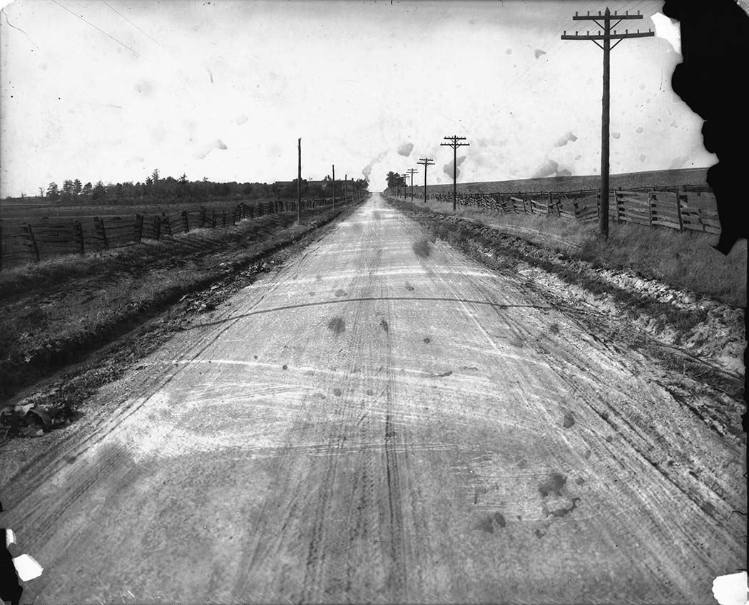
Kennedy Road
Kennedy Road
Location: Highview Avenue – Steeles Avenue East
(continues north into Markham) Kennedy Road, south of Ellesmere Road, circa 1925
Kennedy Road is named for the Kennedy family, one of the many early farming settlers in the 18th and 19th centuries to which Thomas Laird Kennedy belonged, who settled along the early concession road. It is likely linked to Private John Kennedy of the 3rd Regiment of the York Militia (now The Queen's York Rangers (1st American Regiment) (RCAC) who was granted 200 acres (0.81 km2) of land near Kennedy Road and Ellesmere Road.[30]
The Toronto section of the road is mainly residential with high rise apartment buildings. However, there is a section between Lawrence Avenue East and north of Sheppard Avenue East which is dominated by commercial plazas and malls, including Kennedy Commons.[3] North of Steeles Avenue, Kennedy Road continues as York Regional Road 3 north to the shore of Lake Simcoe.
Midland Avenue
Midland Avenue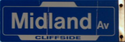
Location: Lake Ontario – Steeles Avenue East
(continues north into Markham)Midland Avenue was known as Church Street until 1882, when it was renamed for the Midland Railway Company in 1882. Only two years later, the Midland Railway would be purchased by the Grand Trunk Railway
Brimley Road
Brimley Road
Location: Bluffer's Park – Steeles Avenue East
(continues north into Markham)Main article: Brimley RoadBrimley Road is of unknown origin. Beginning at Bluffer's Park at the foot of the Scarborough Bluffs,[41] Brimley weaves through Scarborough, past Steeles Avenue and ends at 14th Avenue in Markham. The Scarborough portion is mainly residential with small strip plazas interspersed along the route. North of Finch Avenue is Brimley forest, a small patch of unaltered land. North of Steeles, Brimley weaves through the residential areas of the Milliken community of Markham.
The section south of Sheppard was once interrupted at Highway 401. An C$11 million overpass and partial interchange of the freeway was built and opened on October 18, 1987 over the objections of many area residents concerned with increased traffic volume. In an attempt to address these concerns, it was initially restricted to transit buses and emergency vehicles.[42] After widely-reported public pressure, Scarborough City Council voted February 18, 1988 to open the overpass to general traffic.[43] Proposals to modify the interchange are currently being examined as part of a larger analysis of Highway 401 through Scarborough.
McCowan Road
McCowan Road
Location: Kingston Road – Steeles Avenue East
(continues south as Cathedral Bluffs Drive; north into Markham; interupted by the Highland Creek) The Scarborough RT crosses above McCowan Road on an elevated guideway
McCowan Road is named for Ruan McCowan, a Scottish family patriarch who settled near the Scarborough Bluffs in 1833. The street, the former Lot 22, and later McCowan's Sideroad, was officially renamed McCowan Road by Scarborough Township in 1956.
McCowan Road begins at Kingston Road and extends north into York Region. There is an interruption at the Highland Creek between Lawrence Avenue and Eglinton Avenue; Danforth Road carries traffic south of Lawrence. When the Scarborough Town Centre complex was opened in 1973, an interchange with Highway 401 was constructed. North of Sheppard Avenue, CP Rail's Toronto marshalling yards use McCowan as a western limit, and stretch east of Markham Road.[3]
Bellamy Road
Bellamy Road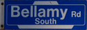
Location: Kingston Road – Progress Avenue
(continues as Corporate Drive)Bellamy Road, previously Secord Road, is named for author Edward Bellamy, who wrote Looking Backwards 2000–1887, about a utopian society. Settlers approached Scarborough Township for a parcel of land to start their own utopia. Although the request was not granted, the road along which they sought to establish their society came to be known as Bellamy Road. The CN grade-separation on Eglinton, built in the early 1960s, split Bellamy Road into two unconnected sections. Consequently, the township of Scarborough renamed the sections as North or South on May 29, 1964.[44]
Bellamy Road South begins at Kingston Road and proceeds north to just short of Eglinton Avenue. It is entirely a minor residential street. Bellamy Road North resumes opposite the southern section, just north of the CN tracks. The road becomes Corporate Drive at Progress Avenue, proceeding towards the Scarborough Town Centre. Most of the northern section is residential, though the section between Ellesmere Road and Progress consists solely of multi-unit warehousing, many of which have been converted into places of worship.[3]
Middlefield Road
[[File:|125px]]
Middlefield RoadLocation: McCowan Road – Steeles Avenue
(continues north into Markham)Markham Road
See also: Ontario Highway 48125px
Markham RoadLocation: Hill Crescent – Steeles Avenue East
(continues north into Markham) Markham Road in the Woburn neighbourhood
Originally the Markham and Scarborough Plank Road, the concession line that led to the town of Markham was an early plank road. Existing first between the Danforth Road (now Painted Post) and the town, it was later extended south to Kingston Road and north to Stouffville. Alongside the construction of the Toronto Bypass (now Highway 401), Highway 48 was extended south, from near Beaverton, to where Markham Road would intersect the new "superhighway". It was originally intended to be upgraded to a freeway that would wrap around the eastern side of Lake Simcoe and end in Orillia or north of Sutherland. However, with the construction of the Don Valley Parkway, Woodbine Avenue would be chosen in its place, becoming Highway 404.
Markham Road begins at Hill Crescent, south of Kingston Road. It proceeds through Scarborough to Steeles Avenue East, but continues into York Region where it is also designated as York Regional Road 68. Between Eglinton Avenue and Lawrence Avenue, the road crosses the Highland Creek ravine; one of the only crossings of the ravine not bypassed by a high-level bridge. South of Sheppard Avenue, most of the route is abutted by a mix of apartments and commercial strip plazas. North of Sheppard is occupied entirely by expanses of industrial land.[3]
Scarborough Golf Club Road
Scarborough Golf Club Road
Location: Hill Crescent – Ellesmere Road Scarborough Gold Club Road was named after the Scarborough Golf Course, which still lay in the Highland Creek valley along the road. Scarborough Golf Club begins at Hill Crescent and travels north to Ellesmere Road.[3]
Orton Park Road
Orton Park Road
Location: Lawrence Avenue East – Ellesmere Road Neilson Road
[[File:|125px]]
Location: Rouge Valley Centenary – Oasis Road Galloway Road
Galloway Road
Location: Guildwood Parkway – Morningside Avenue
Morningside Avenue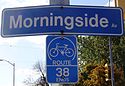
Location:
()Main article: Morningside Avenue (Toronto)Sewells Road
[[File:|125px]]
Sewells RoadLocation: – Steeles Avenue East Manse Road
[[File:|125px]]
Manse RoadLocation:
()Reesor Road
[[File:|125px]]
Reesor RoadLocation: Old Finch Avenue – Steeles Avenue East
(continues north into Markham)Morrish Road
[[File:|125px]]
Location:
()Conlins Road
[[File:|125px]]
Conlins RoadLocation:
()Meadowvale Road
[[File:|125px]]
Meadowvale RoadLocation: Lawrence Avenue East – Plug Hat Road Meadowvale Road is primarily a residential route in Scarborough. It is the site of the Toronto Zoo north of Sheppard Avenue. North of the zoo, Meadowvale Road crosses through Toronto's only rural region, which includes farmland, large section of plain fields, forests, and wildlife.
Centennial Road
[[File:|125px]]
Location: Rolling Meadows – Ellesmere Road
(interrupted by Highway 2A)Centennial Road, despite travelling through an area that was developed during Canada's centennial, takes its name from the church at its intersection with Kingston Road. The church was named Centennial in honour of the 100 year anniversary. Many of the streets along or near Centennial Road are named after the Fathers of Confederation.
Beare Road
[[File:|125px]]
Beare RoadLocation: Finch Avenue East – Steeles Avenue East
(continues east as Finch Avenue East)Port Union Road
[[File:|125px]]
Port Union RoadLocation: Lake Ontario – Kingston Road
(continues northwest as Sheppard Avenue East)East Avenue
Location: Lawrence Avenue East – Rouge Hills Drive
()References
- Sources
- ^ Wise & Gould 2000, p. 128.
- ^ "Islington Village". Maple Tree Publishing. http://www.torontoneighbourhoods.net/regions/etobicoke/77.html. Retrieved February 2, 2011.
- ^ a b c d e f g h i j k l m n o p q r s City of Toronto (2008). TO maps (Map). http://map.toronto.ca/imapit/iMapIt.jsp?app=TOMaps. Retrieved January 20, 2011.
- ^ Wise & Gould 2000, p. 179.
- ^ City of Toronto Bylaw 8663 (1921)
- ^ Wise & Gould 2000, p. 124.
- ^ Google, Inc. Google Maps – Roncesvalles length and route (Map). Cartography by Google, Inc. http://maps.google.ca/maps?ll=43.648498,-79.44746&spn=0.02801,0.076561&t=k&z=14. Retrieved February 2, 2011.
- ^ Wise & Gould 2000, p. 177.
- ^ Wise & Gould 2000, pp. 121–122.
- ^ Wise & Gould 2000, p. 131.
- ^ Wise & Gould 2000, pp. 82–83.
- ^ Internal Database, Department of Public Works and the Environment, Survey and Mapping Division
- ^ Google, Inc. Google Maps – Route of Ossington Avenue (Map). Cartography by Google, Inc. http://maps.google.ca/maps?ll=43.657564,-79.421883&spn=0.059737,0.15295&t=k&z=13. Retrieved January 27, 2010.
- ^ a b Robson, Mary E (1987). Johnson, Norah. ed. The Origins of Street Names in Toronto's Ward 5. Spadina Road Library. p. 7. ISBN 0-9692938-2-8.
- ^ Wise & Gould 2000, p. 46.
- ^ Wise & Gould 2000, pp. 29–30.
- ^ Wise 200, pp. 197–198.
- ^ Wise & Gould 2000, p. 216.
- ^ Scadding 1873, p. 308.
- ^ City of Toronto Council (1922). Appendix 'B' to the Minutes of Proceedings to the Council of the Corporation for the City of Toronto for the year 1922: Volume Two. Toronto: The Carswell Company. p. 589.
- ^ City of Toronto Council (1924). Appendix 'B' to the Minutes of Proceedings to the Council of the Corporation for the City of Toronto for the year 1922: Volume Two. Toronto: The Carswell Company.
- ^ Wise & Gould 2000, p. 58–59.
- ^ Wise & Gould 2000, pp. 122–123.
- ^ Wise & Gould 2000, pp. 193–194.
- ^ Wise & Gould 2000, p. 160.
- ^ Wise & Gould 2000, pp. 31–32.
- ^ Rand McNally Canada (2010). Toronto & Area Map Book (Map). Cartography by Perly's. p. 3, section D1. ISBN 978-0-88640-928-9.
- ^ Wise, Gould & 2000 128–129.
- ^ History of the Danforth
- ^ a b City of Markham. History of Markham Street Names. Accessed on February 3, 2010.
- ^ Wise & Gould 2000, p. 137.
- ^ McCormick Rankin (July 1990). Leslie Street Extension and Bayview Avenue Widening Environmental and Needs Assessment Study (Report). Metropolitan Toronto Transportation Department.
- ^ Toronto Bylaw 7297 (1915), section VIII
- ^ Wise & Gould 2000, p. 65.
- ^ "A brief history of Whitchurch-Stouffville - Part 1". Town of Whitchurch-Stouffville. http://www.townofws.com/history.asp. Retrieved March 1, 2007.
- ^ [1]
- ^ Toronto Archive Image
- ^ Toronto Archives - Birchmount Loop under construction
- ^ James Bow. Remembering Birchmount Loop Transit Toronto.
- ^ Birchmount in the 1960s
- ^ "T.O's un-tourist guide". Toronto Star. 2007-07-29. http://www.thestar.com/News/GTA/article/240999. Retrieved 2007-12-30.
- ^ Abbate, Gay (December 17, 1987). "Stage set for final battle on Brimley, 401 overpass". The Globe and Mail (Toronto): p. A23.
- ^ "Committee votes to open Brimley Road". The Globe and Mail (Toronto): p. A13. February 19, 1988.
- ^ Township of Scarborough By-Law No. 11461 (1964)
- Bibliography
- Filey, Mike (1992). Toronto Sketches: The Way We Were. Dundurn Press.
- Filey, Mike (1994). Toronto Sketches 3: The Way We Were. Dundurn Press. ISBN 1-55002-227-X.
- Filey, Mike (2004). Toronto Sketches 8: The Way We Were. Dundurn Press. ISBN 1-55002-527-9. http://books.google.ca/books?id=0dPEnyoio_gC&printsec=frontcover. Retrieved January 30, 2010.
- Laycock, Margaret; Myrvold, Barbara (1991). Parkdale in Pictures. Toronto Public Library Board. ISBN 0-920601-12-X.
- Ritchie, Don (1992). North Toronto. Boston Mills Press. ISBN 1-55046-011-0.
- Scadding, Henry (1873). Toronto of Old. Adam, Stevenson & Co. http://books.google.ca/books?id=tpovAAAAYAAJ&pg=PP1. Retrieved January 10, 2010.
- Wise, Leonard; Gould, Allan (2000). Toronto Street Names. Firefly Books. ISBN 1-55209-386-7.
Major roads in Toronto North-south Bathurst · Bayview · Birchmount · Brimley · Browns Line · Dufferin · Islington · Jane · Keele · Kennedy · Kipling · Leslie · Markham · Martin Grove · McCowan · Morningside · Royal York · Victoria Park · Warden · Weston · Woodbine · YongeOther streetsAvenue/University · Bay · Black Creek · De Grassi · Jameson · Jarvis · John · Lansdowne · Mount Pleasant · Ossington · Palmerston · Parliament · Roncesvalles · Spadina · VaughanEast-west Concession roadsBloor/Danforth · Eglinton · Finch · Lawrence · Sheppard · St. Clair · Steeles · The Queensway/Queen West/Queen East · York MillsOther streetsCollege/Carlton · Dundas · Eastern · Front · Gerrard · King · Kingston · Lake Shore · Queen's Quay · RaymoreExpressways and highwaysRoads in Toronto on Wikimedia Commons · Roads in Ontario Categories:- Streets in Toronto
- Toronto-related lists
- Lists of roads in Ontario


Wikimedia Foundation. 2010.