- Dhupu
-
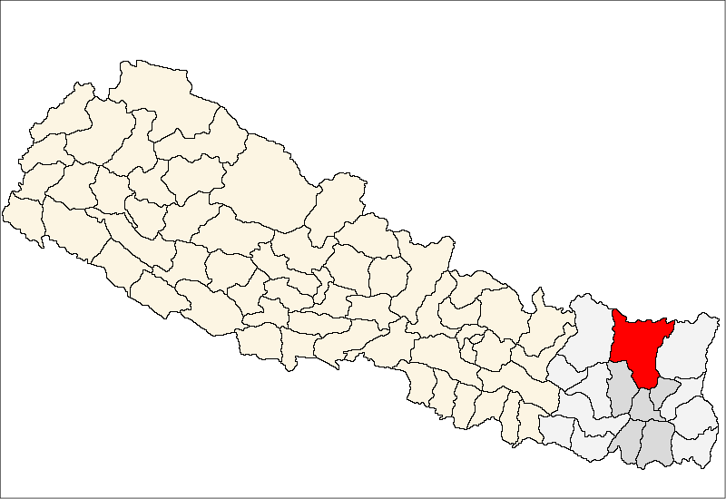
Dhupu — Village development committee — Location in Nepal
 Dhupu
DhupuCoordinates: 27°25′N 87°17′E / 27.41°N 87.28°ECoordinates: 27°25′N 87°17′E / 27.41°N 87.28°E Country  Nepal
NepalZone Kosi Zone District Sankhuwasabha District Population (1991) – Total 4,295 Time zone Nepal Time (UTC+5:45) Dhupu is a village development committee in Sankhuwasabha District in the Kosi Zone of north-eastern Nepal. At the time of the 1991 Nepal census it had a population of 4295 people living in 813 individual households.[1]
References
- ^ "Nepal Census 2001". Nepal's Village Development Committees. Digital Himalaya. http://www.digitalhimalaya.com/collections/nepalcensus/form.php?selection=1. Retrieved 19 November 2008.
External links
Ankhibhui, Bahrabise Bazar, Bala, Bana, Baneswor, Chainpur, Chepuwa, Dhupu, Diding, Hatiya, Jaljala, Keemathnka, Kharang, Madi Mulkharka, Madi Rambeni, Makalu, Malta, Mamling, Manakamana, Mangtewa, Matsya Pokhari, Mawadin, Num, Nundhaki, Pangma, Pathibhara, Pawakhola, Savapokhari, Siddhakali, Siddhipokhari, Sisuwakhola, Sitalpati, Syabun, Tamfok, Tamku, Yafu Categories:
- Populated places in Sankhuwasabha District
- Kosi Zone geography stubs

Wikimedia Foundation. 2010.