- Alice Springs
-
Alice Springs
Northern Territory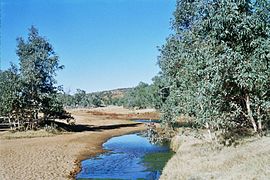
The "Springs" that gave the town its name
 Alice Springs
Population: 27,481 (2008)[1] • Density: 178/km² (461.0/sq mi) Established: 1872 Postcode: 0870-0872 Area: 148 km² (57.1 sq mi) Time zone: ACST (UTC+9:30) Mayor: Damien Ryan Location: LGA: Alice Springs Town Council State District: Federal Division: Lingiari Mean max temp Mean min temp Annual rainfall 28.7 °C
84 °F13.2 °C
56 °F279.2 mm
11 inAlice Springs is the second largest town in the Northern Territory of Australia. Popularly known as "the Alice" or simply "Alice", Alice Springs is situated in the geographic centre of Australia near the southern border of the Northern Territory.[2] The site is known as Mparntwe to its original inhabitants, the Arrernte, who have lived in the Central Australian desert in and around what is now Alice Springs for thousands of years. Alice Springs has a population of 27,481 people, which makes up 12 percent of the territory's population.[1] Alice averages 576 metres (1,890 ft) above sea level;[citation needed] the town is nearly equidistant from Adelaide and Darwin.[citation needed]
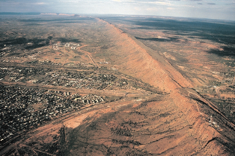
The town of Alice Springs straddles the usually dry Todd River on the northern side of the MacDonnell Ranges. The region where Alice Springs is located is known as Central Australia, or the Red Centre, and is an arid environment consisting of several different deserts. In Alice Springs, temperatures can vary dramatically with an average maximum temperature in summer of 35.6 °C (96.1 °F), and an average minimum temperature in winter of 5.1 °C (41.2 °F).[3]
Contents
History
Traditional Custodians
The Arrernte Aboriginal people[4] have made their home in the Central Australian desert in and around the site of the future Alice Springs for thousands of years, with evidence suggesting Indigenous occupation of the region dating back at least 30,000 years.[5] The Aboriginal name for Alice Springs is Mparntwe.[6] Many Arrernte people also live in communities outside of Alice Springs and on outstations.[citation needed]
Three major groups: the Western, Eastern and Central Arrernte people live in Central Australia, their traditional land including the area of Alice Springs and MacDonnell Ranges. They are also referred to as Aranda, Arrarnta, Arunta, and other similar spellings. Their neighbours are the Southern Arrernte, Luritja, Anmatyerr, Alyawarr and Western Arrernte peoples. There are five dialects of the Arrernte language: South-eastern, Central, Northern, Eastern and North-eastern.[citation needed]
There are roughly 1,800 speakers of Eastern and Central Arrernte, making it the largest spoken language in the Arandic family.[citation needed] This is one of the largest populations to speak any Australian language.[citation needed] It is taught in schools, and heard in local media and local government.[citation needed]
Arrernte country is rich with mountain ranges, waterholes, and gorges, which create a variety of natural habitats. The Arrernte people have set aside conservation areas in which various animal and other species are protected.[citation needed] According to the Arrernte traditional stories, in the desert surrounding Alice Springs, the landscape was shaped by caterpillars, wild dogs, travelling boys, two sisters, euros, and other ancestral figures.[6]
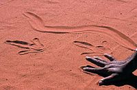 Alice Springs Desert Park, Sand Drawing Aboriginal
The numerous sites of traditional importance in and around Alice Springs include Anthwerrke (Emily Gap), Akeyulerre (Billy Goat Hill), Ntaripe (Heavitree Gap), Atnelkentyarliweke (Anzac Hill), and Alhekulyele (Mt Gillen).[6]
Early settlement
In 1861–62, John McDouall Stuart led an expedition through Central Australia, to the west of what later became Alice Springs, thereby establishing a route from the south of the continent to the north.[citation needed]
A European settlement was started ten years later with the construction of a repeater station on the Overland Telegraph Line, which linked Adelaide to Darwin and Great Britain. The OTL was completed in 1872. It traced Stuart's route and opened up the interior for permanent settlement. It was not until alluvial gold was discovered at Arltunga, 100 kilometres (62 mi) east of the present Alice Springs, in 1887 that any significant European settlement occurred.[citation needed] Until 31 August 1933, the town was known as Stuart.[7]
 Telegraph station
The telegraph station was sited near what was thought to be a permanent waterhole in the normally dry Todd River.[8] The settlement was optimistically named Alice Springs after the wife of the former Postmaster General of South Australia, Sir Charles Todd. The Todd River was named after Sir Charles.
The original mode of British-Australian transportation in the outback were camel trains, operated by immigrants from Pathan tribes in the North-West frontier of then British India (present-day Pakistan); they were misnamed Afghan camellers. In 1929 the Palmerston and Pine Creek Railway was completed from Darwin as far as Birdum, while the Great Northern Railway had been completed in 1891 from Port Augusta as far as Oodnadatta, South Australia, 700 kilometres (430 mi) south of Alice Springs. The lines were not connected until 2003. On 4 February 2004, the first passenger train arrived in Darwin from Adelaide.
World War II
World War II brought significant changes to Alice Springs. Prior to the war, Alice Springs was an extremely isolated settlement of less than 500 people. During the war, however, the town was an extremely active staging base, known as No 9 Australian Staging Camp, and a depot base for the long four-day trip to Darwin. The railway hub in Alice Springs was taken over by military operations and the number of soldiers posted in Alice Springs grew rapidly, as did the number of personnel passing through on their way to and from Darwin. When Darwin was threatened by Japanese forces, the sea routes -- the Northern Territory capital's primary means of transportation and resupply -- were cut off. The evacuation of Darwin first brought a large number of civilians including elected officials and many of the territory government's records. Alice Springs became the war-time civilian capital of the Northern Territory. When Darwin was bombed by Japanese air forces, a large number of military personnel and their heavy equipment were rapidly moved south to Alice Springs. The number of soldiers posted in Alice Springs peaked at around 8000 and the number of personnel passing through totaled close to 200,000. [9] Once the war ended, the military camps and the evacuees departed and Alice Springs' population declined rapidly. But Alice would be changed for ever. After being visited by nearly 200,000 people, including the American General Douglas MacArthur, Alice Springs gained considerable fame. The war years also left behind many beneficial material assets. The historically-listed Totem Theatre, created for the entertainment of this camp, still exists today. The Australian Army set up the 109th Australian General Hospital at Alice Springs. Seven mile aerodrome was constructed by the Royal Australian Air Force. War related operations necessitated the first sealing of the road between Alice Springs and Larrimah, expansion and improvement of Alice Springs' water supply, and improving the rail head. The war-related operations left behind thousands of pieces of excess military equipment and vehicles, and a marked increase in Alice Springs' population.[10] [9]
Post World War II
During the 1960s Alice Springs became an important defence location with the development of the US/Australian Pine Gap joint defence satellite monitoring base, home to about 700 workers from both countries.
By far the major industry in recent times is tourism. Almost in the exact centre of the continent, Alice Springs is some 1,200 kilometres (750 mi) from the nearest ocean and 1,500 kilometres (930 mi) from the nearest major cities, Darwin and Adelaide. Alice Springs is at the midpoint of the Adelaide–Darwin Railway.[11]
Modern town
The modern town of Alice Springs has both European and Aboriginal influences. The town's focal point, the Todd Mall, hosts a number of Aboriginal art galleries and community events. Alice Springs’ desert lifestyle has inspired several unique events, such as the Camel Cup, the Henley-on-Todd Regatta and the Beanie Festival.
Built environment
Alice Springs has many historic buildings, such as the Overland Telegraph Station, Adelaide House, the Old Courthouse and Residency and the Hartley Street School. Today the town is an important tourist hub and service centre for the surrounding area. It is a well-appointed town for its size, with several large hotels, a world class convention centre and a good range of visitor attractions, restaurants and other services.
Geography
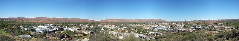 Panorama of Alice Springs
The region around Alice Springs is part of the Central Ranges xeric scrub area of dry scrubby grassland[12] and includes the MacDonnell Ranges which run east and west of the city and contain a number of hiking trails and swimming holes such as Ormiston Gorge, Ormiston Gorge Creek, Red Bank Gorge and Glen Helen Gorge. The 223-kilometre (139 mi) long Larapinta Trail follows the West MacDonnell Ranges and is considered among the world's great walking experiences.
The Simpson Desert, south-east of Alice Springs is one of Australia's great wilderness areas containing giant red sand dunes and interesting rock formations such as Chambers Pillar and Rainbow Valley.
Climate
The town of Alice Springs straddles the usually dry Todd River on the northern side of the MacDonnell Ranges. Alice Springs is located in Central Australia, also called the Red Centre, an arid environment consisting of several different deserts.
In Alice Springs, temperatures can vary by up to 28 °C (50 °F)[clarification needed] and rainfall can vary quite dramatically from year to year. In summer, the average maximum temperature is in the high 30s, whereas in winter the average minimum temperature can be 7.5 °C (45.5 °F), with an average of 12.4 nights below freezing every annum. While hot, this climate is not as severe as places such as Phoenix, Arizona or much of the Middle East. The elevation of the town is about 545 metres (1791 feet).[13]
Under the Köppen climate classification, Alice Springs has a desert climate (BWh).[14][15] The annual average rainfall is 279.2 millimetres (11.0 in) which would make it a semi-arid climate except that its high evapotranspiration, or its aridity, makes it a desert climate.[16] Annual precipitation is erratic, varying year to year in Alice Springs. In 2001 741 millimetres (29.2 in) fell and in 2002 only 198 millimetres (7.8 in) fell.[17] The highest daily rainfall is 204.8 millimetres (8.06 in), recorded on 31 March 1998.
Climate data for Alice Springs (1941–2010) Month Jan Feb Mar Apr May Jun Jul Aug Sep Oct Nov Dec Year Record high °C (°F) 45.2
(113.4)44.7
(112.5)42.2
(108.0)39.9
(103.8)35.0
(95.0)31.6
(88.9)31.6
(88.9)34.7
(94.5)38.8
(101.8)41.7
(107.1)42.9
(109.2)44.2
(111.6)45.2
(113.4)Average high °C (°F) 36.4
(97.5)35.0
(95.0)32.7
(90.9)28.2
(82.8)23.0
(73.4)19.8
(67.6)19.7
(67.5)22.6
(72.7)27.2
(81.0)30.9
(87.6)33.6
(92.5)35.4
(95.7)28.7 Average low °C (°F) 21.4
(70.5)20.8
(69.4)17.5
(63.5)12.6
(54.7)8.3
(46.9)5.1
(41.2)4.0
(39.2)6.0
(42.8)10.3
(50.5)14.8
(58.6)17.8
(64.0)20.2
(68.4)13.2 Record low °C (°F) 10.0
(50.0)8.5
(47.3)6.1
(43.0)1.4
(34.5)−2.7
(27.1)−6
(21.2)−7.5
(18.5)−4.1
(24.6)−1.1
(30.0)1.3
(34.3)3.5
(38.3)9.3
(48.7)−7.5
(18.5)Rainfall mm (inches) 38.6
(1.52)43.5
(1.713)31.0
(1.22)16.3
(0.642)19.2
(0.756)14.3
(0.563)14.0
(0.551)9.3
(0.366)8.1
(0.319)21.1
(0.831)28.2
(1.11)37.1
(1.461)281.5
(11.083)Avg. rainy days 4.6 4.6 3.1 2.1 3.1 2.8 2.5 1.9 2.2 4.6 5.6 5.8 42.9 Sunshine hours 319.3 296.9 300.7 285.0 283.5 272.0 282.1 303.8 300.0 313.1 303.0 310.0 3,509.4 Source: Australian Bureau of Meteorology[18] Demographics
In June 2006, approximately 27,481 people lived in Alice Springs with a total of 39,888 in the region.[citation needed] In 2006, the largest ancestry groups in the Alice Springs were, Australian (9,814 or 31.4%), English (6,970 or 22.3%), Irish (2,217 or 7.1%), Scottish (1,825 or 7.1%), Australian Aboriginal (1,790 or 5.7%, although note that a far greater proportion of the town's residents identify as Aboriginal), German (1,502 or 4.8%), and Italian (529 or 1.7%).[19] Although 74.7% of Alice Springs' population was born in Australia, the most common places of birth for immigrants in 2006 Census were the United Kingdom (3.4%), United States of America (3%), New Zealand (1.9%), and Philippines (0.8%).[20]
The most common non-English languages spoken in Alice Springs are: Arrernte, Warlpiri, Luritja, Pitjantjatjara, and Italian.[20]
Aboriginal population
According to the 2006 census, Aboriginal Australians make up approximately 18.8% of the population of Alice Springs[20] and 27.8% of the Northern Territory,[21] although the census figure for Alice Springs is likely to be an underestimate.[22] As Alice Springs is the regional hub of Central Australia, it attracts Aboriginal people from all over that region and well beyond. Many Aboriginal people visit regularly to use the town's services. Aboriginal residents usually live in the suburbs, on special purpose leases (or town camps), or further out at Amoonguna to the South and on the small family outstation communities on Aboriginal Lands in surrounding areas.
The traditional owners of the Alice Springs area are the Central Arrernte people.[23] As it is the largest town in central Australia, there are also speakers of Warlpiri, Warumungu, Kaytetye, Alyawarre, Luritja, Pintupi, Pitjantjatjara, Yankunytjatjara, Ngaanyatjarra, Pertame, Eastern, and Western Arrernte among others.[24]
Foreign and itinerant populations
United States population
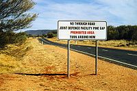 Prohibited Area sign
United States citizens have resided in Alice Springs constantly since the establishment of the United States Air Force Detachment 421, in 1954. Currently located on Schwarz Crescent, it is part of a joint United States-Australian project called the Joint Geological and Geographical Research Station (JGGRS). The unit is locally known as "Det 421" or "The Det" and has sponsored as many as 25 American families to live as temporary residents of the Alice Springs district. To mark the longstanding friendship with the community, on 1 July, 1995, the Alice Springs Town Council granted Detachment 421 Freedom of Entry to the Town of Alice Springs.[25]
Since the early 1970's, the majority of the American population in Alice Springs has been associated with the proximity to Pine Gap, a joint Australian and US satellite tracking station, located 19 kilometres (12 mi) south-west of Alice Springs. While Pine Gap employs 700 Americans and Australians, there are currently 2,000 people in the Alice Springs district who carry citizenship of the United States.
The American citizens celebrate most of the major US public festivals, including Independence Day and Thanksgiving. A portion of the Australian citizens engage in the festivities as well. Americans in Alice Springs are known to participate in a variety of associations and sporting teams, including baseball, basketball, and soccer competitions.[26]
Other cultures
Several small immigrant communities of other foreign cultures have found a home in Alice Springs, including Vietnamese, Chinese, Thai, and Indian ethnic groups. The most obvious impact of their presence in such a small and isolated town has been the opening of various restaurants serving their traditional cuisines.
Itinerant population
Alice Springs has a large itinerant population. This population is generally composed of foreign and Australian tourists, Aboriginal Australians visiting from nearby Central Australian communities, and Australian or international workers on short-term contracts (colloquially referred to as "blow-ins"). The major sources of work that recruit workers into town are the stations and mines. Foreign tourists usually pass through on their way to Uluru-Kata Tjuta National Park, whilst Australian tourists usually come through as a part of an event such as the Masters Games and the Finke Desert Race. These events can cause the population of the town to fluctuate by several thousand within a matter of days.
Government
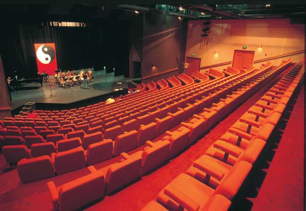
 Araluen Centre for Arts and Entertainment – Alice Springs Cultural Precinct
The Alice Springs Town Council governs the Alice Springs area, which takes in the town centre, its suburbs and some rural area. The Alice Springs Town Council has governed Alice Springs since 1971. The Alice Springs council consists of 9 members, the Mayor and 8 aldermen. The town is not divided up into wards. The current mayor of Alice Springs is Damien Ryan. Council Meetings are held on the last Monday of each month. The Alice Springs Region is governed by the newly created shire MacDonnell Shire, for which Alice Springs serves as council seat.
Alice Springs and the surrounding region have five elected members to the Northern Territory Legislative Assembly. There is one elected member of the Federal Parliament in the Australian House of Representatives for the area outside of Darwin, the Electoral Division of Lingiari.
Economy
 This view shows the transport links passing through Heavitree Gap in the MacDonnell Ranges found adjacent to the town
Alice Springs began as a service town to the pastoral industry that first came to the region. The introduction of the rail line increased its economy and productivity.[citation needed] Today the town services a region of 546,046 square kilometres (210,830 sq mi) and a regional population of 38,749.[citation needed] The region includes a number of mining and pastoral communities, the Joint Defence Space Research Facility at Pine Gap and tourist attractions at Uluru-Kata Tjuta National Park, Watarrka National Park and the MacDonnell Ranges.
The largest employer in Alice Springs is the Northern Territory Government, with 7.5% of employed people working in government administration, 6.6% in school education, and 3.7% in the Alice Springs Hospital.[20] The economy of Alice is somewhat reliant on domestic and international tourism, with 3.8% of its workforce employed providing accommodation.[20] It is home to the Northern Territory's largest dedicated travel organiser, Territory Discoveries, which employs over 50 full time local staff members.
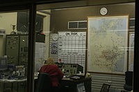 Flying Doctor dispatch service
As well as Territory Discoveries, all major tour companies have a base in Alice Springs, including AAT Kings & APT, as well as numerous local operators, including Emu Run Tours, Anganu Waai! tours, Alice Wanderer and Wayoutback Desert Safaris, the only locally based Advanced Ecotourism Accredited operator.
Alice is home to numerous hotels, from the 5-star Lasseters Hotel Casino, to the backpacker standard Toddies Resort. Also, there are several caravan parks for the driving visitor.
A dispatch centre for the Royal Flying Doctor Service of Australia operates here.
Education
Further information: List of schools in the Northern TerritoryEducation is overseen territory-wide by the Department of Education and Training (DET). It works to continually improve education outcomes for all students, with a focus on Indigenous students.[27]
Preschool, primary and secondary
Alice Springs is served by nineteen public and private schools that cater to local and overseas students. Over 3,843 primary and secondary students are enrolled in schools in Alice Springs, with 2,187 students attending primary education, and 1,656 students attending secondary education.[28] There are over 1,932 students enrolled in government schools and 1,055 students enrolled in independent schools.[28]
Alice Springs has an Alice Springs School of the Air which delivers education to students in remote areas.
Tertiary and vocational
The Alice Springs Campus of Charles Darwin University offers courses in TAFE and higher education. The Centre for Appropriate Technology was established in 1980 and provides a range of services to encourage and help Aboriginal people enhance their quality of life in remote communities.
Recreation and culture
Social characteristics
Alice Springs has occasionally been referred to as the lesbian capital of Australia owing to an unsubstantiated perception that there is a large percentage of lesbians in the population.[29]
Events and festivals
 Camel Cup, Alice Springs
The town's focal point, the Todd Mall, hosts a number of Aboriginal art galleries and community events. Alice Springs’ desert lifestyle has inspired several unique events, such as the Alice Desert Festival Camel Cup, the Henley-on-Todd Regatta, Beanie Festival and the Finke Desert Race. The Finke Desert Race is some 400 kilometres (250 mi) south of Alice Springs in the Simpson Desert.
The American population celebrates most of the major American festivals, including Halloween, Independence Day and Thanksgiving. A portion of the Australian citizens engage in the festivities as well.
Arts and entertainment
Alice Springs is renowned as the Aboriginal Art capital of Central Australia, home to many local and Aboriginal art galleries.[30] Indigenous Australian art is the more dominant, and galleries showcase the rich culture and native traditions that abound in Central Australia. Trade in Aboriginal art soared after the painting movement began at Papunya, a Central Australian Aboriginal settlement, and swept other indigenous communities. Central Australia is the home of some of the most prominent names in Aboriginal art, including Emily Kngwarreye, Minnie Pwerle, Clifford Possum Tjapaltjarri, Albert Namatjira and Wenten Rubuntja.
The Araluen Centre for Arts and Entertainment presents world-class ballets and orchestras, as well as local performances.
Locals also enjoy meeting up in Konjo Park for BBQ's every Sunday at 11am. This is an excellent time to meet and greet the locals who can quite often undertake games of Football and Frisbee.
The annual Desert Mob Art Show sees art collectors and art lovers from all over the world travel to Alice Springs to see works from Aboriginal art centres in Central Australia, with works by artists from remote areas of the Northern Territory, South Australia and Western Australia. This show is in conjunction with the Artist Association Desart and usually runs in September of each year at the Araluen Art Centre.
Crime
Main article: Crime in Alice SpringsCrime is a significant social issue in Alice Springs.[31][32][33][34]
In popular culture
- Liz Phair included a song called "Alice Springs" on her 1994 album Whip Smart.
- The group Midnight Oil mention Alice Springs in their songs "Kosciusko" and "Warakurna" ('There is enough in Redfern as there is in Alice'); and they mention Pine Gap in "Power and the Passion".
- The well-known Australian song My Island Home was originally written about the experience of an islander living 'west of Alice Springs', and this is mentioned in the lyrics of the original Warumpi Band version of the song.
- Nevil Shute's novel A Town Like Alice, and the resulting film and television mini-series, take their name from Alice Springs, although little of the action takes place there; because part of the story is set in Willstown (possibly modelled on Burketown) situated north of Alice Springs, near the Gulf of Carpentaria. The heroine, Jean, wants to change Willstown into a town "like" Alice. The local library in Alice Springs is named after Nevil Shute: the Nevil Shute Memorial Library.
- A casino in Alice Springs is the destination for the drag queen protagonists in the Australian road movie The Adventures of Priscilla, Queen of the Desert.
Recreation
Leisure and entertainment activities include hiking in the nearby MacDonnell Ranges, driving the four-wheel drive tracks at Finke Gorge National Park and visiting the many art galleries in Todd Mall.
Parks and gardens
The Alice Springs Desert Park was created to educate visitors about the many facets of the surrounding desert environment. The arid climate botanic garden, Olive Pink Botanic Garden, is a short distance from the town centre. They were named after anthropologist, naturalist and artist Olive Pink, who lived in the town for almost 30 years and died in 1975. She was well known locally and referred to by all as Miss Pink. The Alice Springs Reptile Centre is located in the town centre.
Sport
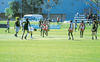 Traeger Park, Alice SpringsMain article: Sport in the Northern Territory
Alice Springs has a high rate of participation in many different sports, including tennis, hockey, Australian rules football, basketball, soccer, cricket and rugby football and boxing.
Rugby League has been a part of the local sporting scene since 1963. The Australian Rugby League has held a number of pre-season games in Alice Springs, at ANZAC Oval. The local competition is the Central Australian Rugby Football League, and sanctions both Junior and Senior Rugby League matches. The season usually kicks off around March/April and runs through to Late August. There are 4 senior teams in Alice Springs; Wests, Memo, United and Vikings. Matches are held during the winter months at ANZAC oval on Saturday afternoons.
Australian rules football is a particularly popular sport in Alice Springs in terms of both participation and as a spectator sport. The Central Australian Football League has several teams. The sport is particularly popular in Indigenous communities. The local stadium, Traeger Park, has a 10,000 seat capacity and was designed to host (pre-season) AFL and is currently home to the Northern Territory Thunder. In 2004, an AFL pre-season Regional Challenge match between Collingwood Football Club and Port Adelaide Football Club attracted a capacity sell-out crowd.
Organized baseball has been played in Alice Springs since the mid-1950s. Currently under the national organization of the Australian Baseball Federation, the Alice Springs Baseball Association organizes baseball competitions for youth players ages 5 - 18 and an adult competition played at Jim McConville Park and on Lyel Kempster Field at Traeger Park. As part of the world-wide Little League network, Alice Springs players and compete in the Australian National Little League competitions.
Cricket is a popular sport in Alice Springs and is primarily played at Traeger Park. The Imparja Cup Cricket Carnival first was played in 1994 and attracts Indigenous teams from all across Australia. The four main clubs are Federal Demons CC, Rovers CC, RSL Works CC and Wests CC.
Soccer is very popular among the younger community. A high number of children play it. Soccer is also played frequently by amateur adults in different divisions. There is also an all-African league for soccer in Alice Springs.
The Traeger Park sporting complex also hosts tennis, baseball, boxing, swimming, canoe polo, hockey, basketball, squash, badminton, gymnastics and skateboarding.
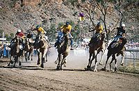
A unique sporting event, held annually, is the Henley-on-Todd Regatta, also known as the Todd River Race. It is a sand river race with bottomless boats and it remains the only dry river regatta in the world. Another unusual sporting event is the Camel Cup. This is also held annually at the local racetrack, Blatherskite Park. It is a full day event featuring a series of races using camels instead of horses.
The annual Camel Cup is held in July at Blatherskite Park, part of the Central Australian Show Society grounds.
Every year, on the Queen's Birthday long weekend, the annual Finke Desert Race is held. It is a grueling off-road race that runs from Alice Springs to the Finke community, then back again the next day. The total length of the race is roughly 500 kilometres (310 mi). It attracts spectators, who camp along the whole length of the track, and roughly 500 competitors, buggies and bikes, every year, making it the biggest sporting event in the Alice Springs calendar.
Media
 Alice Springs Desert Park, Bush Tucker
Alice Springs is served by both local and national radio and television services. The government-owned ABC provides four broadcast radio stations – local radio 783 ABC Alice Springs and the national networks ABC Radio National, ABC Classic FM and Triple J.
Commercial radio stations are 8HA 900 kHz and Sun 96.9 MHz and community radio is provided by indigenous broadcaster 8KIN 100.5 MHz.
Alice Springs is home to Australia's largest Indigenous media company. The Central Australian Aboriginal Media Association (CAAMA) consists of a radio station (CAAMA Radio), Music recording label (CAAMA Music), television and film production company (CAAMA Productions) and CAAMA technical. CAAMA serves to record and promote indigenous talent across its own radio network (one of the largest transmission footprints in the world), and through sales of CD's and screening of CAAMA movies and documentaries on national broadcasters.
Four broadcast television services operate in Alice Springs – commercial stations Imparja Television (callsign IMP9) and Southern Cross Central (QQQ31), and the Government-owned ABC (ABAD7) and SBS (SBS28). Imparja has a commercial agreement with the Nine network. Southern Cross Central has programming affillliations with both the Seven Network and Network Ten Australia.
Digital Television transmissions have commenced in Alice Springs. New channels provided by the ABC and SBS can be received with a digital set top box or digital television. Additional channels from the commercial broadcasters that are available in most other areas of Australia are expected to commence transmission in 2011–2012. Analogue television transmissions will be switched off by 31 December 2013.
Imparja Television is operated from studios in Alice Springs, It has a program affiliation contract with the Nine Network. The programming schedule on Imparja is the same as Nine Darwin NTD-8 and Channel 9 Brisbane with variations in Imparja's schedule for local Australian rules football, Rugby League, the children's show Yamba's Playtime, news, regional weather and other programs produced in Alice Springs by the station. Infomercials are shown in place of Home Shopping & other programs overnight and in some daytime timeslots. NITV is broadcast on the second channel allocated to Imparja by the Federal Government.
There are two local newspapers circulated in Alice Springs. The weekly publication, The Alice Springs News appears each Thursday; and the twice weekly The Centralian Advocate is published on Tuesdays and Fridays.
Infrastructure
Transport
 The Ghan at Alice Springs Station
 Departing Runway 12 at Alice Springs
Located on the Adelaide-Darwin railway, Alice Springs is accessible by train. Alice Springs railway station is visited by The Ghan, operated by Great Southern Railway, on its journey between Adelaide and Darwin. The train arrives twice weekly in each direction.[35]
The line first opened to Alice Springs in 1929, as the narrow gauge Central Australia Railway. It was not until 1980 that the current standard gauge line was opened, which was extended to Darwin in 2004.
The Ghan Tennant Creek (to Darwin)
↔ Alice Springs ↔ Kulgera (to Adelaide)
There are daily express coach services to and from Adelaide and Darwin servicing Alice Springs. The Stuart Highway, running north from Adelaide to Darwin via Alice Springs, is Northern Territory's most important road. The distance from Alice Springs to Adelaide is 1,530 kilometres (950 mi) and to Darwin is 1,498 kilometres (931 mi).
There are daily flights from Alice Springs Airport to Adelaide, Ayers Rock (Uluru), Cairns, Darwin, Melbourne, Perth and Sydney. There are also direct flights a few times a week to Brisbane. Two airlines serve Alice Springs: Qantas and Tiger Airways Australia. Virgin Blue made an appearance in Alice Springs for a short time, before it was undercut by Qantas.
Alice Springs is a base for the Royal Flying Doctor Service of Australia.
Sister cities
See also
- Alice Springs Juvenile Holding Centre
- Alice Springs Correctional Centre
- Kings Canyon, Northern Territory
- The Residency
- List of films and TV series shot in Alice Springs
- Crying Out Love, In the Center of the World (Japanese film using Alice Springs as a location.)
- Eiffel Tower
References
- ^ a b Australian Bureau of Statistics (23 April 2009). 7'!A1 "Regional Population Growth". http://www.ausstats.abs.gov.au/ausstats/subscriber.nsf/0/057C7AB6661166CDCA2575A0001802DC/$File/32180ds0002_2001-08.xls#'Table 7'!A1. Retrieved 13 January 2009.
- ^ Geoscience Australia Centre of Australia, States and Territories updated July 2006 "Officially, there is no centre of Australia. This is because there are many complex but equally valid methods that can determine possible centres of a large, irregularly shaped area especially one that is curved by the earth's surface." See the Geoscience Australia page for further details.
- ^ "Climate statistics for Alice Springs Airport". Bureau of Meteorology. 2011. http://www.bom.gov.au/climate/averages/tables/cw_015590.shtml. Retrieved 19 June 2011.
- ^ Aboriginal Australia Art & Culture Centre. "Arrernte Aboriginal Art and Culture Centre Alice Springs". Aboriginalart.com.au. http://aboriginalart.com.au/culture/arrernte.html. Retrieved 30 May 2011.
- ^ Thorley, Peter (2004). "Rock-art and the archaeological record of Indigenous settlement in Central Australia". Australian Aboriginal Studies (1). http://search.informit.com.au/fullText;dn=200409749;res=APAFT. Retrieved 18 June 2011.
- ^ a b c Brooks, David (2003). A town like Mparntwe: a guide to the dreaming tracks and sites of Alice Springs. Alice Springs: Jukurrpa Books. ISBN 1864650451. https://iadpress.com/shop/a-town-like-mparntwe-reprint/.
- ^ "About Alice Springs – History". Alicesprings.nt.gov.au. 31 August 1933. http://www.alicesprings.nt.gov.au/alice-springs/history. Retrieved 30 May 2011.
- ^ Stanton, Jenny (2000). The Australian Geograhic Book of the Red Centre. Terrey Hills, New South Wales: Australian Geographic. p. 75. ISBN 978-1-86276-013-4.
- ^ a b "Central Australia the war year - 1939-1945". RSL On-Line Museum. RSL Sub Branch Alice Springs. http://www.thewaryears.alicespringsrsl.com.au/townlife.shtml. Retrieved 8 August 2011.
- ^ "Alice Springs (Mparntwe) NT". Flinders Range Research. Flinders Ranges Research,. http://www.southaustralianhistory.com.au/alicesprings.htm. Retrieved 8 August 2011.
- ^ "The Ghan – Outback experiences – Northern Territory Official Travel Site". Travelnt.com. http://www.travelnt.com/en/experience/outback/the-ghan.htm. Retrieved 30 May 2011.
- ^ "Terrestrial Ecoregions – Central Ranges xeric scrub (AA1302)". Nationalgeographic.com. http://www.nationalgeographic.com/wildworld/profiles/terrestrial/aa/aa1302.html. Retrieved 30 May 2011.
- ^ "Qwikcast.com: Records and Averages for Alice Springs, Northern Territory, Australia". Qwikcast.weatherbase.com. http://qwikcast.weatherbase.com/weather/weather_c.php3?s=62349&refer=. Retrieved 30 May 2011.
- ^ Tapper, Andrew; Tapper, Nigel (1996). Gray, Kathleen. ed. The weather and climate of Australia and New Zealand (First ed.). Melbourne, Australia: Oxford University Press. p. 300. ISBN 0195533933.
- ^ Linacre, Edward; Geerts, Bart (1997). Climates and Weather Explained. London: Routledge. p. 379. ISBN 978-0-415-12519-2. http://books.google.com.au/books?id=mkZa1KLHCAQC&lpg=PA379&pg=PA379#v=onepage&q=&f=false.
- ^ McKnight & Hess, pp. 212–1, "Climate Zones and Types: Dry Climates (Zone B)"
- ^ Alice Springs' Climate[dead link]
- ^ "Climate statistics for Australian locations". June 2011. http://www.bom.gov.au/climate/averages/tables/cw_015590_All.shtml.
- ^ "2006 Census Tables : Alice Springs (T) (Local Government Area)". Australian Bureau of Statistics. http://www.censusdata.abs.gov.au/ABSNavigation/prenav/ViewData?action=404&documentproductno=LGA70200&documenttype=Details&order=1&tabname=Details&areacode=LGA70200&issue=2006&producttype=Census%20Tables&javascript=true&textversion=false&navmapdisplayed=true&breadcrumb=POLTD&&collection=Census&period=2006&productlabel=Ancestry%20%28full%20classification%20list%29%20by%20Sex&producttype=Census%20Tables&method=Place%20of%20Usual%20Residence&topic=Ancestry&. Retrieved 18 June 2011.
- ^ a b c d e Australian Bureau of Statistics (25 October 2007). "Alice Springs (T) (Local Government Area)". 2006 Census QuickStats. http://www.censusdata.abs.gov.au/ABSNavigation/prenav/LocationSearch?collection=Census&period=2006&areacode=LGA70200&producttype=QuickStats&breadcrumb=PL&action=401. Retrieved 14 January 2009.
- ^ "2006 Census QuickStats: Northern Territory". Australian Bureau of Statistics. 25 October 2007. http://www.censusdata.abs.gov.au/ABSNavigation/prenav/ViewData?method=Place%20of%20Usual%20Residence&subaction=-1&producttype=QuickStats&areacode=7&action=401. Retrieved 19 June 2011.
- ^ Foster, Denise; Michell, Julia; Ulrik, Jane; Williams, Raelene (2003). "Population and Mobility in the Town Camps of Alice Springs: A report prepared by Tangentyere Council Research Unit". Tangentyere Council, Alice Springs. http://www.tangentyere.org.au/publications/research_reports/DKCRC-Report-9-Population-and-Mobility-in-the-town-camps-of-Alice-Springs.pdf. Retrieved 2010-06-16.
- ^ Alice Springs Community – Indigenous Services, Alice Springs Town Council
- ^ "Alice Springs – Aboriginal Culture". Alice Springs Town Council. 8 June 2006. Archived from the original on 18 December 2006. http://web.archive.org/web/20061218024623/http%3A//www.alicesprings.nt.gov.au/about_alice/aboriginal.asp. Retrieved 25 November 2006.
- ^ "Council History - The Seventh Council". Council History - The Seventh Council. Alice Springs Town Council. http://www.alicesprings.nt.gov.au/alice-springs-town-council/council-history-7. Retrieved 8 August 2011.
- ^ The American Connection[dead link]
- ^ Department of Education and Training – About the Department[dead link]
- ^ a b Tables&javascript=true&textversion=false&navmapdisplayed=true&breadcrumb=TLPD&&collection=Census&period=2006&productlabel=Type of Educational Institution Attending (Full/Part-Time Student Status by Age) by Sex&producttype=Census Tables&method=Place of Usual Residence&topic=School Education& ABS education tables[dead link]
- ^ Adlam, Nigel (31 December 2008). "DAILY TELEGRAPH, Outed: Lesbian capital of Australia". News.com.au. http://www.news.com.au/dailytelegraph/story/0,22049,24858909-5001021,00.html. Retrieved 30 May 2011.
- ^ "General Information". Clean Enery Council. http://www.cleanenergycouncil.org.au/cec/mediaevents/ATRAA-2010/general-info.html. Retrieved 7 August 2010.[dead link]
- ^ Nicolas Rothwell (19 February 2011). "Violence in Alice spirals out of control". The Australian. http://www.theaustralian.com.au/in-depth/aboriginal-australia/violence-in-alice-spirals-out-of-control/story-e6frgd9f-1226008399065. Retrieved 30 May 2011.
- ^ 19 February 2011 12:00 am (19 February 2011). "Destroyed in Alice". The Australian. http://www.theaustralian.com.au/national-affairs/destroyed-in-alice/story-fn59niix-1226008040782. Retrieved 30 May 2011.
- ^ Tlozek, Eric (31 March 2010). "Alice crime rates reach unprecedented levels – ABC Alice Springs – Australian Broadcasting Corporation". Australian Broadcasting Corporation. http://www.abc.net.au/news/stories/2010/03/31/2861586.htm?site=alicesprings. Retrieved 30 May 2011.
- ^ Natasha Robinson (22 December 2008). "Down like Alice the meltdown of a tourism mecca". The Australian. http://www.theaustralian.com.au/news/fears-for-alice-as-crime-escalates/story-e6frg6po-1111118383082. Retrieved 30 May 2011.
- ^ Australian Railmaps, "RAIL MAP – PERTH to ADELAIDE, CENTRAL AND NORTHERN AUSTRALIA". Retrieved 12 June 2007.
- ^ "Alice Springs – Sister city media release". Alice Springs Town Council. 9 August 2005. Archived from the original on 20 August 2006. http://web.archive.org/web/20060820223023/http%3A//www.alicesprings.nt.gov.au/news/newsItem.asp%3Fdate%3D050809%26txt%3DAli. Retrieved 5 July 2007.
External links
- Alice Springs Town Council (local government) web site
- Official Tourism web site for Alice Springs and surrounds
- Photographs of Alice Springs in 1994, National Library of Australia
- [1] (Link to TV transmission frequencies list from ACMA website).
- History of the stratospheric balloon launch base located in the Alice Spring airport and records of balloons launched there
- Gigapixel Panorama of Alice Springs Sunrise from Anzac Hill looking towards The Gap
- Gigapixel Panorama of Alice Springs Sunrise from Anzac Hill Looking East
- The American Connection[dead link]
Coordinates: 23°42′S 133°52′E / 23.7°S 133.87°E
Northern Territory Topics 
Regions Major Settlements Categories:- 1872 establishments in Australia
- Towns in the Northern Territory
- Alice Springs
- Springs of Australia


Wikimedia Foundation. 2010.