- Vistula
-
For other uses, see Vistula (disambiguation).
Vistula River 
Confluence of the Narew and the Vistula at ModlinOrigin Barania Góra, Silesian Beskids Mouth Gdańsk Bay, Baltic Sea Basin countries Poland, Ukraine, Belarus, Slovakia Length 1,047 km (651 mi) Source elevation 1,106 m (3,629 ft) Avg. discharge 1,080 m³/s (at mouth) Basin area 194,424 km²; (75,067 mi²) The Vistula (pronounced /ˈvɪstʃələ/; Polish: Wisła [ˈviswa], German: Weichsel) is the longest and the most important river in Poland, at 1,047 km (651 miles) in length. The watershed area of the Vistula is 194,424 km2 (75,068 sq mi), of which 168,699 km2 (65,135 sq mi) lies within Poland (splitting the country in half).
The Vistula has its source at Barania Góra in the south of Poland, 1220 meters above sea level in the Silesian Beskids (western part of Carpathian Mountains) where it begins with the White Little Vistula (Biała Wisełka) and the Black Little Vistula (Czarna Wisełka). It then continues to flow over the vast Polish plains, passing several large Polish cities along its way, including Kraków, Sandomierz, Warsaw, Płock, Włocławek, Toruń, Bydgoszcz, Świecie, Grudziądz, Tczew and Gdańsk. It empties into the Vistula Lagoon or directly into the Gdańsk Bay of the Baltic Sea with a delta and several branches (Leniwka, Przekop, Śmiała Wisła, Martwa Wisła, Nogat and Szkarpawa).
Contents
Origins of the name Vistula
The name was first recorded by Pliny in AD 77 in his Natural History. He uses Vistula (4.52, 4.89) with an alternative spelling, Vistillus (3.06). The Vistula River ran into the Mare Suebicum, which is today known as the Baltic Sea. The root of the name Vistula is Indo-European ultimately from proto-Indo-European. The diminutive endings -ila, -ula, were used in many Indo-European language groups, including Latin (see Ursula).
In writing about the Vistula River and its peoples, Ptolemy uses the Greek spelling, "Ouistoula". Other ancient sources spell it "Istula". Pomponius Mela refers to the "Visula" (Book 3) and Ammianus Marcellinus to the "Bisula" (Book 22), both of which names lack the -t-. The definitive reference is probably Jordanes (Getica 5 & 17), who uses "Viscla". The Anglo-Saxon poem Widsith refers to it as the "Wistla".[1] 12th century Polish chronicler Wincenty Kadłubek called the river Vandalus from the Lithuanian "vanduo", meaning "water". Jan Długosz in his Annales seu cronicae incliti called the Vistula "White river": "a nationibus orientalibus Polonis vicinis, ab aquae condorem Alba aqua ... nominatur".
Geography
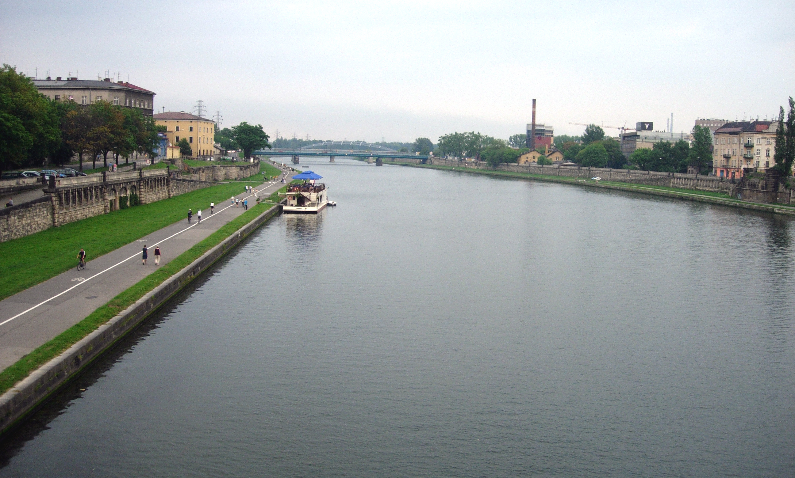
 Vistula River flowing through Kraków, Poland.
The reaches of the Vistula are composed of three stretches: upper, from its sources to the city of Sandomierz; centre, from Sandomierz to the mouth of Narew and Bug; and bottom, from mouth of Narew till Vistula's own delta at the Baltic.
The Vistula river basin covers 194,424 km² (in Poland 168,700 km²); its average altitude rising to 270 m above sea level. In addition, the majority of its river basin (55%) is located at heights of 100 to 200 m above sea level; over 3/4 of the river basin ranges from 100 – 300 m in altitude. The highest point of the river basin lies at 2655 m (Gerlach Peak in the Tatra mountains). One of the features of the river basin of the Vistula is its asymmetry - in great measure resulting from the tilting direction of the Central-European Lowland toward the north-west, the direction of the flow of glacial waters, as well as considerable predisposition of its older base. The asymmetry of the river basin (right-hand to left-hand side) is 73-27%.
The most recent glaciation of the Pleistocene epoch, which ended around 10,000 BC, is called the Vistulian glaciation or Weichselian glaciation in regard to north-central Europe.[2]
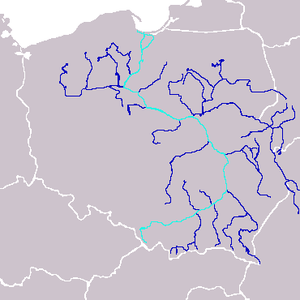
Major cities and towns along Vistula tributaries
Delta of the Vistula River
The river forms a wide delta called the Żuławy around the town of Biała Góra near Sztum, about 50 km from the mouth, splitting into two branches: the Leniwka (left) and the Nogat (right). In the city of Gdańsk the Head of the Leniwka branch separates again into the Szkarpawa branch, for the purpose of flood control closed to the east with a lock. The so-called Dead Wisła divides again into the Przegalinie branch flowing into Gdańsk Bay. Until the 14th century the Vistula was divided into a main eastern branch, the Elbląg Vistula, and the smaller western branch, the Gdańsk Vistula. Since 1371 the Vistula of Gdańsk is the river's main artery. After the flood in 1840 an additional branch formed called the Śmiała Wisła ("Bold Vistula"). In 1890 through 1895, additional waterworks were carried out up the Świbna.
Near Kwidzyń the Vistula is divided at present into two separate branches that constitute the river delta:
Nogat Leniwka Town Tributaries Remarks Town Tributaries Remarks Sztum Tczew Malbork Gdańsk Motława, Radunia, Potok Oliwski in the city the river divides into several separate branches that reach the Baltic Sea at different points, the main branch reaches the sea at Westerplatte Elbląg Elbląg shortly before reaching Vistula Bay Tributaries
List of right and left tributaries with a nearby city, from source to mouth:
Right tributaries
- Brennica - Skoczów
- Iłownica
- Biała - Czechowice-Dziedzice
- Soła
- Skawa - Zator
- Skawinka - Skawina
- Wilga - Kraków
- Drwinka
- Raba
- Gróbka
- Uszwica
- Kisielina
- Dunajec
- Breń
- Brnik
- Wisłoka
- Babulówka - Baranów Sandomierski
- Trzesniówka - Sandomierz
- Łęg - Sandomierz
- San
- Sanna - Annopol
- Wyżnica - Józefów
- Chodelka
- Bystra - Kazimierz Dolny
- Kurówka - Puławy
- Wieprz - Dęblin
- Okrzejka
- Promnik
- Wilga - Wilga
- Świder - Otwock, Józefów
- Kanał Żerański - Warsaw
- Narew - Nowy Dwór Mazowiecki
- Mołtawa
- Słupianka - Płock
- Rosica - Płock
- Brzeźnica - Płock
- Skrwa Prawa - Płock
- Mień - Nieszawa
- Drwęca - Toruń
- Bacha - Toruń
- Struga
- Osa - Grudziądz
- Liwa
Left tributaries
- Krajka - Strumień
- Pszczynka
- Gostynia
- Przemsza - Chełmek
- Chech
- Rudno
- Sanka - Kraków
- Rudawa - Kraków
- Prądnik - Kraków
- Dłubnia - Kraków
- Roporek - Nowe Brzesko
- Szreniawa
- Nidzica
- Nida - Nowy Korczyn
- Strumień
- Czarna - Połaniec
- Koprzywianka - Sandomierz
- Opatówka
- Kamienna
- Krępianka - Solec nad Wisłą
- Iłżanka
- Zwoleńka
- Plewka - Janowiec
- Zagożdzonka - Kozienice
- Radomka
- Pilica - Warka
- Czarna - Góra Kalwaria
- Jeziorka - Konstancin-Jeziorna
- Bzura - Wyszogród
- Skrwa Lewa - Płock
- Zgłowiączka - Włocławek
- Tążyna
- Zielona
- Brda - Bydgoszcz
- Wda - Świecie
- Wierzyca - Gniew
- Motława - Gdańsk
- Radunia - Gdańsk

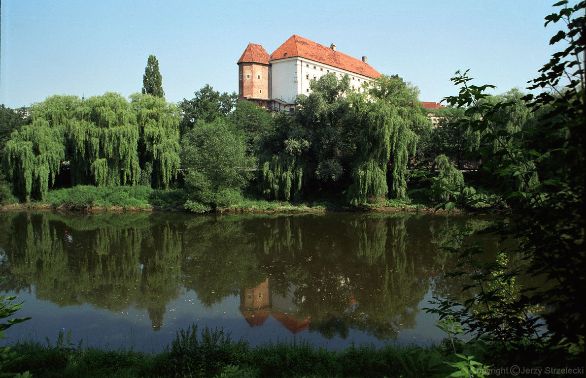
 Royal Castle in Sandomierz seen from the Vistula river.
 Renaissance town of Kazimierz Dolny overlooking serene Vistula.
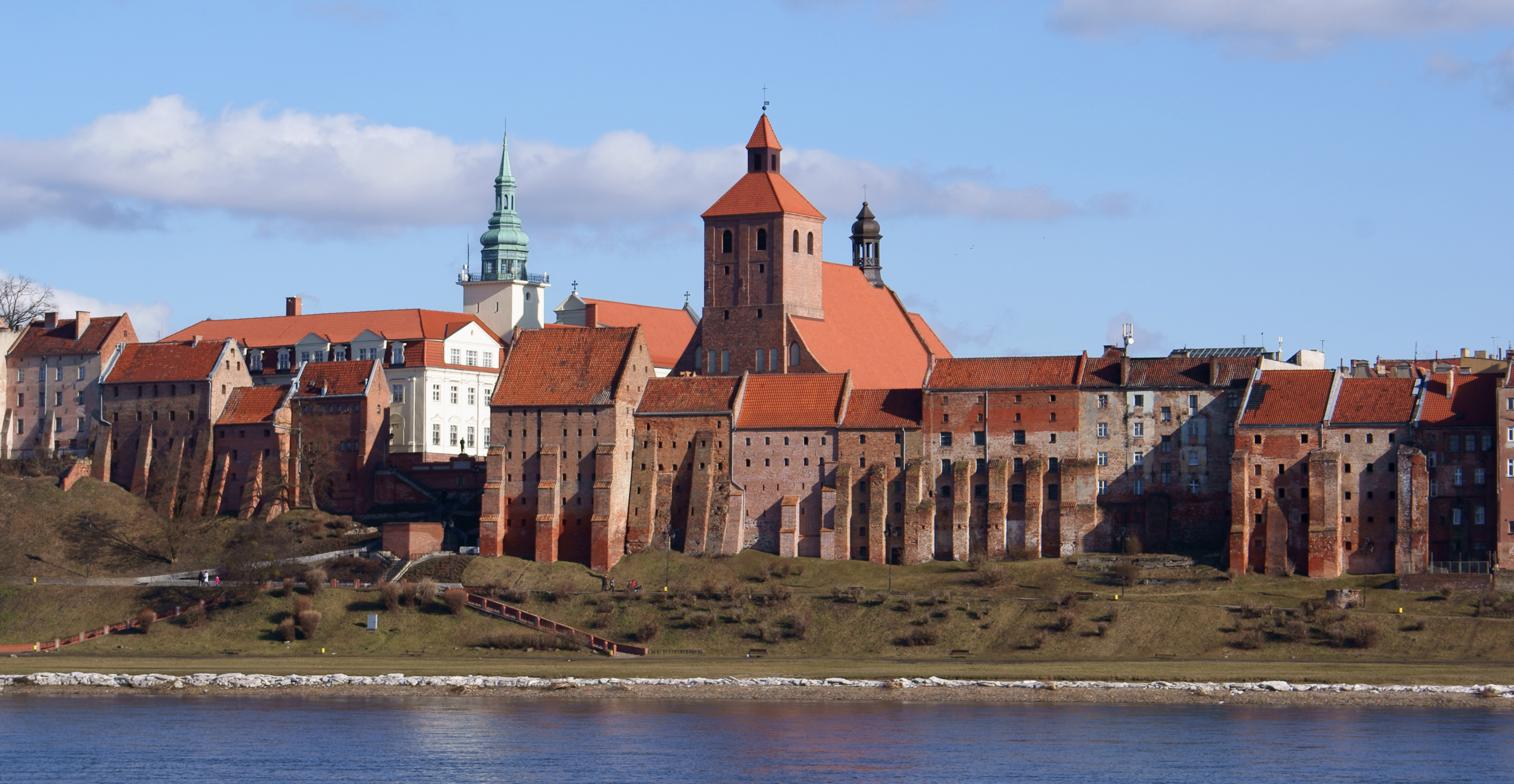
 Granaries in Grudziądz seen from the left riverside of the Vistula river, 13th - 17th century.
Global warming and the flooding of the Vistula delta
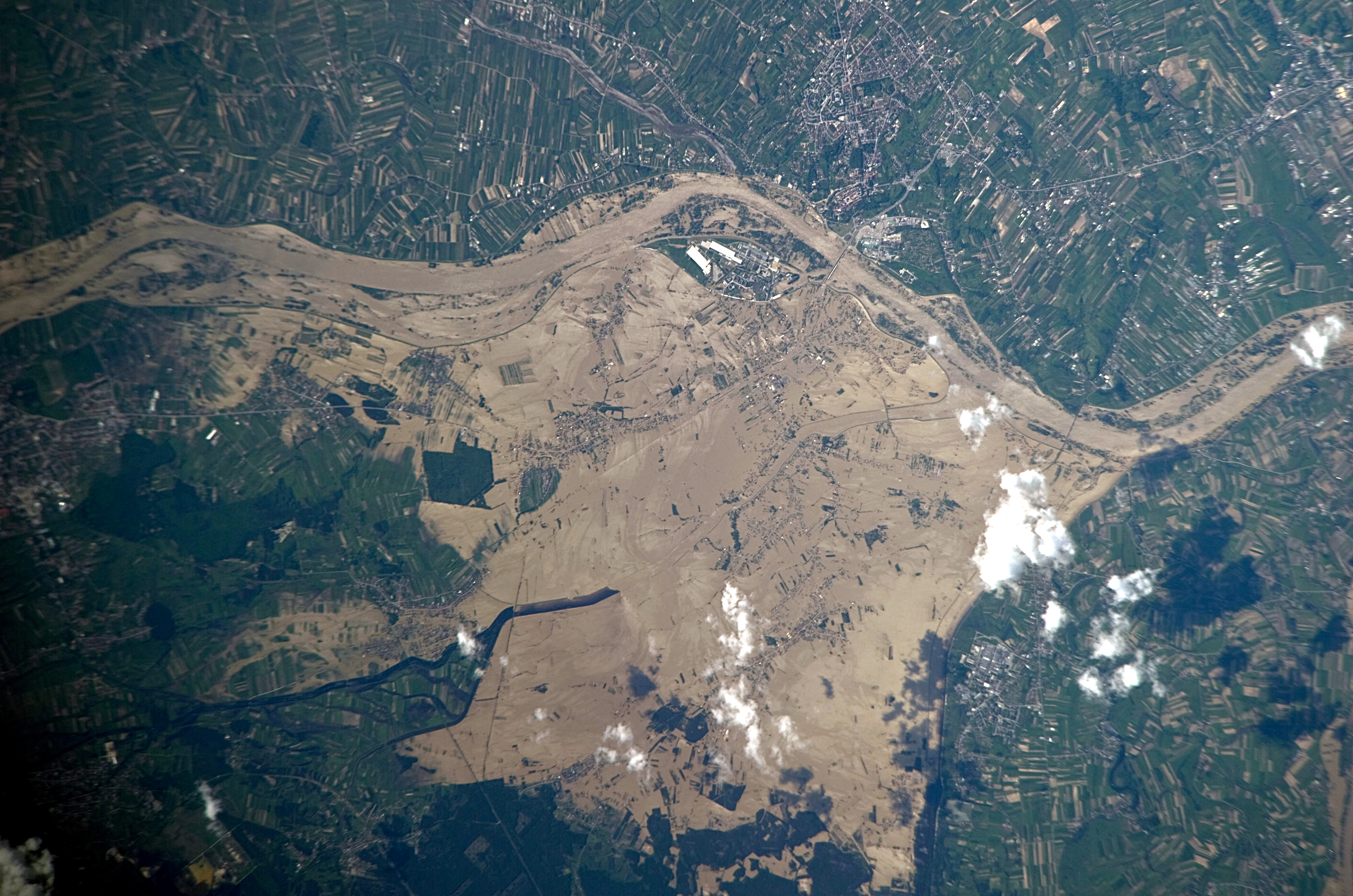
 Widespread flooding along the Vistula River in south-eastern Poland.
According to flood studies carried out by Professor Zbigniew Pruszak, who is the co-author of the scientific paper Implications of SLR[3] and further studies carried out by scientists attending Poland’s Final International ASTRA Conference,[4] and predictions stated by climate scientists at the climate change pre-summit in Copenhagen,[5] it is highly likely most of the Vistula Delta region (which is below sea level[6]) will be flooded due to the sea level rise caused by climate change by 2100.
Geological history
The history of the River Vistula and her valley spans over 2 million years. The river is connected to the geological period called the Quaternary, in which distinct cooling of the climate took place. In the last million years, an ice sheet entered the area of Poland eight times, bringing along with it changes of reaches of the river. In warmer periods, when the ice sheet retreated, the Vistula deepened and widened its valley. The river took its present shape within the last 14,000 years, after complete recession of the Scandinavian ice sheet from the area. At present, along the Vistula valley, erosion of the banks and collecting of new deposits are still occurring.[7]
As the principal river of Poland, the Vistula is also located in the centre of Europe. Three principal geographical and geological land masses of the continent meet in her river basin: the lowland Eastern European shield, the area of uplands and low mountains of Western Europe, and the Alpine zone of high mountains to which both the Alps and the Carpathians belong. The Vistula begins in the Carpathian mountains. The run and character of the river was shaped by ice sheets flowing down from the Scandinavian Peninsula. The last ice sheet entered the area of Poland about 20,000 years ago. During periods of warmer weather, the ancient Vistula, "Pra-Wisła", searched for the shortest way to the sea - thousands of years ago it flowed into the North Sea somewhere at the latitude of contemporary Scotland. The climate of the Vistula valley, its plants, animals and its very character changed considerably during the process of glacial retreat.[8]
-

Biała Wisełka
-

Lake Morskie Oko, White Dunajec Springs
-

Vistula flooding south of Warsaw, 2004
-

Vistula in Płock
The Vistula is navigable from the Baltic Sea to Bydgoszcz (where the Bydgoszcz Canal joins the river). The Vistula can accommodate modest river vessels of CEMT class II. Further upstream the river depth lessens. Although a project was undertaken to increase the traffic-carrying capacity of the river upstream of Warsaw by building a number of locks in and around Kraków, this project was not extended further, so that navigability of the Vistula remains limited. The potential of the river would increase considerably if a restoration of the East-West connection via the Narew–Bug–Mukhovets–Pripyat–Dnieper waterways were considered. The shifting economic importance of parts of Europe may make this option more likely.
Historical relevance
Ancient settlements
 Vistula valley east (upstream) of Toruń.
Protoslavic tribes (Lusatia and Przeworsk Culture) occupied large parts of the Vistula Basin in the first millennium BCE. Genetic analysis indicates that there has been an unbroken genetic continuity of the inhabitants over the last 3,500 years, which would suggest that Polish tribes lived here for a long time and successfully defended against distant invaders,[9] such as Suebi and Burgundians. Even though the Romans do not appear to have had direct contact with the regions between Odra-Nysa Łużycka and the Bug, the Vistula Basin along with the lands of the Rhine, Danube, Elbe, and Oder came to be called Magna Germania by Roman authors of the 1st century AD.[9] Ptolemy, in the 2nd century AD, would describe the Vistula as the border between Germania and Sarmatia.
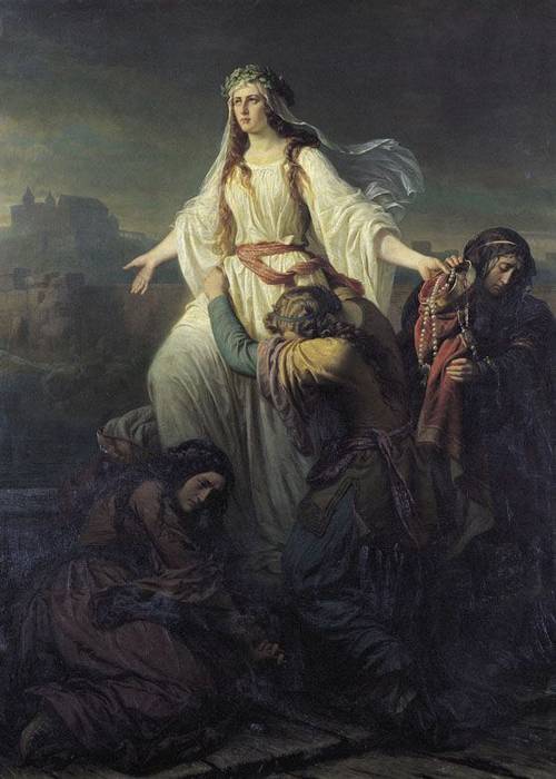
 Death of princess Wanda by Maksymilian Piotrowski, 1859.
Tacitus is another source regarding information on the early inhabitants of the Vistula. However, he makes no secret that many of the tribes to the east of the Vistula were somewhat shrouded in mystery. For example, when describing the Venethi, Peucini and Fenni he wrote that he was not sure if he should call them Germans, since they had settlements and they fought on foot, or rather Sarmatians since they have some similar customs to them.[10]
The Vistula river used to be connected to the Dnieper River, and thence to the Black Sea via the Augustów Canal, a technological marvel with numerous sluices contributing to its aesthetic appeal. It was the first waterway in Central Europe to provide a direct link between the two major rivers, the Vistula and the Neman. It provided a link with the Black Sea to the south through the Oginski Canal, Dnieper River, Berezina Canal, and Dvina River. The Baltic Sea–Vistula–Dnieper–Black Sea route with its rivers was one of the most ancient trade routes, the Amber Road, on which amber and other items were traded from Northern Europe to Greece, Asia, Egypt, and elsewhere.[11][12]
The Vistula estuary was settled by Slavs in the 7th and 8th century.[13] Based on archeological and linguistic findings, it has been postulated that these settlers moved northward along the Vistula river.[13] This however contradicts another hypothesis supported by some researchers saying the Veleti moved westward from the Vistula delta.[13]
A number of West Slavic Polish tribes formed small dominions beginning in the 8th century, some of which coalesced later into larger ones. Among the tribes listed in the Bavarian Geographer's 9th century document were the Vistulans (Wiślanie) in southern Poland. Kraków and Wiślica were their main centres.
Many Polish legends are connected with the Vistula and the beginnings of Polish statehood. One of the most enduring is that about princess Wanda co nie chciała Niemca (who rejected the German).[14] According to the most popular variant, popularized by the 15th century historian Jan Długosz,[15] Wanda, daughter of King Krak, became queen of the Poles upon her father's death.[14] She refused to marry a German prince Rytigier (Rüdiger), who took offence and invaded Poland, but was repelled.[16] Wanda however committed suicide, drowning in the Vistula river, to ensure he would not invade her country again.[16]
Main trading artery
 11th century Benedictine Abbey in Tyniec overlooks the Vistula.
For hundreds of years the river was one of the main trading arteries of Poland, and the castles that line its banks were highly prized possessions. Salt, timber, grain, and building stone were among goods shipped via that route between the 10th and 13th centuries.[17]

In the 14th century the lower Vistula was controlled by the Teutonic Order, invited in 1226 by Konrad I of Masovia to help him fight the pagan Prussians on the border of his lands. In 1308 the Teutonic Knights captured the Gdańsk castle and murdered the population.[18] Since then the event is known as the Gdańsk slaughter. The Order had inherited Gniew from Sambor II, thus gaining a foothold on the left bank of the Vistula.[19] Many granaries and storehouses, built in the 14th century, line the banks of the Vistula.[20] In the 15th century the city of Gdańsk gained great importance in the Baltic area as a centre of merchants and trade and as a port city. While at this time the surrounding lands were inhabited by Pomeranians, Gdańsk soon became a starting point for German settlement of the largely fallow Vistulan country.[21]
Before its peak in 1618, trade increased by a factor of 20 from 1491. The tonnage of grain traded on the river in key years is telling: 1491 - 14.000; 1537 - 23.000; 1563 - 150.000; 1618 - 310.000.[22]
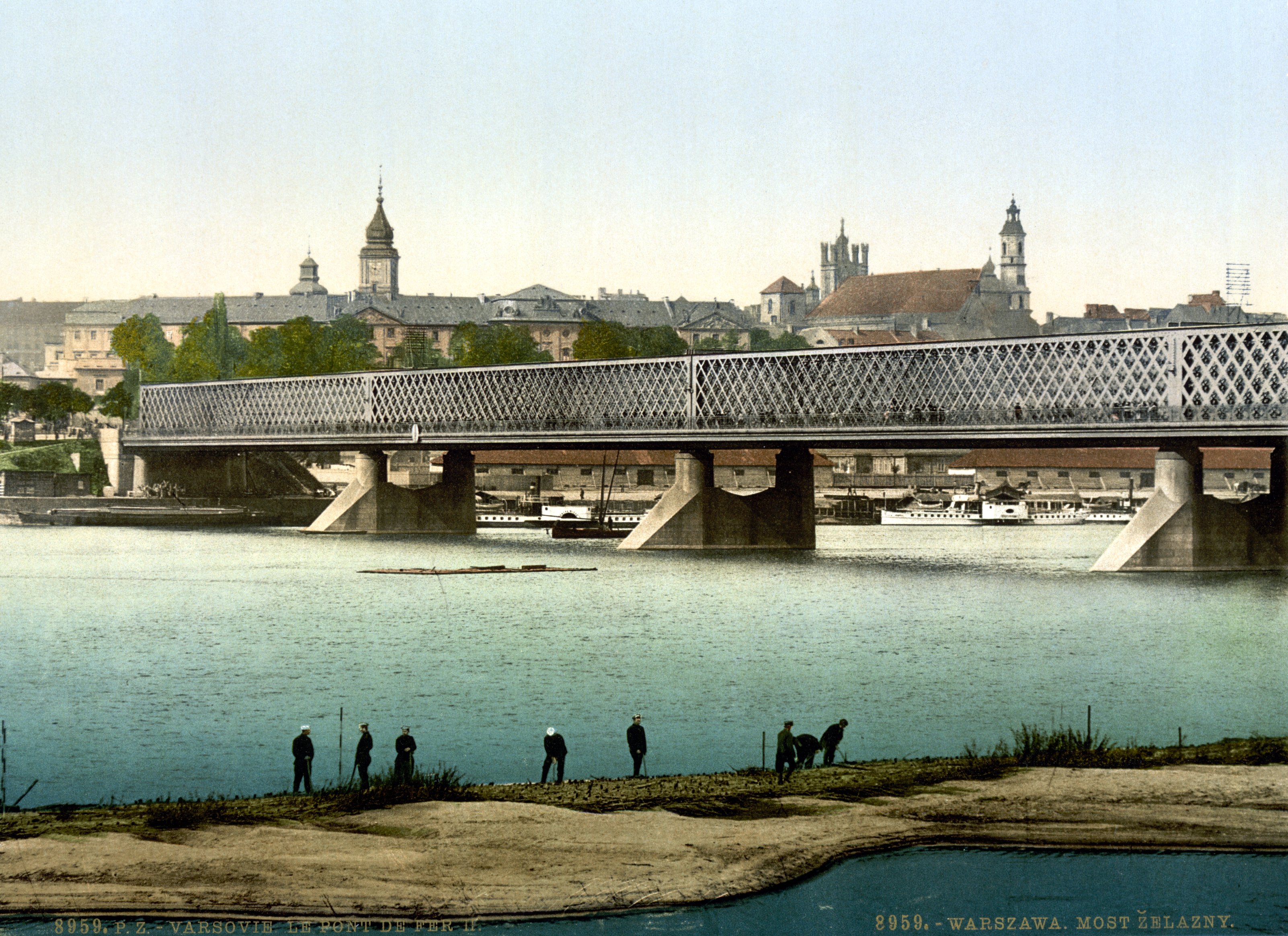
 Vistula river in Warsaw near the end of the 16th century. The right side shows the Sigismund Augustus bridge built between 1568-1573 by Erazm Cziotko (c. 500 m (1,600 ft) long).[23]
In the 16th century most of the grain exported was leaving Poland through Gdańsk, which because of its location at the terminal point of the Vistula and its tributaries waterway and of its Baltic seaport trade role became the wealthiest, most highly developed (by far the largest center of crafts and manufacturing) and most autonomous of the Polish cities.[24] Other towns were negatively affected by Gdańsk's near-monopoly in foreign trade. During the reign of Stephen Báthory Poland ruled two main Baltic Sea ports: Gdańsk[25] controlling the Vistula river trade and Riga controlling the Western Dvina trade. Both cities were among the largest in the country. Around 70% the exports from Gdańsk were of grain.[22]
Grain was also the largest export commodity of the Polish–Lithuanian Commonwealth. The volume of traded grain can be considered a good and well-measured proxy for the economic growth of the Commonwealth.
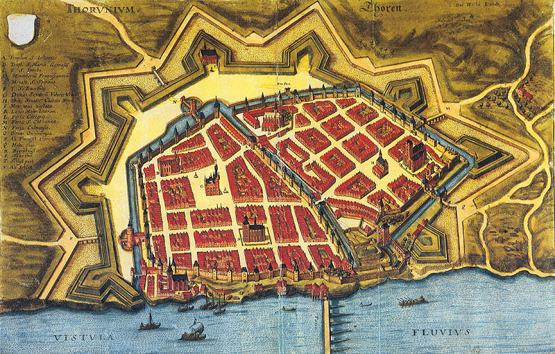
 Vistula river (Vistvla fluvivs) in Toruń in 1641.
The owner of a folwark usually signed a contract with the merchants of Gdańsk, who controlled 80% of this inland trade, to ship the grain north to that seaport on the Baltic Sea. Many rivers in the Commonwealth were used for shipping purposes, including the Vistula. The river had a relatively well-developed infrastructure, with river ports and granaries. Most river shipping travelled north, southward transport being less profitable, and barges and rafts were often sold off in Gdańsk for lumber.
In order to arrest recurrent flooding on the lower Vistula, the Prussian government in 1889-95 constructed an artificial channel about 12 km. east of Gdańsk (German name: Danzig) – known as the Vistula Cut (German: Weichseldurchstich; Polish: Przekop Wisły) – that acted as a huge sluice, diverting much of the Vistula flow directly into the Baltic. As a result, the historic Vistula channel through Gdańsk lost much of its flow, and was known thereafter as the Dead Vistula (German: Tote Weichsel; Polish: Martwa Wisła). German states got complete control of the region in 1795-1812 (see: Partitions of Poland), as well as during the World Wars, in 1914-1918 and 1939-1945.
 Jewish Feast of trumpets (Polish: Święto trąbek) at the banks of Vistula, Aleksander Gierymski, 1884.
From 1867 to 1917, the Russian tsarist administration called the Kingdom of Poland the Vistula Land after the collapse of the January Uprising (1863–1865).[26]
Almost 75% of the territory of interbellum Poland was drained northward into the Baltic Sea by the Vistula (total area of drainage basin of the Vistula within boundaries of the Second Polish Republic was 180,300 km²), the Niemen (51,600 km²), the Odra (46,700 km²) and the Daugava (10,400 km²).
In 1920 the decisive battle of the Polish–Soviet War Battle of Warsaw (sometimes referred to as the Miracle at the Vistula), was fought as Red Army forces commanded by Mikhail Tukhachevsky approached the Polish capital of Warsaw and nearby Modlin Fortress situated on the mouth of the Vistula.[28]
World War II
The Polish September campaign included battles over control of the mouth of the Vistula, and of the city of Gdańsk, so close to the river delta. During the Invasion of Poland (1939), after the initial battles in Pomerelia, the remains of the Polish Army of Pomerania withdrew to the southern bank of the Vistula.[29] After defending Toruń for several days, the army withdrew further south under pressure of the overall strained strategic situation, and took part in the main battle of Bzura.[29]
The Auschwitz complex of concentration camps was located on the Vistula, at the confluence of the Vistula and the Soła rivers.[30]
During World War II prisoners of war from the Nazi Stalag XX-B camp were assigned to cut ice blocks from the River Vistula. The ice would then be transported by truck to the local beer houses.
The 1944 Warsaw Uprising was planned with the expectation that the Soviet forces, who had arrived in the course of their offensive and were waiting on the other side of the Vistula River in full force, would help in the battle for Warsaw.[31] However the Soviets betrayed the Poles, stopping their advance at the Vistula and branding the insurgents as criminals in radio broadcasts.[31][32][33]
In early 1945 came the Vistula–Oder Offensive, in which the Red Army crossed the Vistula and drove the German Wehrmacht back past the Oder river in Germany.
See also
- Rivers of Poland
- Geography of Poland
- Vistula Lagoon
- Vistula Spit
References
- ^ (English) William Napier (November 20, 2005). "Building a Library: The Fall of Rome". findarticles.com. Independent Newspapers UK Limited. http://findarticles.com/p/articles/mi_qn4159/is_20051120/ai_n15851679/. Retrieved 2009-04-01.[dead link]
- ^ Wysota, W.; Molewski, P.; Sokołowski, R.J., Robert J. (2009). "Record of the Vistula ice lobe advances in the Late Weichselian glacial sequence in north-central Poland". Quaternary International 207: 26. doi:10.1016/j.quaint.2008.12.015.
- ^ (English) Zbigniew Pruszaka, Elżbieta Zawadzka. "Potential Implications of Sea-Level Rise for Poland". www.bioone.org. http://www.bioone.org/doi/abs/10.2112/07A-0014.1. Retrieved 2009-10-23.
- ^ (English) "Final International ASTRA conference in Espoo, Finland, 10–11 December 2007". www.astra-project.org. http://www.astra-project.org/03_071210_espoo_astraconference_final.html. Retrieved 2009-10-23.
- ^ (English) Matt McGrath (2009-03-12). "Climate scenarios 'being realised'". news.bbc.co.uk. http://news.bbc.co.uk/2/hi/science/nature/7940532.stm. Retrieved 2009-10-23.
- ^ (English) "Hydrology and morphology of two river mouth regions (temperate Vistula Delta and subtropical Red River Delta)". www.iopan.gda.pl. http://www.iopan.gda.pl/oceanologia/473prusz.pdf. Retrieved 2009-10-23.
- ^ Państwowy Instytut Geologiczny (State Geological Institute), Warsaw, "Geologiczna historia Wisły"
- ^ R. Mierzejewski, Państwowa Wyższa Szkoła Filmowa, Telewizyjna i Teatralna im. Leona Schillera w Łodzi, Narodziny rzeki
- ^ a b (Polish) Jędrzej Giertych. "Tysiąc lat historii narodu polskiego". www.chipublib.org. http://www.chipublib.org/search/details/cn/927545. Retrieved 2009-04-03.
- ^ De Origine et Situ Germanorum by Cornelius Tacitus
- ^ Augustów Canal on UNESCO Tentative List of Cultural Properties
- ^ The Augustów Canal at www.suwalszczyzna.pl
- ^ a b c (German) Jan M. Piskorski (1999). Pommern im Wandel der Zeit. ISBN 8-3906-184-8. p.29
- ^ a b (English) Paul Havers. "The Legend of Wanda". www.kresy.co.uk. http://www.kresy.co.uk/wanda.html. Retrieved 2009-03-31.
- ^ (English) Leszek Paweł Słupecki. "The Krakus’ and Wanda’s Burial Mounds of Cracow". sms.zrc-sazu.si. http://sms.zrc-sazu.si/pdf/02/SMS_02_Slupecki.pdf. Retrieved 2009-03-31. p.84
- ^ a b (English) "Wanda". www.brooklynmuseum.org. http://www.brooklynmuseum.org/eascfa/dinner_party/heritage_floor/wanda.php. Retrieved 2009-03-31.
- ^ (English) Władysław Parczewski, Jerzy Pruchnicki. "Vistula River". www.britannica.com. http://www.britannica.com/EBchecked/topic/630787/Vistula-River. Retrieved 2009-04-03.
- ^ (English) "History of the City Gdańsk". www.en.gdansk.gda.pl. http://www.en.gdansk.gda.pl/about,2,12.html. Retrieved 2009-04-03.
- ^ (English) Vol.5, ed (1995). The New Cambridge Medieval History: C. 1198-C. 1300. Cambridge University Press. ISBN 05-2136-289-X. http://books.google.com/?id=bclfdU_2lesC&printsec=frontcover&dq=The+New+Cambridge+Medieval+History:+C.+1198-C.+1300.
- ^ (Polish) Krzysztof Mikulski. "Dzieje dawnego Torunia". www.mowiawieki.pl. http://www.mowiawieki.pl/artykul.html?id_artykul=1634. Retrieved 2009-04-03.
- ^ (German) A history of Poland. Routledge. 1978. ISBN 07-1008-647-4. p.35
- ^ a b (English) Krzysztof Olszewski (2007). The Rise and Decline of the Polish-Lithuanian Commonwealth due to Grain Trade. a - p. 6, b - p. 7, c - p. 5, d - p. 5
- ^ (Polish) Jerzy S. Majewski (2004-04-29). "Most Zygmunta Augusta". miasta.gazeta.pl. http://miasta.gazeta.pl/warszawa/1,97596,2049149.html. Retrieved 2009-10-25.
- ^ (English) "Gdańsk (Poland)". www.britannica.com. http://www.britannica.com/EBchecked/topic/227552/Gdansk. Retrieved 2009-04-03.
- ^ (English) "Stephen Bathory (king of Poland)". www.britannica.com. http://www.britannica.com/EBchecked/topic/565459/Stephen-Bathory. Retrieved 2009-04-03.
- ^ The name of the kingdom was changed to Privislinsky Krai, which was reduced to a tsarist province; it lost all autonomy and separate administrative institutions. (English) Richard C. Frucht (2008). Eastern Europe: An Introduction to the People, Lands, and Culture. ABC-CLIO. ISBN 15-7607-800-0. http://books.google.com/?id=lVBB1a0rC70C&printsec=frontcover&dq=Eastern+Europe:+An+Introduction+to+the+People,+Lands,+and+Culture. p. 19
- ^ (English) "SEPTEMBER 13, 1944". www.1944.pl. http://www.1944.pl/index.php?a=site_text&id=12147&se_id=12196. Retrieved 2009-10-25.[dead link]
- ^ (English) "Vistula River Victory". www.electronicmuseum.ca. http://www.electronicmuseum.ca/Soviet-Polish_War/spw_3.html-. Retrieved 2009-04-03.[dead link]
- ^ a b (English) Marek Jan Chodakiewicz (1978). Between Nazis and Soviets: occupation politics in Poland, 1939-1947. Lexington Books. ISBN 07-3910-484-5. http://books.google.com/?id=TvUErL-MnV8C&printsec=frontcover.
- ^ US Holocaust Memorial Museum, Holocaust Encyclopedia, Auschwitz Environs, Summer 1944, online map
- ^ a b (English) "Warsaw Uprising of 1944". www.warsawuprising.com. http://www.warsawuprising.com/timeline.htm. Retrieved 2008-07-14.
- ^ The Uprising remained the ultimate symbol of Communist betrayal and bad faith for Poles. (English) John Radzilowski. "Warsaw Uprising". ww2db.com. http://ww2db.com/battle_spec.php?battle_id=150. Retrieved 2010-03-25.
- ^ The Warsaw Rising was termed a “criminal organization” (English) John Radzilowski (2009). Remembrance and Recovery: The Museum of the Warsaw Rising and the Memory of World War II in Post-communist Poland. The Regents of the University of California and the National Council on Public History. pp. 143–158. ISBN 02723433.
External links
Odra Vistula Lagoon Baltic Sea Categories:- Vistula basin
- Rivers of Poland
- Cieszyn Silesia


Wikimedia Foundation. 2010.