Pine Lake Aerodrome

Pine Lake Aerodrome
Pine Lake Aerodrome
IATA: noneICAO: noneTC LID: CFY5
Summary
Airport type Public
Operator Government of Yukon
Location Pine Lake, Yukon
Elevation AMSL 3,250 ft / 991 m
Coordinates 60°06′11″N 130°56′01″W / 60.10306°N 130.93361°W / 60.10306; -130.93361Coordinates: 60°06′11″N 130°56′01″W / 60.10306°N 130.93361°W / 60.10306; -130.93361
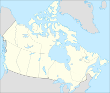
Map
CFY5 is located in Canada
CFY5
Location in Yukon
Runways
Direction Length Surface
ft m
16/34 3,000 914 Gravel
Source: Canada Flight Supplement[1]

Pine Lake Aerodrome formerly Daughney Aerodrome (TC LID: CFY5) is a registered aerodrome located 63 NM (117 km; 72 mi) west of Pine Lake, Yukon, Canada.

References

  1. ^ Canada Flight Supplement. Effective 0901Z 20 October 2011 to 0901Z 15 December 2011


Wikimedia Foundation. 2010.

Игры ⚽ Поможем написать реферат

Look at other dictionaries:

  • Pine Lake — may refer to:PlacesCanada* Pine Lake, Alberta * Pine Lake, Alberta TornadoUnited States;Communities * Pine Lake, Georgia * Pine Lake, Wisconsin * Pine Lake Township, Cass County, Minnesota * Pine Lake Township, Clearwater County, Minnesota * Pine …   Wikipedia

  • Haines Junction/Pine Lake Water Aerodrome — is located convert|4|NM|abbr=on|lk=in north of Haines Junction, Yukon, Canada and is open from June until October.References …   Wikipedia

  • Pine Dock Water Aerodrome — is located convert|1|NM|abbr=on|lk=in southwest of Pine Dock, on Lake Winnipeg, Manitoba, Canada.Pine Dock Airport, which is serviced by Northway Aviation only, serves as a private type airline for Bennett Lake Lodge and Outcamps.ee also*Pine… …   Wikipedia

  • Pine Dock Airport — is located convert|1|NM|abbr=on|lk=in south of Pine Dock, Manitoba, Canada.Pine Dock Airport, which is serviced by Northway Aviation only, serves as a private type airline for Bennett Lake Lodge and Outcamps. ee also*Pine Dock Water… …   Wikipedia

  • Daughney Aerodrome — is a registered aerodrome located convert|63|NM|abbr=on|lk=in west of Pine Lake, Yukon, Canada.References …   Wikipedia

  • Chichester Dam — Lake Chichester Location New South Wales Coordinates 32°14.2161′S 151°41.3672′E …   Wikipedia

  • List of Australian Air Force installations — This is a list of current and previous Royal Australian Air Force bases. The air force also owns and maintains bare bases in remote areas of Australia. These bases have runways and buildings, but only a caretaker staff. They are generally only… …   Wikipedia

  • List of airports in New York — This is a list of airports in New York (a U.S. state), grouped by type and sorted by location. It contains all public use and military airports in the state. Some private use and former airports may be included where notable, such as airports… …   Wikipedia

  • West Coast Range — The West Coast Range (coord|42|05|S|145|36|E|region:AU TAS type:mountain) of Tasmania is a group of mountains in the West Coast area of Tasmania in Australia that lies to the west of the Franklin Gordon Wild Rivers National ParkThe range has had… …   Wikipedia

  • Список аэропортов штата Нью-Йорк — Соединённых Штатов Америки, сгруппированных по типу. Содержит все гражданские и военные аэропорты штата. Некоторые частные и ныне не используемые аэропорты могут находиться в списке (например, если ФАА зафиксированы коммерческие перевозки или… …   Википедия

Share the article and excerpts

Direct link
Do a right-click on the link above
and select “Copy Link”