- Dardanelle, California
-
Dardanelle, California — Unincorporated community — 
 Dardanelle, California
Coordinates: 38°20′28″N 119°50′02″W / 38.34111°N 119.83389°WCoordinates: 38°20′28″N 119°50′02″W / 38.34111°N 119.83389°W Country United States State California County Tuolumne Elevation 5,774 ft (1,760 m) Time zone Pacific (PST) (UTC-8) – Summer (DST) PDT (UTC-7) Area code(s) 209 GNIS feature ID 1655949[1] Dardanelle is an unincorporated community in Tuolumne County, California, United States. Dardanelle is located on California State Route 108 39 miles (63 km) northeast of Sonora. Dardanelle has a post office with ZIP code 95314, which was established in 1924.[2][3]
References
- ^ U.S. Geological Survey Geographic Names Information System: Dardanelle, California
- ^ ZIP Code Lookup
- ^ Durham, David L. (1998). California's Geographic Names: A Gazetteer of Historic and Modern Names of the State. Quill Driver Books. pp. 764. ISBN 1884995144. http://books.google.com/books?id=Yfa0hmE7yocC.
Municipalities and communities of Tuolumne County, California City 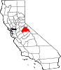
CDPs Cedar Ridge | Chinese Camp | Cold Springs | Columbia | East Sonora | Groveland | Jamestown | Long Barn | Mi-Wuk Village | Mono Vista | Phoenix Lake | Pine Mountain Lake | Sierra Village | Soulsbyville | Strawberry | Tuolumne City | Tuttletown | Twain Harte
Unincorporated
communitiesBlanchard | Buchanan | Bumblebee | Confidence | Dardanelle | Deadwood | Groveland-Big Oak Flat | Mather | Moccasin | Phoenix Lake-Cedar Ridge | Pinecrest | Standard
Categories:- Populated places in Tuolumne County, California
- Unincorporated communities in California
- Sierra Nevada geography stubs


Wikimedia Foundation. 2010.