- 2011 Virginia earthquake
-
2011 Virginia earthquake 
Shake map
 Epicenter
Date 17:51:04 UTC, August 23, 2011[1] Magnitude 5.8[1] Depth 4 miles (6 km)[1] Epicenter 37°56′10″N 77°55′59″W / 37.936°N 77.933°WCoordinates: 37°56′10″N 77°55′59″W / 37.936°N 77.933°W Type Earthquake Countries or regions  United States
 Canada
Max. intensity VII (very strong)[2] The 2011 Virginia earthquake occurred on August 23, 2011, at 1:51 pm EDT (17:51 UTC) in the Piedmont region of the U.S. state of Virginia. The epicenter, in Louisa County, was 38 miles (61 km) northwest of Richmond and 5 miles (8.0 km) south-southwest of the town of Mineral.[1][3] It was an intraplate earthquake with a magnitude of 5.8 and a maximum perceived intensity of VII (very strong) on the Mercalli intensity scale. Several aftershocks, ranging up to 4.5 Mw in magnitude occurred after the main tremor.[4]
The earthquake, along with a magnitude-5.8 quake on the New York-Ontario border in 1944, is the largest to have occurred in the U.S. east of the Rocky Mountains since an 1897 quake centered in Giles County in western Virginia[5][6] whose magnitude has been estimated as 5.8[7] or 5.9.[8]
The quake was felt across more than a dozen U.S. states and in several Canadian provinces. No deaths and only minor injuries were reported.[9][10]
Minor damage to buildings was widespread. The damage was estimated by one risk-modeling firm at $200 million to $300 million, of which about $100 million was insured.[11][12]
Contents
Geology
 Generalized geologic map of the central Virginia Piedmont with faults and earthquakes (M>2, 1973-2011)
The earthquake occurred in the Virginia Seismic Zone, located in the Piedmont region.[13] The Virginia Piedmont area was originally formed as part of a zone of repeated continental collision that created the ancestral Appalachian Mountains, a process that started in the Ordovician period with the Taconic orogeny and finished in the Carboniferous Period with the Alleghenian orogeny. The reverse faults formed during the various orogenies were partly reactivated in extension during the Mesozoic Era as the supercontinent Pangaea broke apart. During the Cenozoic Era, some of these structures have been further reactivated in a reverse sense.[14]
The earthquake's epicenter and most of the aftershocks lie between the surface traces of two structures, the Spotsylvania fault, a southeast dipping zone of high ductile strain, and the Chopawamsic Fault, a thrust fault.[15] The earthquake's focal mechanism shows reverse slip faulting on a north to northeast striking fault plane. The size of the rupture is as yet uncalculated, but similar quakes have been caused by slippage along fault segments that are five to 15 km long.[1]
After the earthquake, several websites speculated about whether hydraulic fracturing (fracking) for natural gas production could have caused or contributed to the quake.[16][17][18] Although there were no fracking operations underway in Virginia at the time of the quake, fracking was taking place in the Marcellus shale in West Virginia, a neighboring state.[19] According to United States Geological Survey geologist James Coleman, there is evidence that fracking "causes relatively small earthquakes," but "smaller than what we had here in Virginia."[16]
Impact
Main article: Impact of the 2011 Virginia earthquakeTremors from the Virginia earthquake were felt as far south as Atlanta, Georgia;[20] as far north as Quebec City, Quebec;[21] as far west as Illinois[22] and as far east as Fredericton, New Brunswick,[23] with damage reported as far away as Brooklyn in New York City.[24]
Although earthquakes in the central and eastern U.S. are much less frequent than in the western U.S., they are typically felt over a much broader region. East of the Rocky Mountains, an earthquake can be felt over an area as much as ten times larger than a similar magnitude earthquake on the west coast. Western rock is relatively young, which means it absorbs a lot of the shaking caused by earthquakes. Thus, western earthquakes result in intense shaking close to the epicenter, but fade more quickly the farther the earthquakes travel. In the eastern United States the rock is far older, and the earthquake energy can therefore spread farther and have a greater impact. A magnitude 5.5 eastern U.S. earthquake can usually be felt as far as 300 mi (483 km) from where it occurred, and sometimes causes damage as far away as 25 mi (40 km). The relatively shallow depth of this quake also contributed to its widespread effects.[25][26]
United States
Soon after the earthquake, the U.S. Federal Aviation Administration ordered a ground stop along the East Coast, causing some flight delays. The Air Traffic Control tower at John F. Kennedy International Airport was evacuated.[27] Flights were delayed at several airports, including John F. Kennedy International Airport, Newark Liberty International Airport, Ronald Reagan Washington National Airport, Dulles International Airport, and Philadelphia International Airport.[28] At National Airport, ceiling tiles fell in one terminal, and flights were halted.[29][30][31]
A spike in cell-phone calls immediately after the event congested the AT&T, Verizon Wireless, Sprint Nextel, T-Mobile USA, and Frontier Communications networks in the Mid-Atlantic region, causing disruptions and loss of service for up to an hour after the earthquake.[32][33]
Virginia
The epicenter of the earthquake was in Louisa County, Virginia, where damage was greatest and several minor injuries occurred. The town of Mineral, located 5 mi (8 km) from the earthquake's epicenter, reported the collapse of two buildings, as well as minor damage to several other structures, including the collapse of the ceiling in its Town Hall. Several minor injuries were reported there, among them people reporting chest pain after the shock of the experience.[34] Fallen chimneys and other structural damage to buildings were reported in Mineral and in Louisa, the county seat. The Gilboa Christian Church, in Cuckoo, was heavily damaged and rendered unusable.[35] At Louisa County High School, cinderblocks fell in classrooms, and cracks were seen in walls. Six students there had minor injuries. Louisa County schools were closed on August 24 while engineers assessed damage to school buildings.[36] The high school and Thomas Jefferson Elementary were closed for the remainder of the school year.[37] Inspections revealed that 65 homes sustained major or severe damage and 125 homes experienced mild to moderate damage.[38] Damage in Louisa County was estimated at $80.6 million of which $63.8 million was from damage to public school buildings and $14.7 million was from damage to residences.[39][40] On August 25, county officials declared a state of local emergency in order to allow them to request state support.[38]
The two nuclear reactors at the North Anna Nuclear Generating Station, located 10 mi (16 km) from the epicenter, shut down automatically seconds before off-site power was lost because multiple reactor sensors detected a slight power reduction as a result of vibrations in the reactor or monitoring devices.[40][41][42] The Nuclear Regulatory Commission sent additional inspectors to the Virginia plant after preliminary measurements suggested that the ground shook more than the two reactors were designed to handle. The damage detected so far has been minimal and the NRC said the additional inspection should not be interpreted to mean the plant is less safe.[43][44]
In Charlottesville, about 27 mi (43 km) from the epicenter, a gas leak closed several streets, including West Main Street.[45]
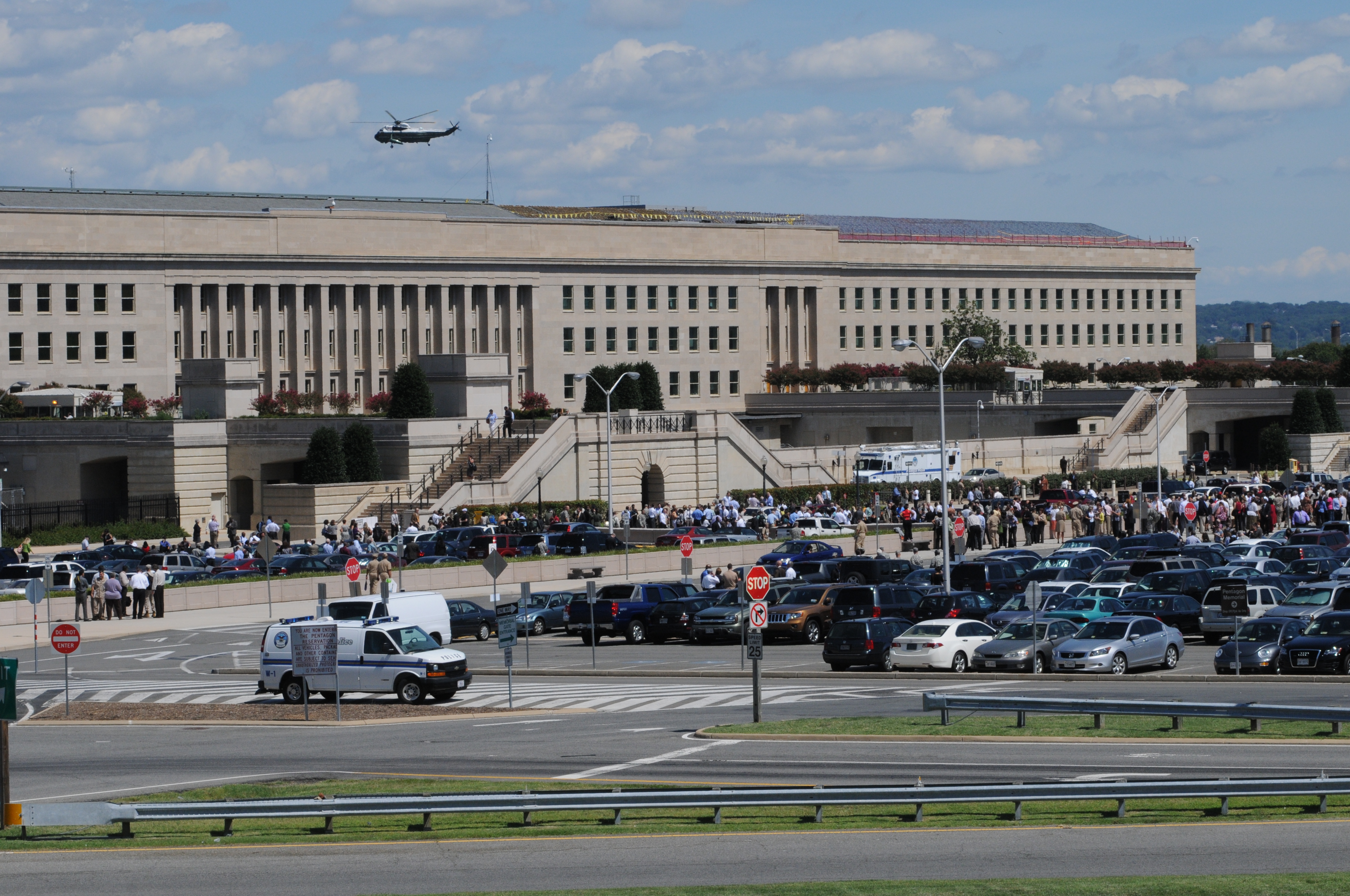
 Some employees evacuated the Pentagon moments after the earthquake
In Spotsylvania County, the August 24 opening of public schools was delayed while damage to buildings was assessed.[46] Six patients were treated at the Spotsylvania Regional Medical Center for minor injuries resulting from the earthquake.[36]
Several buildings in Culpeper, about 37 mi (60 km) from the epicenter, sustained structural damage. The brick façade of the Levy Building, built in 1848, collapsed and the building was condemned and demolished.[38][47][48] The walls of St. Stephen's Episcopal Church, constructed in 1821, buckled and were deemed unstable by town officials. Another church, Culpeper Baptist Church, built in 1894, lost its chimney. Schools in Culpeper County delayed their scheduled August 24 opening to assess damage to buildings.[46] Two minor earthquake injuries were reported by the Culpeper Regional Hospital.[47] Damage in Culpeper was estimated at $10 million.[40]
In Fredericksburg, about 37 mi (60 km) from the epicenter, the Dickinson Building on the campus of Germanna Community College was deemed unusable for the rest of the semester, and classes were canceled indefinitely until alternative classrooms could be found.[49] Also in Fredericksburg, a gas leak led to the evacuation of homes and businesses in a two-block radius.[36] Officials estimate the damage total at around $711,000.[40]
In Arlington County, a burst pipe flooded two corridors at the Pentagon. Employees, many of whom left the building when the earthquake was felt, were alerted to the flooding by an alarm system that was installed after the September 11 attacks.[50] Nearby Alexandria also reported structual damages though no injuries.[51]
Washington, D.C.
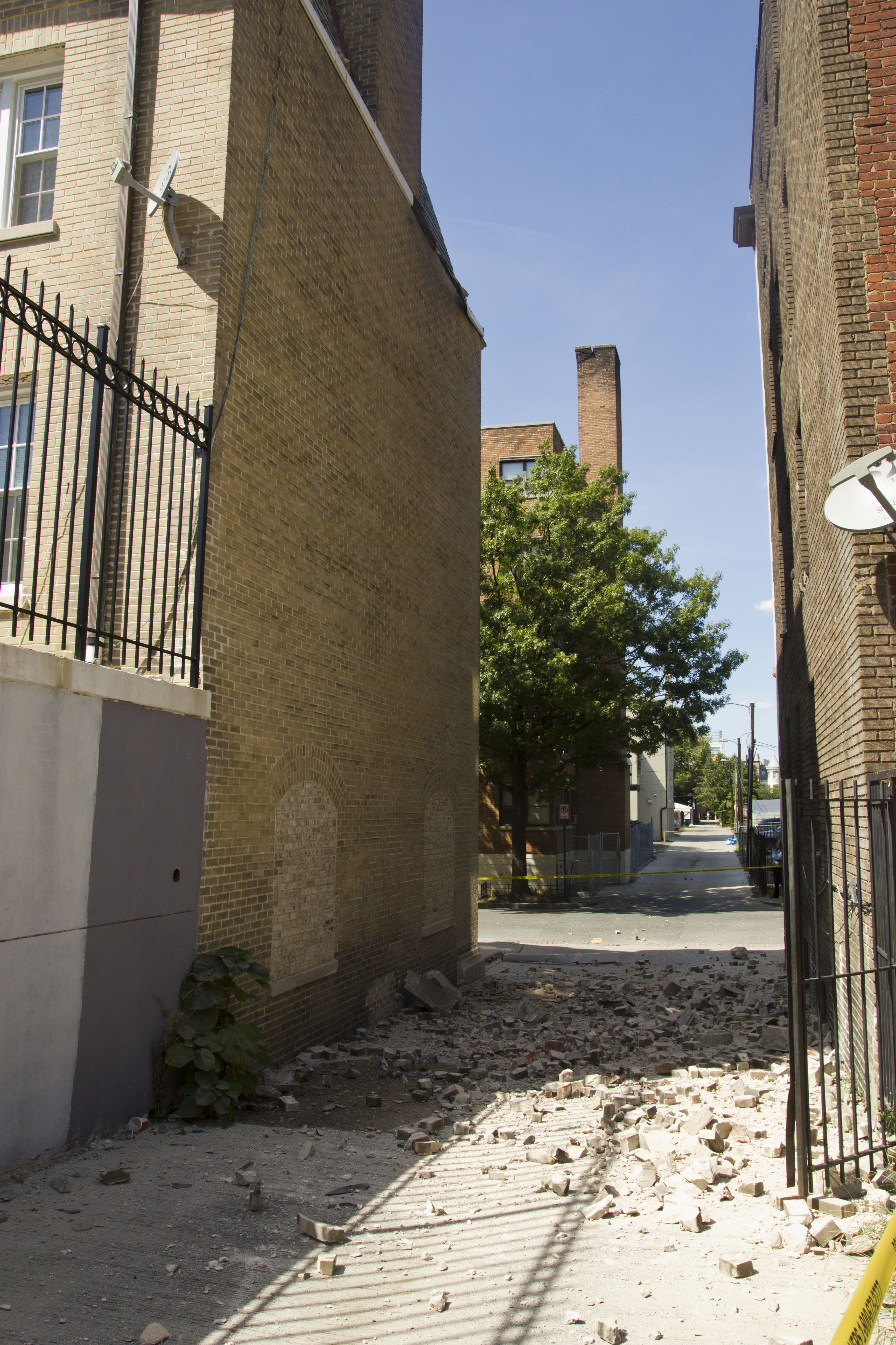
 Damage to the Embassy of Ecuador.
The White House,[52] the Capitol, and various other buildings were evacuated. The afternoon rush hour was affected, as many workers left early,[53] and the Washington Metro system's trains ran at reduced speeds while tracks and tunnels were inspected.[54]
A National Park Service spokesperson reported that surveys revealed cracks near the top of the Washington Monument, the world's tallest stone structure, which was closed indefinitely.[55] [56] The quake damaged three of the four pinnacles (corner spires) on the central tower of the Washington National Cathedral, cracked some of its flying buttresses, and caused additional damage.[57][58][59] As the cathedral's insurance policy did not cover earthquake damage, cathedral officials stated that they would need to raise millions of dollars to fully evaluate the damage and to stabilize and repair its limestone exterior.[59]
 Repair work at the central tower of the Washington National Cathedral due to damage caused by the earthquake
The Smithsonian Castle incurred damage to five decorative turrets, and fifty jars of preserved specimens fell from shelves at the Smithsonian's National Museum of Natural History.[60] The Embassy of Ecuador suffered structural damage, including three collapsed chimneys and cracked internal walls.[61] The Treasury Building suffered minor damage to exterior railings, some of which fell to the ground and caused closure of a sidewalk.[62] Other damage reported in the District of Columbia was minor, and no injuries were reported.
Staff at the National Zoo reported that the behavior of some of the animals in the park suggested that they anticipated the quake seconds or even minutes before they felt it. The earthquake was felt at the great ape exhibits during afternoon feeding time. About three to 10 seconds before the quake, many of the apes abandoned their food and climbed to the top of a tree-like structure in the exhibit. The red-ruffed lemurs sounded an alarm call about 15 minutes before the quake, and the flock of 64 flamingos rushed about and grouped themselves together just before the quake. During the quake, some animals made sounds, some ran or dove for cover, and some stood up and stared at the walls of their enclosures. Some of the animals remained agitated for the rest of the day, while others calmed quickly.[63][64]
Maryland, Delaware, and West Virginia
Maryland: In Temple Hills, residents were evacuated from two damaged apartment buildings.[65] In Kensington, the tops of four spires on the Washington D.C. Temple of The Church of Jesus Christ of Latter-day Saints fell to the ground along with several pieces of marble from the façade.[66] Near Brunswick, the quake caused "significant discoloration and a reduction in the quality of the water" of a spring, leading officials to warn against using the water until further notice.[67] In the Fells Point neighborhood of Baltimore, St. Patrick Catholic Church was deemed unsafe and will be closed for weeks for repairs.[68] In Salisbury, the City Police station endured damage above doorways and in concrete block walls,[69] and there was also minor cracking in classroom walls at Salisbury University.[70] In Annapolis, several buildings at the United States Naval Academy were damaged.[71] In Suitland, eight jars of preserved fish specimens fell from shelves at a Smithsonian Institution storage facility.[60] The 1740 Mt. Calvert mansion, historic site, and museum on the Patuxent River in Upper Marlboro received substantial structural damage and was closed indefinitely to the public. [72]
Delaware: In Wilmington, blocks fell to the street from the steeple of St. Thomas the Apostle Church, and the New Castle County Courthouse was evacuated, as was the air traffic control tower of the New Castle County Airport in nearby Wilmington Manor. In Dover, fire marshals and building inspectors were called to assess structures throughout the capital city, where the city hall was evacuated. In Georgetown, numerous buildings in the county seat were evacuated while crews checked for damage; the Emergency Operations Center there reported 200 calls to 911. Delaware Department of Transportation crews were dispatched statewide to inspect interstate highways, the under-construction replacement Indian River Inlet Bridge, the Delaware Memorial Bridge on I-295, and other bridges and roads.[73]
West Virginia: In Martinsburg, several government buildings were evacuated, and multiple citizens reported feeling their homes shaking violently enough to rattle picture frames off the walls. In Charleston, the Kanawha County Courthouse, the West Virginia State Capitol campus, and several other downtown buildings were evacuated; Kanawha County dispatchers received more than 350 calls in 45 minutes, but there were no reports of damage to buildings and infrastructure other than minor plaster cracking in the old courthouse. In Philippi, part of a chimney collapsed at the Barbour County courthouse. The West Virginia Office of Miners' Health, Safety and Training stated that West Virginia coal mines were safe following the tremors.[74][75] A roof collapse in Patriot Coal Company's Big Mountain Complex forced the closure of the mine. [76]
Pennsylvania, New Jersey, and New York
 People gather outside 40 Wall Street in New York City after the earthquake.
Pennsylvania: Trembling was felt in buildings in Philadelphia and Pittsburgh and across the state. In Center City Philadelphia, a window shattered on a lower floor at the Independence Blue Cross building, and the company sent its 3,000 employees home for the day.[77] Other office buildings in Center City Philadelphia were also evacuated following the earthquake.[78] Workers at the PPL Corporation in Allentown evacuated the building.[77] The Three Mile Island nuclear plant south of Harrisburg continued to operate during the earthquake.[77] The Bucks County Courthouse in Doylestown was evacuated following the earthquake.[79] In Philadelphia, SEPTA Regional Rail trains were restricted to a speed of 25 miles per hour (40 km/h) while tracks were inspected for damage, and PATCO Speedline trains were briefly suspended, with no damage reported. The Pennsylvania Department of Transportation conducted inspections on bridges across the state to check for possible damage. The Delaware River Port Authority reported no damage to its four bridges across the Delaware River.[80]
New Jersey: Damage in New Jersey was minor. The state Emergency Management office reported two gas leaks in Gloucester County.[81][82] In Burlington, Temple B'nai Israel's 1801 synagogue building sustained some water damage, and about 20 bricks fell off, damaging a congregant's car.[82] In Camden, a vacant house partially collapsed, and government buildings were evacuated, with city workers given the option of returning home for the day.[82] Due to damage done by the quake, the municipal government of Woodbury is seeking to raze the historic Colonel George Gill Green Opera House, which was built in 1880.[83] No infrastructure damage was reported in the state.[82]
New York: Tremors were felt to varying degrees throughout New York State. Physical damage was seen in Brooklyn.[24] There were some disruptions, including building evacuations and delays at airports.[84] Amtrak train service at Penn Station was also delayed.[84]
New England
The earthquake was felt throughout much of the six New England states.[85]
Connecticut: In New Haven, play at the 2011 New Haven Open at Yale tennis tournament was stopped for two hours and the main stadium was evacuated while the fire department checked it for damage. No damage or injuries were reported.[86]
Massachusetts: In Boston, the Massachusetts Emergency Management Agency reported tremors and swaying buildings but no damage. The U.S. District Court in South Boston was evacuated and the University of Massachusetts Boston closed early.[87]
Maine: In Maine, the earthquake was felt as far north as Augusta and Portland, but no damage was reported in the state.[88]
Midwestern states
The earthquake was felt in the Midwestern states as far west as eastern Illinois and Wisconsin.[85]
Ohio: In Columbus, the Huntington Center was briefly evacuated,[89] and occupants on the upper floors of the Rhodes State Office Tower and the Vern Riffe State Office Tower reported feeling strong shaking. Evacuations also occurred in Canton[90] and Akron.[91] In Cleveland, the press box at Progressive Field shook during the third inning of a Cleveland Indians baseball game.[92]
Michigan: Tremors from the earthquake were felt in Detroit,[93] as far north as Saginaw,[93] and as far west as communities on Lake Michigan.[94] There were no reports of damage in the state.[93]
Southern states
The earthquake was felt in several southern states as far from the epicenter as Alabama,[85] but no damage was reported.
Canada
Tremors from the earthquake were also felt in eastern Canada, mostly in Southern Ontario, as well as in parts of southern Quebec and the Maritime provinces. In Ontario, a few buildings in Toronto were evacuated, and precautionary measures were taken in Sudbury [95] [96] [97] and Windsor.[98][99][85]
2011 is the second consecutive year in which an earthquake was widely felt in Southern Ontario and Quebec, the previous being the June 2010 Central Canada Earthquake that also affected that region.
Aftershocks
Numerous aftershocks followed the main tremor. The first four (of moment magnitude 2.8, 2.2, 4.2 and 3.4) occurred within 12 hours of the main shock. A 2.5-magnitude shock occurred just after midnight on August 25, followed at 1:08 am EST by the strongest: a magnitude-4.5 aftershock that woke many residents in Northern Virginia and Washington, D.C. and was felt as far away as New England, Georgia, and Illinois.[4][100][101][102]
Internet activity and social media
The United States Geological Survey "Did you feel it?" citizen-based earthquake-intensity web site received about 60,000 reports in the first two hours after the quake, and over 100,000 responses within four hours.[103]
According to Facebook, the word "earthquake" appeared in the status updates of 3 million users within four minutes of the quake. Twitter said users were sending up to 5,500 messages (tweets) per second, which tops the peak rate immediately following the 2011 death of Osama bin Laden and was "on par with" the rate after the 2011 Tōhoku earthquake and tsunami.[104]
Due to the significantly slower propagation of seismic waves compared to the near-speed-of-light transmission of internet traffic, some Twitter users read about the earthquake seconds before feeling the tremors. For example, Twitter users in such cities as New York City and Boston reported reading tweets about the quake from users in Washington, D.C., or Richmond, Virginia, 15 to 30 seconds before feeling the quake itself.[105]
Wikipedia had an article dedicated to the earthquake by 2:03 PM, 12 minutes after the event, and it was mentioned in two other Wikipedia articles even earlier.[106]
See also
References
- ^ a b c d e "Magnitude 5.8 – Virginia". United States Geological Survey. http://earthquake.usgs.gov/earthquakes/recenteqsww/Quakes/se082311a.html. Retrieved August 23, 2011.
- ^ "Pager– M 5.8– Virginia". United States Geological Survey. 2011. http://earthquake.usgs.gov/earthquakes/pager/events/us/082311a/index.html. Retrieved August 23, 2011.
- ^ "Earthquake strikes US east coast, felt all the way down in Orlando, FL reported by KCNSEN.". BBC. August 24, 2011. http://www.bbc.co.uk/news/world-us-canada-14634730. Retrieved 23 August 2011.
- ^ a b "Earthquake List for Map Centered at 38°N, 78°W". Earthquake Hazards Program. United States Geological Survey. http://earthquake.usgs.gov/earthquakes/recenteqsus/Maps/US2/37.39.-79.-77_eqs.php. Retrieved 26 August 2011.
- ^ "Largest Earthquakes by State, List of Earthquakes". United States Geological Survey. http://earthquake.usgs.gov/earthquakes/states/state_largest.php. Retrieved August 23, 2011.
- ^ "Historic United States Earthquakes Sorted by State & Date". United States Geological Survey. http://earthquake.usgs.gov/earthquakes/states/historical_state.php. Retrieved August 24, 2011.
- ^ "Seismicity of the United States, 1568-1989 (Revised) by Carl W. Stover and Jerry L. Coffman (United States Geological Survey Professional Paper 1527, 1993, pages 376-378)". http://www.geol.vt.edu/outreach/vtso/VA-Eq.html. Retrieved August 23, 2011.
- ^ "Historic Earthquakes". earthquake.usgs.gov. http://earthquake.usgs.gov/earthquakes/states/events/1897_05_31.php. Retrieved August 23, 2011.
- ^ Dolak, Kevin, and Jessica Hopper. "Earthquake Aftermath: National Landmarks Damaged". ABC News. http://abcnews.go.com/US/earthquake-aftermath-national-monuments-damaged/story?id=14368908. Retrieved 27 August 2011.
- ^ Anderson, Rebecca. "Earthquake... in Virginia?". Associated Press. http://www.huffingtonpost.com/rebecca-anderson/earthquake-virginia-dc_b_934489.html. Retrieved August 24, 2011.
- ^ Carol Morello and Ovetta Wiggins, "Region tallies earthquake damage, mostly uninsured" (August 24, 2011). Washington Post.
- ^ Estimate by the Oakland, California-based catastrophe modeling and risk assessment firm EQECAT, which further estimated that only 5 percent of East Coast property owners have earthquake coverage. Mark A. Hofmann, "Insured losses in East Coast earthquake less than $100M: EQECAT" (August 24, 2011). Business Insurance.
- ^ Bentley, Callan. "The Mineral, VA earthquake of August 23, 2011". AGU Blog. American Geophysical Union. http://blogs.agu.org/mountainbeltway/2011/08/23/the-mineral-va-earthquake-of-august-23-2011/. Retrieved 24 August 2011.
- ^ Bailey, C.M. (2004). "Shaken! Earthquake Rocks Central Virginia". What's New in Virginia Geology. Department of Geology, College of William & Mary. http://web.wm.edu/geology/virginia/whats_new/QuakeStory.pdf?svr=www. Retrieved 24 August 2011.
- ^ Virginia Department of Mines Minerals and Energy. "August 23, 2011 1:51pm; 5.8 Magnitude Earthquake". http://www.dmme.virginia.gov/DMR3/va_5.8_earthquake.shtml. Retrieved 4 September 2011.
- ^ a b Phillips, Susan (August 26, 2011). "How Fracking Causes Earthquakes, But Not the One in Virginia". NPR. http://stateimpact.npr.org/pennsylvania/2011/08/26/how-fracking-causes-earthquakes-but-not-the-one-in-virginia/.
- ^ "Fracking could have caused East Coast earthquake". RT. TV-Novosti. August 24, 2011. http://rt.com/usa/news/fracking-earthquake-virginia-dc-817-061/.
- ^ Reader, Stephen. "Explainer: Did Hydrofracking Have Anything to Do With the East Coast Quake?". WNYC. http://www.wnyc.org/articles/wnyc-news/2011/aug/23/explainer-did-hydrofracking-have-anything-do-east-coast-quake/. Retrieved August 23, 2011.
- ^ Gilliland, Donald (August 24, 2011). "Marcellus Shale drilling to blame for Virginia earthquake? No fracking way, industry officials say". The Patriot-News. http://www.pennlive.com/midstate/index.ssf/2011/08/marcellus_shale_drilling_to_bl.html. Retrieved 24 August 2011.
- ^ Michael King (23 August 2011). "Mag 5.8 earthquake felt in Metro Atlanta". http://www.11alive.com/news/article/202707/8/Mag-58-earthquake-felt-in-Metro-Atlanta. Retrieved 23 August 2011.
- ^ "Need to know". Maclean's. 2008-06-20. http://www2.macleans.ca/category/need-to-know/?current=211381. Retrieved 2011-08-23.
- ^ Rhodes, Dawn (2011-08-23). "Illinois residents may have felt Virginia quake". Chicago Tribune. http://www.chicagotribune.com/news/local/breaking/chi-illinois-residents-may-have-felt-east-coast-quake-20110823,0,5283354.story. Retrieved 2011-08-23.
- ^ Lee-Anne Goodman (2011-08-23). "Earthquake rattles parts of U.S. East Coast and Canada; no serious injuries". The Canadian Press. http://www.globaltoronto.com/canada/canadians+from+windsor+to+fredericton+report+feeling+virginia+earthquake/6442468735/story.html. Retrieved 2011-08-23.
- ^ a b Doll, Jen. "Earthquake Damage in NYC Is Minimal; Mike Bloomberg Is More Concerned About Hurricane Irene". The Village Voice. http://blogs.villagevoice.com/runninscared/2011/08/earthquake_damage_hurricane_irene.php. Retrieved August 23, 2011.
- ^ "Magnitude-5.8 Earthquake Strikes National Capital Area". United States Department of the Interior, United States Geological Survey, National Earthquake Information Center. http://www.usgs.gov/newsroom/article.asp?ID=2898&from=rss_home. Retrieved 24 August 2011.
- ^ "Magnitude 5.8 - VIRGINIA: Summary". Earthquake Hazards Program. United States Geologic Survey. http://earthquake.usgs.gov/earthquakes/recenteqsww/Quakes/se082311a.php#summary. Retrieved 30 August 2011.
- ^ Lowy, Joan (August 23, 2011). "Thousands of travelers delayed, airport towers evacuated after East Coast quake". Newser. http://www.newser.com/article/d9pa1u6g2/thousands-of-travelers-delayed-airport-towers-evacuated-after-east-coast-quake.html. Retrieved August 28, 2011.
- ^ "5.8 magnitude quake rocks East Coast". USA Today. August 23, 2011. http://content.usatoday.com/communities/ondeadline/post/2011/08/apparent-earthquake-rocks-washington-dc-area/1. Retrieved August 23, 2011.
- ^ "Earthquake shakes Washington". Wichita Business Journal. August 23, 2011. http://www.bizjournals.com/wichita/news/2011/08/23/earthquake-shakes-washington.html. Retrieved 27 August 2011.
- ^ "Earthquake reported along the East Coast". The Washington Post. August 24, 2011. http://www.washingtonpost.com/blogs/post_now/post/earthquake-reported-along-the-east-coast/2011/08/23/gIQAozdEZJ_blog.html. Retrieved August 23, 2011.
- ^ Lewis, Bob. "Strongest quake since '44 jars East Coast". Associated Press. http://www.google.com/hostednews/ap/article/ALeqM5glXXMSE2akelnuYBbr8eSWnx5_GQ?docId=bfcc6ba3015c484f86ac771acab5d9a8. Retrieved 27 August 2011.
- ^ Washington Post, Cellphone service falls short after earthquake, August 23, 2011. Retrieved August 24, 2011.
- ^ Melvin, Jasmin (August 24, 2011). "Quake bolsters calls for public safety wireless network". Reuters. http://www.reuters.com/article/2011/08/24/us-quake-usa-communications-idUSTRE77N0DK20110824. Retrieved 2 September 2011.
- ^ "Town at epicenter assesses damage". USA Today. 2011-08-24. http://www.usatoday.com/news/story/2011-08-24/Town-at-epicenter-assesses-quake-damage/50118308/1. Retrieved 2011-08-24.
- ^ Dennen, Rusty (September 2, 2011). "Rebuilding Process Begins". The Free Lance-Star; Fredericksburg, Virginia. http://fredericksburg.com/News/FLS/2011/092011/09022011/649182/index_html?page=1. Retrieved 5 September 2011.
- ^ a b c Dennen, Rusty (August 24, 2011). "Quake Damages Buildings, Causes Injuries Across Region". Free Lance-Star (Fredericksburg, Virginia). http://fredericksburg.com/News/FLS/2011/082011/08242011/647368/index_html?page=1. Retrieved 24 August 2011.
- ^ Smith, Portsia (August 27, 2011). "Louisa Shuts Two Schools". Free Lance-Star (Fredericksburg, Virginia). http://www.fredericksburg.com/News/FLS/2011/082011/08272011/648059. Retrieved 27 August 2011.
- ^ a b c Dennen, Rusty (August 26, 2011). "Culpeper, Mineral clean up". Free Lance-Star; Fredericksburg, Virginia. http://fredericksburg.com/News/FLS/2011/082011/08262011/647796. Retrieved 26 August 2011.
- ^ "Louisa Updates Earthquake Damage Estimates". Charlottesville Newsplex. http://www.newsplex.com/home/headlines/Louisa_Updates_Earthquake_Damage_Estimates_128792333.html. Retrieved August 31, 2011.
- ^ a b c d Dennen, Rusty (September 29, 2011). "Damage Tops $90 Million". The Free Lance-Star; Fredericksburg, Virginia. http://fredericksburg.com/News/FLS/2011/092011/09292011/655155. Retrieved 29 September 2011.
- ^ Smith, Portsia. "Lousia works on school details". Free Lance-Star; Fredericksburg, Virginia. http://fredericksburg.com/News/FLS/2011/082011/08302011/648531. Retrieved 30 August 2011.
- ^ "5.8-magnitude quake shakes central Virginia, East Coast". Richmond Times-Dispatch. 2011-08-24. http://www2.timesdispatch.com/news/2011/aug/23/48/58-earthquake-rocks-virginia-other-parts-east-coas-ar-1256961/. Retrieved 2011-08-24.
- ^ "More checks set at Va. nuke plant". Philly.com. http://articles.philly.com/2011-08-30/news/29945489_1_warren-jeffs-sect-leader-nuke-plant. Retrieved August 30, 2011.
- ^ Squires, Paula C.. "NRC team begins three-week review of North Anna Power Station". News. Virginia Business News. http://www.virginiabusiness.com/index.php/news/article/nrc-team-begins-three-week-review-of-north-anna-power-station/314024/. Retrieved 2 September 2011.
- ^ "Charlottesville Gas Leak Likely Triggered by Earthquake". Charlottesville Newsplex. http://www.newsplex.com/home/headlines/Charlottesville_Gas_Leak_Likely_Triggered_by_Earthquake_128287198.html. Retrieved 25 August 2011.
- ^ a b Gould, Pamela (August 24, 2011). "ALL SHOOK UP Two school divisions delay start of the school year after earthquake". Free Lance-Star (Fredericksburg, Virginia). http://fredericksburg.com/News/FLS/2011/082011/08242011/647320. Retrieved 24 August 2011.
- ^ a b Johnston, Donnie (August 24, 2011). "Seismic Event Rattles Culpeper, Injuring Two and Buckling Historic Church". Free Lance-Star (Fredericksburg, Virginia). http://fredericksburg.com/News/FLS/2011/082011/08232011/1314155182fls. Retrieved 24 August 2011.
- ^ Champion, Allison Brophy. "Going, going, gone". News. Star Exponent. http://www2.starexponent.com/news/2011/aug/27/going-going-gone-ar-1267107/. Retrieved 30 August 2011.
- ^ "Germanna Community College will reopen as soon as final arrangements are made.". Germanna Community College. http://www.germanna.edu/. Retrieved 24 August 2011.
- ^ Dwyer, Devin. "US Capitol, Pentagon, State Department Shaken By 5.9 Magnitude Earthquake". ABC News. http://abcnews.go.com/blogs/politics/2011/08/us-capitol-pentagon-state-department-evacuated-after-59-magnitude-earthquake/. Retrieved 2 September 2011.
- ^ "Earthquakes and Historic Alexandria". Historic Alexandria. City of Alexandria. http://alexandriava.gov/historic/info/default.aspx?id=51362. Retrieved 7 September 2011.
- ^ Harris, Paul (August 24, 2011). "US earthquake leads to evacuation of White House". London: The Guardian. http://www.guardian.co.uk/world/2011/aug/24/us-earthquake-evacuation-white-house. Retrieved 27 August 2011.
- ^ Associated Press, "East Coast earthquake creates early rush hour, leads to train delays in DC area," (August 23, 2011), accessed August 24.
- ^ Metro: Inspections Continue, Trains At Reduced Speed, WUSA 9 (August 23, 2011) accessed August 24.
- ^ "Park service: Earthquake cracks Washington Monument near its top, closed indefinitely". The Washington Post. http://www.washingtonpost.com/politics/park-service-earthquake-cracks-washington-monument-near-its-top-closed-indefinitely/2011/08/23/gIQAanr6ZJ_story.html. Retrieved August 24, 2011.[dead link]
- ^ Washington Monument Earthquake Update, NPS, page contains news releases, picture and video images of the earthquake and damage
- ^ "D.C. National Cathedral Damaged, official says". http://www.nationalcathedral.org/.
- ^ Dan Gilgoff. "National Cathedral damaged in earthquake" (August 23, 2011). CNN.
- ^ a b Boorstein, Michelle (2011-08-25). "Earthquake-damaged Washington National Cathedral needs to raise millions". Post Local (Washington Post). http://www.washingtonpost.com/local/earthquake-damaged-washington-national-cathedral-needs-to-raise-millions/2011/08/24/gIQA2I8UcJ_story.html. Retrieved 2011-08-25.
- ^ a b "Update on Earthquake Damage at the Smithsonian (press release)". Smithsonian Institution. http://newsdesk.si.edu/releases/update-earthquake-damage-smithsonian. Retrieved 24 August 2011.
- ^ "Ecuador embassy damaged in quake; no injuries reported.". Associated Press. 2011-08-24. http://www.washingtonpost.com/local/ecuador-embassy-damaged-in-quake-no-injuries-reported/2011/08/23/gIQAOFXcZJ_story.html. Retrieved 2011-08-24.[dead link]
- ^ O'Keefe, Ed, "Earthquake Damaged U.S. Treasury Building." Washington Post. August 26, 2011. Accessed 2011-08-26.
- ^ "National Zoo Animals React to the Earthquake (press release)". Smithsonian National Zoological Park. 2011-08-24. http://nationalzoo.si.edu/Publications/PressMaterials/PressReleases/NZP/2011/earthquake.cfm. Retrieved 2011-08-25.
- ^ Achenbach, Joel (2011-08-24). "Zoo mystery: How did apes and birds know quake was coming?". The Washington Post. http://www.washingtonpost.com/national/health-science/zoo-mystery-how-did-apes-and-birds-know-quake-was-coming/2011/08/24/gIQAZrXQcJ_story.html. Retrieved 2011-08-25.
- ^ "Md. residents homeless after East Coast earthquake". The Associated Press. http://www.abc2news.com/dpp/news/state/md.-residents-displaced-after-east-coast-earthquake. Retrieved 27 August 2011.
- ^ "East Coast quake damages people's nerves and temple spires". KSL-TV. 23 August 2011. http://www.ksl.com/?nid=148&sid=16937670. Retrieved 24 August 2011.
- ^ "Washington County residents warned not to drink water from Yourtee Spring line". The Herald-Mail. 24 August 2011. http://www.herald-mail.com/breakingnews/hm-brunswick-residents-warned-not-to-drink-water-from-yourtree-spring-line-20110824,0,5543232.story. Retrieved 24 August 2011.
- ^ "Quake closes historic Baltimore church". The News Journal. http://www.delawareonline.com/article/20110824/NEWS/110824022/Quake-closes-historic-Baltimore-church?odyssey=tab%7Ctopnews%7Ctext%7CHome. Retrieved August 24, 2011.
- ^ "Salisbury Police Department Suffers Slight Damages In Earthquake". WMDT-TV. http://www.wmdt.com/story/15319079/salisbury-police-department-suffers-slight-damages-in-earthquake. Retrieved August 24, 2011.
- ^ "Earthquake Causes Minor Damage to Salisbury University Buildings". WMDT-TV. http://www.wmdt.com/story/15319018/earthquake-causes-minor-damage-to-salisbury-university-buildings. Retrieved August 24, 2011.
- ^ Stabley, Matthew. "Naval Academy Damaged in East Coast Quake". Washington, D. C. msnbc.com. MSNBC. http://www.msnbc.msn.com/id/44263797/ns/local_news-washington_dc/. Retrieved 24 August 2011.
- ^ "Mt. Calvert Historical & Archaeological Park". Md.-Nat'l Capital Parks & Planning Commission. http://www.pgparks.com/Things_To_Do/Nature/Mount_Calvert_Historical_and_Archaeological_Park.htm. Retrieved Sept. 19, 2011.
- ^ Quake rocks region, buildings evacuated" (August 23, 2011). delawareonline.com.
- ^ Staff reports, "Earthquake in Virginia felt throughout W.Va." (August 23, 2011). Charleston Gazette.
- ^ Taylor Kuykendall, "West Virginia shakes from quake" (August 23, 2011), Register-Herald Reporter.
- ^ Elmquist, Sonja. "Patriot Slumps After Reporting Reduced Coal Output, Higher Mining Costs". Bloomerg News. Bloomberg. http://www.bloomberg.com/news/2011-09-16/patriot-slumps-after-reporting-reduced-coal-output-higher-mining-costs.html. Retrieved 21 September 2011.
- ^ a b c Mandak, Joe. "Earthquake centered in Va. rolls across Pa.". Houston Chronicle. http://www.chron.com/news/article/Earthquake-centered-in-Va-rolls-across-Pa-2137474.php. Retrieved August 24, 2011.
- ^ Adler, Danny and Laurie Mason Schroeder (August 24, 2011). "Residenrs: Temblor 'bizzare' and 'scary'". The Intelligencer.
- ^ Weckselblatt, Gary (August 24, 2011). "Bucks courthouse evacuated after quake strikes". The Intelligencer.
- ^ Ciavaglia, Jo and Danny Adler (August 24, 2011). "Bucks, Montco rumbles". The Intelligencer.
- ^ Carly Q. Romalino; Jessica Driscoll (August 24, 2011). "Gloucester County suffers minor earthquake damage, reports in Woodbury, Deptford". Gloucester County Times. http://www.nj.com/gloucester-county/index.ssf/2011/08/gloucester_county_suffers_mino.html. Retrieved August 26, 2011.
- ^ a b c d Joshua Adam Hicks (August 24, 2011). "Rattled by earthquake, but mostly unscathed in New Jersey". The Philadelphia Inquirer. http://articles.philly.com/2011-08-24/news/29922430_1_nuclear-power-plants-vacant-house-collapse/2. Retrieved August 26, 2011.
- ^ Romalino, Carly Q. (August 27, 2011). "Woodbury city pushes for G.G. Green building demolition after quake". Gloucester County Times. http://www.nj.com/gloucester-county/index.ssf/2011/08/woodbury_city_pushes_for_gg_gr.html. Retrieved 29 August 2011.
- ^ a b "NY gets tremors but no damage from quake in Va. damage" (August 23, 2011). Associated Press.
- ^ a b c d "USGS Community Internet Intensity Map: Virginia, August 23, 2011". United States Geological Survey. http://earthquake.usgs.gov/earthquakes/dyfi/events/se/082311a/us/index.html. Retrieved August 26, 2011.
- ^ "Earthquake Causes Evacuation At New Haven Open". Associated Press. http://www.greenwichcitizen.com/sports/article/Earthquake-causes-Conn-tennis-stadium-evacuation-2137507.php. Retrieved August 24, 2011.
- ^ John R. Ellement and Martin Finucane, "Va. earthquake shakes Boston area; no damage reported" (August 23, 2011). Boston Globe.
- ^ Hench, David. "Mainers report feeling tremors and wondering what's shaking". Portland Press Herald. http://www.pressherald.com/news/mainers-report-feeling-tremors-and-wondering-whats-shaking_2011-08-24.html. Retrieved August 24, 2011.
- ^ "Virginia quake shakes up Columbus" (August 23, 2011). Columbus Dispatch.
- ^ "5.9 Earthquake Rattles East Coast, Northeast Ohio". The Repository. August 23, 2011. http://www.cantonrep.com/topstories/x1131630271/Did-you-feel-the-tremors. Retrieved August 24, 2011.
- ^ "Earthquake Rattles Nerves in Akron Area". Akron Beacon Journal. August 24, 2011. http://www.ohio.com/news/break-news/earthquake-rattles-nerves-in-akron-area-1.231093. Retrieved August 24, 2011.
- ^ Manoloff, Dennis (August 23, 2011). "Shin-Soo Choo Homer in 9th Lifts Indians past Mariners, 7-5; Rumblings from Virginia Earthquake Felt in Bottom of 3rd". The Plain Dealer. http://www.cleveland.com/tribe/index.ssf/2011/08/indians-mariners_tied_1-1_afte.html. Retrieved August 24, 2011.
- ^ a b c Gonzalez, John (24 August 2011). "Earthquake Map: Why Michigan residents felt the Virginia Earthquake". MLive.com. http://www.mlive.com/news/index.ssf/2011/08/earthquake_map_why_michigan_re.html. Retrieved 24 August 2011.
- ^ "Tremor Felt in Southwest Michigan". The Herald-Palladium. 24 August 2011. http://www.theh-p.com/articles/2011/08/24/local_news/6208901.txt. Retrieved 24 August 2011.
- ^ Aftershocks hit Sudbury just before 2, police report, Sudbury Star, August 23, 2011
- ^ Tom Davies Square evacuated as aftershocks felt in Greater Sudbury, Sudbury Star, August 23, 2011
- ^ Tom Davies Square evacuated after earthquake, Northern Life, August 23, 2011
- ^ "Strong earthquake hits Canada, U.S. East Coast". Vancouver Sun. August 23, 2011. http://www.vancouversun.com/news/thewest/quake+hits+East+Coast+felt+Toronto/5295200/story.html. Retrieved August 23, 2011.
- ^ "5.8 earthquake rattles Canada, eastern U.S.". CBC News. August 23, 2011. http://www.cbc.ca/news/world/story/2011/08/23/quake-virginia.html. Retrieved August 23, 2011.
- ^ "Earthquake, aftershocks rattle Northern Virginia". News & Messenger/insidenova.com. August 24, 2011. http://www2.insidenova.com/news/2011/aug/23/9/rare-earthquake-rattles-northern-virginia-ar-1257687/.
- ^ Radnofsky, Louise; Winslow, Ron (25 August 2011). "Magnitude 4.5 Aftershock Hits Washington, D.C., Area". Wall Street Journal. http://online.wsj.com/article/SB10001424053111904787404576530311802500604.html?mod=googlenews_wsj.
- ^ Felberbaum, Michael (August 31, 2011). "Aftershocks Continuing". Free Lance-Star; Fredericksburg, Virginia.
- ^ "Responses vs. time plot ...". United States Geological Survey. http://earthquake.usgs.gov/earthquakes/dyfi/events/se/082311a/us/index.html. Retrieved 1 October 2011.
- ^ Rebecca Ford (23 August 2011). "Earthquake: Twitter Users Learned of Tremors Seconds Before Feeling Them". The Hollywood Reporter. http://www.hollywoodreporter.com/news/earthquake-twitter-users-learned-tremors-226481. Retrieved 29 August 2011.
- ^ Montgomery, David (August 24, 2011). "Minutes after Virginia earthquake, it was on Wikipedia". Washington Post. http://www.washingtonpost.com/lifestyle/style/minutes-after-virginia-earthquake-it-was-on-wikipedia/2011/08/24/gIQAQqQMcJ_story.html.
External links
← Major earthquakes in 2011 January - Tirúa, Chile (7.1, Jan 2)
- Pakistan (7.2, Jan 19)
February - Christchurch, New Zealand (first) (6.3, Feb 22)†
March - Sendai, Japan (7.2, Mar 9)
- Yunnan, China (5.4, Mar 10)
- Tōhoku, Japan (Great East Japan) (9.0, Mar 11)†‡
- Burma (6.8, Mar 24)†
April - Java, Indonesia (6.8, Apr 3)
- Miyagi, Japan (7.1, Apr 7)
- Fukushima, Japan (6.6, Apr 11)
May - Guerrero, Mexico (5.7, May 5)
- Lorca, Spain (5.1, May 11)
- Simav, Turkey (5.8, May 19)
June - Eritrea and Ethiopia (4.5, June 12)
- Christchurch, New Zealand (second) (6.3, June 13)
July - Fergana Valley (Uzbekistan, Kyrgyzstan, and Tajikistan) (6.1, July 19)
August - Port Vila, Vanuatu (7.1, Aug 20)
- Colorado (United States) (5.3, Aug 22)
- Virginia (United States) (5.8, Aug 23)
September - Fox Islands, Alaska, United States (6.8, Sep 2)
- Aceh Singkil, Indonesia (6.7, Sep 6)
- British Columbia, Canada (6.4, Sep 9)
- Sikkim, India (6.8, Sep 18)†
October - Gujarat, India (5.3, Oct 20)
- Van, Turkey (7.2, Oct 23)†
November - Oklahoma, United States (5.6, Nov 6)
- Van, Turkey (5.6, Nov 10)†
† indicates earthquake resulting in at least 30 deaths
‡ indicates the deadliest earthquake of the yearCategories:- 2011 earthquakes
- 2011 in Virginia
- 2011 in Washington, D.C.
- Earthquakes in Virginia
- Geology of Virginia
- Louisa County, Virginia
- 2011 natural disasters in the United States


Wikimedia Foundation. 2010.