- Cat Tien District
-
- For the singer, see Cat Tien (Vietnamese American singer)
Cát Tiên — District — Location in Lâm Đồng Province
Country  Vietnam
Region Central Highlands Province Lâm Đồng Province Capital Dong Nai Area - Total 165.3 sq mi (428 km2) Population (2003) - Total 41,706 Time zone UTC + 7 (UTC+7) Cat Tien (Vietnamese: Cát Tiên) is a district (huyện) of Lam Dong Province in the Central Highlands region of Vietnam.
As of 2003 the district had a population of 41,706.[1] The district covers an area of 428 km². The district capital lies at Dong Nai.[1]
The district is in the southwest of the province. The northern edge border Đăk R'Lấp ( in Đắk Nông Province), the northwest and west border Bù Đăng in Bình Phước Province, the south borders Tân Phú District, Dong Nai, the east borderd Đạ Tẻh và Bảo Lâm. The upper sources of the Dong Nai River are in the district. The Đa Dâng River is the northern, southern and western boundary of the district.The district consists of small mountains and hills as the Tay Nguyen highlands dissipates into plains. The average elevation is 400 m. The soil is rich and moist. The area is often flooded during the monsoon.
Cat Tien National Park is in the district.
Aside from the district seat, the following communes in the district: Đức Phổ, Gia Viễn, Mỹ Lâm, Nam Ninh, Phước Cát 1, Phước Cát 2, Quảng Ngãi, Tư Nghĩa, Tiên Hoàng, Phù Mỹ and Đồng Nai Thượng.
91% of the population works in agriculture. The most important crops are soybeans, strawberries, wheat. Buffaloes can also be seen grazing in the area.
The district was created in 1987 due to the division of Đạ Huoai into the districts of Đạ Huoai, Đạ Tẻh and Cát Tiên.
References
- ^ a b "Districts of Vietnam". Statoids. http://www.statoids.com/yvn.html. Retrieved March 13, 2009.
See also
Cat Tien archaeological site
Cat Tien National ParkCoordinates: 11°40′01″N 107°19′59″E / 11.667°N 107.333°E
 Districts of Central Highlands (Tay Nguyen)
Dak Lak province Buon Ma Thuot · Buon Don · Buon Ho · Cu Kuin · Cu M'gar · Ea Sup · Krong Ana · Krong Bong · Krong Buk · Krong Nang · Krong Pak · Lak · M'Drak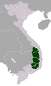
Dak Nong province Gia Lai province Kon Tum province Lam Dong province Categories:- Central Highlands geography stubs
- Districts of Lam Dong Province


Wikimedia Foundation. 2010.