- Czarny Las, Częstochowa County
-
For other places with the same name, see Czarny Las (disambiguation).
Czarny Las — Village — 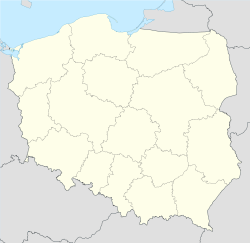
 Czarny Las
Coordinates: 50°53′N 19°5′E / 50.883°N 19.083°E Country  Poland
Voivodeship Silesian County Częstochowa County Gmina Mykanów Population 1,029 Czarny Las [ˈt͡ʂarnɨ ˈlas] is a village in the administrative district of Gmina Mykanów, within Częstochowa County, Silesian Voivodeship, in southern Poland.[1] It lies approximately 10 kilometres (6 mi) north of Częstochowa and 71 km (44 mi) north of the regional capital Katowice.
The village has a population of 1,029.
References
Seat 
Other villages Adamów • Antoniów • Borowno • Borowno-Kolonia • Cykarzew Północny • Cykarzew Północny-Stacja • Czarny Las • Dudki • Florków • Grabowa • Grabówka • Jamno • Kokawa • Kolonia Wierzchowisko • Kuźnica Kiedrzyńska • Kuźnica Lechowa • Lemańsk • Łochynia • Lubojenka • Lubojna • Nowa Rybna • Nowy Broniszew • Nowy Kocin • Osiny • Pasieka • Przedkocin • Radostków • Radostków-Kolonia • Rusinów • Rybna • Stary Broniszew • Stary Cykarzew • Stary Cykarzew POM • Stary Kocin • Topolów • Tylin • Wierzchowisko • Wola Hankowska • Wola KiedrzyńskaCategories:- Częstochowa County geography stubs
- Villages in Częstochowa County

Wikimedia Foundation. 2010.