- Cyclone Innis (2009)
-
Tropical Cyclone Innis Category 1 cyclone (Australian scale) Tropical storm (SSHS) 
Tropical Cyclone Innis over New Caledonia Formed February 13, 2009 Dissipated February 18, 2009 Highest winds 10-minute sustained:
75 km/h (45 mph)
1-minute sustained:
75 km/h (45 mph)
Gusts:
95 km/h (60 mph)Lowest pressure 990 mbar (hPa; 29.23 inHg) Fatalities None Reported Damage Minimal Areas affected Vanuatu, New Caledonia, Lord Howe Island, New Zealand. Part of the 2008–09 South Pacific cyclone season, 2008–09 Australian region cyclone season Cyclone Innis (RSMC Nadi Designation:10F, BOM Designation:13U, JTWC Designation:15P) was a tropical cyclone which formed as Tropical Disturbance 10F to the east of Fiji on February 13, 2009. As it moved east, the disturbance was designated as a tropical depression late the next day by the Regional Specialized Meteorological Centre in Nadi, Fiji. A Tropical Cyclone Formation Alert was issued on February 15 by the Joint Typhoon Warning Center, as the depression moved towards Vanuatu and continued to organise itself. Vanuatu then suffered a direct hit from the depression early the next day before it was upgraded to a cyclone and named Innis Innis early on February 17 as it moved across New Caledonia. Innis then quickly reached its peak intensity with winds of 75 km/h (45 mph), before RSMC Nadi transferred primary warning responsibility of Cyclone Innis, to the Tropical Cyclone Warning Center in Wellington, who downgraded it to an extratropical low within their first advisory. Cyclone Innis was then absorbed by a trough of low pressure which brought heavy rain to New Zealand during February 20. There were no deaths reported by Cyclone Innis and little impact was reported from the storm in Vanuatu or New Caledonia.
Contents
Meteorological history
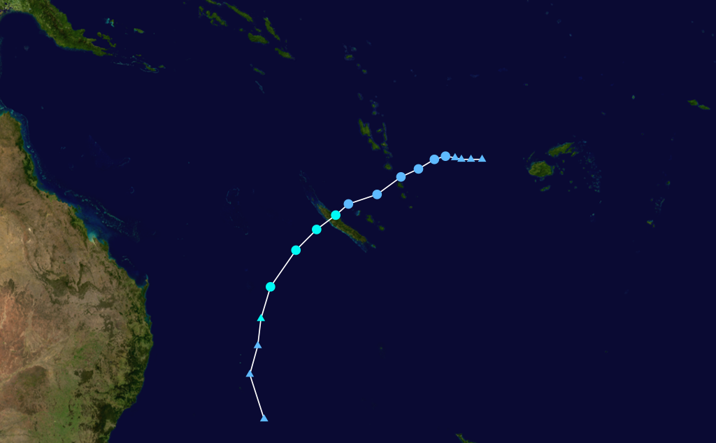
 Storm path
Late on February 13, 2009, RSMC Nadi reported that Tropical Disturbance 10F, had formed to the west of Nadi, Fiji.[1] At this time the disturbance's low level circulation centre was difficult to locate and was not organised while convection had persisted for the previous 24 hours and was located within an area of moderate vertical wind shear.[1] Late the next day as the disturbance had organised itself RSMC Nadi upgraded the disturbance to a Tropical Depression while it was moving east towards Vanuatu.[2] The Depression's low level circulation centre was exposed and was located to the south of an anti cyclonic circulation and under an upper trough of low pressure.[2] Late on February 15 the Joint Typhoon Warning Center issued a Tropical Cyclone Formation Alert as convective banding was wrapping into the depression's well defined low level circulation centre.[3] Early the next morning the depression passed over the southern islands of Vanuatu.[4]
Later on February 15 while outflow was good, and was being steered towards the southwest, RSMC Nadi reported that land interaction and higher vertical wind shear was expected to weaken the depression and issued their last advisory on the depression.[5] Early the next day the JTWC designated the Tropical Depression, as Tropical Cyclone 15P this came as the depression was making its second landfall on New Caledonia.[4][6] However, the land interaction did not weaken the depression and had moved into an area of low vertical windshear, and thus RSMC Nadi started to reissue warnings on the depression.[7] Later that morning, RSMC Nadi upgraded the depression, to a category one cyclone, and named it as Cyclone Innis.[8][9] Later that day both the JTWC and RSMC Nadi reported that Cyclone Innis had reached both its one minute and ten minute peak wind speeds of 75 km/h (45 mph).[10][11] RSMC Nadi then released their last Advisory on Innis, as they transferred primary warning responsibility to the Tropical Cyclone Warning Center in Wellington, due to Innis moving to the south of 25S.[12] Early the next day as TCWC Wellington issued their first advisory, TCWC Wellington downgraded Innis to an extratropical low.[13][14] Later that day the extratropical low that was Cyclone Innis, was absorbed by a trough of low pressure while moving between Australia and New Zealand.[14][15][16]
Preparations, and impact
On February 16, RSMC Nadi started to issue special weather advisories for Vanuatu on Tropical Depression 10F, as a strong wind warning had been declared for Vanuatu.[17] RSMC Nadi also reported at this time that the winds could strengthen to damaging gale force while passing over Vanuatu.[17] They also anticipated that rainfall would be rather heavy at times while the depression passed, between Efate and Erromango islands.[17] Later that day as damaging gale force winds were no longer expected to affect Vanuatu, RSMC Nadi cancelled the special weather advisories for Vanuatu.[17] Later that day, an orange tropical cyclone alert was issued for New Caledonia as Tropical Depression 10F was about to make landfall on New Caledonia within 24 hours.[18] After Tropical Depression 10F had made landfall it was reported that overall damage was light while 22.2 mm of rain was reported in Poindimié, 70 mm in Tontouta, 10.4 mm in Noumea.[18] Shortly after Innis became extratropical, warnings were issued by both the TCWC's in Brisbane, and Wellington for Lord Howe Island and parts of New Zealand.[16] This was because Cyclone Innis was expected to affect the countries once it had merged with a trough of low pressure, which had affected New South Wales in Australia.[16][19] There was no impact reported on Lord Howes Island while in New Zealand only heavy rain was reported from the trough of low pressure that was Cyclone Innis.[20]
See also
- 2008–09 South Pacific cyclone season
- 2008-09 Australian region cyclone season
- Timeline of the 2008–09 South Pacific cyclone season
- Timeline of the 2008–09 Australian region cyclone season
References
- ^ a b "Tropical Disturbance Summary 13-02-2009 21z". Fiji Meteorological Service. 13-02-2009. http://www.webcitation.org/5eZVPFFrT. Retrieved 2009-02-18.
- ^ a b "Tropical Disturbance Summary 14-02-2009 21z". Fiji Meteorological Service. 14-02-2009. http://www.webcitation.org/5eau4Aqc2. Retrieved 2009-02-18.
- ^ "Tropical Cyclone Formation Alert 15-02-2009". Joint Typhoon Warning Center. 15-02-2009. http://www.webcitation.org/5ecIJDnXq. Retrieved 2009-02-18.
- ^ a b "Tropical Cyclone Innis Track Map". Fiji Meteorological Service. 17-02-2009. http://www.webcitation.org/5eeyeSXpV. Retrieved 2009-02-18.
- ^ "Tropical Disturbance Advisory 15-02-2009 18z". Fiji Meteorological Service. 15-02-2009. http://www.webcitation.org/5ediXrqNu. Retrieved 2009-02-18.
- ^ "Tropical Cyclone Warning 15-02-2009 00z". Joint Typhoon Warning Center. 15-02-2009. http://www.webcitation.org/5ee4Bibyj. Retrieved 2009-02-18.
- ^ "Tropical Disturbance Advisory 17-02-2009 03z". Fiji Meteorological Service. 17-02-2009. http://www.webcitation.org/5ehUgB2mi. Retrieved 2009-02-19.
- ^ "Tropical Disturbance Advisory 17-02-2009 06z". Fiji Meteorological Service. 17-02-2009. http://www.webcitation.org/5ehW7TJ0y. Retrieved 2009-02-19.
- ^ "Tropical Cyclone Innis". Fiji Meteorological Service. 17-02-2009. http://www.webcitation.org/5efhfztun. Retrieved 2009-02-19.
- ^ "Tropical Disturbance Advisory 17-02-2009 12z". Fiji Meteorological Service. 17-02-2009. http://www.webcitation.org/5ehaZx7Jn. Retrieved 2009-02-19.
- ^ "Tropical Cyclone Innis". Joint Typhoon Warning Center. 17-02-2009. http://199.9.2.143/tcdat/tc09/SHEM/15P.INNIS/trackfile.txt. Retrieved 2009-02-19.
- ^ "Tropical Disturbance Advisory 17-02-2009 18z". Fiji Meteorological Service. 18-02-2009. http://www.webcitation.org/5efGuFSuV. Retrieved 2009-02-22.
- ^ "Gale Warning 18-02-2009 00z". Meteorological Service of New Zealand Limited. 19-02-2009. http://www.webcitation.org/5efXL1kHO. Retrieved 2009-02-22.
- ^ a b Rajenda Prasad (19-02-2009). "Cyclone loses momentum: weatherman". Fiji Live. http://www.webcitation.org/5emi4yjeE. Retrieved 2009-02-22.
- ^ Chris Noble (17-02-2009). "Severe Weather Watch 17-02-08 23z". Meteorological Service of New Zealand Limited. http://www.webcitation.org/5efZ8tZRB. Retrieved 2009-02-22.
- ^ a b c Bob Mcdavitt (19-02-2009). "Brace for some rain from the Tropics". Meteorological Service of New Zealand Limited. http://www.webcitation.org/5f8792pnO. Retrieved 2009-02-22.
- ^ a b c d Fiji Meteorological Service (2009-02-16). "Weather Warnings issued on 16-02-2009". MT Archive. http://mtarchive.geol.iastate.edu/2009/02/16/text/Severe/Severe_16.txt. Retrieved 2008-02-24.
- ^ a b Kevin Vang (2009-02-17). "Cyclone Alert Issued for New Caledonia (Nouvelle Caledonie)". APECDI. http://www.afap.org/apcedi/2009/02/apcedi-alert-spnc-15p10f-noname-1-2009.html. Retrieved 2008-02-23.
- ^ Margaret De Silva (2009-02-19). "Rain to stay for around 4 days". Grafton Daily Examiner. http://www.dailyexaminer.com.au/story/2009/02/19/rain-to-stay-for-around-4-days/. Retrieved 2008-02-23.
- ^ "Heavy rain pounds the country". TVNZ. 2009-02-20. http://tvnz.co.nz/national-news/heavy-rain-pounds-country-2496650. Retrieved 2008-02-23.
External links
Categories:- Tropical cyclones in Vanuatu
- Tropical cyclones in New Zealand
- 2009 in Vanuatu
- 2009 in New Zealand
- Category 1 South Pacific cyclones
- 2008–09 South Pacific cyclone season
- Tropical Lows
- 2008–09 Australian region cyclone season
- Tropical cyclones in New Caledonia

Wikimedia Foundation. 2010.