- 2010–11 South-West Indian Ocean cyclone season
-
2010–11 South-West Indian Ocean cyclone season 
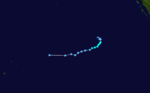
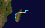
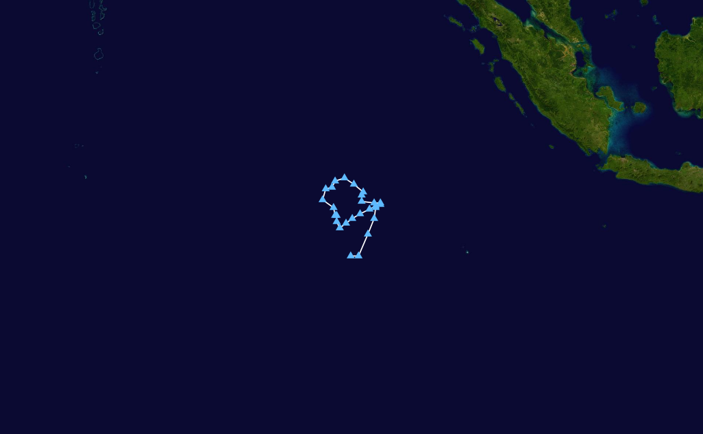
Season summary mapFirst storm formed: 25 October 2010 (01) Last storm dissipated: 16 April 2011 (09) Strongest storm: Bingiza – 953 hPa (mbar), 165 km/h (105 mph) (10-minute sustained) Total disturbances: 9 Tropical depressions: 6 Total storms: 4 Official, 1 Unofficial Tropical cyclones: 2 Intense cyclones: 1 Total fatalities: Unknown Total damage: Unknown South-West Indian Ocean cyclone seasons
2008-09, 2009-10, 2010-11 Post-2010Related articles: - 2010–11 Australian region cyclone season
- 2010–11 South Pacific cyclone season
The 2010–11 South-West Indian Ocean cyclone season was the least active tropical cyclone season in the South-West Indian Ocean on record. It began on November 1, 2010 and ended on April 30, 2011, dates which conventionally delimit the year in which most tropical cyclones form in the basin. However any tropical cyclone that developed between July 1, 2010, and June 30, 2011 would've count towards the seasonal count. The South-West Indian Ocean basin is defined as being to the south of the equator and between the coast of Africa and 90°E. The basin is monitored by Meteo France in Réunion (MFR), while the Madagascan weather service (MWS) and Mauritius Meteorological service (MMS) name tropical cyclones when they reach moderate tropical storm intensity. The Joint Typhoon Warning Center (JTWC) also issue warnings for the basin, designating tropical cyclones with a number and an "S" Suffix. The 2010-11 season was originally predicted by MMS to see 8-10 named tropical storms. However, the season became the first season since 1926-27 to only have two tropical storms, at the start of March.
Contents
Seasonal Summary
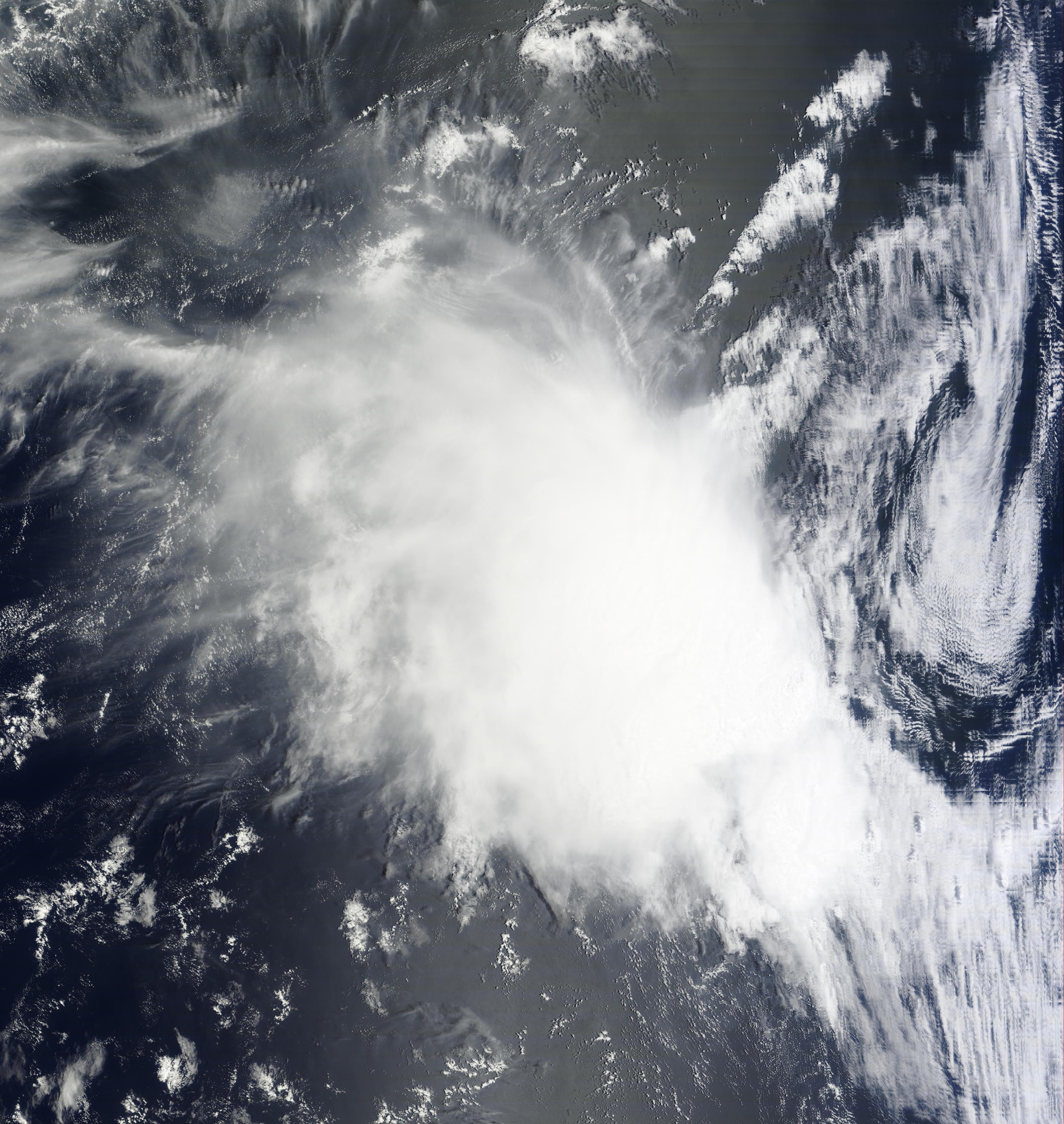
On October 22 2010, the MMS, released their seasonal outlook and predicted that there would be between 8 and 10 named storms within the basin during the season.[1] On October 25, MFR initiated advisories on Tropical Disturbance 1, which was located to the west of Jakarta, Indonesia, during the next day the disturbance intensified into a tropical depression. Over the next couple of days, the depression gradually weakened, before MFR issued the final advisory on October 29. The basin then lay quiet for a month before Tropical Disturbance 2, developed on November 29, and gradually intensified further. On December 1, MFR reported that the disturbance had developed into a moderate tropical storm while the MMS named it as Abele. Abele then intensified further and on December 2, peaked as a tropical cyclone, before during the next day, it moved into the Australian region. Throughout the rest of December the basin remained quiet, with no tropical disturbances developing. At the end of December, the MMS issued an updated seasonal outlook, predicting that only 6-8 named tropical storms would develop during 2010-11.[2] Tropical Disturbance 03 then developed on January 2, to the southeast of Diego Garcia and quickly developed into a tropical depression. MFR then issued their final advisory on the system the next day as it had rapidly weakened. Until January 30, there were no more recorded tropical disturbances, however the remnants of Tropical Disturbance 3 persisted until January 16. On January 30, MFR reported that Tropical Disturbance 4 had developed to the southwest of Reunion, however they issued their final advisory the next day as the disturbance was no longer tropical. On February 9, MFR reported that Tropical Disturbance 5, had developed to the east of Madagascar, during that day the disturbance quickly developed into a tropical storm, with the MWS, naming the system as Bingiza. During the next couple of days, Bingzia slowly developed further, before rapidly intensifying into a intense tropical cyclone by early on February 14. During that day Bingzia fluctuated in intensity before making landfall on Madagascar. On February 15, while Bingiza was over Madagascar, MFR reported that Tropical Disturbance 6 had developed to the northwest of Reunion. During the rest of February, there were no more tropical disturbances or named systems.
Storms
Tropical Depression 01
Tropical depression (MFR) Tropical storm (SSHS) 
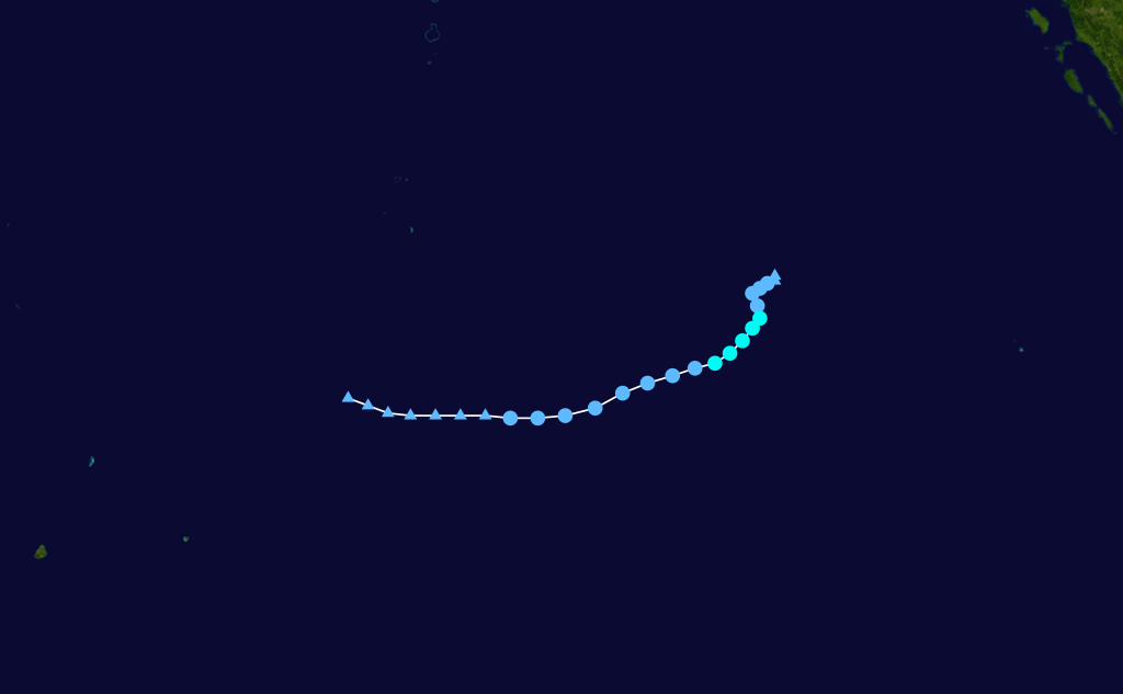
Duration October 25 – October 29 Intensity 55 km/h (35 mph) (10-min), 997 mbar (hPa) On October 25, the Météo-France (MFR) reported that a tropical disturbance has formed in the South Western Indian Ocean, and gave it the identifier "01".[3] On the same day, the Joint Typhoon Warning Center (JTWC) identified the tropical disturbance as a low pressure area, located at approximately 800 nautical miles (1,500 km; 920 mi) east of Diego Garcia. On October 26, the MFR upgraded the disturbance into a tropical depression.[4] Later that day, the JTWC upgraded the low pressure area directly into a tropical storm.[5] On October 27, the MFR reported that the system slightly weakened.[6] Later that day, the MFR reported that the system further weakened into a Tropical Disturbance.[7] Late on the same day, the JTWC has also reported that the storm weakened into a lower end Tropical Depression issuing their final warning on the system.[8] Despite its weakness, the system had very good convection and showed a few signs of re-intensifying.[9] However, on October 29, the convection in the system started depleting and the disturbance continued to weaken.[10] Later, the MFR issued their final advisory on the disturbance.[11] The remnants of the system persisted as they slowly moved west, until it dissipated completely on November 1, just south of the Arabian Sea.
Tropical Cyclone Abele
Tropical cyclone (MFR) Category 1 tropical cyclone (SSHS) 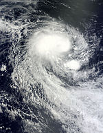

Duration November 29 – December 3 (out of basin) Intensity 130 km/h (80 mph) (10-min), 973 mbar (hPa) On 29 November, both the TCWC Perth and the Météo-France (MFR) reported that a tropical distrubance had formed within the South-West Indian Ocean, and gave it the identifier "02".[12] Later that day, the Joint Typhoon Warning Center (JTWC) classified it as Tropical Cyclone 03S, locating it 700 nautical miles (1,300 km; 810 mi) west of Cocos Island.[13] On November 30, the MFR upgraded the disturbance into a tropical depression.[14] On December 1 it was named Abele by the Mauritius Meteorological Service as it became the first tropical storm of the season.[15] On the very same day, the MFR reported that Abele intensified into a severe tropical storm.[16] On December 2, the MFR reported that Abele continued to intensify and became a tropical cyclone. [17] It was given a Category 1 Tropical cyclone status by the JTWC.[18] On December 3, both the JTWC and MFR reported that Abele crossed 90°E and moved into the Australian region.[19][20]
Tropical Depression 03
Tropical depression (MFR) 
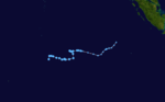
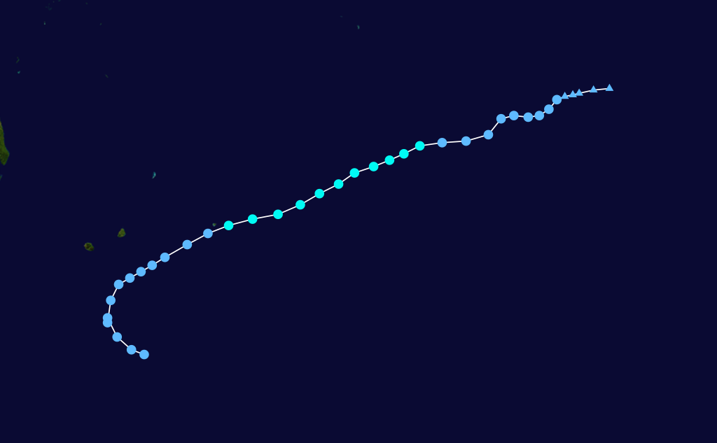
Duration January 2 – January 17 Intensity 55 km/h (35 mph) (10-min), 996 mbar (hPa) On December 28, 2010, an area of low pressure developed near Indonesia.[21] On January 2, 2011, the Météo-France (MFR) upgraded the area of low pressure into a tropical disturbance giving it the identifier "03".[22] A few hours later, the MFR upgraded the disturbance into a tropical depression.[23] Early the next day, the MFR reported that the depression started weakening and became a Tropical Disturbance.[24] A few hours later, the MFR issued their final advisory on the system.[25] On January 4, nearly a day after the system dissipated, the remnant had good convection developing around it.[26] Early on January 5, the convection in the remnants started depleting.[27] The remnants of the depression continued to track towards the west-southwest before turning southward several hundred kilometres northeast of Reunion on January 12. On January 15, the system began to redevelop, prompting the issuance of a Tropical Cyclone Formation Alert by the JTWC.[28] Early on January 16, the remnants of the system had gained enough organization and the MFR reupgraded the system into a Tropical Depression. However, the system drifted straight and made landfall near Fenoarivo, Madagascar and quickly weakened over land.[29] This resulted in the cancellation of the Tropical Cyclone Formation Alert by the JTWC.[30] Late on 17 January, the system dissipated completely.[31]
Tropical Disturbance 04
Tropical disturbance (MFR) 

Duration January 30 – January 31 Intensity 45 km/h (30 mph) (10-min), 998 mbar (hPa) On January 30, the Météo-France (MFR) upgraded an area of low pressure, south of La Réunion into a Tropical Disturbance and designated it with '04'.[32] Early on the next day, the MFR issued their last advisory on the system as it was no longer tropical.[33]
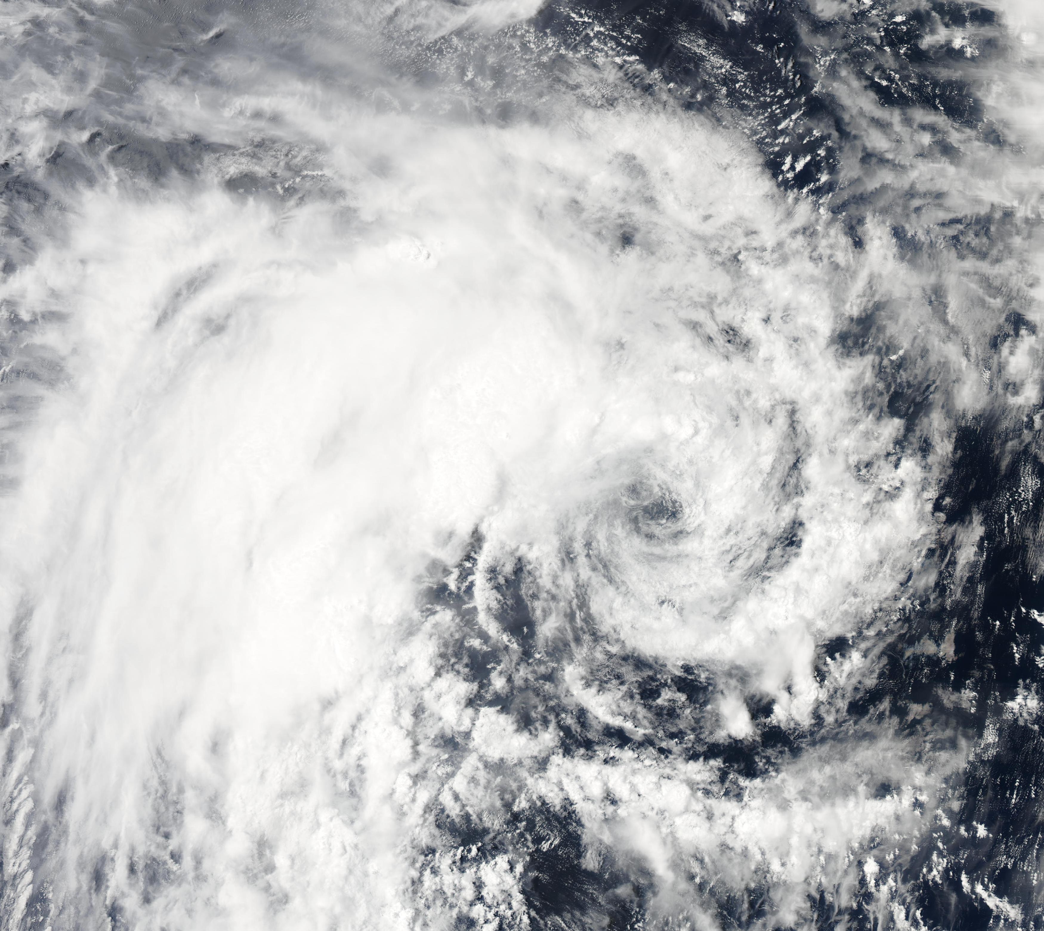
Intense Tropical Cyclone Bingiza
Intense tropical cyclone (MFR) Category 3 tropical cyclone (SSHS) 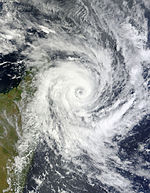
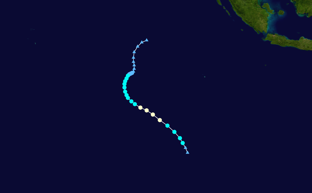
Duration February 9 – February 18 Intensity 165 km/h (105 mph) (10-min), 953 mbar (hPa) Main article: Cyclone BingizaEarly on February 9, the Météo-France (MFR) upgraded an area of low pressure into a Tropical Disturbance and designated it with '05'.[34] At the time it was reported to be 140 nm (260 km) north-northeast of Tromelin Island.[35] A few hours later, the MFR upgraded the disturbance into a tropical depression.[36] The depression continued to intensify rapidly and on the same day, it became a Moderate Tropical Storm.[37] Soon afterwards, the Joint Typhoon Warning Center (JTWC) started monitoring the system as Tropical Cyclone 13S.[38] However, on February 11, the central pressure started increasing and the system gradually weakened.[39] On the next day, environmental conditions became very favourable for rapid strengthening, with no upper level wind shear and very good upper level divergence. The nearly-stationary system started intensifying again and became a Severe Tropical Storm,[40] and soon a Tropical Cyclone,[41] and then into an Intense Tropical Cyclone.[42] But, due to interaction with land mass, Bingiza weakened into a Tropical cyclone, late on February 13.[43] Early on the next day, Bingiza made landfall over Saranambana, Madagascar and started weakening rapidly.[44] As a result, the MFR downgraded it into an Overland Depression.[45] The system slowly moved over Madagascar and crossed into the Mozambique Channel on February 16, with the MFR reporting that the system became a Tropical Disturbance.[46] As it entered water, it started intensifying and soon became a Tropical Depression.[47] It briefly attained Moderate Tropical Storm status before making landfall and weakening to Tropical Depression strength. Bingiza later rapidly weakened as it crossed southern Madagascar, and dissipated on February 20 in the southern Indian Ocean.
As Bingiza neared land, rain and thundershowers hit Madagascar,[48] causing flooding.
Tropical Disturbance 06
Tropical disturbance (MFR) 
Duration February 15 – February 20 Intensity 45 km/h (30 mph) (10-min), 1000 mbar (hPa) On February 15, the Météo-France (MFR) upgraded an area of low pressure northeast of La Réunion into a Tropical Disturbance, and designated it with '06'.[49] The next day it weakened under moderate windshear.[50] It dissipated completely on February 20.
Moderate Tropical Storm Cherono
Moderate tropical storm (MFR) Tropical storm (SSHS) 
Duration March 14 (entered basin) – March 23 Intensity 75 km/h (45 mph) (10-min), 995 mbar (hPa) On 14 March, Tropical Low 23U crossed from the Australian region into the South West Indian Ocean basin, and was classified as Tropical Disturbance 07. It quickly strengthened the next day into a Tropical Depression, before being upgraded to Moderate Tropical Storm strength and being named Cherono. By 19 March, it was reported to be weakening and on 23 March Cherono dissipated.
Tropical Disturbance 08
Tropical disturbance (MFR) 
Duration March 29 – April 1 Intensity 45 km/h (30 mph) (10-min), 1004 mbar (hPa) On March 28, an area of disturbed weather moved into the South-West Indian Ocean Basin, and the next day it was classified as Tropical Disturbance 08. The MFR expected it to intensify into a Moderate Tropical Storm at the start of April; however, increased shear took its toll, and it dissipated on April 1.
Subtropical Depression 09
Subtropical depression (MFR) 
Duration April 13 – April 16 Intensity 95 km/h (60 mph) (10-min), 985 mbar (hPa) On April 13, a Subtropical Depression formed south-east of Madagascar. It retained subtropical characteristics, while the winds reached that equivalent of a Severe Tropical Storm strength.
Timeline

Storm Names
Within the South-west Indian Ocean Tropical Depressions and Subtropical Depressions that are judged to have 10-minute sustained windspeeds of 65 km/h, (40 mph) by the Regional Specialized Meteorological Center on La Réunion Island, France (RSMC La Réunion) are usually assigned a name. However it is the Sub-Regional Tropical Cyclone Advisory Centers in Mauritius and Madagascar who name the systems. The Sub-Regional Tropical Cyclone Advisory Center in Mauritius names the storm should it intensify into a moderate tropical storm between 55°E and 90°E, if the storm should intensify into a moderate tropical storm between 30°E and 55°E then the Sub-Regional Tropical Cyclone Advisory Center in Madagascar assigns the appropriate name to the storm. Tropical Cyclones moving into this region from the Australian Region are renamed by the Sub-Regional Tropical Cyclone Advisory Center in Mauritius, however tropical cyclones moving into the Australian region do not get renamed. New name lists are used every year, whilst a name is normally only used once so thus no names are retired.[51][52]
- Abele
- Bingiza
- Cherono
- Dalilou (unused)
- Elvire (unused)
- Francis (unused)
- Giladi (unused)
- Haingo (unused)
- Igor (unused)
- Jani (unused)
- Khabonina (unused)
- Lumbo (unused)
- Maina (unused)
- Naledi (unused)
- Onani (unused)
- Paulette (unused)
- Qiloane (unused)
- Rafael (unused)
- Stella (unused)
- Tari (unused)
- Unjaty (unused)
- Vita (unused)
- Willy (unused)
- Ximene (unused)
- Yasmine (unused)
- Zama (unused)
Season effects
This table lists all the storms that developed in the Southern Hemisphere during the 2010–2011 South-West Indian Ocean cyclone season. It includes their intensity, duration, name, landfalls, deaths, and damages. All data is taken from Météo-France. The damage figures are all from 2010 USD.
RSMC/JTWC
NumberStorm
NameDates active Storm category
at peak intensityPeak 10-min
sustained windsPressure
hPaAreas affected Damage
(USD)Deaths Notes 01/01S N/A October 25 – October 29 Tropical Depression 55 km/h (35 mph) 997 None None None 02/03S Abele November 29 – December 3 Tropical Cyclone 130 km/h (80 mph) 973 None None None 03 N/A January 2 – January 17 Tropical Depression 55 km/h (35 mph) 996 Madagascar None None 04 N/A January 30 – January 31 Tropical Disturbance 45 km/h (30 mph) 998 None None None 05/13S Bingiza February 9 – February 20 Intense Tropical Cyclone 165 km/h (105 mph) 953 Réunion, Madagascar Unknown 5 [53] 06 N/A February 15 – February 20 Tropical Disturbance 45 km/h (30 mph) 1003 None None None 07/18S Cherono March 14 – March 23 Moderate Tropical Storm 75 km/h (45 mph) 992 Rodrigues Island None None 08 N/A March 29 – April 1 Tropical Disturbance 45 km/h (30 mph) 1005 None None 09 N/A April 13 – April 16 Subtropical Depression 95 km/h (60 mph) 987 None None None 9 Systems October 25 – April 16 165 km/h (105 mph) 953 None 5 Notes
See also
- List of Southern Hemisphere cyclone seasons
- Atlantic hurricane seasons: 2010, 2011
- Pacific hurricane seasons: 2010, 2011
- Pacific typhoon seasons: 2010, 2011
- North Indian Ocean cyclone seasons: 2010, 2011
References
- ^ Dunputh, B. (2010-10-26). "Seasonal climate prediction - Summer 2010-2011 - Seasonal Outlook". Mauritius Meteorological Service. http://www.webcitation.org/5tklBw7gq. Retrieved 2011-03-03.
- ^ Dunputh, B. (2010-12-23). "Seasonal climate prediction - Updated Summer 2010-11 Seasonal Outlook". Mauritius Meteorological Service. http://www.webcitation.org/5wuzmSwsr. Retrieved 2011-03-03.
- ^ "Meteo France Tropical Cyclone Advisory 01 for Tropical Disturbance 01". Météo-France. http://www.webcitation.org/5tkI6MCMC. Retrieved 26 October 2010.
- ^ "Meteo France Technical Bulletin 03 for Tropical Depression 01". Météo-France. http://www.webcitation.org/5tkyFcDZA. Retrieved 26 October 2010.
- ^ "JTWC Tropical Cyclone 01S Warning 01". Joint Typhoon Warning Center. http://www.webcitation.org/5tlkDQfgZ. Retrieved 26 October 2010.
- ^ "Meteo France Technical Bulletin 09 for Tropical Depression 01". Météo-France. http://www.webcitation.org/5tnBpG0g0. Retrieved 27 October 2010.
- ^ "Meteo France Technical Bulletin 10 for Tropical Depression 01". Météo-France. http://www.webcitation.org/5tnb5clv8. Retrieved 27 October 2010.
- ^ "JTWC Tropical Cyclone 01S Warning 05". Joint Typhoon Warning Center. http://www.webcitation.org/5toR7czCs. Retrieved 27 October 2010.
- ^ "FNMOC (Image) - Tropical Cyclone 01S having good convection even after weakening into a Tropical Depression". Fleet Numerical Meteorology and Oceanography Center. https://www.fnmoc.navy.mil/tcweb/cgi-bin/tc_home.cgi?ATCF_NAME=sh012011.wrn&SENSOR=&PROD=ir1km&PHOT=yes&ARCHIVE=Latest&SIZE=full&TYPE=ssmi&NAV=tc&DISPLAY=Active&DIR=/tcweb/dynamic/products/tc11/SHEM/01S.ONE/ssmi/ir1km&CURRENT=20101028.1157.mtsat-1r.ir.01S.ONE.25kts.1004mb.13.8S.80.9E.100pc.jpg&YEAR=2010&MO=Oct&BASIN=SHEM&STORM_NAME=01S.ONE&STYLE=table&ACTIVES=10-SHEM-01S.ONE,10-WPAC-16W.CHABA,10-ATL-90L.INVEST,10-ATL-91L.INVEST,10-ATL-92L.INVEST,. Retrieved 28 October 2010.
- ^ "Tropical Cyclone 01S running out of convection". Fleet Numerical Meteorology and Oceanography Center. https://www.fnmoc.navy.mil/tcweb/cgi-bin/tc_home.cgi?ATCF_NAME=sh012011.wrn&SENSOR=&PROD=ir1km&PHOT=yes&ARCHIVE=Latest&SIZE=full&TYPE=ssmi&NAV=tc&DISPLAY=Active&DIR=/tcweb/dynamic/products/tc11/SHEM/01S.ONE/ssmi/ir1km&CURRENT=20101028.2230.mtsat-1r.ir.01S.ONE.25kts.1004mb.14.6S.79.6E.100pc.jpg&YEAR=2010&MO=Oct&BASIN=SHEM&STORM_NAME=01S.ONE&STYLE=table&ACTIVES=10-SHEM-01S.ONE,10-WPAC-16W.CHABA,10-ATL-20L.SHARY,10-ATL-90L.INVEST,10-ATL-91L.INVEST,10-SHEM-92S.INVEST,10-WPAC-99W.INVEST,. Retrieved 29 October 2010.
- ^ "Meteo France Technical Bulletin 15 for Tropical Depression 01". Météo-France. http://www.webcitation.org/5tpxkBYX0. Retrieved 29 October 2010.
- ^ "Meteo France Tropical Cyclone Advisory 01 for Tropical Disturbance 02". Météo-France. http://www.webcitation.org/5ubOrPRPs. Retrieved 29 November 2010.
- ^ "JTWC Tropical Cyclone 03S Warning 01". Joint Typhoon Warning Center. http://www.webcitation.org/5ubUvEkDb. Retrieved 29 November 2010.
- ^ "Meteo France Technical Bulletin 04 for Tropical Depression 02". Météo-France. http://www.webcitation.org/5ucZZaC0t. Retrieved 29 November 2010.
- ^ "Meteo France Technical Bulletin 09 for Tropical Storm Abele". Météo-France. http://www.webcitation.org/5ueVAlaBO. Retrieved 1 December 2010.
- ^ "Meteo France Technical Bulletin 10 for Tropical Storm Abele". Météo-France. http://www.webcitation.org/5ueqo6x5a. Retrieved 1 December 2010.
- ^ "Meteo France Technical Bulletin 13 for Tropical Cyclone Abele". Météo-France. http://www.webcitation.org/5ufyBzRaY. Retrieved 2 December 2010.
- ^ "JTWC Tropical Cyclone 03S Warning 08". Joint Typhoon Warning Center. http://www.webcitation.org/5ugat17RS. Retrieved 03 December 2010.
- ^ "JTWC Tropical Cyclone 03S Warning 09". Joint Typhoon Warning Center. http://www.webcitation.org/5uhFer3bv. Retrieved 03 December 2010.
- ^ "Meteo France Technical Bulletin 15 for Tropical Cyclone Abele". Météo-France. http://www.webcitation.org/5uhBzbLvF. Retrieved 3 December 2010.
- ^ "Pre-Tropical Depression 03 imagery - December 28, 2010". FNMOC. http://199.9.2.143/tcdat/tc11/SHEM/97S.INVEST/vapor/geo/1km/20101223.2232.mtsat2.x.wv1km.97SINVEST.15kts-1010mb-120S-1000E.100pc.jpg. Retrieved 5 January 2011.
- ^ "Meteo France Tropical Cyclone Advisory 01 for Tropical Disturbance 03". Météo-France. http://www.webcitation.org/5vR1IAawg. Retrieved 2 January 2011.
- ^ "Meteo France Technical Bulletin 2 for Tropical Depression 3". Météo-France. http://www.webcitation.org/5vRPRCX8w. Retrieved 2 January 2011.
- ^ "Meteo France Technical Bulletin 5 for Tropical Depression 3". Météo-France. http://www.webcitation.org/5vSNcfGuJ. Retrieved 4 January 2011.
- ^ "Meteo France Technical Bulletin 6 for Tropical Depression 3". Météo-France. http://www.webcitation.org/5vSgWQBnn. Retrieved 4 January 2011.
- ^ "Tropical Depression 03's remnants imagery - January 4, 2011". FNMOC. http://199.9.2.143/tcdat/tc11/SHEM/97S.INVEST/vapor/geo/1km/20110105.0430.meteo7.x.wv1km.97SINVEST.25kts-1004mb-134S-771E.100pc.jpg. Retrieved 5 January 2011.
- ^ "Tropical Depression 03's remnants imagery - January 5, 2011". FNMOC. http://199.9.2.143/tcdat/tc11/SHEM/97S.INVEST/vapor/geo/1km/20110105.1100.meteo7.x.wv1km.97SINVEST.25kts-1004mb-137S-773E.100pc.jpg. Retrieved 5 January 2011.
- ^ "JTWC TCFA on Tropical Depression 03". Joint Typhoon Warning Center. http://www.webcitation.org/5vkhOeNKD. Retrieved 16 January 2011.
- ^ "Daily Bulletin for Cyclonic Activity and Significant Tropical Weather in the Southwest Indian Ocean". Météo-France. January 16, 2011. http://www.webcitation.org/5vmeW7aBg. Retrieved January 16, 2011.
- ^ "JTWC TCFA on Tropical Depression 03 (Withdrawn)". Joint Typhoon Warning Center. http://www.webcitation.org/5vmDMbQ5R. Retrieved 16 January 2011.
- ^ "JTWC ABIO10 171800". Joint Typhoon Warning Center. http://www.webcitation.org/5vpUt0Q6d. Retrieved 18 January 2011.
- ^ "Tropical Cyclone Technical Bulletin 1 for Tropical Disturbance 04". Météo-France. http://www.webcitation.org/5w8AZFBSx. Retrieved 31 January 2011.
- ^ "Tropical Cyclone Technical Bulletin 3 for Tropical Disturbance 04". Météo-France. http://www.webcitation.org/5w9058rwD. Retrieved 31 January 2011.
- ^ "Tropical Cyclone Technical Bulletin 1 for Tropical Disturbance 05". Météo-France. http://www.webcitation.org/5wMbHZRia. Retrieved 9 February 2011.
- ^ "Tropical Weather Discussion". Météo-France. 9 February 2011. http://www.webcitation.org/5wMsVLMyy. Retrieved 9 February 2011.
- ^ "Tropical Cyclone Technical Bulletin 2 for Tropical Disturbance 05". Météo-France. http://www.webcitation.org/5wN1Q0OYq. Retrieved 9 February 2011.
- ^ "Tropical Cyclone Technical Bulletin 3 for Moderate Tropical Storm Bingiza". Météo-France. http://www.webcitation.org/5wNKpOUFD. Retrieved 9 February 2011.
- ^ "JTWC Tropical Cyclone 13S Warning 01". Joint Typhoon Warning Center. http://www.webcitation.org/5wNvd7qh2. Retrieved 10 February 2011.
- ^ "Tropical Cyclone Technical Bulletin 10 for Moderate Tropical Storm Bingiza". Météo-France. http://www.webcitation.org/5wPyUAgTr. Retrieved 11 February 2011.
- ^ "Tropical Cyclone Technical Bulletin 13 for Severe Tropical Storm Bingiza". Météo-France. http://www.webcitation.org/5wR9vahk2. Retrieved 12 February 2011.
- ^ "Tropical Cyclone Technical Bulletin 15 for Tropical Cyclone Bingiza". Météo-France. http://www.webcitation.org/5wRsnwHNO. Retrieved 12 February 2011.
- ^ "Tropical Cyclone Technical Bulletin 16 for Intense Tropical Cyclone Bingiza". Météo-France. http://www.webcitation.org/5wSby7ZtF. Retrieved 13 February 2011.
- ^ "Tropical Cyclone Technical Bulletin 19 for Intense Tropical Cyclone Bingiza". Météo-France. http://www.webcitation.org/5wTSs90eN. Retrieved 14 February 2011.
- ^ "JTWC Tropical Cyclone 13S Warning 10". Joint Typhoon Warning Center. http://www.webcitation.org/5wUHliPbb. Retrieved 14 February 2011.
- ^ "Tropical Cyclone Technical Bulletin 22 for Intense Tropical Cyclone Bingiza". Météo-France. http://www.webcitation.org/5wUbr983k. Retrieved 14 February 2011.
- ^ "Tropical Cyclone Technical Bulletin 28 for Intense Tropical Cyclone Bingiza". Météo-France. http://www.webcitation.org/5wX98ARRs. Retrieved 16 February 2011.
- ^ "Tropical Cyclone Warning 26 for Intense Tropical Cyclone Bingiza". Météo-France. http://www.webcitation.org/5wXK5NNJH. Retrieved 16 February 2011.
- ^ "Bingiza headed straight for Madagascar". La Sentinelle Limited. http://www.lexpress.mu/story/20953-bingiza-se-dirige-tout-droit-sur-madagascar.html. Retrieved 12 February 2011.
- ^ "Tropical Cyclone Warning 1 for Tropical Disturbance 06". Météo-France. http://www.webcitation.org/5wWVdIWbp. Retrieved 15 February 2011.
- ^ "Technical bulletin 3 for Tropical Disturbance 06". Météo-France. http://www.webcitation.org/5wXKQu7hp. Retrieved 16 February 2011.
- ^ Regional Association I Tropical Cyclone Committee (2006). "Tropical Cyclone Operational Plan for the South-West Indian Ocean" (PDF). World Meteorological Organization. http://www.wmo.ch/pages/prog/www/tcp/documents/TCP12Edition2006-English.pdf. Retrieved 2008-12-14.
- ^ Regional Association I Tropical Cyclone Committee (2009). "FAQ: B5) What are the upcoming tropical cyclone names ?". Meteo France. http://www.meteo.fr/temps/domtom/La_Reunion/webcmrs9.0/anglais/faq/FAQ_Ang_B.html. Retrieved 2010-06-06.
- ^ (French) "La Réunion en vigilance fortes pluies". Clicanoo. February 11, 2011. http://www.webcitation.org/5wRsnhlIR. Retrieved February 12, 2011.
External links
- Joint Typhoon Warning Center (JTWC).
- Météo France (RSMC La Réunion).
- World Meteorological Organization
Tropical cyclones of the 2010–11 South-West Indian Ocean cyclone season
MFR Tropical Cyclone Scale DIS TD MTS STS TC ITC VITC  Book ·
  Category ·
  Portal ·
  WikiProject ·
  Commons
2010–19 South-West Indian Ocean cyclone seasons Categories:


Wikimedia Foundation. 2010.