- Cuajinicuilapa (municipality)
-
Cuajinicuilapa — Municipality — Location in Mexico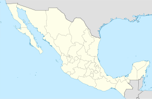
 Cuajinicuilapa
Coordinates: 16°08′N 98°23′W / 16.133°N 98.383°WCoordinates: 16°08′N 98°23′W / 16.133°N 98.383°W Country  Mexico
State Guerrero Municipal seat Cuajinicuilapa Area - Total 857.1 km2 (330.9 sq mi) Population (2005) - Total 25,537 Cuajinicuilapa is one of the 81 municipalities of Guerrero, in south-western Mexico. The municipal seat lies at Cuajinicuilapa. The municipality covers an area of 857.1 km². As of 2005, the municipality had a total population of 25,537.[1][2]
According to data provided by the XII General Census of 2000 documenting Population and Housing carried out by the National Institute of Geographic Statistics and Informatics (INEGI), there are three main ethnic groups in the municipality: whites, indigenous Mexicans and blacks, which by intermarriage have formed the current phenotypical characteristics of some of the Cuajinicuilapa population.
It is possible to distinguish some small numbers of Indians in the town of Cuajinicuilapa. According to INEGI there are around 1,170 indigenous people in this town, representing 4.56% on the total municipal population whose languages are amusgo with 297 speakers, Mixtec with 211 speakers, Nahuatl with 5, Tlapanecos with 22, Zapotec with 2.
There are also whites and other native indian newcomers to the municipality who are traders and merchants. Some residents of the municipality have distinct Negroid features which in colonial days were called "mulatos pardos" (mulatto brown) denoting their negroid admixture.[3]
History
Cuajinicuilapa is located on what was once the Ayacastla province, stretching from the river Ayutla all the way to the plains that share borders with the states of Guerrero and Oaxaca, and was integrated with people of different ethnic and language groups such as: Ayutla Xochitonala, Acatlan Cuauhtepec, Tututepec, and the Tlacuilo had the language of the Mixtec. Nahuatl was probably the majority. Igualapa and Ometepec spoke ayacasteca, but also understood amusga speaking individuals.
This language was peculiar to Xicayán, Ayotzinapa and Xochistlahuaca. They also formed part of the province of Huehuetán which spoke Huehueteca. The Quetzapotla, spoke quetzapoteca and Quahuitlán spoke quahuteca.
Cuajinicuilapa lies precisely in what was Quahhuitlán, which is an area thirty miles wide and fifty miles long which was situated on the dividing line between the town now called Cuajinicuilapa and the State of Oaxaca. Quahuitlán was subject to the chieftainship of Tututepec.
In 1824, when Mexico first became a Federal Republic, Cuajinicuilapa belonged to the party of Ayutla and to the District of Tlapa in the State of Puebla. By creating the state of Guerrero in 1850 Cuajiniculapa was integrated to the municipality of Ometepec and the District of Allende in 1852 and was constituted as a town with the southern part of Ometepec and was integrated to San Nicolás Maldonado which is the municipal head of Cuajinicuilapa which since 1862 belongs to Abasolo district.[3]
References
- ^ "Cuajinicuilapa". Enciclopedia de los Municipios de México. Instituto Nacional para el Federalismo y el Desarrollo Municipal. http://www.e-local.gob.mx/work/templates/enciclo/guerrero/municipios/12023a.htm. Retrieved December 23, 2008.
- ^ http://galileo.inegi.gob.mx/CubexConnector/validaDatos.do?geograficaE=12023
- ^ a b http://www.guerrero.gob.mx/?P=cuajinicuilapa#01
Municipalities/
(seats)Acapulco (Acapulco) · Acatepec (Acatepec) · Ajuchitlán del Progreso (Ajuchitlán) · Ahuacuotzingo (Ahuacuotzingo) · Alcozauca de Guerrero (Alcozauca de Guerrero) · Alpoyeca (Alpoyeca) · Apaxtla (Apaxtla de Castrejón) · Arcelia (Arcelia) · Atenango del Río (Atenango del Río) · Atlamajalcingo del Monte (Atlamajalcingo del Monte) · Atlixtac (Atlixtac) · Atoyac de Álvarez (Atoyac de Álvarez) · Ayutla de los Libres (Ayutla de los Libres) · Azoyú (Azoyú) · Benito Juárez (San Jerónimo de Juárez) · Buenavista de Cuéllar (Buenavista de Cuéllar) · Chilapa de Álvarez (Chilapa de Álvarez) · Chilpancingo de los Bravo (Chilpancingo de los Bravo) · Coahuayutla de José María Izazaga (Coahuayutla de Guerrero) · Cochoapa el Grande (Cochoapa el Grande) · Cocula (Cocula) · Copala (Copala) · Copalillo (Copalillo) · Copanatoyac (Copanatoyac) · Coyuca de Benítez (Coyuca de Benítez) · Coyuca de Catalán (Coyuca de Catalán) ·
Cuajinicuilapa (Cuajinicuilapa) · Cualac (Cualac) · Cuautepec (Cuautepec) · Cuetzala del Progreso (Cuetzala del Progreso) · Cutzamala de Pinzón (Cutzamala de Pinzón) · Eduardo Neri (Zumpango del Río) · Florencio Villarreal (Cruz Grande) · General Canuto A. Neri (Acapetlahuaya) ·General Heliodoro Castillo (Tlacotepec) · Huamuxtitlán (Huamuxtitlán) · Huitzuco de los Figueroa (Huitzuco) · Huixtac Iguala de la Independencia (Iguala de la Independencia) · Igualapa (Igualapa) · Ixcateopan de Cuauhtémoc (Ixcateopan de Cuauhtémoc) · Iliatenco (Iliatenco) · José Joaquín de Herrera (Hueycantenango) · Juan R. Escudero (Tierra Colorada) · Juchitán (Juchitán) · La Unión de Isidoro Montes de Oca (La Unión) · Leonardo Bravo (Chichihualco) · Malinaltepec (Malinaltepec) · Marquelia (Marquelia) · Mártir de Cuilapán (Apango) · Metlatónoc (Metlatónoc) · Mochitlán (Mochitlán) · Olinalá (Olinalá) · Ometepec (Ometepec) · Pedro Ascencio Alquisiras (Ixcapuzalco) · Petatlán (Petatlán) · Pilcaya (Pilcaya) · Pungarabato (Ciudad Altamirano) · Quechultenango (Quechultenango) · San Juan Union (San Juan) San Luis Acatlán (San Luis Acatlán) · San Marcos (San Marcos) · San Miguel Totolapan (San Miguel Totolapan) · Taxco de Alarcón (Taxco de Alarcón) · Tecoanapa (Tecoanapa) · Tecpán de Galeana (Tecpán de Galeana) · Teloloapan (Teloloapan) · Tepecoacuilco de Trujano (Tepecoacuilco de Trujano) · Tetipac (Tetipac) · Tixtla de Guerrero (Tixtla de Guerrero) · Tlacoachistlahuaca (Tlacoachistlahuaca) · Tlacoapa (Tlacoapa) · Tlalchapa (Tlalchapa) · Tlalixtaquilla de Maldonado (Tlalixtaquilla) · Tlapa de Comonfort (Tlapa de Comonfort) · Tlapehuala (Tlapehuala) · Xalpatlahuac (Xalpatlahuac) · Xochihuehuetlan (Xochihuehuetlan) · Xochistlahuaca (Xochistlahuaca) · Zapotitlán Tablas Zapoapa (Zapotitlán Tablas) · Zihuatanejo de Azueta (Zihuatanejo) · Zirándaro (Zirándaro de los Chávez) · Zitlala (Zitlala) Categories:


Wikimedia Foundation. 2010.