- Csóványos
-
Csóványos 
Elevation 938 m (3,077 ft) [1] Location Hungary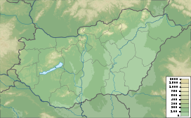
 Csóványos
Range Börzsöny, North Hungarian Mountains Coordinates 47°56′56″N 18°56′54″E / 47.94889°N 18.94833°ECoordinates: 47°56′56″N 18°56′54″E / 47.94889°N 18.94833°E Csóványos is a mountain in the Börzsöny range of the North Hungarian Mountains.[2] It has an altitude of 938 metres and spans the border of Nógrád County and Pest County.[1] This area was geologically active in the Miocene era, 18 to 19 million years ago. In the Quaternary, when volcanic activity commenced, the immediate environment of Csóványos emerged. These movements created water features, high above the forests. The forest on the mountain is dense with blue beech and Austrian oak.[3]
Contents
Geography
The mountain lies within the Ipoly River Basin, which is a transboundary river between Slovakia and Hungary with the middle and lower basin lying in Hungarian territory. The Hungarian territory of the basin covers an area of 1521 km² formed by the hills of Nograd, Cserhat and Borzsony; Borzsony includes the Csóványos[4] The Csóványos mountain peak as part of the Börzsöny Mountain ranges, lie in the Danube-Ipoly National Park in northern Hungary; the park is one of ten Hungarian national parks set up to "protect forested hills as well as riparian and lowland habitats."[5]
Flora
 Look out tower
The nearby alder forest of Drégelypalánk and the red pine forest of Diósjenő have been described as "almost mystic".[3] Common wildlife found in this area are over 100 protected species of birds, pheasants, rabbits and deer. The plant life is equally rich in the region turning lush green in spring season.[3] Blasia pusilla and Anthoceros laevis have been recorded in this region of Hungary.[6]
Trails
In the mid-1960s, the railway was developed in the area as well as mountain bike trails. It has since became a popular hiking and biking route. A 28 metre high building tower (a geodetic station) near the Peace Monument was built in 1973 and offers panoramic views of the countryside.
Literature
A poetry book A Csóványos északi oldala by Győrffy Ákos about this mountain was published in 2000, and won the Hungarian Writers' Association Gérecz Attila Prize.[7][8]
References
- ^ a b Tom Chrystal, Beáta Dósa. Walking in Hungary – 32 routes through upland areas. Cicerone. p. 69. ISBN 1 85284 352 7. http://books.google.com/books?id=bfzUJja_m1YC. Retrieved 16 April 2011.
- ^ "Börzsöny" (in Hungarian). Kirándul a család. Kirándul a család Programiroda. 1997. http://www.fsz.bme.hu/mtsz/utleiras/kcs28.htm. Retrieved 16 April 2011.
- ^ a b c Mena, Dante (30 January 2007). Adventure Guide to Hungary. Hunter Publishing, Inc. p. 258. ISBN 9781588435767. http://books.google.com/books?id=vX5bdR1BlccC&pg=PA258. Retrieved 16 April 2011.
- ^ "Iplypoly". Ministry of Environment of Hungary and Slovakia. http://docs.google.com/viewer?a=v&q=cache:ix2tQZhwruEJ:iwacportal.org/File/downloads/ipelypoly_report_no_1.pdf+Cs%C3%B3v%C3%A1nyos+UNEP&hl=en&gl=in&pid=bl&srcid=ADGEESglMwJAgAZYl1DvUhEKiI8EFNE90JEmBCfTpglUkFhmFSy-IDRlEzGumj5wN-eJW7TtooXWPmpVf0yoqRf5EqFGkggwjTaalNHfqK7m3v7LzR6CdzvSW_k5KaVYATMyv_hmdVqj&sig=AHIEtbRhMrvb-EW1VrODCbkKI2LxPjW8uA. Retrieved 17 April 2011.
- ^ "Krásy Poiplia:The Ipeľ-Valley". ipelskaunia.sk. http://www.ipelskaunia.sk/oldPage/?sid=22&lng=en&sbm=19&do=. Retrieved 17 April 2011.
- ^ Természettudományi Múzeum (Hungary) (1958) (in Magyar). Annales historico-naturales Musei Nationalis Hungarici. Nepmuvelesi propaganda iroda. p. 98. http://books.google.com/books?id=4-bRAAAAMAAJ. Retrieved 16 April 2011.
- ^ Győrffy Ákos (2005-06-02). "Önéletrajz" (in Magyar). Litera. http://www.litera.hu/irodalom/oneletrajz. Retrieved 16 April 2011.
- ^ Legeza Ilona. "Győrffy Ákos: A Csóványos északi oldala" (in Magyar). Legeza Ilona. http://legeza.oszk.hu/sendpage.php?rec=li0785. Retrieved 16 April 2011.
Categories:- Mountains of Hungary
- Nógrád County
- Pest County
- Mountains of the Western Carpathians


Wikimedia Foundation. 2010.