- Shire of Croydon
-
Shire of Croydon
Queensland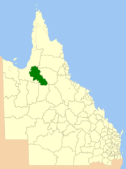
Location within QueenslandPopulation: 273(2010)[1] Established: 1887 Area: 29577.8 km² (11,420.1 sq mi) Mayor: Corrie Pickering Council Seat: Croydon Region: Far North Queensland State District: Mount Isa Federal Division: Kennedy LGAs around Shire of Croydon: Carpentaria Carpentaria Tablelands Carpentaria Shire of Croydon Etheridge McKinlay Richmond Richmond The Shire of Croydon is a Local Government Area in western Queensland, Australia. The shire, administered from the town of Croydon, covers an area of 29,577.8 square kilometres (11,420.1 sq mi), and has existed since its creation on 31 December 1887 under the Divisional Boards Act 1887. The council consists of a mayor plus four councillors, each of whom represents the entire Shire.
The Shire was originally settled as part of a gold rush in the 1880s, and at one time had a population of 7,000. At one stage a Town of Croydon was responsible for the town itself; however, this was dissolved into the Shire on 1 January 1909.[2]
Contents
Amalgamation
Croydon, like many western Local Government Areas, was not affected by amalgamations in 2007–2008, mainly because of the large geographical size and remoteness of the shire. Despite being rated as "weak" by the Financial Sustainability Review, analysis by the Local Government Commissioners revealed this to be due to factors upon which amalgamation would have no effect.
Towns and localities
- Croydon
- Blackbull
Population
Year Population 1933 318 1947 167 1954 161 1961 181 1966 162 1971 236 1976 222 1981 255 1986 324 1991 281 1996 316 2001 322 2006 255 References
- ^ Australian Bureau of Statistics (31 March 2011). "Regional Population Growth, Australia, 2009–10". http://www.abs.gov.au/ausstats/abs@.nsf/Products/3218.0~2009-10~Main+Features~Queensland?OpenDocument. Retrieved 11 June 2011.
- ^ "Order in Council". Queensland Government Gazette: p. 91:1196. 19 December 2008.
External links
- Croydon Shire Council (official site)
- University of Queensland: Queensland Places: Croydon and Croydon Shire
- Croydon's listing on Queensland LG database
Local Government Areas of Queensland South East Brisbane · Gold Coast · Ipswich · Lockyer Valley · Logan · Moreton Bay · Redland · Scenic Rim · Somerset · Sunshine CoastWide Bay-Burnett Darling Downs Central Central Highlands · Gladstone · Isaac · Mackay · Rockhampton · WoorabindaNorth Far North Aurukun · Cairns · Cassowary Coast · Cook · Hopevale · Kowanyama · Lockhart River · Mapoon · Napranum · Northern Peninsula Area · Pormpuraaw · Tablelands · Torres · Torres Strait Islands · Weipa · Wujal Wujal · YarrabahNorth West Burke · Carpentaria · Cloncurry · Croydon · Doomadgee · Etheridge · Flinders · McKinlay · Mornington · Mount Isa · RichmondCentral West South West Coordinates: 18°12′10.18″S 142°14′39″E / 18.2028278°S 142.24417°E
Categories:- Populated places established in 1887
- 1887 establishments in Australia
- Local Government Areas of Queensland
- Australian gold rushes
- Queensland geography stubs

Wikimedia Foundation. 2010.