- Crow River (Ontario)
-
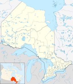
Crow River River Country Canada Ontario Ontario Region Northeastern Ontario District Nipissing Municipality Nipissing, Unorganized South Part Part of Saint Lawrence River drainage basin Source Inez Lake - location Freswick township - elevation 431 m (1,414 ft) - coordinates 45°47′58″N 78°30′59″W / 45.79944°N 78.51639°W Mouth Petawawa River - location White township - elevation 265 m (869 ft) - coordinates 45°57′31″N 78°10′56″W / 45.95861°N 78.18222°W The Crow River is a river in the Saint Lawrence River drainage basin in the Unorganized South Part of Nipissing District in northeastern Ontario, Canada.[1] The river lies entirely within Algonquin Provincial Park and is a right tributary of the Petawawa River.
Course
The river begins at Inez Lake in the geographic township of Freswick and flows south into Bower geographic township to Redrock Lake, then east to Proulx Lake and then northwest to Little Squirrel Lake and Big Squirrel Lake. It heads northeast over a series of rapids, enters Anglin geographic township and reaches Crow Bay on Lavielle Lake. The river leaves northeast over the Lake Lavielle Dam, enters White geographic township, passes over a series of rapids, turns northwest, then heads north and reaches its mouth at the Petawawa River. The Petawawa River flows via the Ottawa River to the Saint Lawrence River.
Tributaries
- Moon Creek (left)
- White Partridge Creek (right)
- Okahan Creek (left)
- Lavielle Lake
- Thomas Creek (right)
- Osprey Creek (right)
- Dickson Creek (right)
- Farncomb Creek (left)
- Abbe Creek (left)
- Woodcock Creek (left)
- Thrush Creek (left)
- Shadfly Creek (left)
- Koko Creek (right)
- Nepawin Creek (left)
- Diver Creek (right)
References
Other map sources:
- McMurtrie, Jeffrey (2008). "Algonquin Provincial Park and the Haliburton Highlands". Wikimedia Commons. http://commons.wikimedia.org/wiki/File:Algonquin_Map_2008_-_Version_1.0_-_Smaller_rs.jpg. Retrieved 2011-07-24.
- Ministry of Transportation of Ontario (2010-01-01) (PDF). Map 9 (Map). 1 : 700,000, Official road map of Ontario. http://www.mto.gov.on.ca/english/traveller/map/images/pdf/southont/sheets/Map9.pdf. Retrieved 2011-07-24.
- Ontario Ministry of Municipal Affairs and Housing (2006). Restructured municipalities - Ontario map #5 (Map). Restructuring Maps of Ontario. http://www.mah.gov.on.ca/Asset1607.aspx. Retrieved 2011-07-24.
Categories:- Rivers of Ontario
- Geography of Nipissing District, Ontario
- Northern Ontario geography stubs
Wikimedia Foundation. 2010.

