- Croome D'Abitot
-
Coordinates: 52°06′08″N 2°10′23″W / 52.102266°N 2.173062°W
Croome D'Abitot 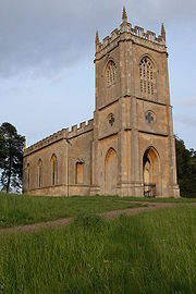
Croome D'Abitot church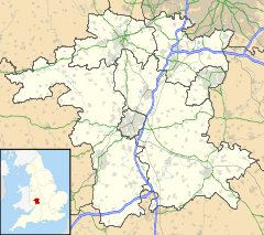
 Croome D'Abitot
Croome D'Abitot shown within WorcestershireParish Croome D'Abitot District Malvern Hills District Shire county Worcestershire Region West Midlands Country England Sovereign state United Kingdom Police West Mercia Fire Hereford and Worcester Ambulance West Midlands EU Parliament West Midlands UK Parliament West Worcestershire List of places: UK • England • Worcestershire Croome D'Abitot is a village and civil parish, which shares a joint parish council with Severn Stoke, in the Malvern Hills District in the county of Worcestershire, England. The parish church of St Mary Magdalene is situated in the grounds of Croome Court.[1]
References
- ^ Bridges, Tim Churches of Worcestershire, 2005ed Logaston Press ISBN 1904396399 p74
Categories:- Villages in Worcestershire
- Worcestershire geography stubs


Wikimedia Foundation. 2010.