- Creagerstown, Maryland
-
Creagerstown is an unincorporated community in Frederick County, Maryland, United States.[1]
The Georgian-style farmhouse Strawberry Hill is located close to Creagerstown, being located on Creagerstown Road and in Frederick County's Creagerstown Election District.[2] It was listed on the National Register of Historic Places in 1976 along with Pennterra.[3]
References
- ^ "Geographic Names Information System". Creagerstown (Populated Place). U.S. Geological Survey. 2009-01-29. http://geonames.usgs.gov/pls/gnispublic.
- ^ "Maryland Historical Trust". National Register of Historic Places: Properties in Frederick County, Strawberry Hill. Maryland Historical Trust. 2008-10-05. http://mht.maryland.gov/nr/NRDetail.aspx?HDID=362&COUNTY=Frederick&FROM=NRCountyList.aspx?COUNTY=Frederick.
- ^ "National Register Information System". National Register of Historic Places. National Park Service. 2008-04-15. http://nrhp.focus.nps.gov/natreg/docs/All_Data.html.
Municipalities and communities of Frederick County, Maryland Cities 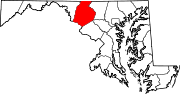
Towns Burkittsville | Emmitsburg | Middletown | Mount Airy‡ | Myersville | New Market | Thurmont | Walkersville | Woodsboro
Village CDPs Other
communitiesAdamstown | Buckeystown | Catoctin Furnace | Creagerstown | Fairhaven | Fairview | Graceham | Ijamsville | Jefferson | Johnsville | Knoxville | Ladiesburg | Lewistown | Libertytown | Lake Linganore | Monrovia | New London | New Midway | Point of Rocks | Rocky Ridge | Sabillasville | Sherwood Forest | Spoolsville | Sunny Side | Tuscarora | Unionville | Urbana | Wolfsville
Footnotes ‡This populated place also has portions in an adjacent county or counties
Categories:- Maryland geography stubs
- Populated places in Frederick County, Maryland
- Unincorporated communities in Maryland

Wikimedia Foundation. 2010.