Monteagle County

Monteagle County
Monteagle
New South Wales
Monteagle NSW.PNG
Location in New South Wales
Lands administrative divisions around Monteagle
Bland Forbes Bathurst
Bland Monteagle King
Harden Harden King

Monteagle County is one of the 141 Cadastral divisions of New South Wales.

Monteagle County was named in honour of Thomas Spring – Rice, First Baron Monteagle (1790-1866).[1]

Parishes within this county

A full list of parishes found within this county; their current LGA and mapping coordinates to the approximate centre of each location is as follows:

Parish LGA Coordinates
Baxter Young Shire 34°17′54″S 148°12′04″E / 34.29833°S 148.20111°E / -34.29833; 148.20111 (Baxter)
Bendick Murrell Young Shire 34°03′54″S 148°29′04″E / 34.065°S 148.48444°E / -34.065; 148.48444 (Bendick Murrell)
Bribaree Young Shire 34°13′05″S 148°04′45″E / 34.21806°S 148.07917°E / -34.21806; 148.07917 (Bribaree)
Brundah Weddin Shire 33°54′54″S 148°11′04″E / 33.915°S 148.18444°E / -33.915; 148.18444 (Brundah)
Bumbaldry Weddin Shire 33°54′54″S 148°30′04″E / 33.915°S 148.50111°E / -33.915; 148.50111 (Bumbaldry)
Bungalong Weddin Shire 33°59′54″S 148°20′04″E / 33.99833°S 148.33444°E / -33.99833; 148.33444 (Bungalong)
Bungalong Weddin Shire 34°00′54″S 148°20′04″E / 34.015°S 148.33444°E / -34.015; 148.33444 (Bungalong)
Burramunda Young Shire 34°08′54″S 148°13′04″E / 34.14833°S 148.21778°E / -34.14833; 148.21778 (Burramunda)
Burrangong Young Shire 34°14′54″S 148°15′04″E / 34.24833°S 148.25111°E / -34.24833; 148.25111 (Burrangong)
Coba Weddin Shire 33°59′54″S 148°15′04″E / 33.99833°S 148.25111°E / -33.99833; 148.25111 (Coba)
Cocomingla Boorowa Council 34°01′54″S 148°47′04″E / 34.03167°S 148.78444°E / -34.03167; 148.78444 (Cocomingla)
Congera Boorowa Council 34°17′54″S 148°43′04″E / 34.29833°S 148.71778°E / -34.29833; 148.71778 (Congera)
Coolegong Young Shire 34°05′54″S 148°14′04″E / 34.09833°S 148.23444°E / -34.09833; 148.23444 (Coolegong)
Cudgymaguntry Weddin Shire 33°59′54″S 148°25′04″E / 33.99833°S 148.41778°E / -33.99833; 148.41778 (Cudgymaguntry)
Dananbilla Young Shire 34°14′54″S 148°27′04″E / 34.24833°S 148.45111°E / -34.24833; 148.45111 (Dananbilla)
Geegullalong Boorowa Council 34°23′54″S 148°38′04″E / 34.39833°S 148.63444°E / -34.39833; 148.63444 (Geegullalong)
Gungewalla Boorowa Council 34°18′54″S 148°37′04″E / 34.315°S 148.61778°E / -34.315; 148.61778 (Gungewalla)
Iandra Weddin Shire 34°02′54″S 148°20′04″E / 34.04833°S 148.33444°E / -34.04833; 148.33444 (Iandra)
Illunie Young Shire 34°06′54″S 148°30′04″E / 34.115°S 148.50111°E / -34.115; 148.50111 (Illunie)
Kikiamah Young Shire 34°04′54″S 148°04′04″E / 34.08167°S 148.06778°E / -34.08167; 148.06778 (Kikiamah)
Marina Young Shire 34°19′54″S 148°24′04″E / 34.33167°S 148.40111°E / -34.33167; 148.40111 (Marina)
Murringo North Young Shire 34°14′54″S 148°30′04″E / 34.24833°S 148.50111°E / -34.24833; 148.50111 (Murringo North)
Murringo Young Shire 34°14′54″S 148°30′04″E / 34.24833°S 148.50111°E / -34.24833; 148.50111 (Murringo)
Murrungal Boorowa Council 34°22′54″S 148°46′04″E / 34.38167°S 148.76778°E / -34.38167; 148.76778 (Murrungal)
Narrallen Boorowa Council 34°11′54″S 148°39′04″E / 34.19833°S 148.65111°E / -34.19833; 148.65111 (Narrallen)
Rossi Boorowa Council 34°06′54″S 148°43′04″E / 34.115°S 148.71778°E / -34.115; 148.71778 (Rossi)
Thuddungara Young Shire 34°13′54″S 148°09′04″E / 34.23167°S 148.15111°E / -34.23167; 148.15111 (Thuddungara)
Tyagong Weddin Shire 34°02′54″S 148°15′04″E / 34.04833°S 148.25111°E / -34.04833; 148.25111 (Tyagong)
Wambanumba Young Shire 34°10′54″S 148°28′04″E / 34.18167°S 148.46778°E / -34.18167; 148.46778 (Wambanumba)
Weddin Weddin Shire 33°59′54″S 148°05′04″E / 33.99833°S 148.08444°E / -33.99833; 148.08444 (Weddin)
Willawong Young Shire 34°21′54″S 148°30′04″E / 34.365°S 148.50111°E / -34.365; 148.50111 (Willawong)
Wilton Young Shire 34°08′54″S 148°18′04″E / 34.14833°S 148.30111°E / -34.14833; 148.30111 (Wilton)
Woodonga Young Shire 34°14′54″S 148°22′04″E / 34.24833°S 148.36778°E / -34.24833; 148.36778 (Woodonga)
Yambira Weddin Shire 33°52′54″S 148°20′04″E / 33.88167°S 148.33444°E / -33.88167; 148.33444 (Yambira)
Young Young Shire 34°18′54″S 148°17′04″E / 34.315°S 148.28444°E / -34.315; 148.28444 (Young)
Yundoo Boorowa Council 34°13′54″S 148°44′04″E / 34.23167°S 148.73444°E / -34.23167; 148.73444 (Yundoo)

References


Wikimedia Foundation. 2010.

Игры ⚽ Поможем решить контрольную работу

Look at other dictionaries:

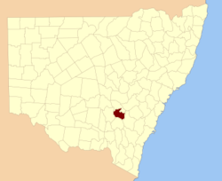
  • Monteagle County, New South Wales — Infobox Australian cadastral name = Monteagle state = New South Wales caption = Location in New South Wales near nw = Bland near n = Forbes near ne = Bathurst near e = King near se = King near s = Harden near sw = Harden near w = BlandMonteagle… …   Wikipedia

  • Monteagle, Tennessee —   Town   Location of Monteagle, Tennessee …   Wikipedia

  • Monteagle Mountain — is the local name given to a stretch of Interstate 24 near Monteagle, Tennessee that passes over the Cumberland Plateau. Being part of the plateau, it is not technically a mountain, but appears that way to motorists crossing over it. It is… …   Wikipedia

  • Monteagle Sunday School Assembly — The Monteagle Sunday School Assembly, or MSSA, is a church. Its Charter, which was granted by the State of Tennessee on October 31, 1882, states the purpose (mission) of the Assembly: the advancement of science, literary attainment, Sunday School …   Wikipedia

  • National Register of Historic Places listings in Grundy County, Tennessee — Location of Grundy County in Tennessee This is a list of the National Register of Historic Places listings in Grundy County, Tennessee. This is intended to be a complete list of the properties and districts on the National Register of Historic… …   Wikipedia

  • Marion County, Tennessee — For counties with a similar name, see Marion County (disambiguation). Coordinates: 35°08′N 85°37′W / 35.13°N 85.61°W / …   Wikipedia

  • Baron Monteagle — or Baron Mount Eagle is a title that has been created three times, once in the Peerage of England, once in the Peerage of Ireland and once in the Peerage of the United Kingdom.The first creation came in the Peerage of England in 1514 when Edward… …   Wikipedia

  • Thomas Spring Rice, 1st Baron Monteagle of Brandon — Thomas Spring Rice, 1st Baron Monteagle of Brandon, PC, FRS (8 February, 1790 7 February 1866) was a British Whig politician. He served as Chancellor of the Exchequer from 1835 to 1839. Spring Rice was the son of Stephen Edward Rice of Mount… …   Wikipedia

  • Baron Monteagle of Brandon — Baron Monteagle of Brandon, in the County of Kerry, is a title in the Peerage of the United Kingdom. It was created in 1839 for the Whig politician Thomas Spring Rice. As of 2006 the title is held by his great great grandson, the sixth Baron, who …   Wikipedia

  • National Register of Historic Places listings in Marion County, Tennessee — Location of Marion County in Tennessee This is a list of the National Register of Historic Places listings in Marion County, Tennessee. This is intended to be a complete list of the properties and districts on the National Register of Historic… …   Wikipedia

Share the article and excerpts

Direct link
Do a right-click on the link above
and select “Copy Link”