Gresham County

Gresham County
Gresham
New South Wales
Gresham NSW.PNG
Location in New South Wales
Lands administrative divisions around Gresham
Clive Drake Clarence
Gough Gresham Fitzroy
Clarke Clarke Fitzroy

Gresham County is one of the 141 Cadastral divisions of New South Wales.

Gresham County was named in honour of the London merchant, Sir Thomas Gresham (1519–1579).[1] It is located to the south of parts of the Mann River, Nymboida River and Clarence River. It includes parts of the Guy Fawkes River National Park.

Parishes within this county

A full list of parishes found within this county; their current LGA and mapping coordinates to the approximate centre of each location is as follows:

Parish LGA Coordinates
Alder Clarence Valley Council 29°59′54″S 152°36′04″E / 29.99833°S 152.60111°E / -29.99833; 152.60111 (Alder)
Barool Clarence Valley Council 29°41′54″S 152°19′04″E / 29.69833°S 152.31778°E / -29.69833; 152.31778 (Barool)
Boyd Clarence Valley Council 29°49′54″S 152°32′04″E / 29.83167°S 152.53444°E / -29.83167; 152.53444 (Boyd)
Braylesford Clarence Valley Council 29°34′54″S 152°36′04″E / 29.58167°S 152.60111°E / -29.58167; 152.60111 (Braylesford)
Broadmeadows Clarence Valley Council 29°51′54″S 152°21′04″E / 29.865°S 152.35111°E / -29.865; 152.35111 (Broadmeadows)
Buccarumbi Clarence Valley Council 29°49′54″S 152°37′04″E / 29.83167°S 152.61778°E / -29.83167; 152.61778 (Buccarumbi)
Camelback Clarence Valley Council 29°24′54″S 152°31′04″E / 29.415°S 152.51778°E / -29.415; 152.51778 (Camelback)
Chaelundi Clarence Valley Council 30°02′54″S 152°20′04″E / 30.04833°S 152.33444°E / -30.04833; 152.33444 (Chaelundi)
Chandler Clarence Valley Council 30°01′54″S 152°24′04″E / 30.03167°S 152.40111°E / -30.03167; 152.40111 (Chandler)
Cowan Clarence Valley Council 29°40′54″S 152°28′04″E / 29.68167°S 152.46778°E / -29.68167; 152.46778 (Cowan)
Cunglebung Clarence Valley Council 29°44′54″S 152°31′04″E / 29.74833°S 152.51778°E / -29.74833; 152.51778 (Cunglebung)
Dalmorton Clarence Valley Council 29°45′54″S 152°29′04″E / 29.765°S 152.48444°E / -29.765; 152.48444 (Dalmorton)
Glen Nevis Glen Innes Severn Council 29°54′54″S 152°14′04″E / 29.915°S 152.23444°E / -29.915; 152.23444 (Glen Nevis)
Grafton Clarence Valley Council 30°05′54″S 152°24′04″E / 30.09833°S 152.40111°E / -30.09833; 152.40111 (Grafton)
Grange Clarence Valley Council 29°26′54″S 152°35′04″E / 29.44833°S 152.58444°E / -29.44833; 152.58444 (Grange)
Henry Clarence Valley Council 29°48′54″S 152°14′04″E / 29.815°S 152.23444°E / -29.815; 152.23444 (Henry)
Jackadgery Clarence Valley Council 29°40′54″S 152°33′04″E / 29.68167°S 152.55111°E / -29.68167; 152.55111 (Jackadgery)
Kaloe Clarence Valley Council 29°29′54″S 152°30′04″E / 29.49833°S 152.50111°E / -29.49833; 152.50111 (Kaloe)
Marara Clarence Valley Council 29°53′54″S 152°36′04″E / 29.89833°S 152.60111°E / -29.89833; 152.60111 (Marara)
Marara West Clarence Valley Council 29°53′54″S 152°32′04″E / 29.89833°S 152.53444°E / -29.89833; 152.53444 (Marara West)
Marengo Clarence Valley Council 29°56′54″S 152°20′04″E / 29.94833°S 152.33444°E / -29.94833; 152.33444 (Marengo)
Newbold Clarence Valley Council 29°31′54″S 152°36′04″E / 29.53167°S 152.60111°E / -29.53167; 152.60111 (Newbold)
Newton Boyd Glen Innes Severn Council 29°47′54″S 152°10′04″E / 29.79833°S 152.16778°E / -29.79833; 152.16778 (Newton Boyd)
Nullama Clarence Valley Council 29°54′54″S 152°25′04″E / 29.915°S 152.41778°E / -29.915; 152.41778 (Nullama)
Oakwood Glen Innes Severn Council 29°52′54″S 152°06′04″E / 29.88167°S 152.10111°E / -29.88167; 152.10111 (Oakwood)
Sara Glen Innes Severn Council 29°58′54″S 152°06′04″E / 29.98167°S 152.10111°E / -29.98167; 152.10111 (Sara)
Springbrook Clarence Valley Council 29°46′54″S 152°23′04″E / 29.78167°S 152.38444°E / -29.78167; 152.38444 (Springbrook)
Stanley Clarence Valley Council 30°04′54″S 152°31′04″E / 30.08167°S 152.51778°E / -30.08167; 152.51778 (Stanley)
Sturt Clarence Valley Council 30°01′54″S 152°32′04″E / 30.03167°S 152.53444°E / -30.03167; 152.53444 (Sturt)
Urania Clarence Valley Council 29°46′54″S 152°19′04″E / 29.78167°S 152.31778°E / -29.78167; 152.31778 (Urania)
Wellington Clarence Valley Council 29°41′54″S 152°24′04″E / 29.69833°S 152.40111°E / -29.69833; 152.40111 (Wellington)
Willy Glen Innes Severn Council 29°54′54″S 152°03′04″E / 29.915°S 152.05111°E / -29.915; 152.05111 (Willy)
Worra Glen Innes Severn Council 29°58′54″S 151°59′04″E / 29.98167°S 151.98444°E / -29.98167; 151.98444 (Worra)

References


Wikimedia Foundation. 2010.

Игры ⚽ Нужен реферат?

Look at other dictionaries:

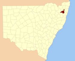
  • Gresham County, New South Wales — Infobox Australian cadastral name = Gresham state = New South Wales caption = Location in New South Wales near nw = Clive near n = Drake near ne = Clarence near e = Fitzroy near se = Fitzroy near s = Clarke near sw = Clarke near w = GoughGresham… …   Wikipedia

  • Gresham-Barlow School District — Gresham School District is a school district in the U.S. state of Oregon. It serves the cities of Boring, Damascus and Gresham. Contents 1 Demographics 2 Elementary schools 3 Middle schools …   Wikipedia

  • Gresham (Oregon) — Gresham Winter in Gresham Lage in Oregon …   Deutsch Wikipedia

  • Gresham (Nebraska) — Gresham Lage in Nebraska …   Deutsch Wikipedia

  • Gresham Middle School (Tennessee) — Gresham Middle School is a grades 6 8 middle school in the Fountain City neighborhood of Knoxville, Tennessee. Its enrollment is approximately 1,000 students from ages 10 14. The school s motto is It s all about YOU! HistoryGresham Middle School… …   Wikipedia

  • Gresham — may refer to:*Gresham s Law Places *Gresham, Norfolk *Gresham Park, Georgia *Gresham, Illinois *Gresham, Nebraska (York County) *Gresham, Oregon *Gresham, Wisconsin Educational Establishments *Gresham s School, Norfolk, England *Gresham College,… …   Wikipedia

  • Gresham Pioneer Cemetery — Gresham Pioneer Cemetery, founded in 1859, lies on the east side of Southwest Walters Road in Gresham, Oregon, United States. The cemetery is bordered by the Springwater Corridor Trail and Johnson Creek on the south and by Escobar Cemetery,… …   Wikipedia

  • Gresham's School — Infobox UK school name = Gresham s School size = 140px latitude = longitude = dms = motto = Al Worship Be to God Only motto pl = established = 1555 approx = closed = c approx = type = Independent religion = Church of England president = head… …   Wikipedia

  • Gresham, Oregon — Infobox Settlement official name = Gresham, Oregon settlement type = City nickname = motto = imagesize = 250px image caption = Downtown Gresham at NE Roberts St and Powell Blvd. image image mapsize = 250px map caption = Location in Oregon… …   Wikipedia

  • Gresham Police Department — Infobox Police Department name = Gresham Police Department motto = established = sworn = jurisdiction = City of Gresham stations = Gresham Police Station non sworn = CSO = jails = None, jails run by County Sheriff helicopters = airplanes = None… …   Wikipedia

Share the article and excerpts

Direct link
Do a right-click on the link above
and select “Copy Link”