- County Bridge No. 36
-
County Bridge No. 36
 County Bridge No. 36, 1982
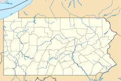

Location: TR 611 over Jacoby Creek, Portland, Pennsylvania Coordinates: 40°55′7″N 75°5′37″W / 40.91861°N 75.09361°WCoordinates: 40°55′7″N 75°5′37″W / 40.91861°N 75.09361°W Area: less than one acre Built: 1907 Architectural style: Other, Reinforced concrete arch Governing body: State MPS: Highway Bridges Owned by the Commonwealth of Pennsylvania, Department of Transportation TR NRHP Reference#: 88000877[1] Added to NRHP: June 22, 1988 County Bridge No. 36 is a historic concrete arch bridge spanning Jacoby Creek at Portland, Northampton County, Pennsylvania. It was built in 1907, and is a small, single arched bridge with a span measuring 28 feet. It features an incised keystone and a simply ornamented, continuous concrete parapet.[2]
It was added to the National Register of Historic Places in 1988.[1]
References
- ^ a b "National Register Information System". National Register of Historic Places. National Park Service. 2010-07-09. http://nrhp.focus.nps.gov/natreg/docs/All_Data.html.
- ^ ""National Historic Landmarks & National Register of Historic Places in Pennsylvania"" (Searchable database). CRGIS: Cultural Resources Geographic Information System. https://www.dot7.state.pa.us/ce/SelectWelcome.asp. Note: This includes R.J. Baransky (August 1982). "National Register of Historic Places Inventory Nomination Form: County Bridge No. 36" (PDF). https://www.dot7.state.pa.us/ce_imagery/phmc_scans/H000303_01D.pdf. Retrieved 2011-10-29.
Bridges and tunnels on the National Register of Historic Places Alabama · Alaska · Arizona · Arkansas · California · Colorado · Connecticut · Delaware · Florida · Georgia · Guam · Hawaii · Idaho · Illinois · Indiana · Iowa · Kansas · Kentucky · Louisiana · Maine · Maryland · Massachusetts · Michigan · Minnesota · Mississippi · Missouri · Montana · Nebraska · Nevada · New Hampshire · New Jersey · New Mexico · New York · North Carolina · North Dakota · Ohio · Oklahoma · Oregon · Pennsylvania (covered) · Puerto Rico · Rhode Island · South Carolina · South Dakota · Tennessee · Texas · Utah · Vermont · Virginia · Washington · Washington, D.C. · West Virginia · Wisconsin · Wyoming
Categories:- Bridges on the National Register of Historic Places in Pennsylvania
- Bridges completed in 1907
- Bridges in Northampton County, Pennsylvania
- Pennsylvania Registered Historic Place stubs


Wikimedia Foundation. 2010.