- Oro-Medonte
-
Oro-Medonte — Township — Rural scene near Mount St. Louis
Motto: Proud Heritage, Exciting Future Location of Oro-Medonte, Ontario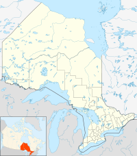
 Oro-Medonte
Coordinates: 44°34′N 79°35′W / 44.567°N 79.583°WCoordinates: 44°34′N 79°35′W / 44.567°N 79.583°W Country  Canada
Province  Ontario
County Simcoe Incorporated 1994 Government – Mayor Harry Hughes – Governing Body – MPs Bruce Stanton – MPPs Garfield Dunlop Area – Total 586.65 km2 (226.5 sq mi) Population (2006) – Total 20,031 – Density 34.1/km2 (88.3/sq mi) Time zone Eastern (EST) (UTC-5) – Summer (DST) EDT (UTC-4) Postal code span Area code(s) 705 Website www.oro-medonte.ca Oro-Medonte is a township in south-central Ontario, Canada on the northwestern shores of Lake Simcoe in Simcoe County.
The two neighbouring townships of Oro and Medonte were merged together in 1994, under a restructuring of Simcoe County. It is divided into lines based on the concession system implemented by the British colonial government in the mid-18th century. Currently there are 15 lines that are now streets and highway exits off Highway 11.
Contents
Communities
The township comprises the communities of Barrillia Park, Bass Lake Park, Baywood Park, Big Cedar Estates, Carley, Carthew Bay, Cedarmont Beach, Coulson, Craighurst, Creighton, Crown Hill, Eady, East Oro, Edgar, Eight Mile Point, Fair Valley, Fergus Hill Estate, Forest Home, Foxmead, Guthrie, Hawkestone, Hawkestone Beach, Hobart, Horseshoe Valley, Jarratt, Lakeview, Marchmont, Martinville, Mitchell Square, Moons Beach, Moonstone, Mount St. Louis, Oro Beach, Oro Lea Beach, Oro Park, Oro Station, Palm Beach, Parkside Beach, Prices Corners, Roberta Park, Rugby, Shanty Bay, Simcoeside, Sugar Bush, Waddington Beach and Warminster.
History
First Nations had long established encampments and trails on the bank of Hawkestone Creek, Ridge Road, Mount St. Louis, and throughout the Township of Oro-Medonte. In the 1830s Richard Hodges established a landing for settlers, mainly from the British Isles, who after arriving by lake steamer, on Lake Simcoe, followed these trails to their settlement in search of independence and land ownership.
Craighurst started as a small community on the Penetanguishene Road in the 1830s. Its post office was established in the 1850s, at its peak in the late 19th century, Craighurst had 4 hotels, three churches, and a school house.
A thriving community of a tavern, hotel, store and the first post office was located near the lake east of the creek at Hodges' Landing. The first postmaster was Charles Bell. Two dams and 3 mills sawed logs and ground grains. It is thought that the first mill was established by John Williamson who subsequently built the large brick house on the North-East corner of the Ridge Road and Line No. 11 South. In 1856 a new wharf was constructed and the name was changed from Hodges' Landing to Hawkestone.
The establishment of Shanty Bay was strongly influenced by the Underground Railroad. Many African-American refugees first settled near the water in shanties (small homes), contributing toward the name of the village. Lucius Richard O'Brien (1832–1899), the noted oil and watercolour landscape painter was from Shanty Bay. His father founded the village.[1] Shanty Bay also has one of Canada's oldest surviving churches, St. Thomas Anglican Church, built between 1838 and 1841 and dedicated in 1842.
In 1866–67 a drill-shed was erected in East Oro by the Oro Company, 35th Battalion the Simcoe Foresters. At this time when the Fenian raids were alarming the country, eight company drill-sheds where built in Simcoe County, the county paying $390 and the government $250 for each. The company was manned by pioneer men of Oro, local Wm.E. O'Brien of Shanty Bay became Lieutenant Colonel of the Battalion in 1882. This building served Oro Company until the turn of the century and was dismantled around 1918.
During 1871 the railroad reached Hawkestone. An extensive "station" evolved with a freight shed, stockyards and a massive water tower to supply the requirements of the steam locomotives. Many types of products were shipped out and supplies shipped in. Another branch of the Canadian Pacific Railway was built through Craighurst in the early 20th century, opening from Bolton to Craighurst in November 1906, when a station was opened. On July 19, 1907 the track was extended to Bala and by June 1908, the line was completed to Sudbury. This is now part of the railway's main line between the east and west.
Edgar was the site of a cold war radar site from 1952 to 1964.[2]
In 1959 the Ukrainian National Federation (UNF) purchased the "Pugsley Farm" property located on the East half of Lot 23 and Lot 24 in Hawkestone. The 200 acres (0.81 km2) were developed into a large recreation area and children's camp where members of the UNF and their families have spent their summers on the shores of Lake Simcoe. A portion of the property was subdivided into 100 lots of 0.5 acres (0.0020 km2) and sold to members of the UNF who built summer homes and cottages adjacent to the UNF. The entire property was named "Sokil", which is the Ukrainian word for "Hawk" in reference to the village of Hawkestone where the community was established. Today the private subdivision is maintained by the Sokil Property Owners Association, which manages the non-municipal water system, roads and other related issues. The UNF still maintains the recreation area and children's camp, where three children's summer camps run throughout the summer, as well as weekend overnight camping area, seasonal cabin rentals and a seasonal trailer park. St. John the Baptist Ukrainian Catholic chapel also conducts services each Sunday throughout the summer season.
Underground Railroad history

Oro Township got its name from a the Spanish name of the Gold Coast of Ghana in Africa, where many of the enslaved were taken from. In the early 19th century the Underground Railroad had escaped slaves from the southern USA make their way into Simcoe County. The government set aside a tract of land in Oro Township for the fugitives. African Americans were given farms on the 2nd line called Wilberforce Street. It was named after the British champion for the freedom of the slaves. This occurred between 1819–1831.
Oro was intended to settle Black Loyalist refugees after the War of 1812. Black veterans who could be mustered to meet hostile forces coming from Georgian Bay were offered land grants. Among them were veterans of Captain Runchey's Company for Coloured Men, which fought at Stoney Creek, Queenston Heights, Lundy's Lane and St. Davids. Oro settlers also included free persons and the formerly enslaved.
Some of the black families found the land unsuitable for farming and drifted to nearby towns. Many ended up at Shanty Bay, NE of Barrie on Lake Simcoe. Here they built small wooden cottages called "shanties" near the lake. The allotted area went from Lake Simcoe north for 3 concessions from Shanty Bay along the 2nd Line. The Oro African Methodist Church near Edgar served their religious needs.
One of the chief Canadian agitators against the American slave trade was Captain Charles Stuart. He retired in 1850 to a farm near Thornbury, Ontario, after helping many runaway slaves. His home was at Lora Bay on Georgian Bay where he refused to allow any usage of products made by slave labour.
Government
The township council is composed of a mayor, deputy mayor, and five councillors who each represent one of five wards. The members of council[4] from the elections of 2010 through 2014 are:
- Mayor: Harry Hughes
- Deputy Mayor: Ralph Hough
- Councillor Ward 1: Mel Coutanche
- Councillor Ward 2: Kelly Meyer
- Councillor Ward 3: Marty Lancaster
- Councillor Ward 4: John Crawford
- Councillor Ward 5: Dwight Evans
The mayor and deputy mayor also represent the township at meetings of Simcoe County Council.
Recreation
 Mount St. Louis Moonstone ski resort
The last Canadian National train passed through in September 1996. In 1998 the railway land through the township was acquired by council for a shared-use recreational trail stretching from Barrie to Orillia. Sections are used in the winter season by the Ontario Federation of Snowmobile Clubs.
Bass Lake Provincial Park and the Copeland Forest Resources Management Area are located within the township. Three major ski resorts, Mount St. Louis Moonstone, Horseshoe Resort, and Hardwood Ski and Bike, are also located within Oro-Medonte.
Transportation
Highway 400, Highway 11 and Highway 12 pass through Oro-Medonte. Penetanguishene Road, a historic colonization road and a former part of Highway 93, defines most of Oro-Medonte's boundary with the neighbouring township of Springwater.
The Lake Simcoe Regional Airport is located in the township near the community of Guthrie.
Population
According to the 2006 Statistics Canada Census:
- Population: 20,031 (18,315)
- % Change (2001–2006): 9.4
- % Change (1996–2001): 9.7
- Dwellings (Homes): 7,667
- Area (km².): 586.65
- Density (persons per km².): 34.1
References
- ^ Reid, Dennis. A Concise History of Canadian Painting. 2nd Edition. Toronto: Oxford University Press, 1988. ISBN 019540663X.
- ^ Directions to Edgar
- ^ Oro African Methodist Episcopal Church National Historic Site. Canadian Register of Historic Places.
- ^ Township of Oro-Medonte
External links

Tay Severn Orillia Springwater 
Lake Simcoe  Oro-Medonte

Barrie Kempenfelt Bay of Lake Simcoe /
InnisfilCities 1 Towns Bradford West Gwillimbury • Collingwood • Innisfil • Midland • New Tecumseth • Penetanguishene • Wasaga BeachTownships First Nations reserves Christian Island 30 • Christian Island 30A • Mnjikaning First Nation 32See also: Communities in Simcoe County • Census divisions of Ontario
1 Separated municipalities but remain a census subdivision of the countyCategories:- Municipalities in Simcoe County, Ontario
- Township municipalities in Ontario


Wikimedia Foundation. 2010.