- Cormorant Rock (Essex County, Massachusetts)
-
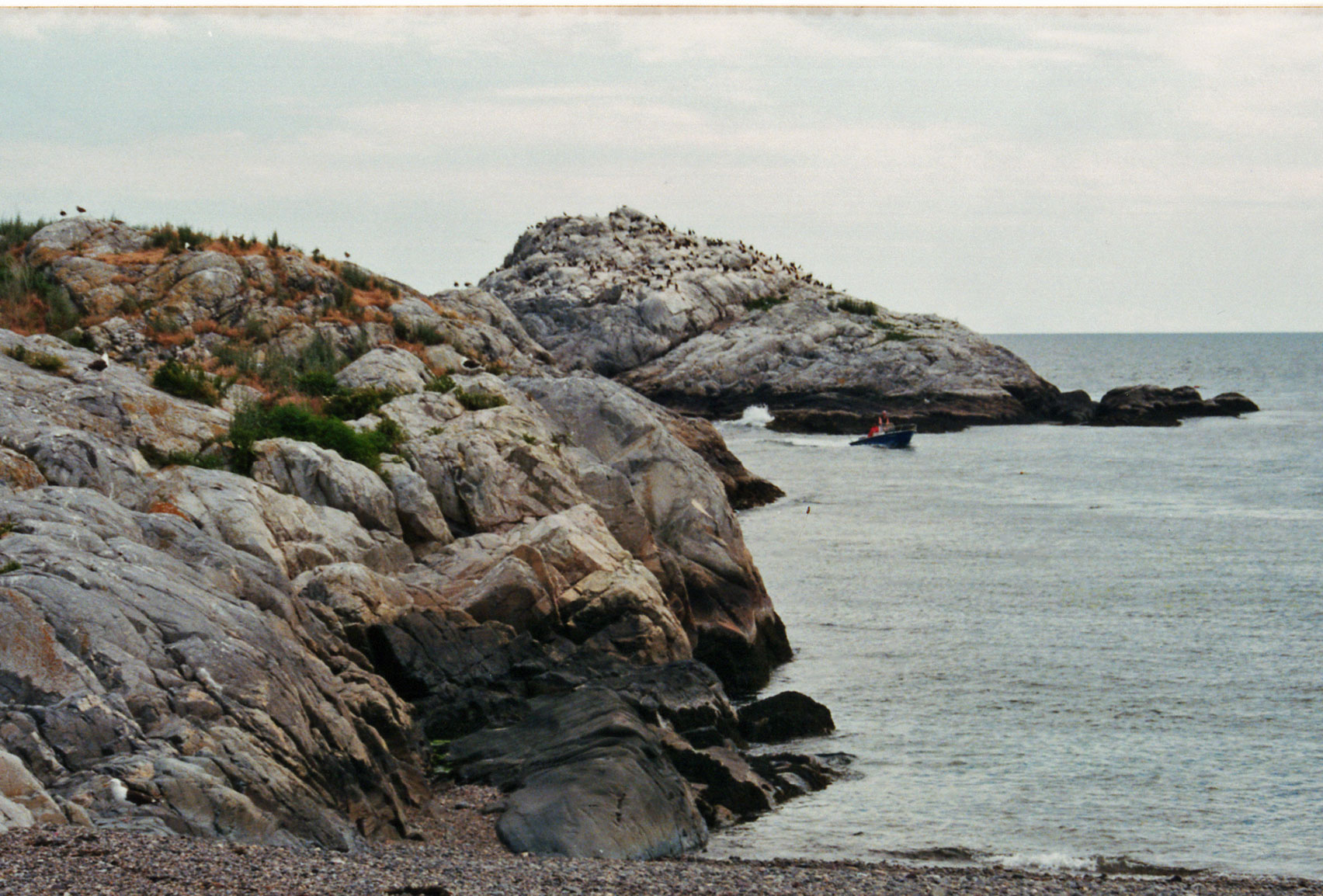
 View of Cormorant Rock from Wally Beach on Children's Island
 1808 engraving on top of Cormorant Rock
Cormorant Rock is a small island about 300 feet off the southeastern tip of Children's Island just outside of Marblehead Harbor, at latitude 42.510ºN, longitude 70.812ºW.[1] Formerly known as Cat Island Rock and Eastern Rock of Cat Island, it is considered to be a part of Children's Island and was the location of a navigational spar erected in 1808 by the Marblehead Marine Society.
For many years, local mariners petitioned for navigational markers to be placed on rocks and islands surrounding Marblehead and Salem harbors, as Reverend Williams Bentley notes in his diary on July 23, 1806: "Marblehead will petition for...eastern rock of Cat Island, & [other nearby rocks]...a poplar [has been planted] on Marblehead rock having found a depth of soil in a spot of 5 feet. Eastern rock of Cat Island admits trees also and three have been planted"[2] and again on Jan 29, 1807: "the Town have had a meeting upon the subject of the petition to the General Court from Marblehead to grant to their marine Society the Islands laying off that Town...They ask for E. Rock of Cat Island, [other nearby rocks]..."[3]
It appears that a navigational beacon was erected on the rock according to the 9th (1817) edition of the American Coast Pilot "the Marblehead Marine Society has erected on Cat island rock, a spar 40 feet high, to the top of which is annexed a cask of about 130 gallons measure, which is seen at sea 20 or 30 feet above the land"[4], which was not mentioned in the 5th (1806) edition. At the top of the rock, a date of 1808 is engraved, but no evidence of a structure exists today.[5] This is the likely date and location of the spar described.
References
Coordinates: 42°30′28.51″N 70°48′43.32″W / 42.5079194°N 70.8120333°W
Categories:- Islands of Essex County, Massachusetts
- Massachusetts geography stubs

Wikimedia Foundation. 2010.