- Conning Towers-Nautilus Park, Connecticut
-
Conning Towers-Nautilus Park is a census-designated place (CDP) in the town of Groton in New London County, Connecticut, United States. The population was 10,241 at the 2000 census. The statistical area consists of the portion of the town in the vicinity of Route 12 and includes Naval Submarine Base New London.
Geography
According to the United States Census Bureau, the CDP has a total area of 14.5 km² (5.6 mi²). 12.9 km² (5.0 mi²) of it is land and 1.6 km² (0.6 mi²) of it (10.91%) is water.
Demographics
As of the census[1] of 2000, there were 10,241 people, 2,660 households, and 2,420 families residing in the CDP. The population density was 794.0/km² (2,055.1/mi²). There were 2,822 housing units at an average density of 218.8/km² (566.3/mi²). The racial makeup of the CDP was 81.31% White, 9.62% African American, 0.57% Native American, 2.32% Asian, 0.32% Pacific Islander, 2.29% from other races, and 3.56% from two or more races. Hispanic or Latino of any race were 6.20% of the population.
There were 2,660 households out of which 67.2% had children under the age of 18 living with them, 83.5% were married couples living together, 5.6% had a female householder with no husband present, and 9.0% were non-families. 7.1% of all households were made up of individuals and 1.8% had someone living alone who was 65 years of age or older. The average household size was 3.30 and the average family size was 3.45.
In the CDP the population was spread out with 34.4% under the age of 18, 19.4% from 18 to 24, 38.5% from 25 to 44, 4.2% from 45 to 64, and 3.5% who were 65 years of age or older. The median age was 24 years. For every 100 females there were 124.2 males. For every 100 females age 18 and over, there were 136.9 males.
The median income for a household in the CDP was $40,033, and the median income for a family was $38,043. Males had a median income of $29,297 versus $25,280 for females. The per capita income for the CDP was $14,216. About 4.1% of families and 4.7% of the population were below the poverty line, including 5.7% of those under age 18 and 6.2% of those age 65 or over.
References
- ^ "American FactFinder". United States Census Bureau. http://factfinder.census.gov. Retrieved 2008-01-31.
Municipalities and communities of New London County, Connecticut Consolidated cities 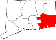
Towns Non-consolidated city Boroughs Unincorporated
communitiesBaltic | Burnetts Corner | Conning Towers-Nautilus Park | Gales Ferry | Graniteville | Greeneville | Groton Long Point | Jordan | Long Hill | Lords Point | Mystic | Niantic | Noank | Norwichtown | Old Mystic | Oswegatchie | Oxoboxo River | Pawcatuck | Poquetanuck | Poquonock Bridge | Preston City | Quaker Hill | Taftville | Uncasville
Coordinates: 41°22′59″N 72°04′22″W / 41.38306°N 72.07278°W
Categories:- Census-designated places in New London County, Connecticut
- Neighborhoods in Connecticut

Wikimedia Foundation. 2010.