- Coll Airport
-
Coll Island Airport IATA: COL – ICAO: EGEL Summary Operator Argyll and Bute Council Serves Isle of Coll Location Isle of Coll, Inner Hebrides, Scotland Elevation AMSL 21 ft / 6 m Coordinates 56°36′07″N 006°37′04″W / 56.60194°N 6.61778°WCoordinates: 56°36′07″N 006°37′04″W / 56.60194°N 6.61778°W Map Location on Coll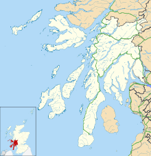
 EGEL
EGELRunways Direction Length Surface ft m 02/20 1,640 500 Asphalt Source: Source: UK AIP at NATS[1] Coll Island Airport (IATA: COL, ICAO: EGEL)[2] is located 5 NM (9.3 km; 5.8 mi) west southwest of Arinagour[1] on the Isle of Coll in the Inner Hebrides.[2] Highland Airways who originally operated the route to Oban went into administration in 2010,[3] but a new operator, Hebridean Air Services now operates the route under a PSO[clarification needed] with flights to Oban, Tiree and Colonsay. The aircraft used for the flights are a Britten-Norman Islander (G-HEBS). Hebridean headquarters are at Cumbernauld Airport, North Lanarkshire
Airlines and destinations
Airlines Destinations Hebridean Air Services Oban, Tiree References
- ^ a b Coll - EGEL
- ^ a b Isle Of Coll (COL) - Airport details
- ^ "Highland Airways goes into administration". BBC News Online. 25 March 2010. http://news.bbc.co.uk/2/hi/uk_news/scotland/highlands_and_islands/8586688.stm. Retrieved 25 March 2010.
Categories:- Airports in Scotland
- Inner Hebrides
- United Kingdom airport stubs

Wikimedia Foundation. 2010.