- Coimbatore District (Madras Presidency)
-
Coimbatore district was one of the districts of the erstwhile Madras Presidency of British India. It covered the areas of the present-day districts of Coimbatore, Erode and Tirupur and the Kollegal taluk of present-day Karnataka. It covered a total area of 7,860 square miles (20,400 km2) and was sub-divided into 10 taluks. The administrative headquarters was the Coimbatore city.
Coimbatore was a part of the ancient Chera kingdom during the Sangam Age. After the Chera kingdom fell, the region was ruled by the Western Gangas and the Hoysalas. Coimbatore came under Muslim rule in the 13th century AD and was a province of the Vijayanagar Empire. After the fall of the Vijayanagar Empire, Coimbatore was ruled by independent polygars and was conquered and ruled by Tipu Sultan. On the defeat of Tipu Sultan in the Third Mysore War in 1792, Coimbatore became a part of British India. Most of Coimbatore's inhabitants were Tamil-speaking but there are also large numbers of Malayalam, Telugu and Kannada speaking people.
Taluks
Coimbatore was sub-divided into 10 taluks:
- Bhavani (Area: 715 square miles (1,850 km2); Headquarters: Bhavani)
- Coimbatore (Area: 812 square miles (2,100 km2); Headquarters: Coimbatore)
- Dharapuram (Area: 853 square miles (2,210 km2); Headquarters: Dharapuram)
- Erode (Area: 598 square miles (1,550 km2); Headquarters: Erode)
- Karur (Area: 612 square miles (1,590 km2); Headquarters: Karur)
- Kollegal (Area: 1,076 square miles (2,790 km2); Headquarters: Kollegal)
- Palladam (Area: 741 square miles (1,920 km2); Headquarters: Palladam)
- Pollachi (Area: 710 square miles (1,800 km2); Headquarters: Pollachi)
- Satyamangalam (Area: 1,177 square miles (3,050 km2); Headquarters: Gobichettipalayam)
- Udamalpet (Area: 566 square miles (1,470 km2); Headquarters: Udamalpet)
Administration
Coimbatore was divided into 4 sub-divisions:
- Coimbatore sub-division: Coimbatore and Sathyamangalam taluks
- Erode sub-division: Bhavani, Dharapuram, Erode and Karur taluks
- Kollegal sub-division: Kollegal taluk
- Pollachi sub-division: Pollachi, Palladam and Udumalpet
Sources
- The Imperial Gazetteer of India, Volume 10. London: Clarendon Press. 1908.
Coimbatore district District Headquarters 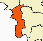 -->
-->Country State Region Taluks Blocks Anamalai · Annur · Karamadai · Kinathukadavu · Madukkarai · Periyanayakkanpalayam · Pollachi(North) · Pollachi(South) · Sarcarsamakulam ·
Sultanpet · Sulur · Thondamuthur ·Municipal Corporations Municipalities Goundampalayam · Kuniyamuthur · Kurichi · Mettupalayam · Nallur · Palladam · Pollachi · Udumalaipettai · Valparai · VelampalayamRivers History Chera Dynasty · Kalabhras · Western Ganga Dynasty · Medieval Cholas · Later Cholas · Later Pandyas · Hoysalas · Delhi Sultanate · Madurai Sultanate · Vijayanagar Empire · Mysore Kingdom · Company Raj · British RajPlaces of interest Aliyar Reservoir · Amaravathi Dam · Black Thunder · G. D. Naidu Industrial Exhibition · Indira Gandhi Wildlife Sanctuary and National Park · Mazhani Amman Temple · Monkey Falls · Patteeswarar Temple, Perur · Sengupathi Falls · Siruvani Waterfalls · Subrahmanya Swamy Temple, Marudamalai · Thirumurthyswami temple · Valparai · Vaideki FallsUniversities Cities and towns · People · Villages
Categories:

Wikimedia Foundation. 2010.