- Coal Clough Wind Farm
-
Coal Clough Wind Farm 
Coal Clough Wind FarmLocation of Coal Clough Wind Farm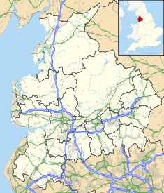

Country England, United Kingdom Location Burnley, Lancashire, North West England Coordinates 53°44′56″N 2°09′07″W / 53.749°N 2.152°WCoordinates: 53°44′56″N 2°09′07″W / 53.749°N 2.152°W Commission date 9 December 1992 Owner(s) Scottish Power Turbine information Turbines 24 x 0.4 MW Manufacturer(s) Vestas Model(s) WD34 Wind farm information Avg. site elevation 365 metres (1,198 ft) Power generation information Maximum capacity 9.6 MW Website
scottishpowerrenewables.comSee also: List of onshore wind farms in the United KingdomCoal Clough Wind Farm is one of the oldest onshore wind farms in England. The wind farm, which was built for Scottish Power, currently produces electricity from 24 Vestas WD34 wind turbines. It has a total nameplate capacity of 9.6 MW of electricity,[1] enough to serve the average needs of 5,500 homes. It is situated near Burnley, Lancashire in the parish of Cliviger, near Coal Clough Farm, on the edge of Stiperden Moor in the South Pennines. For just a few weeks it was the largest wind farm in the UK, until the much larger Penrhyddlan and Llidiartywaun wind farms (now called Llandinam) in Powys, Wales overtook it. It narrowly remained the largest in England until Coldham opened in Cambridgeshire in November 2005, the record is currently held by Scout Moor Wind Farm just 7 miles (11 km) to the south west. In 2009 Scottish Power announced plans to replace the existing turbines with eight 2 MW units with an estimated maximum height 110 metres (361 ft).[2]
Specifications [3] Manufacturer Vestas Model WD34 Tower height 30 metres (98 ft) Blade length 16.8 metres (55 ft) Total maximum height 46.8 metres (154 ft) Turbine weight Maximum turbine effect 0.4 megawatts (540 hp) Installed turbines 24 Total nameplate capacity (maximum output) 9.6 megawatts (12,900 hp) Electricity generated per annum 24,000 MW·h (86 TJ) Capacity factor 28.5% Notes
- ^ RES Accessed 2010
- ^ Scottish Power leaflet Accessed 2010
- ^ thewindpower.net Accessed 2010
Electricity generation in North West England Power stations ActiveFiddlers Ferry (co-fires)ActiveClosedAgecroft · Back o' th' Bank · Barton · Blackburn · Bloom Street · Bold · Bolton · Carlisle · Carrington · Chadderton · Dickinson Street · Fleetwood · Hartshead · Huncoat · Ince A · Kearsley · Lancaster · Lister Drive · Merseyside · Padiham · Radcliffe · Ribble · Roosecote · Salford · Slacks Valley · Southport · Spa Road · Stockport · Stuart Street · Trafford · Warrington · Westwood · WhitebirkActiveProposed/FutureCarringtonIncinerators/WasteActiveProposed/FutureInce · Weston PointActiveHeyshamClosedClosedInce A + BActiveAskam and Ireleth · Barrow Offshore · Baywind · Burbo Bank · Coal Clough · Scout Moor · Winscales MoorProposed/Future
Organisations Categories:- Power stations in North West England
- Wind farms in England
- Burnley


Wikimedia Foundation. 2010.