- Cleveland Park (WMATA station)
-
Cleveland Park 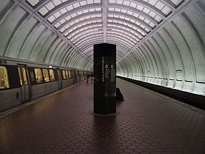
Station statistics Address 3559 Connecticut Avenue NW
Washington, D.C. 20008Lines Connections WMATA Metrobus Structure Underground Platforms 1 island platform Tracks 2 Bicycle facilities 16 racks, 12 lockers Other information Opened December 5, 1981 Accessible 
Code A05 Owned by WMATA Traffic Passengers (2007) 1.293 million  2%
2%Services Preceding station Washington Metro Following station Van Ness – UDCtoward Shady GroveRed Line Woodley Parktoward GlenmontCleveland Park is a rapid transit station on the Red Line of the Washington Metro. Located in the neighborhood of the same name in Washington, D.C., it opened on December 5, 1981.
Contents
Location
The station serves the residential Cleveland Park neighborhood in Northwestern Washington. Its principal attraction is the National Zoo; the zoo is not only a downhill walk from this station, but also 106 feet closer from Cleveland Park than from Woodley Park-Zoo/Adams Morgan station. Across Porter Street NW lies the Adas Israel Congregation, the District's largest Conservative Jewish synagogue.[1]
History
While Cleveland Park was part of the initial system plan in 1959, the station opened on December 5, 1981, five years after the first segment began operations.[2][3] Its opening coincided with the completion of 2.1 miles (3.4 km) of rail northwest of the Dupont Circle station and the opening of Van Ness–UDC and Woodley Park–Zoo stations.[2][3][4]
Station layout
There are two entrances to the station, both on Connecticut Avenue but on opposite sides of the street between Ordway Street NW and Porter Street NW. Each of these street-level entrances contains an escalator and a staircase leading to a middle landing that joins the two entrances underground. A further row of three escalators leads to the station concourse where passengers may buy tickets from vending machines and pass through faregates.[5] An escalator and staircase lead down from the faregates to the platform.[5] An elevator from street level to the concourse is available on the northeastern corner of the intersection of Connecticut Avenue NW and Ordway Street NW and an elevator is available between the concourse and platform after passing through the faregates.[1][5]
Cleveland Park station utilizes the island platform layout with two tracks, A1 and A2. Glenmont-bound trains use track A1 whilst Shady Grove-bound trains use track A2. A pair of crossovers north of the station are remnants of its status as the penultimate station of the Red Line from its opening until August 25, 1984, when the Red Line was extended westward once again to Grosvenor; other extensions have taken place since then.
Architecture
Architecturally, Cleveland Park is similar to other stations along the underground stretch of the Red Line between Woodley Park-Zoo/Adams Morgan and Medical Center. Because of the high cost of the waffle design and the relative large depth of these stations, pre-fabricated concrete segments were shipped to the construction site and placed together to form the structure of the station, resulting in a four-coffer station design.[2]
References
- ^ a b Cleveland Park station: Connecticut Avenue exit WMATA Retrieved 2009-01-24
- ^ a b c Burgess, John (December 4, 1981), "The new northwest passage; 3 more stops on the Red Line...", The Washington Post: B1
- ^ a b Burgess, John (December 5, 1981), "3 Metro stations opening today", The Washington Post: B7
- ^ Washington Metropolitan Area Transit Authority (July 2009). "Sequence of Metrorail openings". http://www.wmata.com/about_metro/docs/metrofacts.pdf. Retrieved August 1, 2010.
- ^ a b c Cleveland Park station WMATA Retrieved 2008-01-24
External links
- WMATA: Cleveland Park Station
- StationMasters Online: Cleveland Park Station
- The Schumin Web Transit Center: Cleveland Park Station
- The east entrance is at coordinates 38°56′9.5″N 77°3′30.7″W / 38.935972°N 77.058528°WCoordinates: 38°56′9.5″N 77°3′30.7″W / 38.935972°N 77.058528°W
- The west entrance is at coordinates 38°56′10.1″N 77°3′32.4″W / 38.936139°N 77.059°W
- Ordway Street entrance from Google Maps Street View
Categories:- Red Line (Washington Metro)
- Washington Metro stations in Washington, D.C.
- Railway stations opened in 1981

Wikimedia Foundation. 2010.