- Nubra Valley
-
Nubra Valley — valley — 
Coordinates 34°36′N 77°42′E / 34.6°N 77.7°ECoordinates: 34°36′N 77°42′E / 34.6°N 77.7°E Country India State Jammu and Kashmir District(s) Leh Time zone IST (UTC+05:30) Nubra Valley (Urdu:نبرا وللے) is about 150 km north of Leh, the capital town of Ladakh, India. Local scholars say that its original name was Ldumra (the valley of flowers). The Shyok River meets the Nubra or Siachan River to form a large valley that separates the Ladakh and the Karakoram Ranges. The average altitude of the valley is about 10,000 ft. above the sea level. The common way to access this valley is to travel over the Khardung La from Leh. Non-locals require an Inner Line Permit (obtainable in Leh town) to enter Nubra.
Contents
Geography
Like the rest of Ladakh, Nubra is a high altitude desert with rare precipitation and scant vegetation except along river beds, where irrigated, and on high slopes. The villages are irrigated and fertile, producing wheat, barley, peas, mustard for oil, and a variety of fruits and nuts, including apple, walnut, apricot and even a few almond trees. Most of the Nubra Valley is inhabited by Ladakhis who speak Ladakhi; the majority of them are Buddhist, with a minority of Shia and Sunni Muslims. In the western or lowest altitude end of Nubra Valley, along the Shyok River, the inhabitants are Balti, speak Balti, and are Shia and Sufia Nurbakhshia Muslims.
Siachen Glacier lies to the north of the valley. The Sasser Pass and the famous Karakoram Pass lie to the northwest of the valley and connect Nubra with Xinjiang. Previously there was much trade passing through the area with East Turkestan and Central Asia.
Places
Along the Nubra or Siachan River lie the villages of Sumur, Kyagar (called Tiger by the Indian Army), Tirith, Panamik and many others. Samstanling monastery is between Kyagar and Sumur villages, and Panamik is noted for its hot springs. Across the Nubra or Siachan River at Panamik, is the isolated Ensa Gompa.
On the Shyok (pronounced Shayok) River, the main village, Diskit, is home to the dramatically positioned Diskit Monastery. Hundar was the capital of the erstwhile Nubra kingdom in the 17th century, and is home to the Chamba Gompa. Between Hundar and Diskit lie several kilometres of sand dunes, and (two-humped) bactrian camels graze in the neighbouring "forests" of seabuckthorn. Non-locals are not allowed below Hundar village into the Balti area, as it is a border area. The beautiful village of Baigdandu is also located in this area. There is a marked presence of people with startling blue eyes, auburn hair and rosy cheeks as against the typical mongoloid features of the Ladakhis. Local lore has it that they were a Greek tribe who came in search of Jesus Christ's tomb and eventually settled here. Baigdandu is also known for the goats that give you the famous Pashmina shawls.
Currently the only road access to the Nubra Valley is over Khardung La pass, whose status as the highest motorable road in the world is no longer accepted by most authorities. The Indian Government has completed another road pass over Wari La from Sakti, to the east of Khardung La, and the road connecting it to central Nubra along the Shyok River is said to be almost completed as of 2008. There are also trekkable passes over the Ladakh Range from the Indus Valley at various points. Routes from Nubra to Baltistan or Yarkand, though historically important, have been closed since 1947 and 1950 respectively.
Nubra River
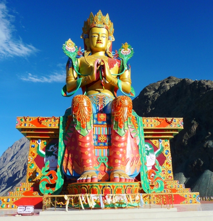
 35 metre statue of Maitreya Buddha facing down the Shyok River towards Pakistan.
 Shyok watershed
The Nubra River is a tributary of the Shyok River, which flows through the Nubra region of Ladakh, into the Indus River to the east of Skardu, Pakistan. The Siachen Glacier melts into this river.
Galllery
-

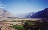
A panoramic view over the Nubra Valley
-

Local map with North towards down
-
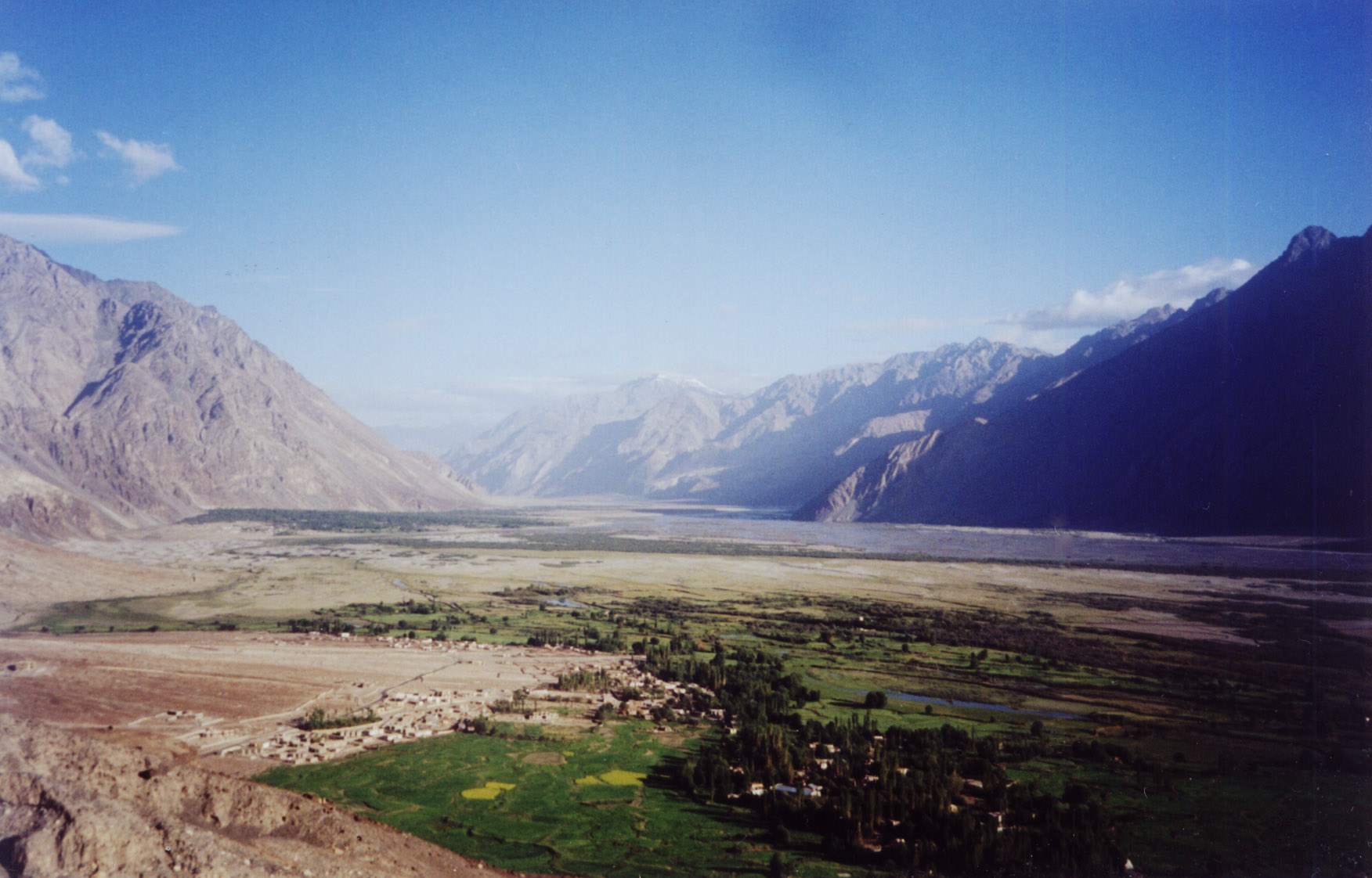
View from Diskit gompa on Nubra Valley
-

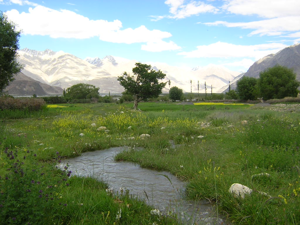
Seabuckthorn berries, Nubra valley, Ladakh
See also
- Ladakh
- Khardung La pass
- Siachen Glacier
- Thoise
- Chalunka
- Project HIMANK, road builders in the valley and creaters of curious sign boards
References
External links
- Photograph of Nubra Valley
- Nubra Valley Trekking,Ladakh Nubra Valley Trek
- Travel Article on Nubra Valley
Ladakh Passes Khardung La · Sasser Pass · Karakoram Pass · Lachulung La · Tanglang La · Chang la · Marsimik La · Rezang La · Zoji La · Pensi La · Shingo LaValleys Cities and Towns Rivers, glaciers and lakes Sutlej · Beas · Ravi · Shyok · Chenab · Indus · Zanskar · Tsarap · Doda River · Suru River · Markha River
Siachen Glacier · Drang-drung · Rimo
Tso Moriri · Pangong TsoMonasteries Alchi · Bardan · Basgo · Chemrey · Diskit · Hanle · Hemis · Hundur · Korzok · Karsha · Lamayuru · Likir · Lingshed · Mashro · Matho · Mulbekh · Namgyal Tsemo · Phugtal · Phyang · Rangdum · Rizong · Sani · Sankar · Saspul · Shey Monastery · Spituk · Stakna · Stok · Stongdey · Takthok · Thikse · Tonde · Wanla · Zangla · ZongkulSee also History of Ladakh · Shanti Stupa · Leh-Manali Highway · Lahaul and Spiti · Tourism in Ladakh · Ladakhi language · Wildlife of Ladakh · * Curious BRO Roadsigns · * Geography of Ladakh · Saltoro Kangri · More plainsCategories:- Geography of Jammu and Kashmir
- Ladakh
- Valleys of India
- Indus basin
-


Wikimedia Foundation. 2010.