- St James' Priory, Bristol
-
St James's Priory 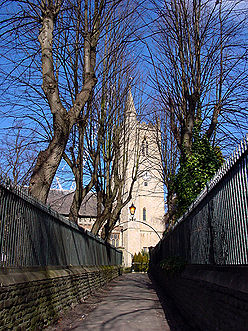
Church of Saint James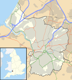
 Location within Bristol
General information Town or city Bristol Country England Coordinates 51°27′31″N 2°35′37″W / 51.458522°N 2.593669°W Construction started 1129 Design and construction Client Robert Rufus The Priory Church of St James, Bristol (grid reference ST588734)[1] is a Grade I listed building[1] in Horsefair, Whitson Street.
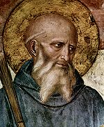
It was founded in 1129 as a Benedictine priory by Robert, Earl of Gloucester, the illegitimate son of Henry I. The nave survives from 1129 but the tower was added around 1374. The south aisle was widened and rebuilt in 1698. The porch dates from the late 18th century, and the north aisle was rebuilt in 1864.[1][2]
Legend has it that every 10th stone brought from Normandy to build the Castle was set aside to build the Priory, and therefore ‘now that the castle has vanished these stones are like an echo from 800 years ago.’[attribution needed]
The building is on the English Heritage Buildings at Risk Register and described as being in very bad condition.[3]
Contents
St James's Fair
From 1238 an annual fair held over fifteen days, was held here. Originally starting on 25 July (the feast day of St James) it was later changed to the first fortnight in September. The fair, which was held in the Churchyard and adjoining streets, was regarded as the most important of the Bristol Fairs. By the 17th century it was so prominent that merchant ships sailing in to Bristol for it were frequently attacked by Turkish pirates in the Bristol Channel. The last fair was held in 1837. It also subsequently left its mark on the geography of Bristol as a nearby road in Broadmead is called the Horsefair.
St James Priory Project
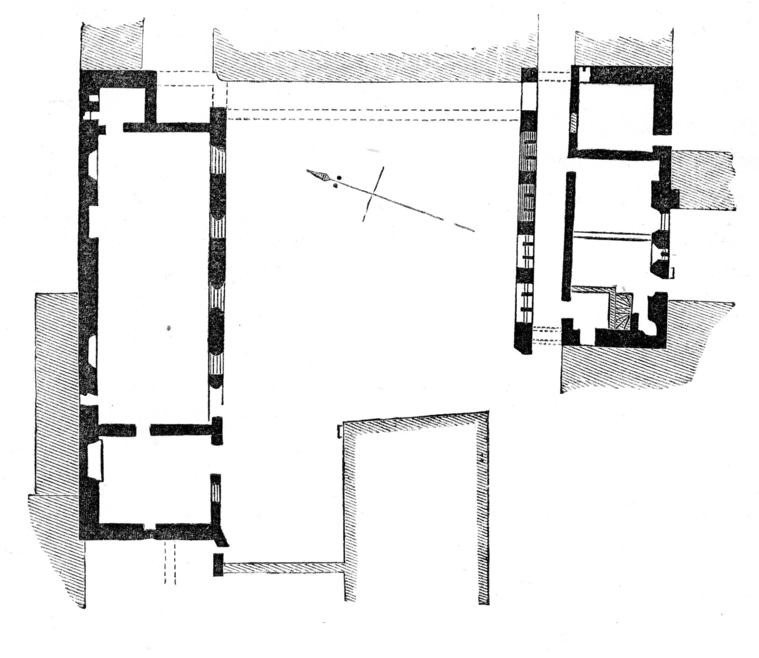
 A plan of the priory from 1882
After the Dissolution of the Monasteries, the nave of the priory church continued in use as an Anglican parish church. It fell into disuse in the 1980s but in 1996 the Little Brothers of Nazareth re-established it as a Catholic church, and set up the St James Priory Project ([2]) which offers comprehensive support to people with a history of homelessness who have a substance dependency.
Restoration
Building work on a project to conserve, repair, and develop the Priory began in November 2009.[4][5]
See also
References
- ^ a b "Church of St James". Images of England. http://www.imagesofengland.org.uk/details/default.aspx?id=380890. Retrieved 2006-10-25.
- ^ Burrough, THB (1970). Bristol. London: Studio Vista. ISBN 0289798043.
- ^ "St James Priory, Whitson Street". English Heritage Buildings at Risk Register. http://www.english-heritage.org.uk/server/show/ConBar.6533. Retrieved 2007-10-26.
- ^ "Priory restoration work to begin". BBC News. 2009-11-16. http://news.bbc.co.uk/1/hi/england/bristol/8362098.stm. Retrieved 2009-11-16.
- ^ Template:Http://non-modern-world.blogspot.com/2011/09/article-from-recent-spab-cornerstone.html
External links
- ChurchCrawler's Page on St James with numerous photographs
- Video interview with Director Sue Jotcham about St James Priory by BizView.tv
- History from about-bristol.co.uk
- History from ukattraction.com
- Excavations of the Priory
Benedictine abbeys and priories in medieval England and Wales Independent houses Abergavenny · Abbotsbury · Abingdon · Alcester · Athelney · Bardney · Bath · Battle · Bedford · Birkenhead · Bradwell · Buckfast · Burton · Bury St Edmunds · Canterbury (Christ Church) · Canterbury (St Augustine's) · Canwell · Cerne · Chertsey · Chester · Cholsey · Colchester · Coventry · Crowland · Durham · Ely · Evesham · Eynsham · Faversham · Glastonbury · Gloucester · Humberston · Luffield · Malmesbury · Milton · Monk Bretton · Muchelney · Mullicourt · Norwich (Holy Trinity) · Pershore · Peterborough · Ramsey · Reading · Rochester · St Albans · St Benet of Hulme · Sandwell · Selby · Sherborne · Shrewsbury · Snelshall · Tavistock · Tewkesbury · Thorney · Upholland · Walden · Westminster · Whitby · Winchcombe · Winchester (New Minister) · Winchester (St Swithun) · Worcester · York (St Mary's)
Dependent houses Aldeby · Alkborough · Alcester · Alvecote · Beadlow · Bedemans Berg · Belvoir · Binham · Brecon · Bristol · Bromfield · Cardiff · Cardigan · Cranborne · Darenth · Deeping · Dover · Dunster · Earls Colne · Ewenny · Ewyas Harold · Exeter · Farne · Felixstowe · Finchale · Freiston · Great Malvern · Hatfield Peverel · Henes (Sandtoft) · Hereford · Hertford · Holy Island · Horton · Hoxne · Hurley · Jarrow · Kidwelly · Kilpeck · Kings Lynn · Lamanna · Leominster · Leonard Stanley · Lincoln · Little Malvern · Littlemore · Lytham · Middlesbrough · Monkwearmouth · Morville · Norwich (St Leonard) · Oxford (of Canterbury) · Oxford (of Durham) · Oxford (of Gloucester) · Penwortham · Pilton · Redbourn · Richmond · Rumsburgh · St Bees · St Ives · Scilly · Snaith · Snape · Stamford · Studley · Sudbury · Tickhill · Tynemouth · Wallingford · Westbury-on-Trym · Wetheral · Wymondham · Yarmouth
Alien priories Allerton Mauleverer · Andover · Andwell · Appuldurcombe · Arundel · Astley · Aston Priors · Atherington · Avebury · Axmouth · Blyth · Boxgrove · Brimpsfield · Burstall · Burwell · Caldy · Carisbrooke · Chepstow · Clatford · Cogges · Corsham · Covenham · Cowick · Creeting · Debden · Deerhurst · Dunwich · Ecclesfield · Edith Weston · Ellingham · Everdon · Eye · Folkestone · Frampton · Goldcliff · Grovebury · Hamble · Harmondsworth · Hatfield Regis · Haugham · Hayling · Headley · Hinckley · Holbeck · Horsham St Faith · Horsley · Lancaster · Lapley · Lewisham · Linton (or Isleham) · Livers Ocle · Llangennith · Llangua · Loders · Minster · Minster Lovell · Minting · Modbury · Monks Kirkby · Monk Sherbourne · Monmouth · Newent · Ogbourne St George · Otterton · Panfield · Pembroke · Pill · Ruislip · Runcton · St Cross · St Dogmells · St Michael's Mount · St Neots · Sele · Spalding · Sporle · Standon · Steventon · Stogursey · Stoke-by-Clare · Stratfied Saye · Swavesey · Takeley · Throwley · Tickford · Titley · Toft Monks · Totnes · Tutbury · Tywardreath · Upavon · Ware · Wareham · Warminghurst · Warmington · Wath · Weedon Beck · Weedon Lois · West Mersea · Wilsford · Wing · Winghale · Wolston · Wootton Wawen · York (Holy Trinity)
Categories:- Buildings on the Buildings at Risk Register
- 1129 establishments
- Grade I listed buildings in Bristol
- 1120s architecture
- Churches in Bristol
- Grade I listed churches
- Religious organizations established in the 1120s
- 12th-century church buildings
- Roman Catholic churches in England and Wales
- Monasteries in Bristol


Wikimedia Foundation. 2010.