- St Mary's Church, Lower Gravenhurst
-
St Mary's Church, Lower Gravenhurst 
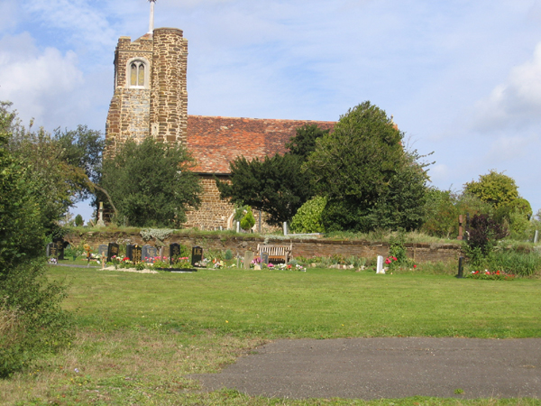
St Mary's Church, Lower Gravenhurst, from the southLocation in Bedfordshire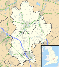
 St Mary's Church, Lower Gravenhurst
Coordinates: 52°00′16″N 0°23′00″W / 52.0045°N 0.3833°W OS grid reference TL 111 352 Location Lower Gravenhurst, Bedfordshire Country England Denomination Anglican Website Churches Conservation Trust History Founder(s) Sir Robert de Bilhemore Architecture Functional status Redundant Heritage designation Grade I Designated 23 January 1961 Architectural type Church Style Gothic Specifications Materials Ironstone with ashlar dressings
Tiled roofsSt Mary's Church, Lower Gravenhurst, is a redundant Anglican church in the village of Lower Gravenhurst, Bedfordshire, England. It has been designated by English Heritage as a Grade I listed building,[1] and is under the care of the Churches Conservation Trust.[2] Lower Gravenhurst is some 10 miles (16 km) southeast of Bedford, to the east of the A6 road. The church is surrounded by fields and stands on a small hill.[2][3]
Contents
History
The church dates from the 14th century, having been built for Sir Robert de Bilhemore, who died in about 1361. The tower was added in about 1400.[1]
Architecture
Exterior
St Mary's is constructed in ironstone rubble with ashlar dressings. Its roofs are tiled. The plan consists of a chancel and a nave in a single unit, and a west tower. The tower is in three stages with diagonal buttresses on the west side. At the southeast corner is a semi-octagonal stair turret. In the lowest stage is a three-light west window. The top stage contains two-light bell openings on each side. The parapet is embattled.[1] On the tower is a pyramidal roof surmounted by a shaft, on top of which is a cross.[2] The chancel has a three-light east window, and a two-light window on the north and south sides. In the nave is a two-light window and a doorway on both sides. Over the south door is a niche for a statue.[1]
Interior
In the chancel is a brass to the memory of the founder. There is also a monument to Benjamin Piggot, who died in 1606, his three wives and his children. It is in polychrome marble and incorporates coats of arms and brasses. The font is octagonal and dates from the 15th century. Also from that century is the rood screen, which still has traces of painted decoration. The pulpit, with its sounding board, dates from the 17th century.[1] In the chancel is a two-bay sedilia, and a piscina with an ogee head.[4]
See also
- List of churches preserved by the Churches Conservation Trust in the East of England
References
- ^ a b c d e "Church of St Mary the Virgin, Gravenhurst", The National Heritage List for England (English Heritage), 2011, http://list.english-heritage.org.uk/resultsingle.aspx?uid=1311911, retrieved 18 May 2011
- ^ a b c St Mary's Church, Lower Gravenhurst, Bedfordshire, Churches Conservation Trust, http://www.visitchurches.org.uk/Ourchurches/Completelistofchurches/St-Marys-Church-Lower-Gravenhurst-Bedfordshire/, retrieved 25 March 2011
- ^ Lower Gravenhurst, Streetmap, http://streetmap.co.uk/grid/510962_235288_120, retrieved 21 February 2011
- ^ Canfield, C. P. (June 2003), Lower Gravenhurst, St Mary, English Church Architecture, http://english-church-architecture.net/bedfordshire%20central/lower%20gravenhurst/lower_gravenhurst.htm, retrieved 21 February 2011
Further reading
- Page, William, ed. (1908), "Parishes: Lower Gravenhurst", A History of the County of Bedford, Victoria County History (University of London & History of Parliament Trust) 2: pp. 336–338, http://www.british-history.ac.uk/report.aspx?compid=62660#s3, retrieved 21 February 2011
Categories:- Grade I listed buildings in Bedfordshire
- Grade I listed churches
- Church of England churches in Bedfordshire
- English Gothic architecture
- Churches preserved by the Churches Conservation Trust

Wikimedia Foundation. 2010.