- Church of St Mary, Hardington
-
Church of St Mary 
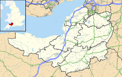
General information Town or city Hardington Country England Coordinates 51°16′16″N 2°22′09″W / 51.2710°N 2.3691°W Completed 11th century The Church of St Mary at Hardington in the parish of Hemington, Somerset, England dates from the 11th century and has been designated as a Grade I listed building.[1]
The church has an un-aisled nave and small west tower which dates from the late 14th century. In the 19th century the earlier chancel was largely rebuilt. The parish of Hardington was form in the Middle Ages and merged into Hemington in 1733.[2]
It is no longer used as a church and has been in the care of the Redundant Churches Fund since 1972.
See also
- List of Grade I listed buildings in Mendip
- List of towers in Somerset
References
- ^ "Church of St Mary". Images of England. http://www.imagesofengland.org.uk/details/default.aspx?id=267882. Retrieved 25 November 2006.
- ^ "Church of St Mary and churchyard, Hardington". Somerset Historic Environment Record. Somerset County Council. http://webapp1.somerset.gov.uk/her/details.asp?prn=23650. Retrieved 1 October 2011.
Categories:- Grade I listed churches
- Grade I listed buildings in Somerset
- Church of England churches in Mendip
- 11th-century church buildings
Wikimedia Foundation. 2010.

