- Dieppe, New Brunswick
-
For other uses, see Dieppe (disambiguation).
Dieppe — City — Dieppe watertower

Seal
LogoMotto: "Constantia et virtute" (Latin)
"By constancy and virtueLocation of Dieppe in New Brunswick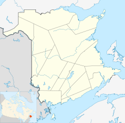

Coordinates: 46°05′56″N 64°43′27″W / 46.098889°N 64.724167°W Country  Canada
Province  New Brunswick
County Westmorland Parish Moncton City January 1, 2003 Town January 1, 1952 Founded 1730 Government – Type Dieppe City Council – Mayor Jean LeBlanc – MPs Robert Goguen – MLAs Cy LeBlanc Area – City 49.85 km2 (19.25 sq mi) – Urban 98.388 km2 (38 sq mi) – Metro 117.309 km2 (45.3 sq mi) Highest elevation 45 m (148 ft) Lowest elevation 5 m (16 ft) Population (2006)[1] – City 18,565 – Density 299.9/km2 (776.7/sq mi) – Urban 76.409 – Metro 101.029 Time zone AST (UTC-4) – Summer (DST) ADT (UTC-3) Postal code(s) E1A Area code(s) 506 NTS Map 021I02 GNBC Code DADHJ Website www.dieppe.ca Dieppe (2006 population: 18,565) is a Canadian city in Westmorland County, New Brunswick.
Contents
Geography
Dieppe is located on the Petitcodiac River east of the adjacent city of Moncton. It forms the southeastern part of the Greater Moncton Area, which also includes the city of Moncton, the town of Riverview, Moncton Parish (8,747), Memramcook (4,638), Coverdale (4,144), and Salisbury (2,036). Statistics Canada estimates that the 2010 metropolitan population is 137,300.
History
Dieppe received its present name upon incorporation as a town in 1952 in honour of the Canadian soldiers killed in the 1942 Dieppe Raid in Dieppe, France. Originally known in 1920 as Léger's Corner, the villages of Saint-Anselme and Chartersville (settled in 1776) and the local service districts of Fox Creek-Dover then known as Ruisseau-des-Renards (settled in 1746) were next amalgamated to the Town of Dieppe in 1973. Dieppe's municipal status was changed in 2003 from a town to a city, in part to avoid amalgamation with Moncton.[2] Dieppe is the biggest city with a francophone majority outside the province of Quebec. Over 74 % of its inhabitants mother tongue is of French. For that reason the city has a vibrant Acadian culture, history and lifestyle. In addition almost 72 % of its residents are bilingual (French and English).
Although considered a suburban bedroom community, Dieppe is now one of the fastest growing municipalities in the Atlantic provinces and the 5th fastest growing in Canada with an increase in population of 24.2% between 2001 and 2006 according to Statistics Canada.[1] It has an economy centred on the transportation, service and logistics industries.
Prominent buildings or locations
Dieppe is the location of the following institutions and attractions:
- Champlain Place, the largest single building shopping centre in Atlantic Canada by floor space.[3] (also the largest single-story mall east of Montreal). When Champlain Place Shopping Centre was built in 1974, it was hailed as an extraordinary engineering accomplishment. Erected on a barren, windswept marsh at the juncture of Moncton and Dieppe in an area once a part of the region’s shipbuilding past, this then new innovative concept in the retail industry has stood the test of time in its ability to keep abreast of changes in a mobile society. Today, with over 160 tenants, Champlain Place is the hub of a powerful retail sector that lies at the heart of sophisticated roadway systems non-existent at its inception. A shopping mecca for patrons throughout the tri-community area, it is the destination of choice for shoppers throughout Atlantic Canada.
- Crystal Palace (French: Palais Crystal) is an indoor amusement park adjacent to the Champlain Place shopping centre. Located around the amusement park area is a Ramada hotel, a McGinnis Landing restaurant, an Empire Theatres cinema multiplex, a 'Pretzelmaker', a cantine named Wazzoos and a Chapters bookstore/Starbucks café. The Park is owned and operated by Cadillac Fairview.The park was opened on February 15, 1990.
- Greater Moncton International Airport, (French: Aéroport international du Grand Moncton) or Moncton/Greater Moncton International Airport (IATA: YQM, ICAO: CYQM). The GMIA has experienced rapid growth. Between 1997 and 2008 passenger traffic increased over 140% to the current (2008) figure of 573,688. In 2007 the airport saw a 61% increase in aircraft movements over 2006, going from 77,886 movements to 125,414. As of 2010 it was the 16th busiest airport in Canada by aircraft movements. In 2008 it was the 18th busiest in Canada by passenger traffic. The airport is classified as an airport of entry by NAV CANADA and is staffed by the Canada Border Services Agency. CBSA officers at this airport currently can handle aircraft with up to 225 passengers. Nevertheless planes as large as the 580 passenger Boeing 747 have been handled. GMIA is home to the Moncton Flight College, the largest private flight school in Canada. MFC has trained over 16,000 pilots from around the world since 1929.
Census Population 1951 3,402 1961 4,032 1971 4,277 1981 8,511 1991 10,463 2001 14,951 2006 18,565 - Place 1604 - it is the city of Dieppe's effort to create a downtown area where citizens can go to eat, shop, do business, obtain government services, participate in the cultural and social scene. Place 1604 is a three storey building that offers high visibility from Champlain Street and Acadie Ave., adjacent to new Dieppe City Hall with ample public parking, plus 40 underground parking spaces. The Dieppe Farmers' Market is nearby, so is the Dieppe Public Library, an art gallery, CFBO BO-FM radio, an auditorium and numerous businesses. During the summer months, live entertainment is offered in the open area of Place 1604.
The City of Dieppe and the Economic Development Corporation of the City of Dieppe have assembled of over 13 acres (53,000 m2) of land in the centre of the city for the purpose of creating a new vibrant city centre that reflects the spirit of the urban Acadian community. The lands are located to the south east of Champlain Street and Acadie Avenue, the main intersection in Dieppe, and include the current city hall.
The Collège communautaire du Nouveau-Brunswick (CCNB) is a first-rate francophone post-secondary learning institution. Le campus de Dieppe provides high quality educational services and training, and values the importance of a skilled, well-trained workforce that responds to changing job demands. Situated at 505 rue du Collège it opened in 1987 providing training in diverse educational discipline.
Media
- L'Étoile Dieppe is the French daily newspaper for the city.
CFBO-FM, located in Dieppe, is a French language radio station broadcasting at the 90.7 FM frequency. The station airs an adult contemporary/community radio format branded as BO-FM. It is owned by Radio Beauséjour Inc.[]
 St. Anselme Church in Dieppe, New Brunswick. The current building was erected in 1900.
Sister cities
Climate
Dieppe Climatological Data Temperature Month Jan Feb Mar Apr May Jun Jul Aug Sep Oct Nov Dec Mean Record high °C (°F) 17 (63) 18 (64) 21 (70) 28 (83) 34 (94) 34 (93) 36 (97) 36 (98) 33 (92) 28 (82) 23 (73) 18 (64) Avg. high °C (°F) -3 (26) -2 (28) 2 (37) 8 (47) 16 (61) 21 (71) 25 (77) 24 (75) 19 (66) 12 (54) 6 (42) -0.5 (31) 11 (52) Mean °C (°F) -8 (17) -7 (18) -2 (28) 3 (39) 10 (51) 16 (60) 19 (66) 18 (65) 13 (56) 7 (46) 2 (35) -4 (23) 6 (42) Avg. low °C (°F) -13 (7) -12 (9) -7 (19) -0.9 (30) 4 (40) 9 (49) 13 (56) 12 (55) 8 (46) 2 (37) -2 (28) -9 (15) 0.6 (33) Record low °C (°F) -42 (-34) -38 (-36) -32 (-25) -18 (-.1) -7 (19) -4 (25) 0 (32) -1 (30) -6 (21) -9 (15) -21 (-6) -34(-30) Precipitation and Sunshine Hours Month Jan Feb Mar Apr May Jun Jul Aug Sep Oct Nov Dec Total Total mm (in) 109 (4.3) 81 (3.2) 103 (4.0) 90 (3.5) 99 (4) 94 (3.7) 100 (3.9) 76 (3.0) 92 (3.6) 100 (3.9) 97 (3.8) 106 (4) 1144 (45) Rainfall mm (in) 42 (1.6) 28 (1.1) 42 (1.6) 58 (2.3) 93 (4) 94 (3.7) 100 (3.9) 76 (3.0) 92 (3.6) 96 (3.8) 77 (3.0) 52 (2) 849 (33) Snowfall cm (in) 67 (26.1) 53 (21.0) 61 (24.5) 32 (13) 5 (2.5) 0 (0) 0 (0) 0 (0) 0 (0) 4 (1.4) 20 (7.8) 54 (21) 295 (116) Sunshine hours 115 124 139 158 205 229 248 244 167 142 103 95 1971 Data recorded in Dieppe by Environment Canada. Data spans 1971 to 2000. See also
References
- ^ a b "Stats Canada Population and Dwelling Count". Statistics Canada. http://www12.statcan.ca/english/census06/data/popdwell/Table.cfm?T=302&SR=1&S=3&O=D&RPP=25&CMA=0&PR=13.
- ^ "History". dieppe.ca. City of Dieppe. http://www.dieppe.ca/historic_en.cfm. Retrieved 17 October 2011.
External links
Subdivisions of New Brunswick Subdivisions Cities Coordinates: 46°05′56″N 64°43′27″W / 46.09889°N 64.72417°W
Categories:- Communities in Westmorland County, New Brunswick
- Cities in New Brunswick


Wikimedia Foundation. 2010.