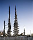
- Chesterfield Square, Los Angeles
-
Chesterfield Square is located in southwestern Los Angeles, California. It is generally considered to be a part of South Los Angeles. The primary ZIP Code served by the neighborhood is 90062. The population of the community as of the 2000 census was 29,721.[1]
Contents
Geography
Chesterfield Square is bordered by Vermont Square and West Park on the east, Leimert Park and Crenshaw District on the west, and King Estates on the north. The district's boundaries are roughly Van Ness and Arlington Avenues on the west, Dr. Martin Luther King Jr. Boulevard on the north, Normandie Avenue on the east, and Slauson Avenue on the south.
Transportation
The community is served primarily by LADOT and five Los Angeles County Metropolitan Transportation Authority bus lines:
The following MTA lines which serves the neighborhood:
Line 105 - West Hollywood to Vernon
Line 207 - Hollywood to West Athens (via Western Avenue)
Line 305 - UCLA to Wilmington/Imperial Station (via Vernon and Western Avenues)
Metro Rapid Line 705 - West Hollywood to Vernon
Metro Rapid Line 757 - Hollywood to Crenshaw Station
See also
- South Central Los Angeles
- Earl C. Gay (1902–75), Los Angeles City Council member, 1933–45
References
External links
- Interactive map of Chesterfield Square
- University Park Family is a collaborative online community focused mainly on University Park, Expo Park and the surrounding areas.
- Leimert Park Beat is a collaborative online community focused mainly on Leimert Park: The Soul
South Los Angeles region, Los Angeles Districts and
neighborhoodsBaldwin Hills · Baldwin Village · Baldwin Vista · Canterbury Knolls · Chesterfield Square · Crenshaw · Hyde Park · Jefferson Park · King Estates · Leimert Park · University Park · Vermont Square · Watts · West Adams
Points of
interestSee also Downtown · Eastside/Northeast · Harbor Area · Greater Hollywood · Westlake/Silver Lake/Los Feliz · San Fernando and Crescenta Valleys · South Los Angeles · Westside · WilshireCategories:- Neighborhoods in Los Angeles, California
- Populated places in California with African American majority populations
Wikimedia Foundation. 2010.

