- Cheltenham Badlands
-
 Cheltenham Badlands
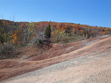
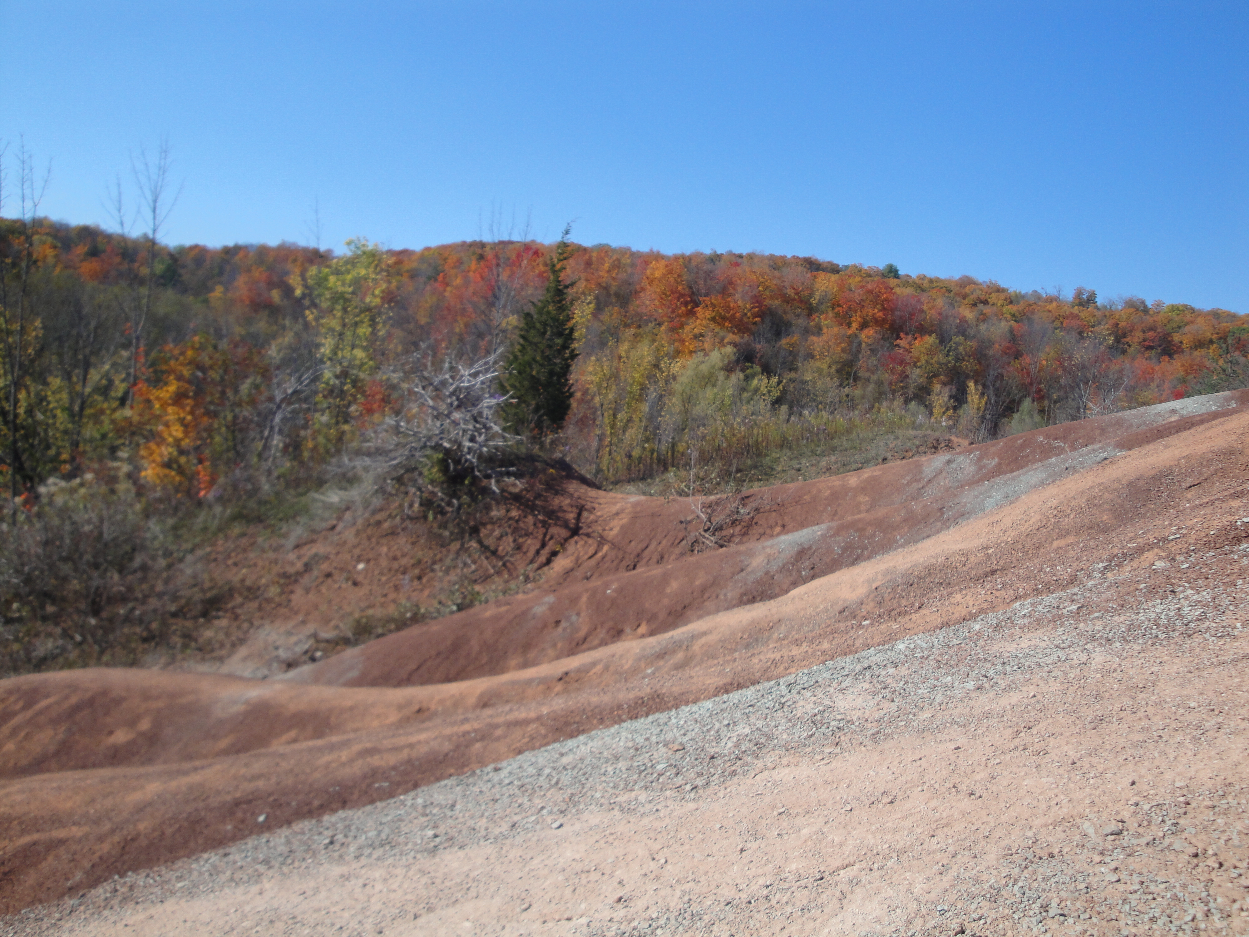
Cheltenham Badlands is a small example of Badlands formation in Caledon, Ontario.
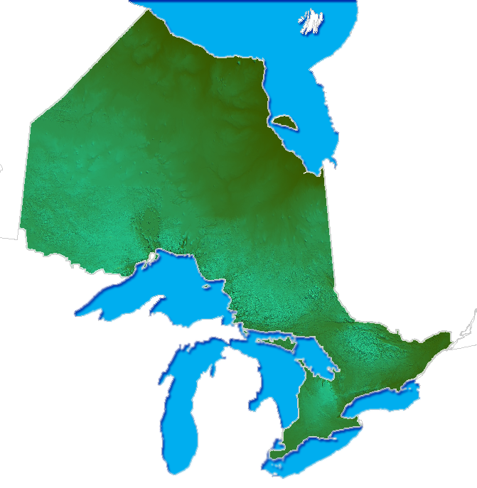
The site is located on the southside of Old Base Line Road (between Ontario Highway 10 and Creditview Road/Peel Regional Road 12) and features exposed and eroded Queenston Shale. The formation is located along the Niagara Escarpment.
Contents
History
The formation was exposed by poor farming practices in the 1930s that led to soil erosion and exposed the underlying shale.[1]
The formation is mostly red in colour due to iron oxide deposits[2] with some faint green streaks due to ground water percolation changing the red iron oxide into green iron oxide.[3]
Conservation
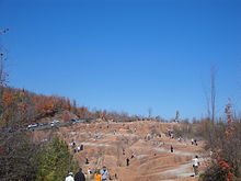 Tourists on the red clay hills
Once farmland, it was purchased by the Ontario Heritage Foundation in 2000 and managed by the Bruce Trail Association.[4] Development is also restricted on the site by the Niagara Escarpment Commission
The formation is located along the Niagara Escarpment and Bruce Trail and is part or near various geographically important area of Southern Ontario:
- Ontario Greenbelt
- just outside of Oak Ridges Moraine
Located within the Niagara Escarpment, the site is by default part of the local UNESCO World Biosphere Reserve.
There are concerns by conservationists that increased visitors to the area will cause damage to the formation and suggest closure or restriction of access to the site.[5] Trails leading from the site are now closed.
Parking is limited to a small area on the south side of Olde Base Line Road with restrictions beyond and on the other side of the road.
See also
References
- ^ http://www.day-trips.ca/content/cheltenham-badlands
- ^ http://www.ontariotrails.on.ca/trails-a-z/cheltenham-hills/
- ^ http://www.torontohiking.com/html/l16badlnd.html Loop Hike L16 Cheltenham Badlands
- ^ http://www.torontooutdoorclub.com/events/details.asp?eventid=1890
- ^ http://www.caledonbrucetrail.org/badlands.htm
Protected areas in Ontario National parks 
Provincial parks Conservation areas Boyd · Claireville · Cold Creek · Guelph Lake · Heber Down · Kortright Centre · Lake Laurentian · Mer Bleue · Mount Nemo · Rattlesnake Point · Spencer Gorge / Webster's Falls · more...UNESCO Biosphere Reserves Georgian Bay Littoral · Long Point · Niagara Escarpment (including Cheltenham Badlands) · Thousand Islands - Frontenac Arch · Wasaga BeachNational Historic Sites of Canada Central Experimental Farm · Dundurn Castle · Laurier House · Massey Hall · Montgomery's Tavern · Osgoode Hall · Parliament · Rideau Canal · Rideau Hall · more...Other areas Categories:

Wikimedia Foundation. 2010.