- Cheadle Heath
-
Coordinates: 53°23′55″N 2°11′20″W / 53.3986°N 2.189°W
Cheadle Heath 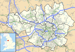
 Cheadle Heath
Cheadle Heath shown within Greater ManchesterMetropolitan borough Stockport Metropolitan county Greater Manchester Region North West Country England Sovereign state United Kingdom Post town STOCKPORT Postcode district SK3 Dialling code 0161 Police Greater Manchester Fire Greater Manchester Ambulance North West EU Parliament North West England List of places: UK • England • Greater Manchester Cheadle Heath is a suburban area of Stockport, part of the wider Metropolitan Borough of Stockport, in Greater Manchester, England. It is approximately 2 miles (3.2 km) west of Stockport's town centre and 8 miles (13 km) southeast of the city of Manchester.
Cheadle Heath was also the site of Cheadle Heath Railway Station until 1967: the site is now largely occupied by Morrison's supermarket.
Areas and suburbs of Stockport Brinnington · Bosden Farm · Cale Green · Cheadle Heath · Davenport · Davenport Park · Edgeley · Foggbrook · Great Moor · Heaviley · Heaton Chapel · Heaton Mersey · Heaton Moor · Heaton Norris · Little Moor · North Reddish · Offerton · Offerton Green · Portwood · Reddish · Reddish Green · Reddish Vale · Shaw Heath · South Reddish · Stepping Hill · WoodsmoorCategories:- Geography of Stockport
- Districts of Greater Manchester
- Greater Manchester geography stubs

Wikimedia Foundation. 2010.