- Chauparan
-
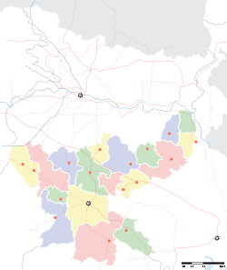
Chauparan — town — Coordinates 24°23′N 85°15′E / 24.38°N 85.25°ECoordinates: 24°23′N 85°15′E / 24.38°N 85.25°E Country India State Jharkhand District(s) Hazaribagh Parliamentary constituency Hazaribagh Assembly constituency Barhi Population 167,246 (2001[update]) Time zone IST (UTC+05:30) Area
• 396 metres (1,299 ft)
Footnotes- CD Block
Website hazaribag.nic.in Chauparan is a town in Hazaribagh district in the Indian state of Jharkhand. It is located near the Jharkhand–Bihar border.
Contents
Geography
Chauparan is located at 24°23′N 85°15′E / 24.38°N 85.25°E. It has an average elevation of 396 metres (1,299 ft).[1]
Transport
Chauparan is on NH 2, Grand Trunk Road. Tilaiya Dam of Damodar Valley Corporation is about 15 kilometres (9.3 mi) from Chauparan[2][3]A road links it to Itkhori and Chatra.
Demographics
Chauparan community development block has a population of 167,246, out of which 81,790 were males and 85,456 were females. 41,537 persons belonged to scheduled castes and 1,348 persons belonged to scheduled tribes. Chauparan block is dominated by other backward communities (OBC). 64,304 persons are literate.[3]
Villages
Some constituent villages of Chauparan block are Mahudi Bara,Brindavan,Daihar,Dadpur,Bahera,Chaikala,Maharajganj,Inguniyan,Papro,Mangarh,Chaithi,podo,Ranik etc..
Schools and Colleges
Munam Public School which is affiliated to CBSE. K.B.S.S +2 school affiliated to Jharkhand Academic Council. Chauparan Inter College affiliated to Jharkhand Academic council.
References
- ^ "Chauparan, India Page". Bihar. Falling Rain Genomics. http://www.fallingrain.com/world/IN/38/Chauparan.html. Retrieved 2009-03-10.
- ^ "Chauparan". india9.com. http://www.india9.com/i9show/Chauparan-65422.htm. Retrieved 2009-03-10.
- ^ a b "Chauparan". Hazaribagh district administration. http://hazaribag.nic.in/pages/blchauparan.htm. Retrieved 2009-03-10.
Categories:- Jharkhand geography stubs
- Cities and towns in Hazaribagh district
Wikimedia Foundation. 2010.


