- Charles Towne Landing
-
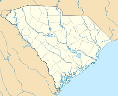
Site of Old Charles Towne
Nearest city: Charleston, South Carolina Coordinates: 32°48′27″N 79°59′13″W / 32.8075°N 79.98694°WCoordinates: 32°48′27″N 79°59′13″W / 32.8075°N 79.98694°W Built: 1670 Governing body: State NRHP Reference#: 69000162[1] Added to NRHP: December 17, 1969 Charles Towne Landing is a park at the original site of the first permanent English settlement in South Carolina. Originally opened in 1970 to commemorate Charleston, South Carolina's tricentennial, this 80-acre (320,000 m2) state park showcases animals indigenous to the state in 1670, with exhibits designed by naturalist Jim Fowler. There is a 17th-century village typical of what the original settlers might have constructed. There is also a 53-foot (16 m) replica of the trading ketch "Adventure", a vessel typical of what the young colony would have used for trade on the eastern coast and in the West Indies. Charles Towne Landing has much to see and do including the Animal Forest, Living History and Archaeological sites, as well as many more attractions.
Living History: Experimental Crop Garden tries to follow the same 1670 instructions given to Captain Joseph West, the leader of the Carolina expedition. The original Crop Garden, the Lords Proprietors’ Plantation, was not located within the original Fortified colony. This garden was located across the Old Towne Creek and connected to Charles Towne by a wooden foot bridge. The Lords Proprietors’ Plantation was surrounded and protected by another palisade wall, the Star Fort. The ADVENTURE was a cargo vessel that would carry supplies, provisions, commodities and livestock between New Amsterdam (present New York) and Barbados in the West Indies. The Adventure was designed by renowned 20th century shipwright William Avery Baker in 1969 and set underway in March 1970 to celebrate the Tri-centennial at Charles Towne Landing State Historic Site in April 1970. A new Adventure was built by Rockport Marine in Maine and was delivered on-site in November 2008. The Fortified Area was the protective boundaries of the original settlement. The colonists were instructed to fashion defenses that would allow for the colony to easily defend itself. The Fortified Area contains two parts, the Palisade Wall and the Earthen Fortifications. Entering Charles Towne settlement in 1670, they traveled by boat. Their front door was located at Albemarle Point where the Adventure is moored. Land side defense was the Palisade Wall. The Palisade was a wooden fence of sharpened logs with a ditch to the front to prevent access by hostile Native Americans who were allied to the Spanish. The water side defense used the earthen fortifications to create embrasures for cannons to be mounted aiming toward the Ashley River and mouth of the Old Towne Creek. The 1670 driveway to Charles Towne Landing is the Old Towne Creek.
Animal Forest:The natural habitat zoo is home to many species of animals found in South Carolina when the first colonists arrived.
Archaeology:Excavations at the park have provided clues to the daily lives of Native Americans, European settlers, and African slaves. The first excavations at the park were undertaken in 1967 and the archaeology program continues today.
References
- ^ "National Register Information System". National Register of Historic Places. National Park Service. 2009-03-13. http://nrhp.focus.nps.gov/natreg/docs/All_Data.html.
External links
Categories:- Parks in Charleston, South Carolina
- National Register of Historic Places in Charleston, South Carolina
- Museums in Charleston, South Carolina
Wikimedia Foundation. 2010.

